67 Fires & 9 Near Misses in
Heritage Building Fires Recorded on the 2020 Database in
September and October
(A Fire is defined as an uncontrolled and unwanted burning event (including explosion) causing damage to a heritage building and/or contents by at least one of the following: flame, heat, smoke or blast)
(A Near Miss is defined as an event in a heritage building that had the potential to start a fire, or a fire adjacent to a heritage building that, without intervention, could have spread to that building)
* on the incident time indicates only the approximate time of the incident is known
Fires Index < Click here
hOME / About / Places of Worship / Heritage Buildings / Domestic listed properties / Country estates / grant /CONTACT US / Fires
Subscribe to our newsletter
Our Newsletter is out now with articles on all things related to fires, fire prevention, protection and restoration of heritage buildings - See this and our previous Newsletters HERE. "Our Heritage Under Fire" brings interesting, informative and enlightening news and comment for everyone who has an interest in the protection of the UKs built heritage.
Subscribe by clicking the button below to be added to our mailing list.
Don't miss an issue.
You are signing up only to receive our newsletter, we will not use your contact details, nor pass them on to third parties, for any other purpose.
You may unsubscribe from the list at any time.
Subscribe by clicking the button below to be added to our mailing list.
Don't miss an issue.
You are signing up only to receive our newsletter, we will not use your contact details, nor pass them on to third parties, for any other purpose.
You may unsubscribe from the list at any time.
“Shame on those who remain unmoved, whose pace fails to quicken, on entering one of these old habitations, a manor-house falling to wrack and ruin or a desecrated church!”
Petrus Borel, (1809 – 1859), French writer of the Romantic Period
Petrus Borel, (1809 – 1859), French writer of the Romantic Period
Click on the HEADLINE to expand the article.
Heritage & Ecclesiastical Fire Protection
Preventing Fire, Protecting Life, Preserving Heritage
Click HERE for Expert Specialist Fire Safety Risk Assessments for Historic and Listed Buildings
Preventing Fire, Protecting Life, Preserving Heritage
Click HERE for Expert Specialist Fire Safety Risk Assessments for Historic and Listed Buildings
Phone: 07840 351458 Email: [email protected]
October - 29 Fires & 3 Near Misses
Near Miss
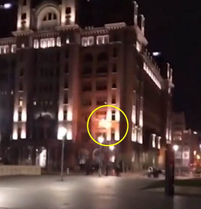
31 October 2020 (22:00*) - 'Disrespectful' thugs filmed firing rockets at Liver Building
31 October 2020 (22:00*) - 'Disrespectful' thugs filmed firing rockets at Liver Building
A shocking video has emerged showing men firing rockets at the Liver Building, just months after a man was charged for doing the same thing. Footage shows a man holding a traffic cone over his shoulder pointed towards the Liver Building. A second man then lights a rocket inside the cone and it is fired at the iconic Liverpool landmark. The firework can then be seen hitting the building and exploding into colour. All the while, spectators can be heard cheering and laughing.
A second rocket is launched but it misses and hits the ground.
Merseyside Police are now investigating the incident and are appealing for information from members of the public. It is believed that the incident may have happened around 10pm on Saturday, October 31, however that has not yet been confirmed. Superintendent Andy Rankine said: “A man was charged and sentenced earlier this year after targeting this famous landmark with a firework and causing a small fire to start in a separate incident. Thankfully, it does not appear the firework caused any serious damage on this occasion, but we will not tolerate people who risk causing criminal damage to any building in this way. An investigation is now underway to find those responsible for this reckless and disrespectful act. We work very closely with Merseyside Fire and Rescue Service and local authorities in relation to the illegal sale and use of fireworks, particularly at this time of year, to prevent incidents like this from happening again. If you have any information on those involved in this incident, please do the right thing and come forward.”
The iconic Grade I listed Royal Liver Building is part of Liverpool's UNESCO-designated World Heritage Maritime Mercantile City. Built between 1908 and 1910, and opened in 1911, the building is the purpose-built home of the Royal Liver Assurance group, which had been set up in the city in 1850 to provide locals with assistance related to losing a wage-earning relative. Today the Royal Liver Building is one of the most recognisable landmarks in the city of Liverpool and is home to two fabled Liver Birds that watch over the city and the sea. Legend has it that, were these two birds to fly away, then the city would cease to exist.
News Source: Echo
A firework strikes the Liver Building

|

|
Listing Details
|
Entry Name: Royal Liver Building, Iron Railings and Stone Piers Surrounding Royal Liver Building
Listing Date: 12 July 1966 Last Amended: 19 June 1985 Grade: I Source: Historic England Source ID: 1356370 English Heritage Legacy ID: 214151 Location: Liverpool, L3 County: Liverpool Electoral Ward/Division: Central Built-Up Area: Liverpool Traditional County: Lancashire Lieutenancy Area (Ceremonial County): Merseyside Church of England Parish: Liverpool Our Lady and St Nicholas Church of England Diocese: Liverpool |
Coordinates
Latitude: 53.4056 / 53°24'20"N Longitude: -2.996 / 2°59'45"W OS Eastings: 333880 OS Northings: 390329 OS Grid: SJ338903 Mapcode National: GBR 71P.X5 Mapcode Global: WH876.YNHJ Plus Code: 9C5VC243+7H |
31 October 2020 (19:44) - Firefighters called after yob stuffs firework through Stoke-on-Trent care home letterbox
Yobs stuffed a firework through the letter box at a Stoke-on-Trent care home. Firefighters were called to Regent Road in Hanley shortly before 7.45pm today (October 31). Eyewitnesses report a care home was evacuated after a firework was shoved through the letter box.One said: "Residents have been evacuated. They were sitting in an outbuilding being given hot drinks."
Staffordshire Fire and Rescue Service confirmed crews attended and provided advice to a care home in the city centre. A spokesman said: "We were called to a care home after it is believed a firework was put through the letter box. Advice was given about securing the letter box in the future. Crews from Hanley and Newcastle were called at 7.44pm."
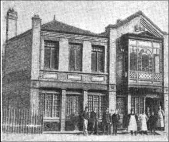
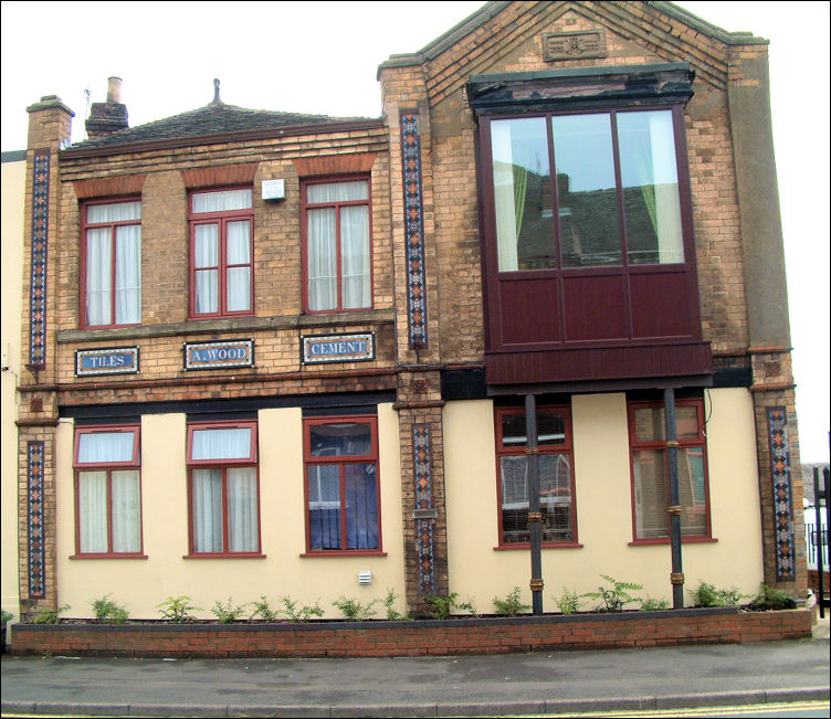
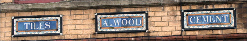
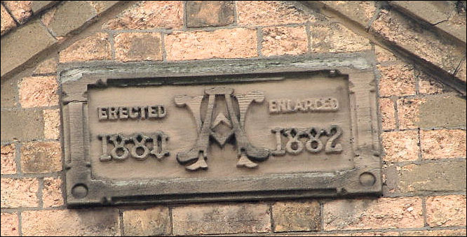
The Regent Road Care Home is run by Shelton Care. Half of the premises is a building known as Regent House and was built in 1880, and enlarged in 1882, by Ambrose Wood, Wholesale Tile Merchant.
News Source: Stoke Sentinel / Stoke on Trent Live
Staffordshire Fire and Rescue Service confirmed crews attended and provided advice to a care home in the city centre. A spokesman said: "We were called to a care home after it is believed a firework was put through the letter box. Advice was given about securing the letter box in the future. Crews from Hanley and Newcastle were called at 7.44pm."
The Regent Road Care Home is run by Shelton Care. Half of the premises is a building known as Regent House and was built in 1880, and enlarged in 1882, by Ambrose Wood, Wholesale Tile Merchant.
News Source: Stoke Sentinel / Stoke on Trent Live
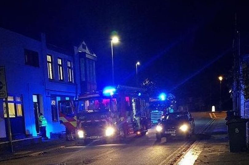
Firefighters in Regent Road. (Image: Karen Poole)
Building History
(Researched by Heritage & Ecclesiastical Fire Protection)
from: A descriptive account of The Potteries (illustrated) 1893 advertising and trade journal. Page 34
Mr. Ambrose Wood, Wholesale Tile Merchant
Regent House, Hanley
"The manufacture of fancy tiles has become of late years and industry of the very first importance in this country, and from all the outward visible signs that we note on every hand there are manifest grounds for believing that the business in question is destined to reach much larger proportions that it has yet assumed.
It would be alien to our purpose and beyond our scope to trace the place of tiles in our ancient decorative systems. We find them on the brightly coloured walls of the Egyptian and Assyrian temples, and they contribute in no small degree to the grandiose pomp of Roman floor ornamentation until the decadence of the latter gave birth to the more bizarre, but often beautiful forms affected by the art workers of the Byzantine period.
But we must direct attention to the achievements of the tile manufacturer in these closing years of the nineteenth century, and in this connection while dealing with the industrial history of Haley one name comes to our mind with special force. We need hardly say that we refer to Mt. Ambrose Wood, of Regent House, a gentleman who has done more than any man in the Potteries district to improve the popular taste in the matter of tiles by devoting artistic energies of a highly cultured order entirely and exclusively into this channel of activity. Mr Ambrose Wood is by training and architect, but twenty years ago he entered upon the business he is now engaged in.
He built the spacious warehouse he occupies, a three-storey building of buff brick, embellished with tiles of very artistic design. Herein will be found an immense stock, embracing all the newest ideas in encaustic plain floor tiles, glazed hearth tiles, dados, walls, and, indeed, every variety known to the trade.
Mr. Wood, besides employing a large staff of workmen at his Hanley warehouse, has also secured the services of a number of experienced tile fixers, many of whom are constantly employed in the English Metropolis alone. Contracts are undertaken in any part of the United Kingdom for the laying of tiles to any extent, and orders are executed with the most exemplary precision and despatch.
Mr. Wood has spared neither effort nor expense to ensure the satisfaction and promote the best interests of his patrons in all parts of the country, and to this spirit of conscientious enterprise and good faith we venture to directly attribute the achievement of that great success which had made his name so popular in connection with the British tile trade."
29 October 2020 (18:05*) - Cannabis factory discovered after fire in Cwmfelinfach pub
A cannabis factory was discovered by police after emergency services were called to fight a fire at the former Pioneer Hotel. Reports of a fire at a disused pub in Cwmfelinfach were received by emergency services shortly after 6pm on Thursday. The small fire was in the basement of the property in Maindee Road, and closed the road.
No one was injured in the fire, but on arrival police discovered a large scale cannabis factory at the property. More than 2,000 plants of varying maturity were found, as well as hydroponics equipment. The cause of the fire is still under investigation. Local inspector, Andrew Boucher said: “Officers and our crime scene investigators are making further enquiries at the scene this morning. I would appeal to anyone with information relating to the fire or cannabis factory to get in touch. I would also encourage all members of our local communities to contact us if they see any suspicious activity in their neighbourhoods, especially around derelict buildings.”
The Pioneer Hotel is a Grade II listed building. It was built in about 1903, with a lease of 99 years from that date, to serve Nine Mile Point Colliery. It was sold in 1909 for £26,000; at this time owned by Griffiths Bros of Newport. The sale notice lists its facilites: in basement 2 large Beer Cellars, Wine Cellar, Minerals Cellar, Kitchen, Scullery, Larder. Ground floor had Public Bar, Luncheon Bar, Commercial Room, Smoke Room, Coffee Room, Jug and Bottle Department, Tap Room, Manager's Sitting Room, Lobby, WCs. First floor had large Club Room. Billiard Room, Servery, Lift from Gournd Floor, Cloakroom, Bathroom, 2 Lavatories. Second floor had 10 bedrooms. Early photographs show chimneys but otherwise the frontage little altered.: it had a second sign Pioneer Hotel on the left bay and outbuildings now demolished to the right.
News Source: South Wales Argus

Fire at the disused Pioneer Hotel in Cwmfelinfach
Listing Details
|
Entry Name: The Pioneer Hotel
Listing Date: 16 September 1999 Last Amended: 16 September 1999 Grade: II Source: Cadw Source ID: 22319 Building Class: Commercial Location: Right in the centre of Cwmfelin-fach at the junction of five roads. County: Caerphilly Community: Ynysddu (Ynys-ddu) Community: Ynysddu Locality: Cwmfelin-fach Built-Up Area: Cwmfelinfach Traditional County: Monmouthshire |
Coordinates
Latitude: 51.6187 / 51°37'7"N Longitude: -3.1789 / 3°10'43"W OS Eastings: 318479 OS Northings: 191751 OS Grid: ST184917 Mapcode National: GBR HY.973J Mapcode Global: VH6DM.VKBZ Plus Code: 9C3RJR9C+FF |

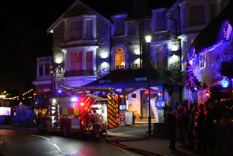
28 October 2020 (20:55*) - Hotel evacuated as fire breaks out – crews rush to the scene in Shanklin
The Isle of Wight Fire and Rescue Service have mobilised to a hotel fire in Shanklin tonight (Wednesday). Fire crews from Shanklin, Sandown and Ventnor are on scene at Holliers Hotel in the Old Village. An Aerial Ladder Platform from Newport is also in attendance alongside the Incident Command Unit – also from Newport. The fire has broken out in the laundry room to the rear of the hotel. Crews wearing breathing apparatus have entered the building to contain and extinguish the fire, which appears to be under control.
The main Shanklin to Ventnor Road is blocked in both directions whilst the incident is dealt with. Southern Vectis buses will divert via Whiteley Bank until further notice. The Isle of Wight Ambulance Service initially dispatched an ambulance crew to the scene but they have quickly stood down.
Leighton Bryant, Tactical Advisor for the incident, has confirmed that around 30 residents have been evacuated and are currently sheltering in the nearby Crab Inn. The fire, which broke out in an outbuilding used as a laundry room at just before 21:00, has now been extinguished. Firefighters are using a thermal imaging camera to check for hotspots and are cutting away to ensure the fire does not reignite. 4 breathing apparatus, 2 hose reel jets and 1 hydrant have been used to tackle the fire, which is thought to have started in either a tumble dryer or washing machine. Firefighters were decontaminated due to the potential presence of asbestos in the damaged outbuilding.
It was the aim was to get residents back in the hotel for the night, subject to safety and electrical checks. But by 10.30pm, the decision was taken that patrons would have to seek alternative accommodation for the night. The same is said for a neighbouring property. The Channel View Hotel in Shanklin have offered assistance, if required. The Isle of Wight Fire and a Rescue Service are beginning to stand down from the incident.
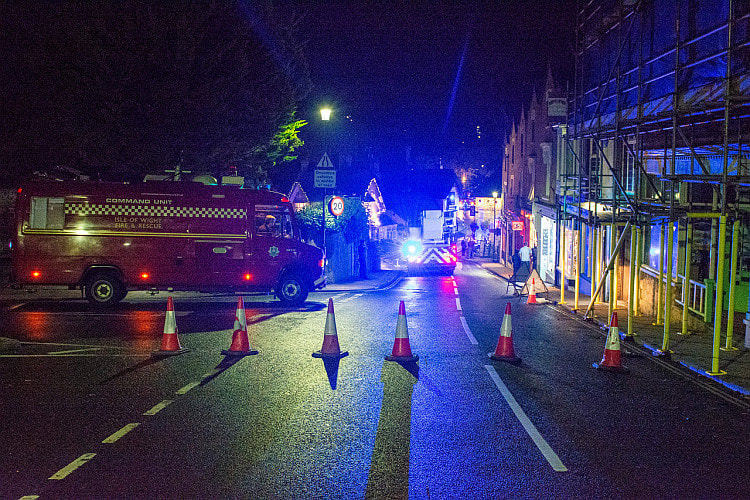
Update: Fire crews have been called back to Holliers Hotel in Shanklin this morning (Thursday) following last night’s laundry room fire. Appliances from Sandown, Shanklin and Ventnor have been mobilised to Church Road in the Old Village alongside the Aerial Ladder Platform and Incident Command Unit from Newport. It’s understood the fire, which was extinguished shortly before 22:00 last night, has reignited – despite crews damping down and cutting away.
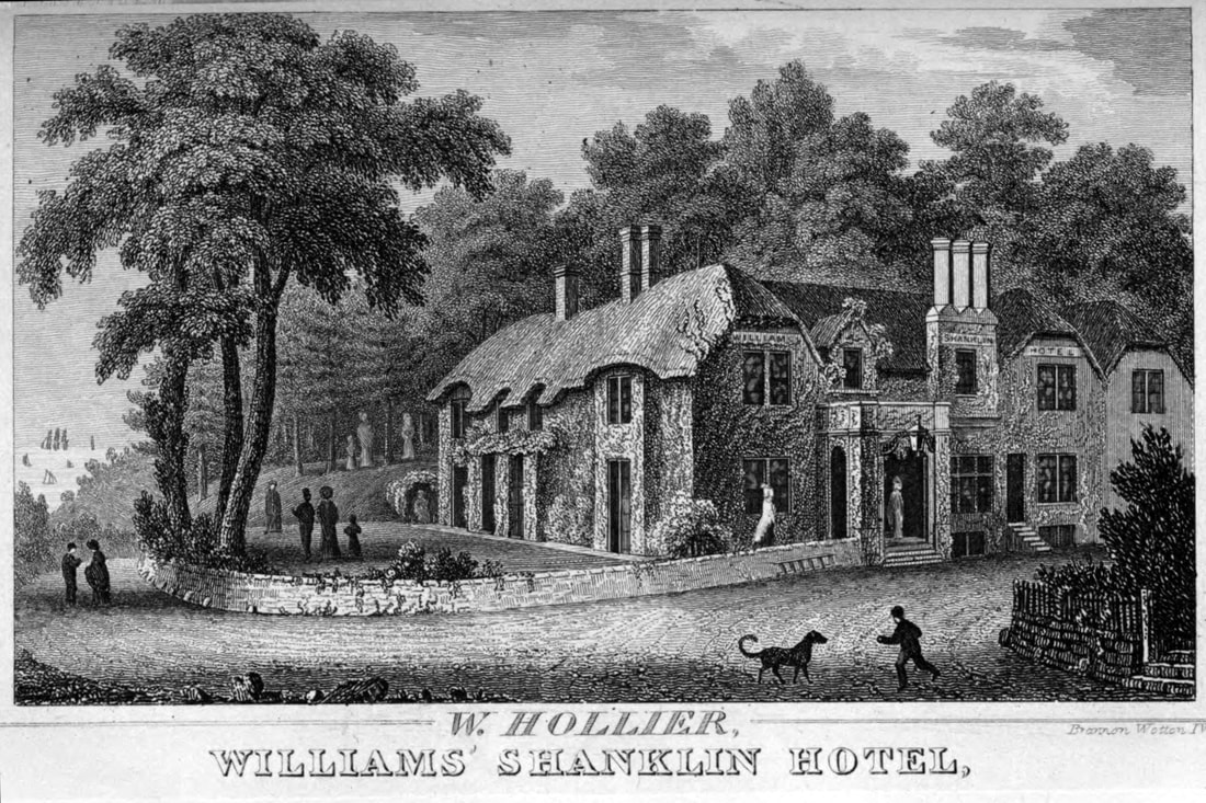
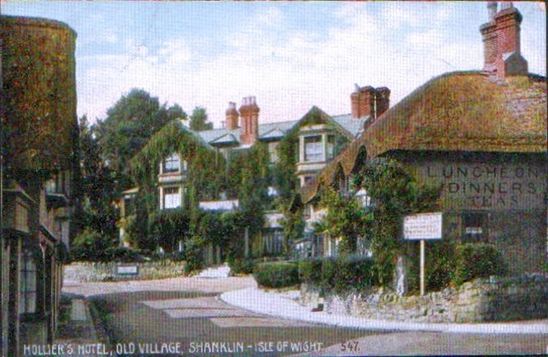
Originally built in the late 17th or early 18th century as a coaching inn, Holliers is the oldest hotel in Shanklin, Isle of Wight and is still licensed to post horses! It originally had a thatched roof, as the surrounding cottages do. It was substantially extended during the Victorian era when it was known as called Williams Hotel, run by William & Alice Hollier, who died respectively in 1875 and 1879. It lies within the Shanklin Conservation Area.
News Source: Island Echo
The main Shanklin to Ventnor Road is blocked in both directions whilst the incident is dealt with. Southern Vectis buses will divert via Whiteley Bank until further notice. The Isle of Wight Ambulance Service initially dispatched an ambulance crew to the scene but they have quickly stood down.
Leighton Bryant, Tactical Advisor for the incident, has confirmed that around 30 residents have been evacuated and are currently sheltering in the nearby Crab Inn. The fire, which broke out in an outbuilding used as a laundry room at just before 21:00, has now been extinguished. Firefighters are using a thermal imaging camera to check for hotspots and are cutting away to ensure the fire does not reignite. 4 breathing apparatus, 2 hose reel jets and 1 hydrant have been used to tackle the fire, which is thought to have started in either a tumble dryer or washing machine. Firefighters were decontaminated due to the potential presence of asbestos in the damaged outbuilding.
It was the aim was to get residents back in the hotel for the night, subject to safety and electrical checks. But by 10.30pm, the decision was taken that patrons would have to seek alternative accommodation for the night. The same is said for a neighbouring property. The Channel View Hotel in Shanklin have offered assistance, if required. The Isle of Wight Fire and a Rescue Service are beginning to stand down from the incident.
Update: Fire crews have been called back to Holliers Hotel in Shanklin this morning (Thursday) following last night’s laundry room fire. Appliances from Sandown, Shanklin and Ventnor have been mobilised to Church Road in the Old Village alongside the Aerial Ladder Platform and Incident Command Unit from Newport. It’s understood the fire, which was extinguished shortly before 22:00 last night, has reignited – despite crews damping down and cutting away.
Originally built in the late 17th or early 18th century as a coaching inn, Holliers is the oldest hotel in Shanklin, Isle of Wight and is still licensed to post horses! It originally had a thatched roof, as the surrounding cottages do. It was substantially extended during the Victorian era when it was known as called Williams Hotel, run by William & Alice Hollier, who died respectively in 1875 and 1879. It lies within the Shanklin Conservation Area.
News Source: Island Echo
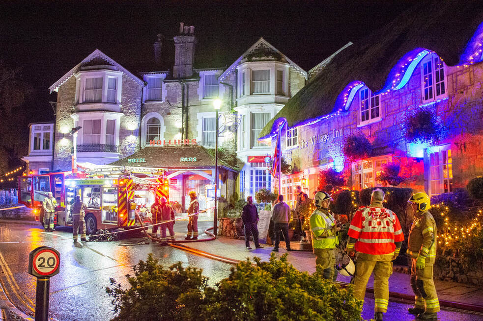
Fire crews from Shanklin, Sandown and Ventnor are on scene at Holliers Hotel in the Old Village
Near Miss
26 October 2020 (19:23) - Fire service called to bin blaze at Boscombe Pier
26 October 2020 (19:23) - Fire service called to bin blaze at Boscombe Pier
A fire crew responded to a bin fire at Boscombe Pier on Monday evening. At 7.23pm, one fire engine from Southbourne Fire Station was called to the bin fire at Boscombe Pier. The crew extinguished the fire using a hose reel and the blaze was under control by 7.35pm. Dorset & Wiltshire Fire and Rescue Service urged people to take care when discarding flammable or lit objects.
The pier opened on 28th July 1889. The Pier 'neck' or entrance building to the pier was built in 1958-60 by Bournemouth Borough Engineer's Department and is Grade II listed.
News Source: Daily Echo
The pier opened on 28th July 1889. The Pier 'neck' or entrance building to the pier was built in 1958-60 by Bournemouth Borough Engineer's Department and is Grade II listed.
News Source: Daily Echo
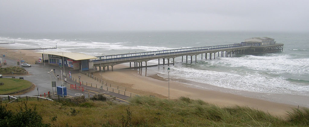
Boscombe Pier
Listing Details
|
Entry Name: Neck or Entrance Building at Boscombe Pier
Listing Date: 8 December 2004 Grade: II Source: Historic England Source ID: 1391158 English Heritage Legacy ID: 491448 Location: Bournemouth, Christchurch and Poole, BH5 County: Bournemouth Christchurch and Poole Electoral Ward/Division: Boscombe West Built-Up Area: Bournemouth Traditional County: Hampshire Lieutenancy Area (Ceremonial County): Dorset Church of England Parish: Bournemouth St Andrew, Boscombe Church of England Diocese: Winchester |
Coordinates
Latitude: 50.7198 / 50°43'11"N Longitude: -1.8432 / 1°50'35"W OS Eastings: 411167 OS Northings: 91140 OS Grid: SZ111911 Mapcode National: GBR XCX.45 Mapcode Global: FRA 7705.RRN Plus Code: 9C2WP594+WP |
uilding History
(Researched by Heritage & Ecclesiastical Fire Protection)
The Boscombe Pier Company was formed in 1886 and the first pile was laid on 11th October 1888. Designed by Archibald Smith, the 600 foot pier opened on 28th July 1889 but, initially, was not successful.
The local council took over the pier in 1904 and erected buildings at the entrance and on the pier-head. Facilities included a busy steamer landing stage. In 1940, the pier was breached for defence reasons. In 1924/5 and 1927, the head was renewed in high alumina concrete and, between 1958 and 1960, the neck was reconstructed using reinforced concrete.
A restaurant and the Mermaid Theatre were built at the pier-head in 1961 although the ‘Theatre’, in fact, opened as a covered roller-skating rink for its first two seasons. In April 1965, the leaseholder, Cleethorpes Amusements, converted it into an arcade. The council formally took over the Mermaid ‘Theatre’ in 1988 when the lease ended.
From June 1982, the council began pursuing a policy of joint redevelopment with private leisure organisations with a view to reconstructing the pier-head which closed, on safety grounds, in 1990. The neck of the pier remained open but the Mermaid ‘Theatre’ was just used as a storage area.
In 2008, the area around Boscombe pier underwent extensive renovation. The derelict and unsafe building at the end of the pier was demolished, and replaced by a simple viewing and fishing platform. The rest of the pier was also restored.
In June 2010, at the National Piers Society Annual General Meeting at Bournemouth, the Pier of the Year award was accepted by the MP for Bournemouth East, Tobias Ellwood, and a representative of Inspieration on behalf of Boscombe Pier. In August 2010, a memorial bench was installed on the pier to remember four surfers who died between 2005 and 2009. In April 2011, the Boscombe land train route was extended to Boscombe precinct and was an immediate success.
Then in June 2011, just three years after the renovation project, the concrete casing around some of the pier supports appeared to be crumbling after it was reported to have been hit by a contractor’s barge. And by September 2011, every pile supporting the pier showed hairline cracks. Bournemouth Borough Council said the pier remained structurally sound and safe for public use while investigations regarding repair work continued.
In August 2011, the lights on the pier were turned off because, it was claimed, they kept leaking rainwater and short circuiting. In March 2012, it was reported that Bournemouth Council had to share a bill of over £5,500 to repair the pier lights after they kept short circuiting in the rain. They had earlier been off for a year after contractor Carillion fitted them during a £2.4million renovation.
In April 2015, a month after questions had been raised once again about cracks in Boscombe Pier, a councillor said nothing has been done to rectify the problem. The issue was first raised in 2011 when every pile supporting the pier showed hairline cracks.
In July 2016 it was reported that the UK’s first ever eco-friendly mini golf attraction which had opened on the pier the previous month, had proven very successful. The specially-made golf balls contained fish food and the final four holes were at the end of the pier with the 18th being bottomless so the ball could fall into the sea.
September 2019 – Should Boscombe Pier be privatised to ease traffic congestion?
The suggestion came after the BCP Council cabinet member for transport, councillor Andy Hadley, said he was “keen” to look at water buses as a way of reducing congestion across the conurbation.
24 October 2020 (23:30*) - Gwent Police appeal over Twyn-y-Ffrwd pub fire in Abersychan
Police have issued a fresh appeal for information following what is believed to be a deliberate fire at a pub. The fire happened at the Twyn-y-Ffrwd Inn, in Ffrwd Road, Abersychan, on Saturday, October 24, at around 11.30pm. The residents were home at the time, police said, but nobody was injured in the fire and damage to the property was limited.
Gwent Police said the suspected offender reportedly ran towards the pub from Lower Harpers Road, and returned that way after the incident. The fire is being treated as deliberate, and anyone with information should contact Gwent Police by calling 101, quoting crime reference number 2000388815. Alternatively, send a direct message with information to Gwent Police on Facebook or Twitter.
Pronounced 'Toon-i-frood', this cosy nook lies in a quiet backwater just off the main Blaenavon/Pontypool road. It was once two cottages believed to have been built in 1835 but recorded as a pub in 1837. It is not listed but gets a short mention in Real Heritage Pubs of Wales.
News Source: South Wales Argus
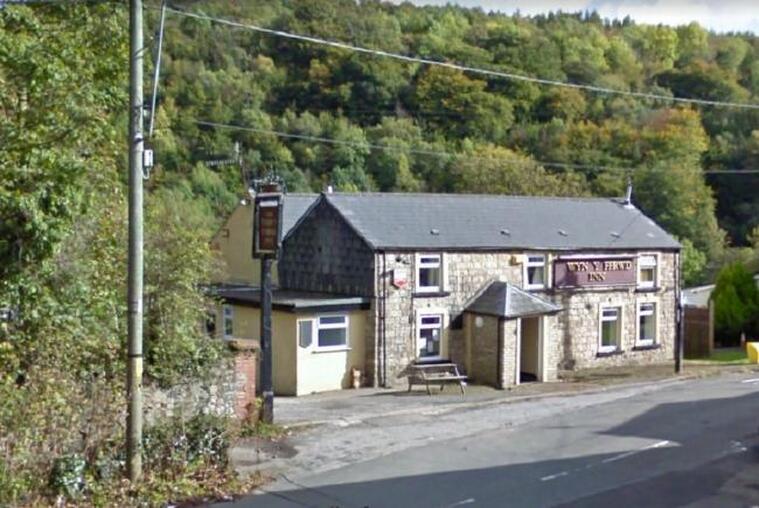
The Twyn-y-Ffrwd pub in Abersychan. Picture: Google
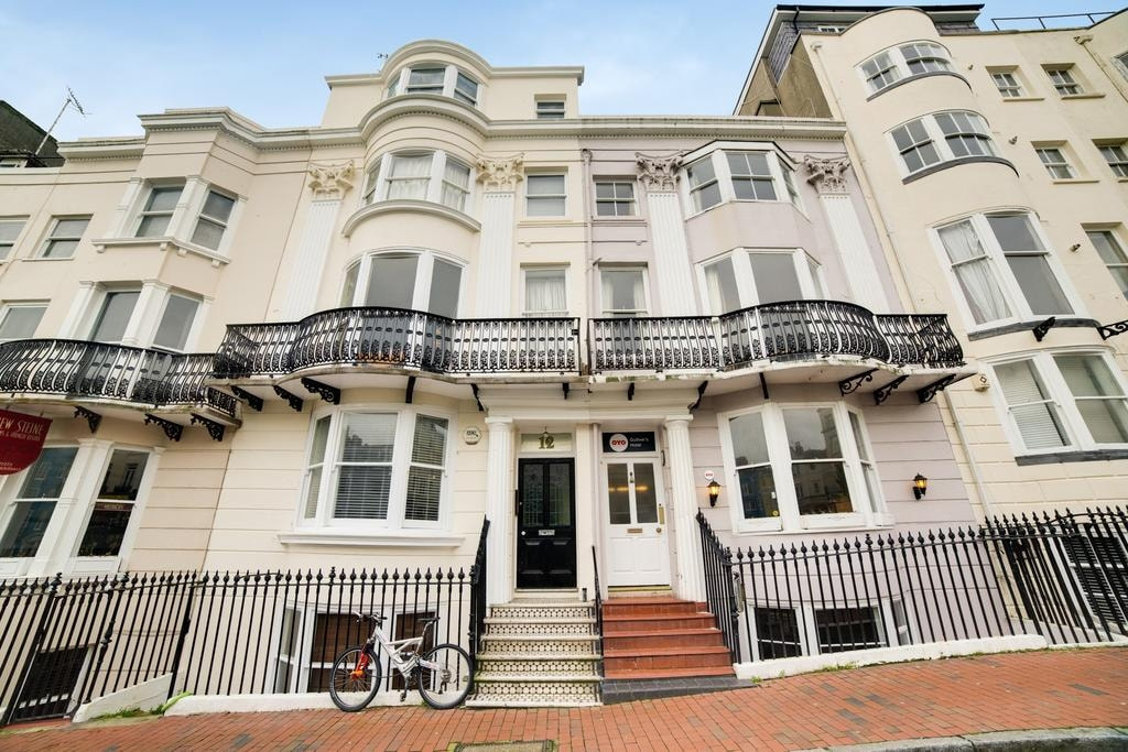
23 October 2020 (22:22) - Homeless people evacuated amid Kemp Town hotel fire
A hotel housing homeless people was evacuated when fire broke out. Fire engines and ambulances were called to Gulliver’s Hotel in New Steine, Brighton, shortly before 10.30pm on Friday. The people inside were evacuated while firefighters tackled the blaze. A nearby resident said: “I saw five engines, two ambulances as well as police. There was strong smell of burning and smoke.”
Sussex Police said they were called by the fire service at 10.22pm. “The premises were evacuated by them and management but there were no reports of any injuries,” a force spokesman said. “They contacted us again 45 minutes later and confirmed that the fire was accidental. There is no police investigation.”
Brighton and Hove City Council said it was working with fire service to ensure safety across the city. In late March, the government demanded that all councils must provide accommodation for every rough sleeper and gave the authorities money to achieve it. Brighton and Hove City Council homed its rough sleepers, reported to number about 200 at the time, by brokering deals with hotels and guest houses which were unable to accommodate guests following the announcement of lockdown measures. A council spokesman said: “The fire was quickly extinguished without damage being caused to the property and no resident was displaced. We work closely with the fire service to ensure the safety of homeless people in temporary accommodation.”
Gulliver’s Hotel is part of a Grade II listed terrace row. The buildings were originally houses when they were built in the early 19th century, but most have now been turned into hotels and guest houses.
News Source: The Argus
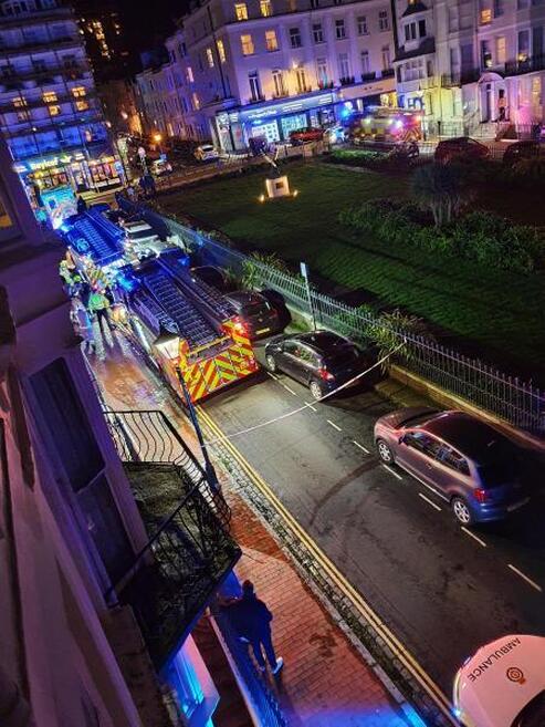
Fire at Gulliver's hotel in New Steine
Listing Details
|
Entry Name: Numbers 2-15 and Attached Railings
Listing Date: 20 August 1971 Last Amended: 26 August 1999 Grade: II Source: Historic England Source ID: 1380588 English Heritage Legacy ID: 480911 Location: Brighton and Hove, BN2 County: Brighton and Hove Electoral Ward/Division: Queen's Park Built-Up Area: Brighton and Hove Traditional County: Sussex Lieutenancy Area (Ceremonial County): East Sussex Church of England Parish: Kemp Town St Mary the Virgin Church of England Diocese: Chichester |
Coordinates
Latitude: 50.82 / 50°49'11"N Longitude: -0.1321 / 0°7'55"W OS Eastings: 531672 OS Northings: 103931 OS Grid: TQ316039 Mapcode National: GBR JP4.HFV Mapcode Global: FRA B6MX.SF6 Plus Code: 9C2XRV99+X5 |
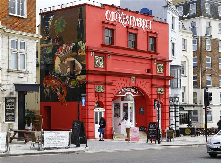
23 October 2020 (19:00*) - The Old Kent Market in Margate temporarily shut after electrical fire
A popular food and crafts market has temporarily shut after an electrical fire triggered a power outage. Fire crews were called to The Old Kent Market in Fort Hill, Margate on Friday evening to reports of an electrical box alight. Two fire engines arrived around 6pm and crews used dry power fire extinguishers to put the blaze out and isolate the power. However, cuts to the supply meant businesses who occupy the property were unable to ply their trade. Yesterday the market posted on social media: "Hi all, unfortunately we have been struck by a power cut here at the market and will not be open today or tomorrow. Hopefully this will be fixed ASAP. I will keep everyone updated when it has been fixed."
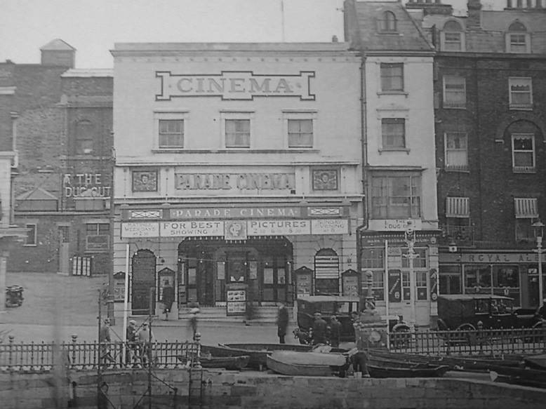
The building was originally The Parade Cinema which opened on 26th June 1911. Typical of a purpose-built cinema of its era, it had a barrel vaulted ceiling, and all seating was on a single floor. The right-hand side of the auditorium was extended beyond the main body of the auditorium, which gave a distorted view onto the screen for seating on that side. A sliding roof was provided for ventilation. The Parade Cinema was renovated in 1937. By 1952, it had been taken over by the Classic Cinemas chain, and was re-named Classic Repertory Cinema. It was closed in 1963, and became a Vogue Bingo Club.
From July 1979 to November 1981, it went back to cinema use as a 16mm cinema club screening uncensored sex films, and was operated as the New Parade Cinema. In 1982, it was converted into a snooker club. A false ceiling has been inserted in the auditorium, hiding the original barrel vaulted ceiling, and the main entrance has been partially bricked in. Latterly it was known as the Thanet Matchroom Social Club and now The Old Kent Market. The building has been lovingly restored to incorporate its history and heritage.
News Source: Kent Online

British Red Cross Dorset Emergency response shared this picture from the scene of the fire last night
Listing Details
|
Entry Name: 1 and 2
Listing Date: 26 January 1956 Last Amended: 27 October 1986 Grade: II Source: Historic England Source ID: 1119238 English Heritage Legacy ID: 105942 Location: Poxwell, Dorset, DT2 County: Dorset District: West Dorset Civil Parish: Poxwell Traditional County: Dorset Lieutenancy Area (Ceremonial County): Dorset Church of England Parish: Osmington with Poxwell St Osmond Church of England Diocese: Salisbury |
Coordinates
Latitude: 50.6584 / 50°39'30"N Longitude: -2.3652 / 2°21'54"W OS Eastings: 374278 OS Northings: 84369 OS Grid: SY742843 Mapcode National: GBR 106.NTJ Mapcode Global: FRA 57YB.DCN Plus Code: 9C2VMJ5M+9W |
(Credit: Google)
22 October 2020 (21:35) - Police to investigate fire at Bradford's Barkerend Mills
Another fire has blighted the derelict Barkerend Mills near Bradford city centre. Three crews from Bradford, Fairweather Green and Stanningley were called out at 9.35pm last night to reports of a fire on the ground and first floor. The fire was extinguished using two hose reel jets, one aerial ladder platform and six breathing apparatus sets and positive pressure ventilation.
A spokesperson for the fire service said it was believed to be "deliberate". The spokesperson added: "It was fairly substantial. It's a derelict mill anyway but there was about 25 per cent of the ground and first floor involved. Police will be investigating."
At the height of its operation, six storey Barkerend Mills, just outside of Bradford city centre, employed over 400 people. The Grade II listed mill buildings have been empty for a number of years, and areas of the site have been repeatedly damaged by fire.
News Source: Telegraph and Argus
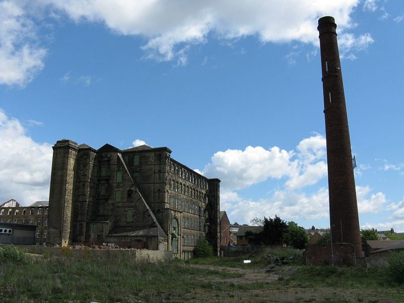
Grade II listed Barkerend Mills
Listing Details
|
Entry Name: Barkerend Mills
Listing Date: 9 August 1983 Grade: II Source: Historic England Source ID: 1314311 English Heritage Legacy ID: 336111 Location: Bradford, BD3 County: Bradford Electoral Ward/Division: Bowling and Barkerend Built-Up Area: Bradford Traditional County: Yorkshire Lieutenancy Area (Ceremonial County): West Yorkshire Church of England Parish: Bradford St Clement Church of England Diocese: Leeds |
Coordinates
Latitude: 53.7961 / 53°47'45"N Longitude: -1.7371 / 1°44'13"W OS Eastings: 417416 OS Northings: 433336 OS Grid: SE174333 Mapcode National: GBR JNJ.JS Mapcode Global: WHC99.9V27 |
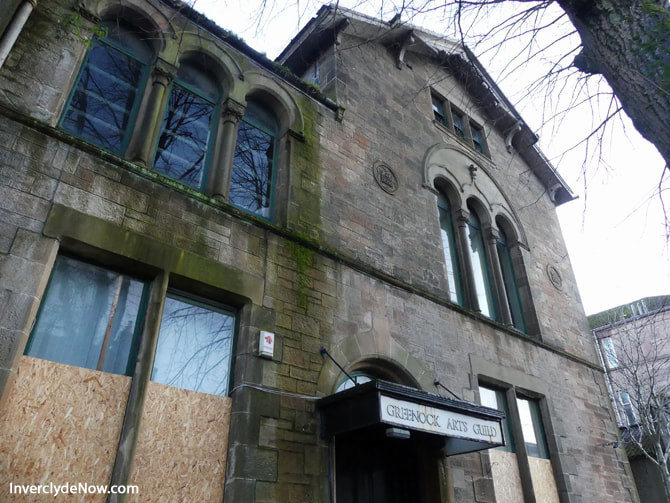
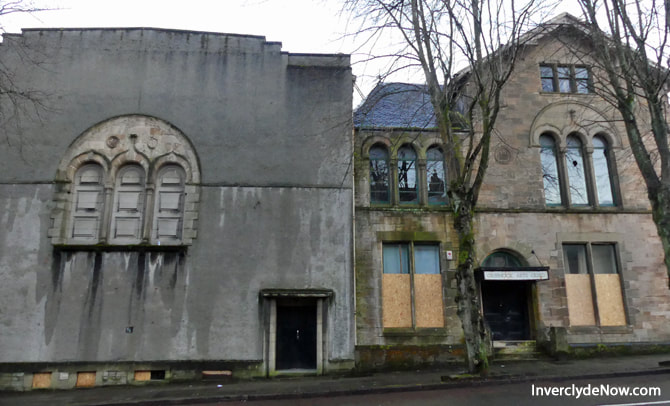
22 October 2020 (20:14) - Massive blaze rips through abandoned theatre in Scotland
A massive fire broke out inside a derelict theatre in Greenock on Thursday evening. Firefighters and police officers responded to the blaze in Inverclyde, western Scotland. Emergency services were alerted to the incident at around 8pm. The blaze went on to engulf the former Arts Guild Theatre. Four fire engines were dispatched to tackle the blaze. The area has been cordoned off by police. It is not known if there have been any casualties. A Scottish Fire and Rescue Service spokesman said: “At around 8.14pm, we were called to reports of a building fire in Campbell Street, Greenock. Operations control mobilised four appliances to the incident. Firefighters remain in attendance.”
The Arts Guild in Greenock was the main theatre venue for the Inverclyde area. The 454 seat main auditorium had a proscenium arch stage with flying facilities. There was also a small studio space, as well as several small meeting and rehearsal rooms, and the bar. The building was formerly the "West End Baths", a private swimming pool built in 1881 which closed in 1941. After 60 years of service this building was considered no longer fit for purpose and construction of a new facility, the Beacon Arts Centre, began in 2011. The Arts Guild closed as a theatre on 08 December 2012. It is believed to have been scheduled for demolition.
News Source: Express
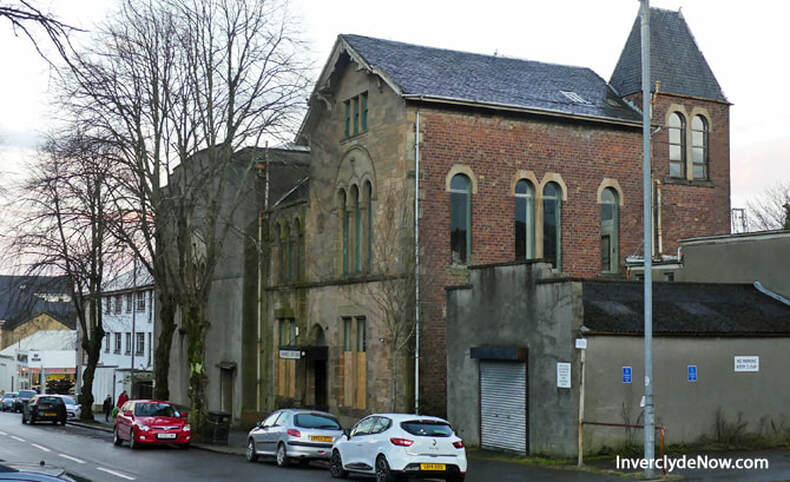
The former West End Baths was converted to the Arts Guild Theatre in 1949
|
|
Building History
(Researched by Heritage & Ecclesiastical Fire Protection)
In the immediate aftermath of World War II, people of Greenock sought a war memorial to be "something worthy of the sacrifice of the fallen, and of practical value to those who have survived". The Greenock Telegraph publicised the need for ideas, and its managing director Ryrie J Erskine Orr spoke at the 1945 West Renfrewshire Drama Festival, proposing "a beautiful and living theatre that would be the headquarters of all the cultured arts."
The Greenock Arts Guild Ltd was founded as a non-profit charitable company to promote local participation in arts activities, and incorporated on 4 December 1946. They bought the "West End Baths", a disused private swimming pool built in 1881 which had closed in 1941, put together plans and material, and raised funds for its conversion. They also promoted theatre productions in other halls in the interim.
The Arts Guild Theatre opened in 1949 with two meeting rooms and a small 100-seat theatre on the first floor of the building, which was named the Wallace Bennett Theatre in memory of a Royal Air Force serviceman from Greenock, and occupied the former billiards room. This was the first new theatre in mainland Britain for more than twenty years, and was greeted with widespread expressions of support, including messages from Benjamin Britten, John Gielgud, Malcolm Sargent, Sybil Thorndyke and Vaughan Williams.
Public performances in this theatre enabled the Arts Guild to gather a local reputation, which helped it to raise funds to cover the cost of building the Main Auditorium. The building had cost £1,000, and construction of the bottom floor theatre (now named the Main Auditorium) was estimated in 1947 to cost within the region of £18,000.The Scottish Arts Council at the time where impressed with the enthusiasm of the group and proposed to lend £9,000 to aid with its construction.
The Main Auditorium which opened in 1955 was converted from the swimming pool itself, with the slope of the pool floor forming raked stalls giving good sightlines to the stage built at the pool's deep end. A live television broadcast from this theatre in 1956 made The Greenock Players (which had formed in 1943) the first amateur dramatic company in Scotland to be televised. The Arts Guild Theatre complex developed as an arts centre and community theatre, with performances from both amateur and professional theatre companies. A scenery store and two additional meeting rooms were added in the 1960s, and in the 1980s the Wallace Bennett Theatre was adapted to become a flexible studio space.
The Main Auditorium provided 454 raked seats in total on two levels (120 circle, 334 stalls, including 5 wheelchair spaces). The Wallace Bennett Theatre allowed 80 seated places. The Arts Guild Theatre also had four dressing rooms, and four rehearsal rooms. It became a receiving house for touring shows, including well known names such as Scottish Opera and Dorothy Paul, as well as producing house with half the performances amateur. It also put on classes and workshops in music, art and drama.
In 2004 it was proposed that the Guild should seek funding to redevelop the Campbell Street premises. The estimated cost was £5.5million and in 2006, the Scottish Arts Council agreed to award £2.6 million towards the refurbishment, with the remainder to be raised by the Guild. Subsequently, however, Inverclyde Council approached the Guild to suggest that they might wish to relocate to a more central site on the waterfront and that that could lever additional support from Riverside Inverclyde. After several months of discussion and a feasibility study, the Guild opted to build a brand new arts centre - The Beacon - on former ship repair graving yard and dockland beside Customhouse Quay.
The Arts Guild Theatre closed with a last show on Saturday 8 December 2012, a performance of the pantomime Cinderella by the Greenock Players amateur dramatic company. The building was subsequently used by the Thistle Theatre Group, but it continued to deteriorate and in December 2017 its owners Peel Land and Property announced demolition of the old premises early in 2018.
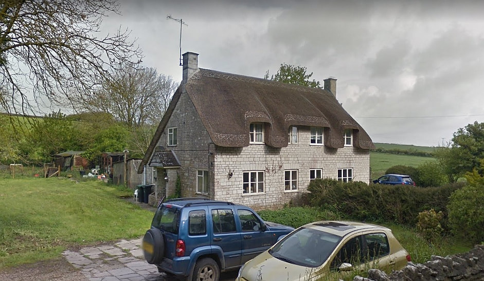
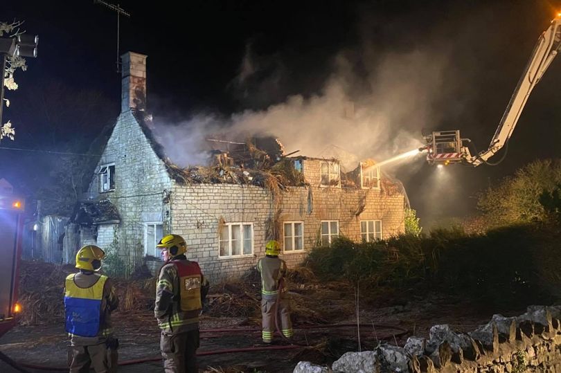
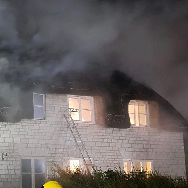
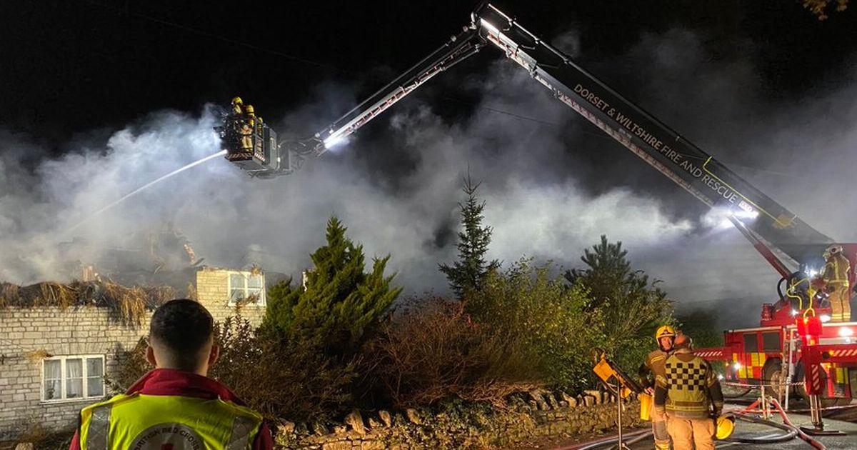
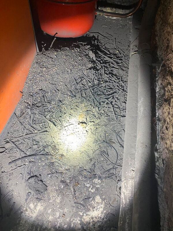
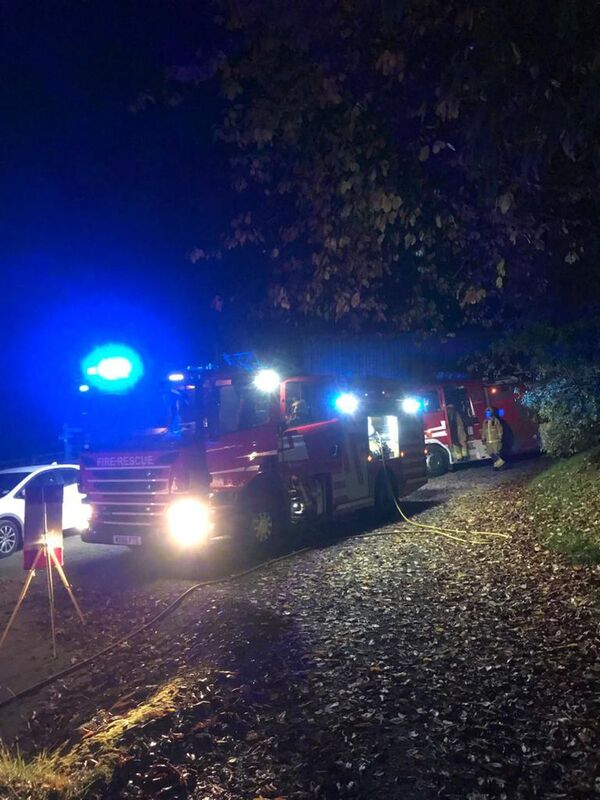
22 October 2020 (18:43) - 65 firefighters deal with 'significant' Dorset house fire
A person was taken to hospital last night as firefighters from across Dorset dealt with a "significant" fire in a thatched cottage. Approximately 65 firefighters were fighting a blaze at a thatched cottage in Poxwell, with photos from the scene showing the house well alight. One person was taken to hospital, they were suffering from smoke inhalation.
Firefighters were initially called at 6.43pm for reports of a kitchen fire in one of a pair of semi-detached cottages, which had spread to the thatched roof. A spokesman for Portland Fire Station said: "At its peak over 20 appliances were in attendance including multiple specials such as an aerial ladder appliance, water carriers, a command support unit, and an incident support unit." All of the occupants were accounted for and possessions from the affected homes have been salvaged. The A353 between Warmwell Cross Roundabout and Osmington Mills was closed as emergency services attend the scene. It has since been reopened. Dorset Police has told people to "please avoid the area."
A spokesman for Dorset and Wiltshire Fire and Rescue said earlier on Thursday evening: “A 999 call was received at 6.43pm for reports of a kitchen fire in one of a pair of semi-detached cottages, which was spreading to the thatched roof. As at 8.15pm, there were 13 fire crews and approximately 65 firefighters on scene – from Weymouth (two), Wareham, Bere Regis, Portland (two), Dorchester, Hamworthy, Poole (two), Beaminster, Bridport and Westbourne – together with an aerial ladder platform from Westbourne, a water carrier from Poole, and support units from Hamworthy and Poole. Crews are currently tackling the fire to try and contain it, while also salvaging possessions from the affected homes. All occupants are accounted for. One person was taken to hospital with smoke inhalation. The A353 between Warmwell Roundabout and Osmington Mills will be closed for some considerable time, and drivers are asked to avoid the area."
The pair of semi detached cottages were built in 1843 and are Grade II listed. It lies within Poxwell Conservation Area.
News Source: Dorset Echo
The Poxwell fire
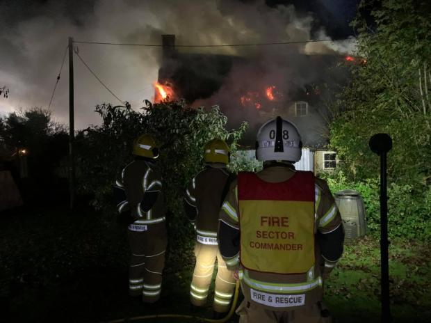
British Red Cross Dorset Emergency response shared this picture from the scene of the fire last night
Listing Details
|
Entry Name: 1 and 2
Listing Date: 26 January 1956 Last Amended: 27 October 1986 Grade: II Source: Historic England Source ID: 1119238 English Heritage Legacy ID: 105942 Location: Poxwell, Dorset, DT2 County: Dorset District: West Dorset Civil Parish: Poxwell Traditional County: Dorset Lieutenancy Area (Ceremonial County): Dorset Church of England Parish: Osmington with Poxwell St Osmond Church of England Diocese: Salisbury |
Coordinates
Latitude: 50.6584 / 50°39'30"N Longitude: -2.3652 / 2°21'54"W OS Eastings: 374278 OS Northings: 84369 OS Grid: SY742843 Mapcode National: GBR 106.NTJ Mapcode Global: FRA 57YB.DCN Plus Code: 9C2VMJ5M+9W |

(Credit: Google)
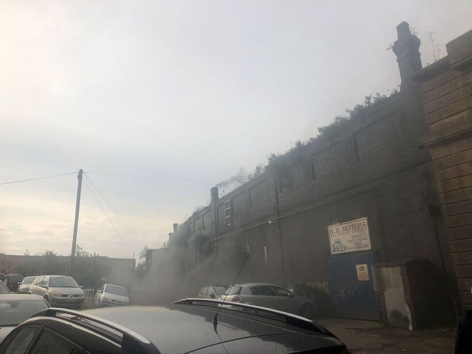
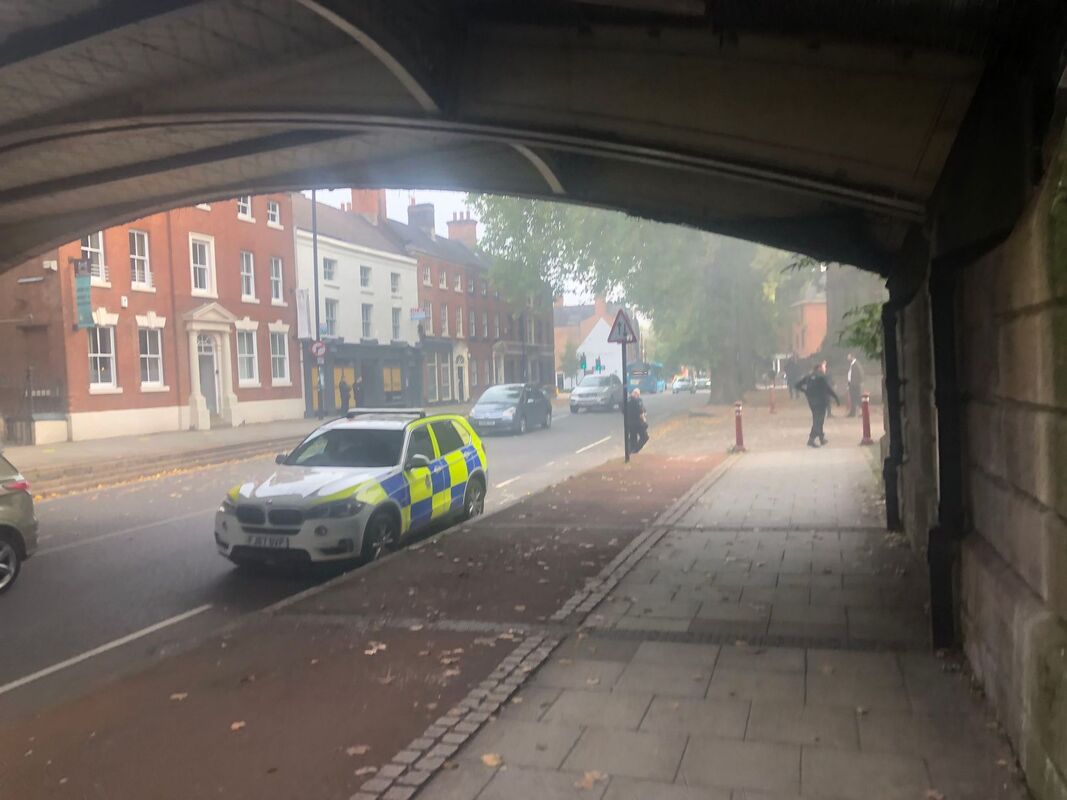
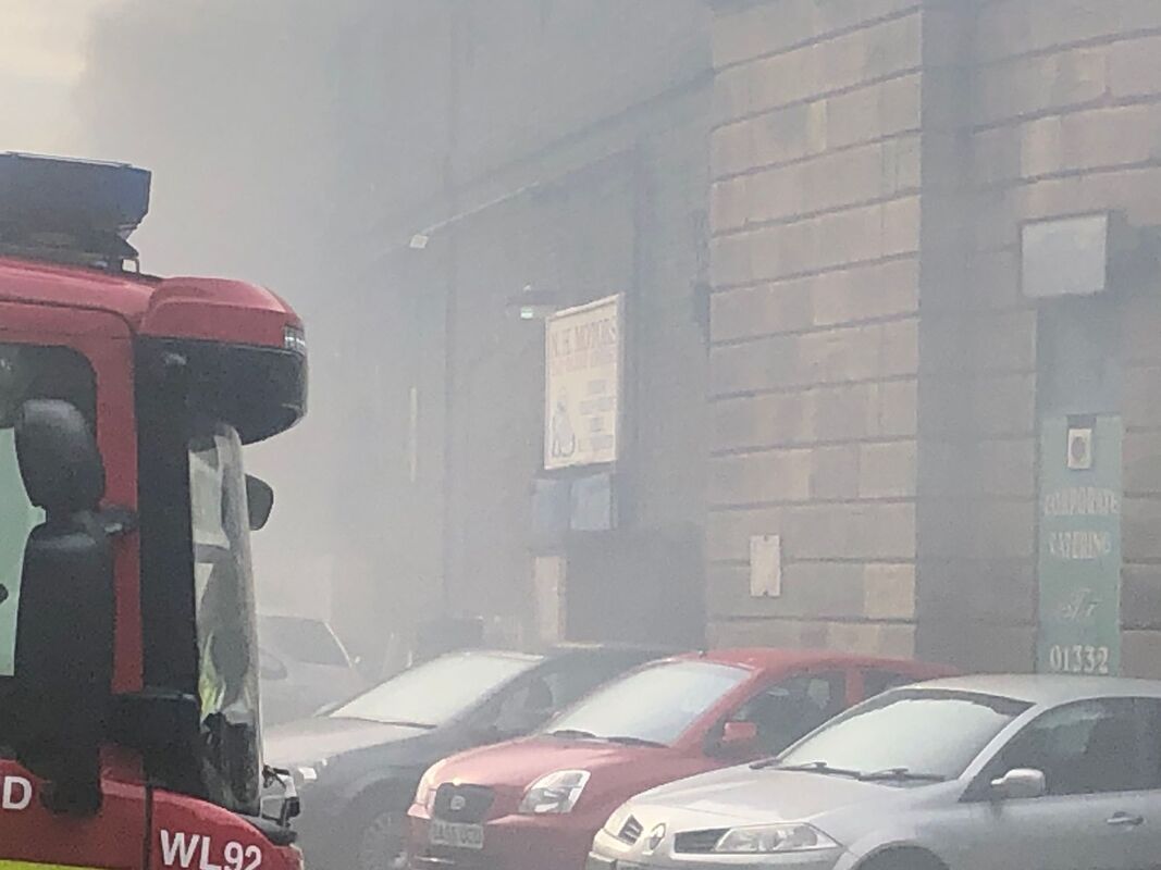
19 October 2020 (13:00*) - Fire breaks out at historic Derby city centre landmark
A fire broke out today at a historic Derby landmark which brought disruption to a key route through the city centre. The blaze broke out near N H Motors at the Friar Gate Arches by the Grade II listed Friar Gate Bridge. The fire had taken hold by around 1pm today, October 19, by which time Derbyshire police were at the scene, warning bystanders to stay back.
The incident was caught on film by University of Derby student Daniel Ross. Mr Ross said: "There weren’t many emergency workers there at the time, but there was a police officer who requested that all the observers to step back, away from the smoke. Police cars came and then fire trucks. I spoke to some people who were just passing by and they were concerned about what was going on, although as far as I can tell, nobody was in direct danger."
In video footage, smoke can be seen billowing out of the side of a building located just underneath Friar Gate Bridge. Mr Ross added: "One member of the public asked if someone was trapped inside, to which a police officer responded that it was just a fire. After approximately 20 minutes, the police had began stopping people from heading down the road and later began condoning off the road."
Derbyshire Fire and Rescue Service shared a tweet in which it was confirmed that a fire broke out at an industrial unit on Friar Gate. The force said that a cordon which had been in place during the afternoon was lifted at around 3.30pm. A Derbyshire Police spokesperson said: "We received a call at just after 1.10pm today (Monday 19 October) at an industrial building on Friar Gate, Derby. Police and fire crews remain at the scene. It is not yet known if it is suspicious."
The Friar Gate Bridge was built by Andrew Handyside and Co, Ironfounders of Derby in 1878.
News Source: Derby Telegraph / Derbyshire Live
A fire broke out at Friar Gate Arches at around 1pm on October 19 (Image: Daniel Ross)
Listing Details
|
Entry Name: Friar Gate Railway Bridge
Listing Date: 28 March 1974 Grade: II Source: Historic England Source ID: 1216461 English Heritage Legacy ID: 401869 Location: Derby, DE1 County: City of Derby Electoral Ward/Division: Darley Built-Up Area: Derby Traditional County: Derbyshire Lieutenancy Area (Ceremonial County): Derbyshire Church of England Parish: Derby St John the Evangelist Church of England Diocese: Derby |
Coordinates
Latitude: 52.924 / 52°55'26"N Longitude: -1.4855 / 1°29'7"W OS Eastings: 434689 OS Northings: 336412 OS Grid: SK346364 Mapcode National: GBR PHF.H5 Mapcode Global: WHDGT.4RXR Plus Code: 9C4WWGF7+JR |
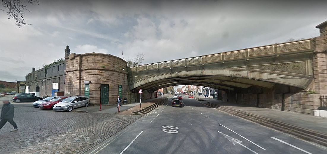
The Friar Gate Bridge (Credit: Google)
17 October 2020 (11:05*) - Firefighters find cannabis plants inside burning St Pauls building
Fire crews stumbled across a stash of suspected cannabis plants as they tackled a blaze at a block of flats. One man was rescued from the roof of the burning building in St Pauls on Saturday (October 17), after climbing out from a top-floor window to escape the smoke. A woman and two children were also evacuated from the building in Bishop Street, shortly after 11am, and everyone managed to get out safely. One neighbour said that, even after firefighters left, a police officer remained on guard outside the entrance and two police cars were parked in nearby Portland Square.
Avon and Somerset Police has now confirmed why they were involved in the incident, and said officers seized "a number of suspected cannabis plants" from inside. A spokesperson said: "We received a call from the fire service after firefighters found a number of suspected cannabis plants during an incident they were dealing with in St Pauls. Four people within the block of flats in Bishop Street had been evacuated by fire crews during the incident. Western Power was also called to the scene to make sure the building was safe before officers could enter the address and seize the plants."
Police remained on scene until Sunday afternoon, and enquiries are continuing. The force was unable to confirm how many plants were seized, or what their potential street value was. No arrests have been made at this time. Anyone with information can report it online via the force's website, or call 101, quoting reference number 5220235663. The fire service has not yet confirmed the cause of the blaze.
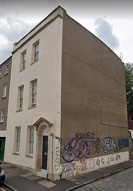
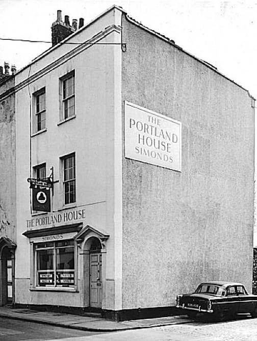
The Grade II listed building dates back to the late 18th century and was formerly The Portland House public house. The pub closed around 2005 and the building was converted to residential flats.
News Source: Bristol Post / Bristol Live
Avon and Somerset Police has now confirmed why they were involved in the incident, and said officers seized "a number of suspected cannabis plants" from inside. A spokesperson said: "We received a call from the fire service after firefighters found a number of suspected cannabis plants during an incident they were dealing with in St Pauls. Four people within the block of flats in Bishop Street had been evacuated by fire crews during the incident. Western Power was also called to the scene to make sure the building was safe before officers could enter the address and seize the plants."
Police remained on scene until Sunday afternoon, and enquiries are continuing. The force was unable to confirm how many plants were seized, or what their potential street value was. No arrests have been made at this time. Anyone with information can report it online via the force's website, or call 101, quoting reference number 5220235663. The fire service has not yet confirmed the cause of the blaze.
The Grade II listed building dates back to the late 18th century and was formerly The Portland House public house. The pub closed around 2005 and the building was converted to residential flats.
News Source: Bristol Post / Bristol Live
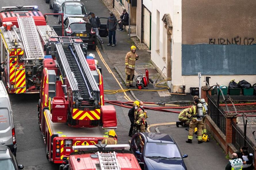
Firefighters on scene in Bishop Street on Saturday (Image: Matt Whiteley/ Black and Whiteley Photography)
|
|
Listing Details
|
Entry Name: Portland House Public House
Listing Date: 4 March 1977 Grade: II Source: Historic England Source ID: 1202002 English Heritage Legacy ID: 378963 Location: Bristol, BS2 County: City of Bristol Electoral Ward/Division: Ashley Built-Up Area: Bristol Traditional County: Gloucestershire Lieutenancy Area (Ceremonial County): Bristol Church of England Parish: Bristol St Paul's Church of England Diocese: Bristol |
Coordinates
Latitude: 51.4618 / 51°27'42"N Longitude: -2.5846 / 2°35'4"W OS Eastings: 359485 OS Northings: 173805 OS Grid: ST594738 Mapcode National: GBR CBG.DV Mapcode Global: VH88N.5J08 Plus Code: 9C3VFC68+P5 |
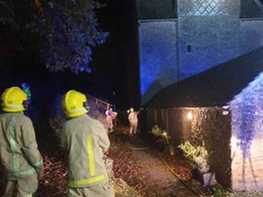
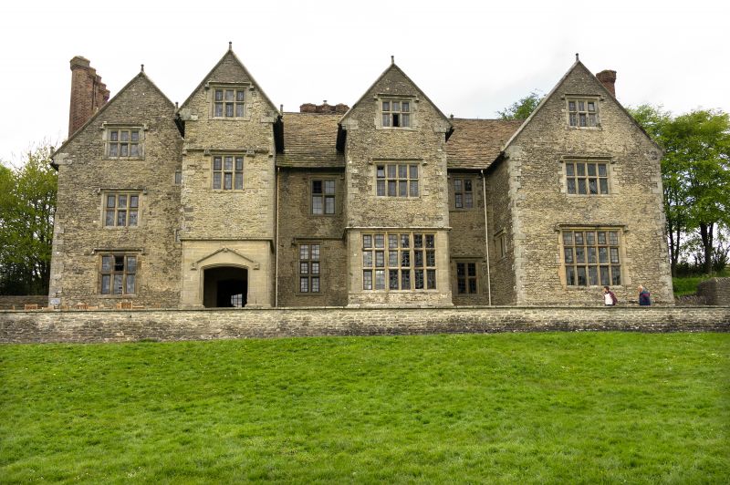
16 October 2020 (19:34) - Bird's nest causes smoke to pour into Wilderhope Manor Youth Hostel
Smoke poured into a Shropshire youth hostel after debris from a bird's nest blocked a boiler flue. Crews were called to the Wilderhope Manor Youth Hostel, in Longville in the Dale, south Shropshire, last night to find that debris from a bird's nest had blocked the boiler flue. Firefighters from Church Stretton and Much Wenlock were called out after smoke filled a room at the hostel. They dealt with the problem within half an hour, using breathing apparatus to go into the smoke-logged room, then chimney rods and a hose as well as a thermal imaging camera to check that there was no fire.
Now Shropshire Fire and Rescue Service has urged people to get chimneys and flues swept before the winter. Operations officers Jim Barker, from Much Wenlock station, said the flue had been blocked by bird's nest debris despite having a bird guard fitted. "Please ensure you have your chimney/flue swept and checked every year prior to using your boiler or fire," he said.
Wilderhope Manor dates from 1585. The house was built for Francis Smallman and is now in the care of the National Trust. It is located at Longville in the Dale on Wenlock Edge 7 miles (11 km) south west of Much Wenlock in Shropshire, England. In 1936 the property was purchased by the W. A. Cadbury Trust who donated it to the National Trust on condition that it was used as youth hostel. The manor is a Grade I listed building and since 1937 has been used by the Youth Hostel Association (YHA).
News Source: Shropshire Star
Firefighters at the youth hostel. Photo: Shropshire Fire & Rescue Service.
|
|
Listing Details
|
Entry Name: Wilderhope Manor
Listing Date: 12 November 1954 Last Amended: 29 February 2000 Grade: I Source: Historic England Source ID: 1383384 English Heritage Legacy ID: 483802 Location: Rushbury, Shropshire, TF13 County: Shropshire Civil Parish: Rushbury Traditional County: Shropshire Lieutenancy Area (Ceremonial County): Shropshire Church of England Parish: Rushbury Church of England Diocese: Hereford |
Coordinates
Latitude: 52.5319 / 52°31'54"N Longitude: -2.6718 / 2°40'18"W OS Eastings: 354527 OS Northings: 292879 OS Grid: SO545928 Mapcode National: GBR BM.FQXK Mapcode Global: VH83C.MMXF Plus Code: 9C4VG8JH+Q7 |
16 October 2020 (01:00*) - Derbyshire church windows damaged in overnight fire
A fire has damaged the exterior wall and windows of a Derbyshire church. The blaze took place outside St Paul's Church, in Quarndon, on Thursday night when the bins were moved close to the Church and set alight. An attempt was also been made to access the building via climbing up to a window but they were unable to enter.
Becky Mathew, the priest in charge of the church, is concerned about the fire, but relieved it did not spread to the inside of the building. She said: "The fire damaged the exterior wall and blackened one of our most beautiful windows. We are hoping that the damage isn't too extensive and we are just seeking some professional advice about cleaning the windows in particular. We are incredibly fortunate the fire didn’t spread and no one was injured. We would urge anyone who have may have seen something to please get in touch with Derbyshire police. As a church family we are concerned about the mental health and welfare of those involved."
St Paul's Church was built between 1872-4 and is Grade II listed.
News Source: Derby Telegraph / Derbyshire Live
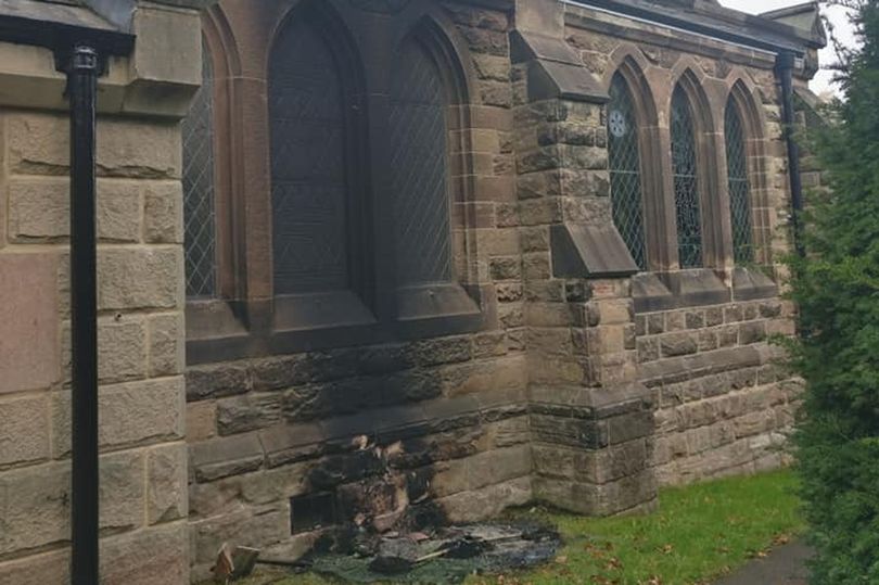
The damage the fire has done to the outside of St Paul's Church, in Quarndon (Image: St Paul's Church)
Listing Details
|
Entry Name: Church of St Paul
Listing Date: 24 January 1986 Grade: II Source: Historic England Source ID: 1109102 English Heritage Legacy ID: 78932 Location: Quarndon, Amber Valley, Derbyshire, DE22 County: Derbyshire District: Amber Valley Civil Parish: Quarndon Built-Up Area: Quarndon Traditional County: Derbyshire Lieutenancy Area (Ceremonial County): Derbyshire Church of England Parish: Quarndon St Paul Church of England Diocese: Derby |
Coordinates
Latitude: 52.9655 / 52°57'55"N Longitude: -1.5028 / 1°30'9"W OS Eastings: 433494 OS Northings: 341022 OS Grid: SK334410 Mapcode National: GBR 6DF.4VR Mapcode Global: WHCFG.WQLF Plus Code: 9C4WXF8W+6V |
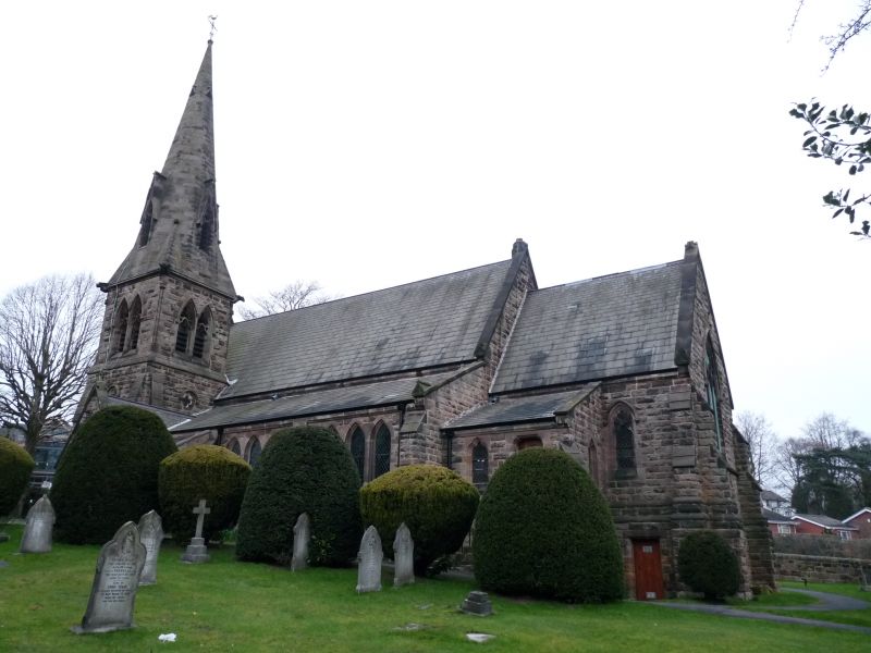
Church of St Paul
15 October 2020 (13:00*) - Crews tackle fire at derelict building in Droylsden
Firefighters battled a blaze at a derelict building in Tameside. The fire broke out at the former Victoria Mill building on Buckley Street, just off Manchester Road opposite the Tesco store in Droylsden at around 1pm on Thursday. Pictures from the scene showed smoke coming from the roof of the building. Three fire engines attended and crews donned breathing apparatus used jets to bring it under control. It took firefighters around an hour to extinguish the blaze.
Victoria Mill was built in 1845 by Edmund Buckley for Henry Lees & Brothers of
Manchester who specialised in the production of heavy cotton cloth. The mill originally
consisted of three ranges with a private canal arm to the south, but was extended
throughout the 19th and 20th centuries to include additional buildings abutting the main
mill structure, a chimney stack and associated buildings to the south and a row of workers’
housing to the north. Although cotton production ceased in 1932, the mill was reopened
after the war and repurposed for the manufacture of other materials before being split in
the later 20th century to accommodate a number of smaller businesses.
News Source: Manchester Evening News
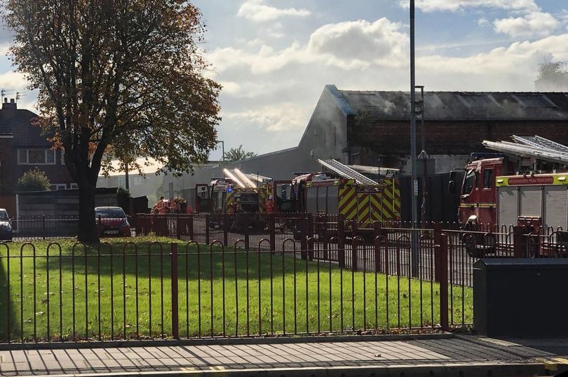
Fire crews at the scene on Thursday afternoon (Image: Mark Taylor)
Building History
(Researched by Heritage & Ecclesiastical Fire Protection)
In July 1845, Edmund Buckley began to construct Victoria Mill for Henry Lees &
Brothers of Manchester, but retained ownership of the building. This integrated spinning
and weaving mill was well placed to take advantage of the newly established transport
links nearby, with the Manchester Road turnpike to the north and the canal to the south,
complete with a private arm to serve the mill directly. The mill went into production in
March 1847. In 1850, Buckley built another mill, a weaving shed known as Angola Mill,
adjacent to the canal basin and linked to the Manchester Road turnpike by the newly
opened Buckley Street (Haynes 2004, 7). Angola Mill was put in full production in
January 1851 by Messrs Kay, Richardson & Wroe (Higson 1859, 99).
Henry Lees & Brothers specialised in producing heavy domestic cloth, such as table
cloths, which they had been producing at their mill at Cromford Court, Manchester, and
continued to produce such cloths when they expanded to Victoria Mill. The company was
owned by Henry Lees and his brothers James and Edward, but Edward left during the
1860s, to be replaced by John Kenworthy, who also owned a firm of carriers. Henry Lees
retired in 1870, and both James Lees and John Kenworthy left the company during the
1870s, leaving the company in the control of Frederick Preston Lees, James’ son.
Following a severe depression in the cotton industry, the company went into liquidation in
1879 with liabilities of £40,000, and the legal documents recount that at this time Victoria
Mill housed 13,000 throstle spindles and 10,000 mule weft spindles, and was producing
some 40,000lbs of yarns each week. The yarns were weaved into heavy domestic cloths on
330 looms, many of which were housed in a weaving shed which had been added to the
mill in 1867 (Haynes 2004, 48-9).
In 1879 the Mill was taken over by the Victoria Spinning Company, which was owned by
John Holt and his son Frank and concentrated on cotton spinning, removing the
powerlooms and introducing ring-spinning frames. The mill housed 44,500 spindles by
1891 (Worrall 1891), although the Company ceased trading in that year, and the mill was
taken over briefly by the Atlas Spinning Co, who sold the company to Joseph Byrom &
Sons in 1893 (Haynes, 2004). The Byroms continued to produce twist and weft yarns, and
converted the mill from steam to electrical driving in 1910, using 20 motors with a
combined power totalling 1.357 hp.
Victoria Mill finally closed in 1932 during the inter-war depression and was not used as a
cotton mill again, but repurposed to accommodate a number of other businesses. The mill
became multi-occupation with various smaller companies occupying the surviving three
floors in the mid- to late 20th century.
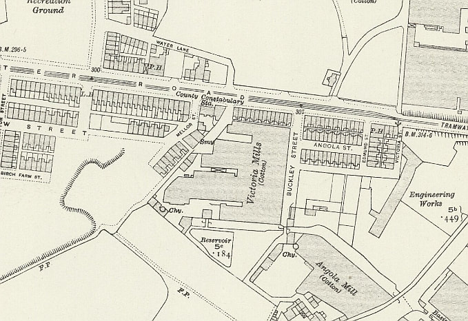
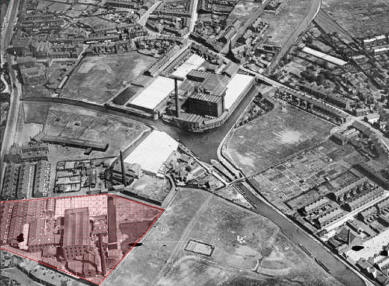
15 October 2020 (00:30) - Fire at Derby church sparks police investigation
A fire blazed through the night destroying a building at a church in Derby. Police and fire crews rushed to St Matthew’s Church, in Darley Abbey, at half past midnight yesterday morning. They found the shed to be ablaze and hastened to put it out. However, the church still suffered damage to the outside of the building. Reverend Peter Barham was concerned about the damage, but thankful as he says it could have been “far worse”. And Derbyshire police have said there is no evidence that points to this fire being linked to the two recent arson attacks on Derby schools .
Mr Barham said: “Waking up to the news of a fire at St Matthew's was not what I wanted. The shed has been destroyed, and there is a bit of damage to the stone and paintwork of the church, but it could have been far worse. Thanks to our neighbours who spotted it, and the fire crews who attended at midnight.” Mr Barham also had words of gratitude towards the emergency services who helped him. He said: “At one point later this morning we had two detectives, a police CSI photographer, two police officers, a fire investigator, a fire engine and crew, and a fire sniffer dog and handler. All of them professional, skilled, and caring. They nearly all said "are you OK Vicar? The dog didn't say that, but he wagged his tail at me. I wonder how much it costs when two fire engines, fully crewed, and a police presence arrive in the middle of the night. I wonder how much their on-going investigation will cost. It's why we pay tax. It's part of being society. Thank you.”
A Derbyshire police spokesperson said: “We were called to reports of a fire at St Matthew’s Church in Church Lane, Darley Abbey, at 12.30am on Thursday, 15 October. A shed was destroyed by the fire and minor damage was caused to the outside of the church and enquiries are ongoing into the cause of the fire. At this time there is no evidence to suggest that the fire is linked to the two school fires which occurred in Derby two weeks ago.”
St Matthew’s Church, in Darley Abbey was designed and built by Henry Moses Wood in the Gothic style. The church was consecrated on 24 June 1819. It is Grade II listed.
News Source: Derbyshire Telegraph / Derbyshire Live
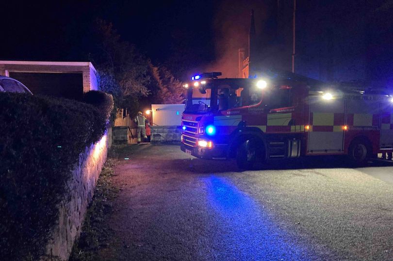
Fire crews worked hard into the night to put out the fire (Image: St Matthew's Church)
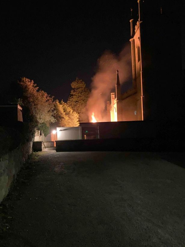
|
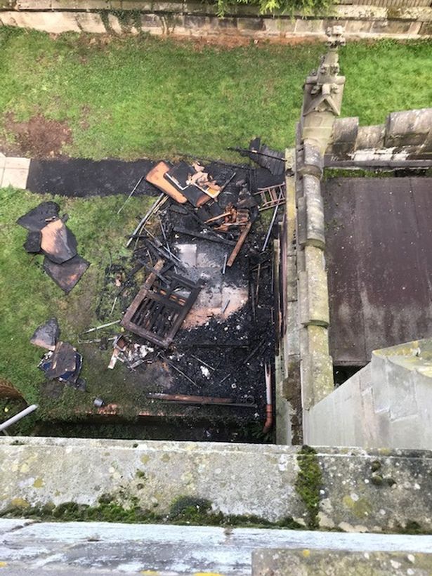
|
Listing Details
|
Entry Name: Church of St Matthew
Listing Date: 13 February 1967 Grade: II Source: Historic England Source ID: 1215814 English Heritage Legacy ID: 401106 Location: Derby, DE22 County: City of Derby Electoral Ward/Division: Darley Built-Up Area: Derby Traditional County: Derbyshire Lieutenancy Area (Ceremonial County): Derbyshire Church of England Parish: Darley Abbey St Matthew Church of England Diocese: Derby |
Coordinates
Latitude: 52.9447 / 52°56'41"N Longitude: -1.4794 / 1°28'45"W OS Eastings: 435082 OS Northings: 338721 OS Grid: SK350387 Mapcode National: GBR PJ5.TR Mapcode Global: WHDGT.77ST Plus Code: 9C4WWGVC+V7 |
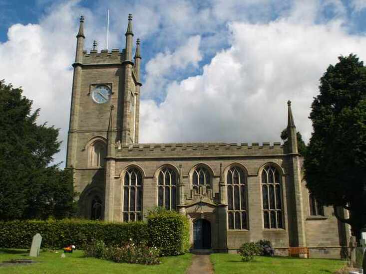
14 October 2020 (22:57) - Person treated by paramedics after fire breaks out in Dorchester flat
A person was treated by paramedics after a fire broke out in a flat's kitchen. Firefighters from Dorchester and Weymouth responded to reports of a blaze at a property on High East Street in Dorchester at 10.57pm on Wednesday (October 14). Fire engines blocked the road as crews entered the property to extinguish the blaze. An ambulance crew attended the scene and treated a resident for light smoke inhalation.
A spokeswoman for Dorset and Wiltshire Fire and Rescue Service said: "We were called to High East Street in Dorchester at 10.57pm yesterday evening. We had three crews in attendance - two from Dorchester Fire Station and one from Weymouth Fire Station. The incident was within a block of flats and the fire was in a first-floor flat's kitchen. Two breathing apparatus wearers used one hose reel jet to extinguish the fire. Nobody was injured but one person had light smoke inhalation and was checked over by an ambulance crew. The fire was started accidentally." She added firefighters left the scene at 11.35pm.
The property is an 18th century Grade II listed building and lies within the Dorchester Conservation Area. There is a plaque on the wall of the building commemorating that the poet and author John Cowper Powys lived here in 1936.
News Source: Dorset Echo
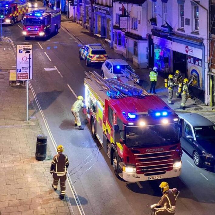
Firefighters outside the Dorchester property. Picture: Sarah Stockham/Dorset and Wiltshire Fire and Rescue Service
Listing Details
|
Entry Name: 37 and 38, High East Street
Listing Date: 8 May 1975 Grade: II Source: Historic England Source ID: 1218488 English Heritage Legacy ID: 104332 Location: Dorchester, Dorset, DT1 County: Dorset District: West Dorset Civil Parish: Dorchester Built-Up Area: Dorchester Traditional County: Dorset Lieutenancy Area (Ceremonial County): Dorset Church of England Parish: Dorchester and West Stafford Church of England Diocese: Salisbury |
Coordinates
Latitude: 50.7157 / 50°42'56"N Longitude: -2.4349 / 2°26'5"W OS Eastings: 369390 OS Northings: 90765 OS Grid: SY693907 Mapcode National: GBR PY.RGJT Mapcode Global: FRA 57S6.36N Plus Code: 9C2VPH88+72 |
13 October 2020 (21:05*) - Firefighters tackle blaze at derelict pub in Bedworth
Firefighters have tonight been tackling a blaze at a derelict pub in Bedworth. Crews from both Nuneaton and Bedworth were called to King Street just after 9pm. The blaze is believed to have taken hold at the British Queen pub, which has stood empty for almost a decade.
The road was closed by Warwickshire Police at the junction with Rye Piece Ringway and then from other side just before bridge for railway station. A spokesman for Warwickshire Fire and Rescue Service said: "Fire appliances from Nuneaton and Bedworth are in attendance at a derelict pub fire in King Street, Bedworth. Firefighters using 2 breathing apparatus, hose reel jet and thermal imaging camera, covering jet and small gear." It isn't yet known how the fire started or how much of the building is impacted. Crews were expected to be on scene until around 11pm.
The British Queen pub dates back to at least 1875, when it was known as the Queens Head. In 2018 there were plans submitted to convert the old pub into flats.
News Source: Coventry Telegraph / Coventry Live
Blaze at derelict pub on King Street, Bedworth
Near Miss
12 October 2020 (23:55) - Investigation into Bridgnorth town centre fires launched
12 October 2020 (23:55) - Investigation into Bridgnorth town centre fires launched
An investigation is underway following two fires in Bridgnorth town centre overnight. Shropshire Fire and Rescue Service were called to a fire involving a small amount of refuse alight outside the Cancer Research UK shop on Waterloo Terrace at just before midnight. One fire appliance was mobilised from Bridgnorth. Crews used a Hosereel jet to tackle the fire. The shop is Grade II listed and was built in the early 19th Century. It lies within the Bridgnorth Conservation Area.
A short time later at 12.43am firefighters were called to Salop Street to extinguish a fire involving a small quantity of rubbish and fence. Police say a male has been interviewed this afternoon in relation to the two fires and their enquiries are still ongoing. Anyone with any information is asked to call West Mercia Police on 101.
News Source: Shropshire Live
A small amount of refuse was set alight outside the Cancer Research UK shop
Listing Details
|
Entry Name: 7 and 8, Waterloo Terrace
Listing Date: 9 March 1970 Grade: II Source: Historic England Source ID: 1053931 English Heritage Legacy ID: 254565 Location: Bridgnorth, Shropshire, WV16 County: Shropshire Civil Parish: Bridgnorth Built-Up Area: Bridgnorth Traditional County: Shropshire Lieutenancy Area (Ceremonial County): Shropshire Church of England Parish: Bridgnorth Church of England Diocese: Hereford |
Coordinates
Latitude: 52.5347 / 52°32'4"N Longitude: -2.4192 / 2°25'9"W OS Eastings: 371660 OS Northings: 293061 OS Grid: SO716930 Mapcode National: GBR BZ.FF4H Mapcode Global: VH90Z.0KX8 Plus Code: 9C4VGHMJ+V8 |
12 October 2020 (19:11) - Three appliances sent to Bexhill flat fire
The crews were sent to the property in St Leonards Road, Bexhill, at 7.11pm on Monday (October 12). A spokesman for the fire service said the cause of the kitchen fire was found to be accidental. Firefighters wearing breathing apparatus used one hose reel jet to tackle the fire and a positive pressure ventilation fan was used to clear smoke from the building, according to a fire service spokesman. There were no reports of any injuries.
The Victorian era building lies within the Bexhill Town Centre Conservation Area.
News Source: Hastings Observer
The Victorian era building lies within the Bexhill Town Centre Conservation Area.
News Source: Hastings Observer
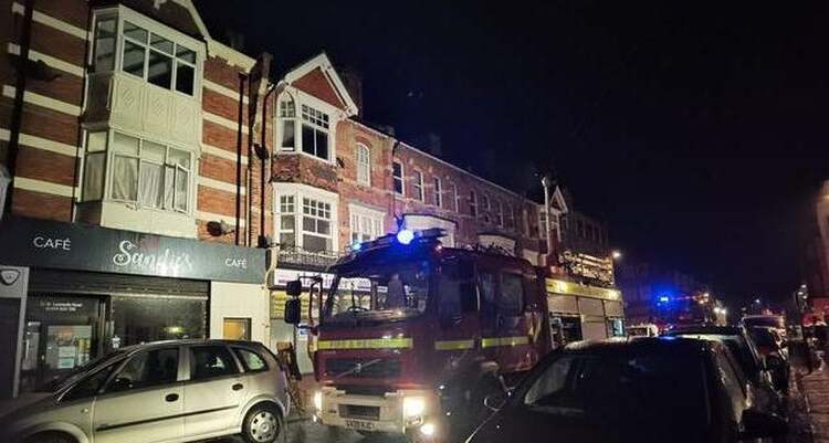
Picture: Bobo Reynolds
11 October 2020 (18:53) - Firefighters tackling Stewartby Brickworks blaze
Firefighters from Bedford, Kempston and Ampthill are currently tackling a blaze at an abandoned building at Stewartby Brickworks. Bedfordshire Fire and Rescue Service are asking people to avoid the area and advising locals living nearby to keep doors and windows closed, due to the amount of smoke in the area. However, they do say the fire remains under control. Currently there are four pumps and one water carrier in attendance at the derelict building on Broad Mead Road. At around 9:45pm, Bedfordshire Fire and Rescue said the fire had been put out but they would remain on the scene to ‘damp down’.
The brickworks date back to 1898 and by 1936 Stewartby brickworks had become the largest brickworks in the world, and was employing 2,000 people and producing 500 million bricks per annum. The works closed in 2008 because it could not achieve modern emission standards. The site, including four tall mid 20th century chimneys were to be demolished immediately after closure, but a month before the works closed, The four chimneys and two Hoffman kilns were awarded Grade II listed status.
News Source: Bedford Independant
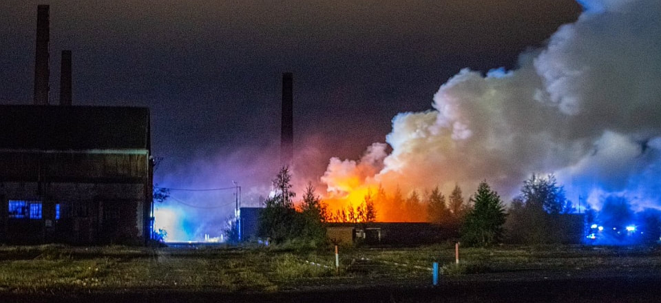
A derelict building is currently ablaze at Stewartby Brickworks.
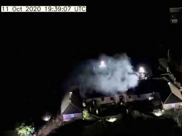
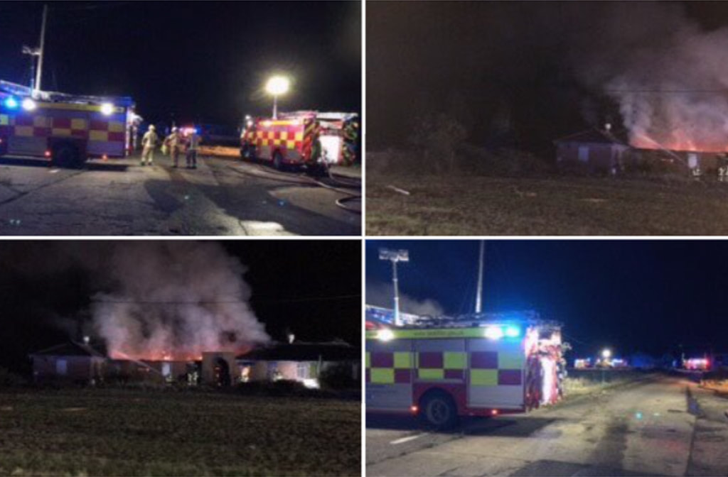
Listing Details
|
Entry Name: Two Kilns and Four Chimneys at the Stewartby Brickworks
Listing Date: 9 January 2008 Grade: II Source: Historic England Source ID: 1392357 English Heritage Legacy ID: 503054 Location: Stewartby, Bedford, MK43 County: Bedford Civil Parish: Stewartby Built-Up Area: Stewartby Traditional County: Bedfordshire Lieutenancy Area (Ceremonial County): Bedfordshire Church of England Parish: Wootton Church of England Diocese: St.Albans |
Coordinates
Latitude: 52.0733 / 52°4'23"N Longitude: -0.5168 / 0°31'0"W OS Eastings: 501749 OS Northings: 242692 OS Grid: TL017426 Mapcode National: GBR G2P.VJN Mapcode Global: VHFQM.043Z Plus Code: 9C4X3FFM+87 |
Building History
(Researched by Heritage & Ecclesiastical Fire Protection)
Brick making in this area was started in Westoning by B.J.Harfield Forder from Buriton in Hampshire. As this operation was successful Forder decided to expand into the Oxford clay belt. He opened new brickworks at Elstow and, in 1898, at Wootton Pillinge, later to be known as Stewartby.
Fletton brick making in the Peterborough area was quite well advanced by this time and Forder looked to this area when he needed partners to expand his business. All three of his sites were highly mechanised and he required more capital. Arthur and George Keeble joined Forder along with Halley Stewart, then a prospective Liberal parliamentary candidate. Stewart had capital to invest as he had recently sold his family's business in Kent.
The Keeble brothers did not want to remain in the brick making business, only wanting short-term investments, and soon sold their small brickworks to Halley Stewart to become part of the Forders' works. In 1900 Forders became a limited company and Stewart became the chairman. By 1910 Forders was producing 48 million bricks a year.
After the First World War the various brick makers within the Oxford clay belt had been reduced to four main groups, with many of the smaller brick companies losing out to competition. These four were Forders, the London Brick Company, the Itter companies and the United and Northan Brick companies. Gradually over the years the companies joined together to try to stabilise the costs and pricing within the industry. By 1923 all of the companies except Itter's had merged. They became the London Brick Company and Forders Ltd. with Percy Malcom Stewart (Halley's son) as Chairman.
In 1927 the new company purchased a controlling interest in Itter's company and in 1936 the merged companies simply traded as the London Brick Company Ltd. These early C20 mergers and changes led to some expansion at Stewartby and it was during this period in the middle of the C20 that the surviving Hoffman kilns, CK1 and CK3, were built. An aerial photograph taken in 1929 shows that at that time the brickworks lay almost entirely to the west of the railway line that divides the site, with CK1 and CK3 yet to be built. Today the works lies almost entirely to the east of the line, that to the west having been demolished. In 1926 Stewartby produced 118 million bricks and work had started on the model 'garden village' to house employees.
Based on the strong moral and religious beliefs of the Stewart family the village of Wootton Pillinge was transformed into Stewartby Model village. As well as providing decent housing, the employees benefited from better pay and working conditions and the company benefited from having a greater degree of control over its workforce. The village became known as Stewartby in 1937 and was later given Parish status.
By 1936 Stewartby brickworks had become the largest brickworks in the world, and was employing 2,000 people and producing 500 million bricks per annum; the largest part of the vast Bedfordshire industry which together employed over 5,000 people at its peak. The development of the brickworks has been a major factor in forging the character of the local communities. After the Second World War, when labour was in short supply, many workers were encouraged to immigrate from other countries to work in the industry; initially from Commonwealth countries and Poland, and then Italy and parts of Asia.
Stewartby was still said to be the largest brickworks in the world in 1979. There were then two other working brickworks in Bedfordshire at Ridgmont and Kempston Hardwick. These have since ceased production, little of them now surviving, leaving Stewartby as the sole working Bedfordshire brickworks.
As noted above, the works to the west of the railway, the earliest part of the site, has been almost entirely cleared of buildings of any historic interest. On the east side of the line, two Hoffman Kilns have been demolished along with three of the seven chimneys that survived until recently.
The Hoffman Kiln was patented by a German engineer Friedrich Hoffman for brickmaking in 1858 and Humphrey Chamberlain took out an English patent in 1868. Over time the design ws improved and adapted. In the C20, the layout of the chambers was changed to form two rows, back to back in a regualar rectangle. A special design for the Fletton brick industry incorporated additonal flues for drying and warming. It is these C20 versions which survive at Stewartby.
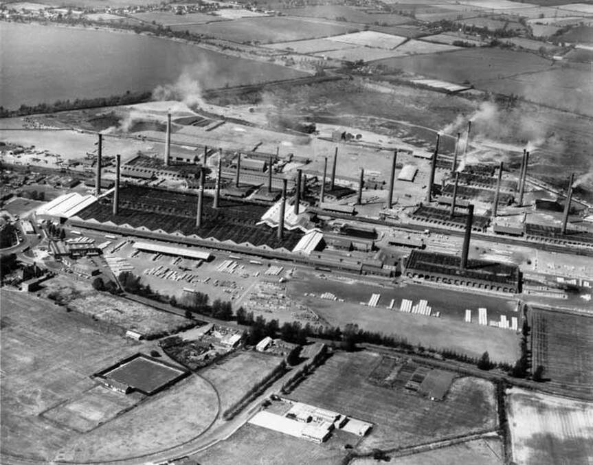
10 October 2020 (23:24) - Crews spent several hours tackling a large fire at a commercial building in Tameside
Dozens of firefighters were called to tackle a blaze at a building in Tameside overnight. Six engines raced to the fire on the third floor of a commercial building on Turner Street, in Ashton-under-Lyne, just before 11.30pm on Saturday night (October 10). Firefighters spent almost five hours fighting the flames, damping down and making the area safe.
Fire investigators were still at the scene on Sunday afternoon (October 11). A Greater Manchester Fire and Rescue Service (GMFRS) spokesperson said: “At 23:24 hours on the 10th October 2020 we were called to reports of a fire at a property in Ashton Under Lyne. Six fire engines from Stalybridge, Ashton Under Lyne, Hollins, Hyde, Mosley, Chadderton were quickly on scene of a fire involving the third floor of a commercial building on Turner Lane, Ashton Under Lyne. Firefighters used four breathing apparatus, two hose reels, Milwaukee saws, short extension ladders and a thermal imaging camera to bring the fire under control.
The building is known as James Howe Mill, which was built in the late 19th century. On early 20th century maps it is shown as a Cotton Waste Mill. It is now divided into a number of industrial units.
News Source: Manchester Evening News
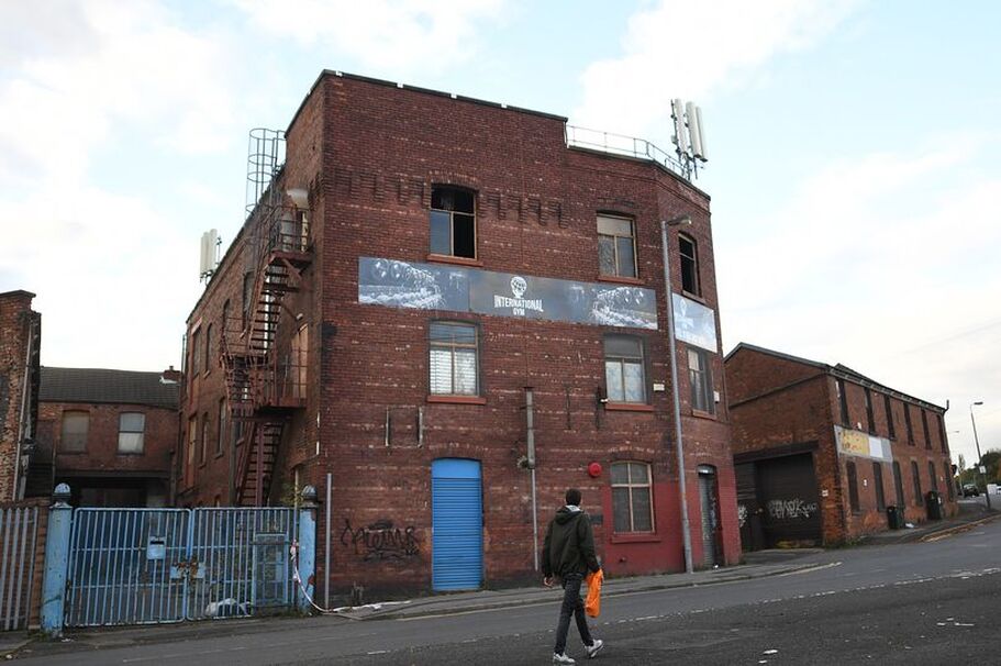
Crews spent almost five hours tackling the blaze at the building on Turner Street (Image: Manchester Evening News)
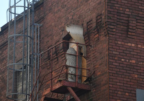
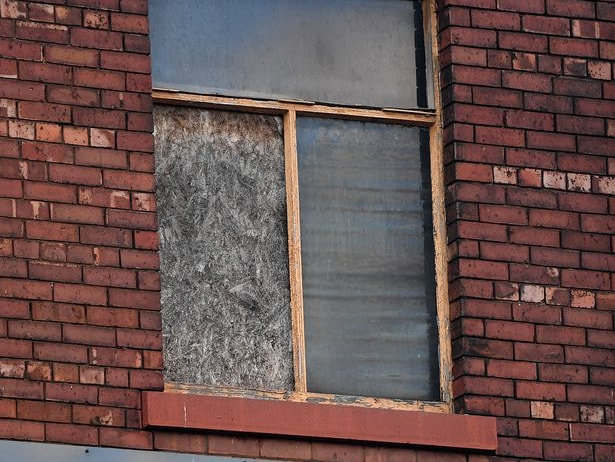
10 October 2020 (22:00*) - Police probe repeated arson attacks in historic Edinburgh graveyard
Repeated arson attacks at a historic graveyard in Edinburgh have been reported to the police by a fed up local. A concerned resident reported the fires to Police Scotland after the Scottish Fire and Rescue Service were forced to extinguish one. He believes they have been set deliberately. He said, "That graveyard is historic and it's very concerning to me that someone would do this. I would have stopped them setting the second fire but I was by myself and there were two of them with a can of petrol. They could have thrown it over me.
New Calton Burial Ground is a historic graveyard, and is the final resting place of several family members of Robert Louis Stevenson. Others buried at the graveyard include the poet William Knox, and a number of authors, doctors and people who served in the armed forces. The whole burial ground including the watch tower and boundary walls are Category B listed. It lies within both The New Town Conservation Area and the New Town Gardens Conservation Area. It also lies within the Edinburgh World Heritage Site.
Police Scotland said, "Enquiries ongoing following a report of a number of suspicious fires being set in a graveyard off Regent Road in Edinburgh on Saturday, 10 October 2020."
New Calton Burial Ground was built as an overspill and functional replacement to Old Calton Burial Ground and a place for re-interment of the bodies affected by the construction of Waterloo Place, which had cut through the Old Calton Burial Ground. This major engineering exercise took from 1817 to 1820 to complete.
News Source: Edinburgh Live
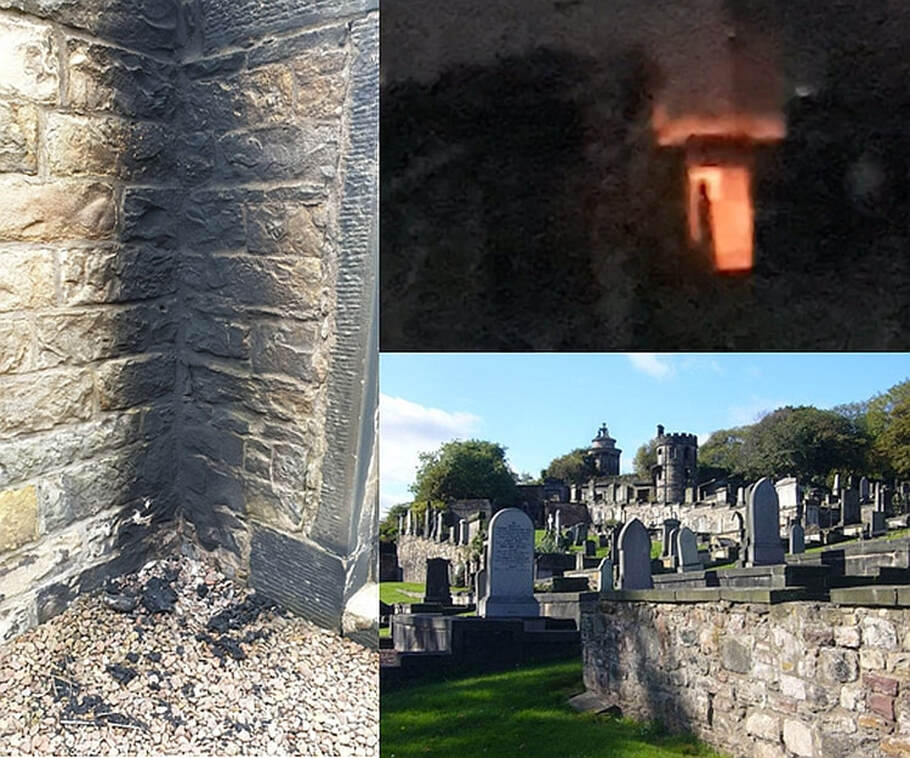
A crypt in the graveyard on fire (Image: Edinburgh Live/UGC)
Listing Details
|
Entry Name: Calton New Burial Ground, Calton Road, Edinburgh
Listing Name: Regent Road, New Calton Burial Ground, Including Watch Tower and Boundary Walls Listing Date: 19 April 1966 Category: B Source: Historic Scotland Source ID: 365298 Historic Scotland Designation Reference: LB27931 Building Class: Cultural Location: Edinburgh County: Edinburgh Town: Edinburgh Electoral Ward: City Centre Traditional County: Midlothian |
Coordinates
Latitude: 55.9535 / 55°57'12"N Longitude: -3.1763 / 3°10'34"W OS Eastings: 326647 OS Northings: 674011 OS Grid: NT266740 Mapcode National: GBR 8SF.3B Mapcode Global: WH6SM.5MRB Plus Code: 9C7RXR3F+CF |
10 October 2020 (04:30) - Donations flood in following arson attack at Birkenhead theatre
Theatre trust chairman Julie Breckon has been overwhelmed by the response to an appeal fund set up after an arson attack at The Little Theatre in Birkenhead overnight last night. The fire destroyed most of the props department at The Little Theatre in Grange Road West, but it could have been far worse had it not been for a quick-thinking resident. A woman who lives near the theatre called the fire service after hearing an alarm and smelling smoke, and firefighters were able to restrict the fire to a props room and corridor.
After visiting the theatre to see the extent of the damage Julie set up an appeal fund on justgiving to ask for donations to cover any uninsured losses the trust may have because of the fire. She set a target of £500, which has been smashed as donations flood in, with the total standing at £1,952. The theatre is home to the Carlton Players, which has performed at the theatre since the 1950s, and Julie is chairman of the Carlton Little Theatre Trust.
She said: “A resident who lives nearby smelled smoke and heard an alarm at 4.30am, so went out to take a look and contacted the fire brigade,” said Julie. “Thankfully because she called them so early the damage is nowhere near as severe as it could have been. We have lost pretty much the contents of our props department, but our auditorium, other than the smell of smoke, is relatively unscathed. The fire brigade said if it had been half an hour later the whole place could have gone up. We also have the damage to the front window, which was broken by the person who had broken in, in order to get out. When I went down there today I didn’t know the extent of the damage, and it was upsetting to see We are a charitable trust, staffed pretty much entirely by volunteers. The things which were damaged we are not going to be able to replace easily because they are things old members have donated - it’s heart-breaking to see.
She added: “The theatre means so much to our members and the community. At the moment we don’t know the extent of the damage, and the appeal fund will cover any uninsured losses we have. The fire has gone into a corridor where we store a lot of our paintings, which are irreplaceable. She thanked the community for the ‘outpouring of support,’ which she said had been ‘phenomenal’. “I set up the justgiving page to give people an option to donate if they could, and couldn’t have expected that we would even reach the £500 target.”
The building, designed by Walter Scott began as the First United Presbyterian Church, built in 1847 and opened the following year. It is constructed of stone in the Gothic style, consisting of nave and could seat 650. Since then, the turret over the entrance has been removed at some stage a narthex/porch was also built to enclose the steps to the main entrance.
The last service was held on 14 July 1948 following which the building was sold to the Birkenhead Repertory Company for use as a theatre in the 1950s. The Little Theatre is the last surviving theatre in Birkenhead and home to The Carlton Players.
News Source: Wirral Globe
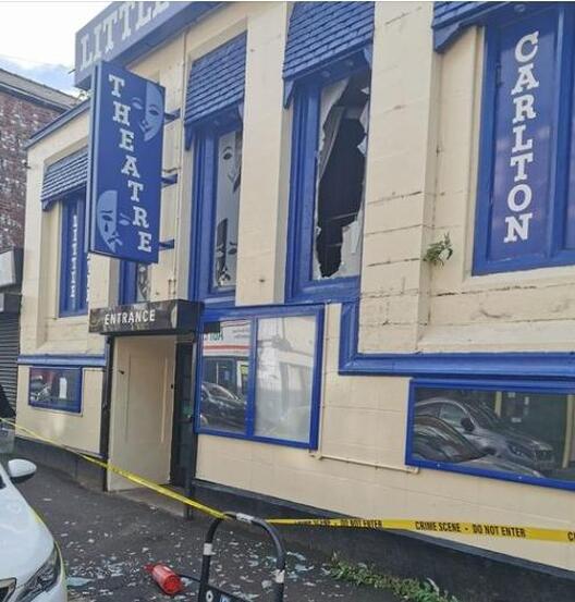
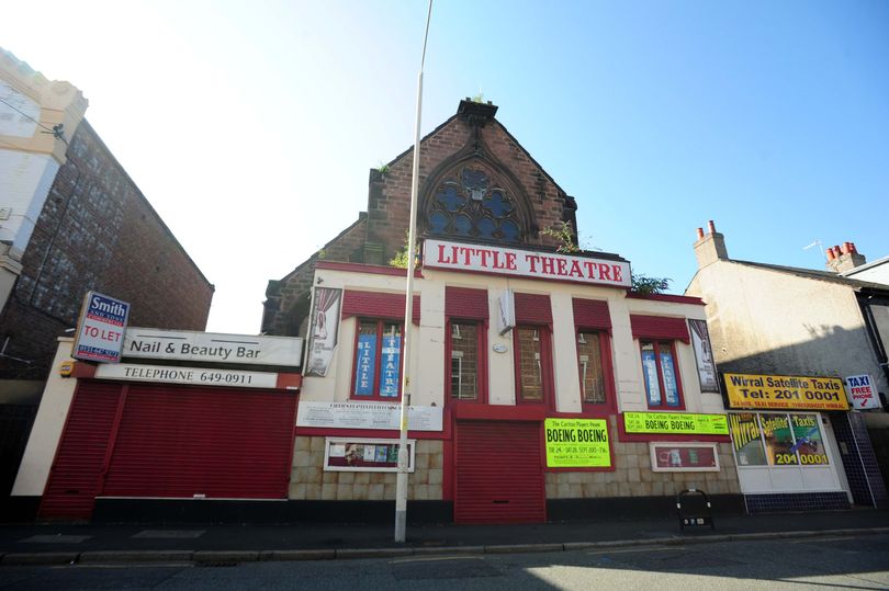
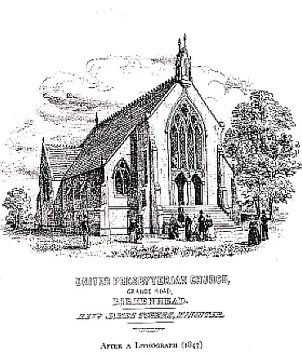
9 October 2020 (23:55) - Historic shelter wrecked in seafront fire
One of Felixstowe’s historic seafront shelters has been wrecked in a midnight blaze. Fire ripped through the newly-refurbished shelter in the gardens alongside the promenade in Sea Road, almost opposite Manwick Road. One fire crew from Felixstowe was called at 11.55pm last night, Friday, October 9, and found the building well alight. Firefighters quickly got the situatuion under control and the fire was completely out and the crew stood down at 12.37am.
The scene today showed severe damage to the seaward-side of the open shelter. WIndows had smashed and blown and woodwork was left charred. Rubbish bins were mangled and melted. The Victorian and Edwardian shelters, named Manwick and Arwela, between Bath Tap and the end of the Sea Road have been a part of the resort’s seafront for more than a century. They are loved by people eating picnics, fish and chips, sitting and reading, or sheltering from the sun or rain but still able to enjoy the sea views. East Suffolk Council this summer spent £150,000 on refurbishing the shelters on the south beach.
Geoff Holdcroft, Suffolk Coastal’s cabinet member with responsibility for economic development, said: “These well-loved shelters are situated within a prominent location on Felixstowe’s south seafront and play an important role in supporting the tourism economy within the town.”
News Source: Ipswich Star
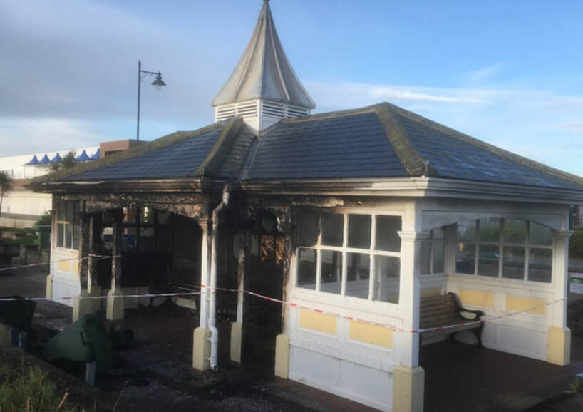
The scene today showed severe damage to the seaward-side of the open shelter.
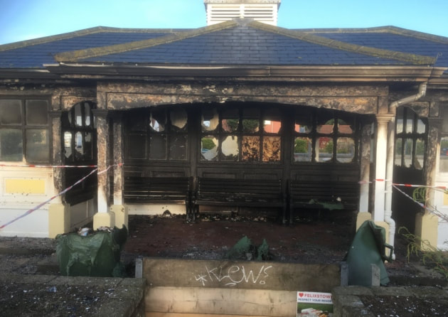
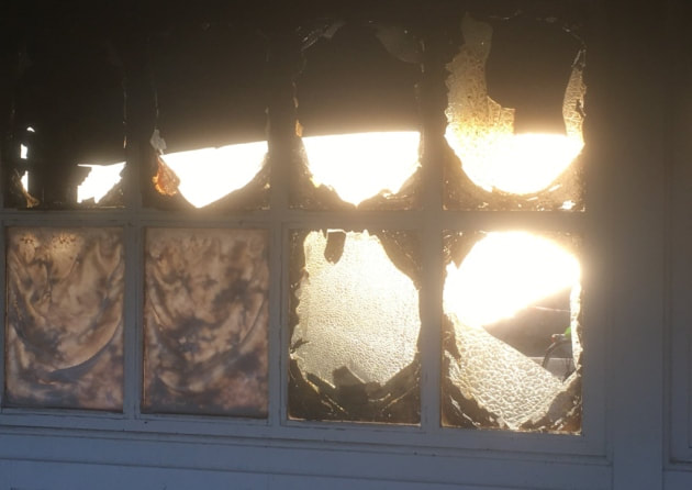


9 October 2020 (03:47) - Fire crews tackle flat oven fire on Wells high street
The occupant of a flat had a lucky escape after food left in the oven started a fire. Neighbours in the building saw smoke residue coming from a first floor flat above a shop in Wells high street. They called the fire service at 3.47am this morning (October 9).
“Crews were soon on scene and had gained entry to the flat within minutes of arriving,” said a spokesperson from Devon and Somerset Fire and Rescue Service. “One casualty, suffering from smoke inhalation, was led to safety by fire service personnel who rendered oxygen therapy awaiting the arrival of an ambulance. In the meantime, the small fire, involving food stuffs left unattended in an oven, had been extinguished by two firefighters in breathing apparatus, using a hose reel jet and thermal imaging camera. Crews worked well to prevent any further fire spread, containing it to the oven but remained on scene for some time clearing the property of smoke and making the area safe. The incident was under control at 04:49hrs, with crews coming away shortly after this time.” Crews from Wells, Glastonbury and Shepton Mallet attended the incident.
The actual building has not been identified, however almost all buildings in High Street are
Grade II listed, with many dating back to the 15th century. The street lies in the Wells Conservation Area.
News Source: Somerset County Gazette
Wells High Street (Credit: Google)
8 October 2020 (01:37) - Phone Box Fire in Hinxton, South Cambrigeshire
On Thursday (8th) at 1.37am a crew from Sawston were called to a fire on Hinxton High Street. On arrival firefighters found a phone box containing books on fire and extinguished the flames using a hose reel. They returned to their station by 2.15am. The cause of the fire was accidental.
The Grade II listed K6 telephone box had been re-purposed as a mini-library.
News Source: Cambridgeshire F&RS
The Grade II listed K6 telephone box had been re-purposed as a mini-library.
News Source: Cambridgeshire F&RS
The historic phone box was destroyed in the blaze
Listing Details
|
Entry Name: K6 Telephone Kiosk
Listing Date: 16 November 1994 Grade: II Source: Historic England Source ID: 1200406 English Heritage Legacy ID: 350368 Location: Hinxton, South Cambridgeshire, Cambridgeshire, CB10 County: Cambridgeshire District: South Cambridgeshire Civil Parish: Hinxton Traditional County: Cambridgeshire Lieutenancy Area (Ceremonial County): Cambridgeshire Church of England Parish: Hinxton St Mary and St John Church of England Diocese: Ely |
Coordinates
Latitude: 52.0845 / 52°5'4"N Longitude: 0.182 / 0°10'55"E OS Eastings: 549607 OS Northings: 245153 OS Grid: TL496451 Mapcode National: GBR MB7.BTQ Mapcode Global: VHHKQ.3VLW Plus Code: 9F4235MJ+RR |
Before the fire
2 October 2020 (23:00) - Historic pub damaged as flames rip through 170-year-old site
A devastating fire tore through an historic pub last night. Fire crews were called to the Halton Castle following reports of a blaze at around 11pm on Friday. Flames could be seen tearing through the inside of the building. Firefighters from stations in Skelmersdale, Ormskirk and a crew from Greater Manchester attended the building, which is on Castle Lane on the outskirts of Ormskirk. Crews battled the fire for three hours before the presence was reduced to one team.
Lancashire Fire and Rescue Service said: "On arrival firefighters found the roof of a building approximately 50m by 40m well alight. Crews used the stinger and three hose reels to bring the fire under control. At approximately 2am the number of fire engines was reduced to one to monitor the scene and continue damping down." The service said an investigation would be launched to examine the cause of the fire.
The pub dates back to the 1840s but has been derelict for several years. It closed its doors in July 2016 and the land has since been the subject of planning enquiries, with proposals to build homes on the site considered in 2017. The pub, and its attached bowling green, would be completely lost to make way for the houses. Castle Lane, between Wigan Road and Ormskirk Golf Club, remained closed on Saturday due to concerns about the structural safety of the building.
News Source: Echo
The Halton Castle pub, Ormskirk
2 October 2020 (21:00*) - Fire crews battle thatched cottage blaze near Devizes
Fire crews battled a blaze at a thatched cottage in Stert, near Devizes on Friday evening. But problems started before they even arrived at the house as the lane was too narrow for the fire engine. A Devizes fire spokesman said: "We were called out to a chimney fire at a thatched property in Stert, along with Melksham Fire Station and the aerial platform from Swindon. "On arrival it was clear that our appliance couldn't get down the lane to the property so we had to attend by foot carrying all equipment with us. Thankfully it hadn't spread to the roof as the logistics of manoeuvring at least 10 other appliances would of been a bit of a headache to say the least. The fire was quickly extinguished using stirrup pump."
It is unclear which building had the fire, but there are two thatched cottages along this lane, Vale Cottage and Vine Cottage. Both date back to the late 16th century and both are Grade II listed.
News Source: Wiltshire Times
It is unclear which building had the fire, but there are two thatched cottages along this lane, Vale Cottage and Vine Cottage. Both date back to the late 16th century and both are Grade II listed.
News Source: Wiltshire Times
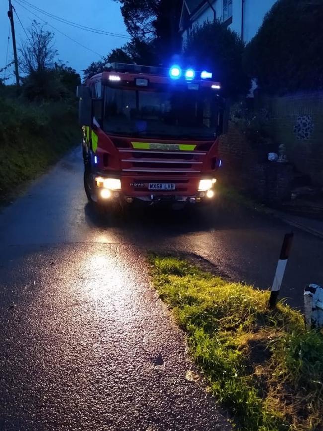
2 October 2020 (10:40) - Three fire crews tackle kitchen fire in The Nelson Chippery
Three fire engines battled a kitchen fire inside The Nelson Chippery today. Firefighters were called just after 10.40am where they found a ground floor kitchen fire in the Bridge Street property. Four firefighters have used high pressure hose reel jets to try and put out the fire, which is not yet extinguished.
The Nelson issued a statement via Facebook. They said: "Unfortunately there has been a fire this morning in the Chippy. All staff who were on the premises are out safe and unhurt. We will not be opening until further notice. The Duke will be open today from 12pm for any of our customers who unfortunately can’t visit The Nelson."
The building was formerly The Nelson Arms pub and has a date stone announcing that it was built in 1902.
News Source: St Helens Star
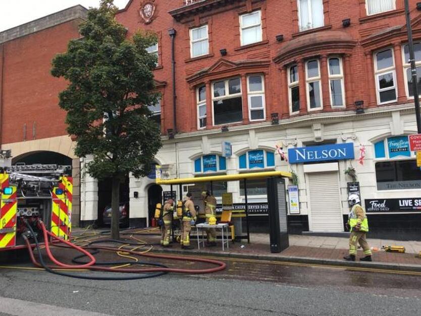
The Nelson Chippery
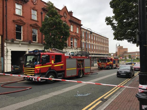
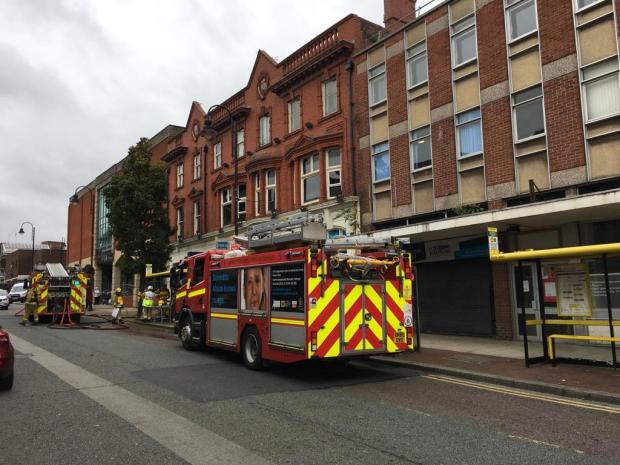
1 October 2020 (09:30) - Fire breaks out at Haltemprice Crematorium
A major fire broke out at a crematorium shortly before a service was due to start. The blaze, at Haltemprice Crematorium, in Willerby, East Yorkshire, started at about 09:30 BST.
Humberside Fire and Rescue said a "severe" blaze took hold in the roof space of the chapel. Crematorium director Steve Gant said no-one was hurt and the fire may have been caused by a fan malfunction inside the cremation equipment. All funeral services today have been cancelled and we thank those bereaved families and funeral directors for being so understanding," he said. He added it was not possible to currently assess the damage but "hoped to be operational as soon as possible".
Irene Kopanska, funeral celebrant for Tandem Funerals, said she arrived for a service to see smoke billowing from the building. "I went up to check everyone was OK," she said. "As we stood on the lawn more and more fire engines arrived. It's a wooden roof. I can imagine it's done a lot of damage," she added.
Group manager Matthew Sutcliffe of Humberside Fire & Rescue spoke at the scene and said that the blaze broke out in the roof, but it is not yet known how it stared. "At 9.30am we received a call to a fire in the roof at Haltemprice Crematorium and as such our crews on arrival quickly realised that it was a well developed fire," he said. "So we escalated it with a number of fire engines. We worked really hard and quite aggressively with the fire fighting techniques to bring this fire under control. We are continuing to work through the building methodically to make sure that the fire in the roof is well contained and well controlled."
The crematorium building is Grade II listed and was formerly the church serving the De la Pole Hospital. The hospital opened as Kingston upon Hull Borough Asylum in December 1883. It became the Willerby Mental Hospital in the 1920s before joining the National Health Service as De la Pole Hospital in 1948. After the introduction of Care in the Community in the early 1980s, the hospital went into a period of decline and closed in July 1998. The main buildings have been demolished and that part of the site redeveloped for business unit use.
News Source: Hull Daily Mail / Hull Live
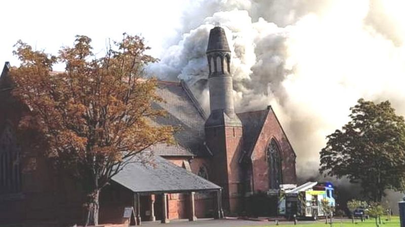
Haltemprice Crematorium, in Willerby, East Yorkshire
Listing Details
|
Entry Name: Church at De La Pole Hospital (Block 49)
Listing Date: 14 November 1997 Grade: II Source: Historic England Source ID: 1376808 English Heritage Legacy ID: 468937 Location: Cottingham, East Riding of Yorkshire, HU10 County: East Riding of Yorkshire Civil Parish: Cottingham Traditional County: Yorkshire Lieutenancy Area (Ceremonial County): East Riding of Yorkshire Church of England Parish: Willerby Church of England Diocese: York |
Coordinates
Latitude: 53.7697 / 53°46'11"N Longitude: -0.4476 / 0°26'51"W OS Eastings: 502418 OS Northings: 431494 OS Grid: TA024314 Mapcode National: GBR TS9V.WD Mapcode Global: WHGFJ.3H4X Plus Code: 9C5XQH92+VX |
Heritage & Ecclesiastical Fire Protection
Preventing Fire, Protecting Life, Preserving Heritage
Click HERE for Expert Specialist Fire Safety Risk Assessments for Historic and Listed Buildings
Preventing Fire, Protecting Life, Preserving Heritage
Click HERE for Expert Specialist Fire Safety Risk Assessments for Historic and Listed Buildings
Phone: 07840 351458 Email: [email protected]
September - 38 Fires & 6 Near Misses
29 September 2020 (02:50) - Man charged over 'arson attack' on Grade II listed South Bank building
Police have charged and named a man arrested in connection with a suspected arson attack on a derelict building. The first floor and roof of the empty building was damaged in the blaze, which happened shortly before 3am on Tuesday. Stefan Geary, 49, was detained by officers and questioned over the incident at the empty Grade II listed building, a former community centre on Millbank Street, South Bank. And on Monday night Cleveland Police confirmed he had been charged.
A spokeswoman said: "Detectives from Redcar CID have this afternoon charged the 49 year old man arrested in connection with an alleged arson at the old community centre on Milbank Street in South Bank in the early hours of today. He has been remanded, to appear at Magistrates’ Court on Wednesday, September 30."
The former presbytery dates back to 1881 and was once used as a probation office and a community centre. The building has been plagued by break-ins and vandalism. Firefighters were called to the scene, close to St Peter's Church, with a hydraulic platform being used during efforts to extinguish the fire. A spokeswoman for Cleveland Fire Brigade said: "We were called at 2.50am today to a fire in a large three storey derelict property on Millbank Street off Middlesbrough Road in South Bank. Two engines from Grangetown and one from Middlesbrough attended including the hydraulic platform. The first floor and roof was damaged by fire."
The fire has also resulted in calls from a local councillor to raise the issue of empty and abandoned buildings in the area. Councillor Sue Jeffrey, former leader of Redcar and Cleveland Council, said the building had been subject to "numerous complaints from residents about people breaking in, vandalising etc". Cllr Jeffrey says she has had to ask the council to arrange to get the building secured "on a number of occasions". "Just the day before yesterday I contacted police following reports of people climbing on the roof", she said. In other areas the council is buying up derelict buildings and finding new uses for them but nothing has been proposed for South Bank and no resources have been allocated to the town for this work. There has been some significant private investment on Middlesbrough Road recently, but there will be no more progress until the problem caused by empty and abandoned buildings is addressed."
In 2018, permission was sought to convert the seven-room building into a 16-room hostel with a bedsit and cafe. Council officers recommended that the application be approved provided the development adhered to the plans submitted to the council and work begins within three years. But the recommendation was overturned at a meeting of Redcar and Cleveland Council’s Regulatory Committee when concerns about vulnerable young people being mixed with people who abuse drugs or drink, or those with criminal records, were raised.
News Source: Gazette Live / Teeside Live
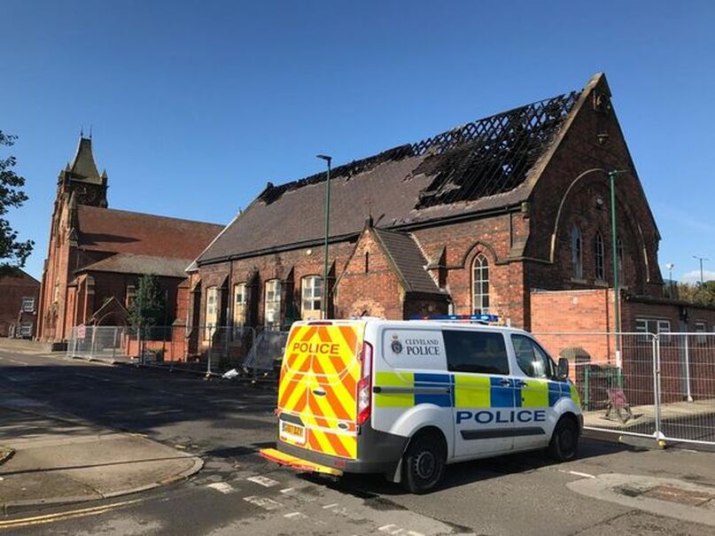
Listing Details
|
Entry Name: 1, Milbank Street
Listing Date: 29 April 1988 Grade: II Source: Historic England Source ID: 1310598 English Heritage Legacy ID: 60367 Location: Redcar and Cleveland, TS6 County: Redcar and Cleveland Electoral Ward/Division: South Bank Built-Up Area: Middlesbrough Traditional County: Yorkshire Lieutenancy Area (Ceremonial County): North Yorkshire Church of England Parish: South Bank St John Church of England Diocese: York |
Coordinates
Latitude: 54.5799 / 54°34'47"N Longitude: -1.1778 / 1°10'40"W OS Eastings: 453242 OS Northings: 520831 OS Grid: NZ532208 Mapcode National: GBR NH6H.T0 Mapcode Global: WHD70.W4BT Plus Code: 9C6WHRHC+XV |
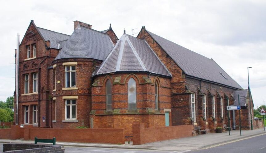
28 September 2020 (18:00) - Fire breaks out at the White Lion pub in Alvanley
Staff and customers had to be evacuated after a fire broke out at a country pub. Firefighters were called to the White Lion on Manley Road, Alvanley, at about 6pm yesterday (September 28). The blaze involved a tumble dryer in the utility room and has caused damage to the rear of the building. The White Lion confirmed on social media that no one was injured as a result of the incident, but the pub would now have to be closed while the damage is repaired.
Two fire engines – one from Runcorn and one from Powey Lane – attended the scene. Cheshire Fire and Rescue Service said: "Firefighters were called to a fire at a pub on Manley Road in Frodsham. The fire involved a tumble dryer located in the utility room. Crews, wearing two breathing apparatus, used a hose reel to extinguish the flames. The thermal imaging camera was used to check if the fire had spread before a large fan was used to disperse the smoke. A number of people were evacuated from the pub as a precaution. Crews were in attendance for approximately one hour and fifty minutes."
The White Lion posted on its Facebook page: "Here at the White Lion we've always been famous for our roaring fires. Unfortunately tonight we experienced the wrong type of fire which has caused some damage to the rear of the property. Thankfully no one was injured and the team are all safe. We will however be closed for a couple of days while we assess and repair the damage. Apologies for any inconvenience caused, we will update via this page regarding reopening. Massive thanks to Cheshire Fire and Rescue Service for attending so quickly which reduced the level of damage caused."
The White Lion is a particularly striking Georgian building and is Locally Listed. It is included in the Alvaney Conservation Area.
News Source: Chester Standard
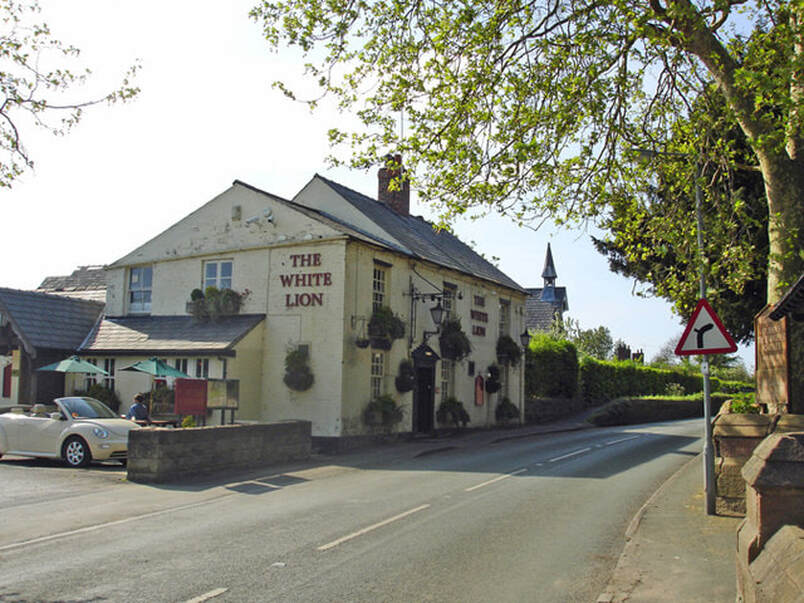
White Lion PH, Alvanley
28 September 2020 (08:22) - Bristol fire sending thick clouds of black smoke over city
Firefighters are expecting to be on the scene of a large fire in Bristol for several hours today (September 28). The fire, in the Cliftonwood area, is sending thick clouds of black smoke over the city. It is understood a block of flats is on fire on the Ambra Vale/Ambrose Road area. Cliftonwood is the small area of Bristol between Clifton and the floating harbour, and is the location for the iconic Victorian terraces of coloured houses that step up from the harbour and are much-photographed.
Avon Fire and Rescue Service was called to Ambrose Road this morning at 8.22am, where a blaze has taken hold of a block of flats. Pictures and video footage from the scene show a large fire burning and a huge cloud of black smoke rising into the air. The fire broke out on the roof of the building and has spread to a neighbouring property. The service has confirmed everyone in the building has been "accounted for". Ambrose Road and Crosby Row have been closed, while Hotwells Road remains open. Crews have been sent to the scene from seven fire stations. Avon Fire and Rescue Service warned people to close their windows due to the smoke.
Between 15 and 20 people were evacuated in the early hours of the morning before the fire was put out at around 11am. A resident has now described what it was like. Marc Miller said he lives two doors down from where the fire started, adding he was sat on the sofa watching TV when the fire alarm went off. He said: “Next thing, a fireman is kicking on my door asking me to leave. We came out and saw the whole roof was well alight - it was incredible. It was like a bad dream and you think ‘is this really happening?’” Mr Miller said they don’t know what caused the fire, but there was smoke and flames everywhere. He added he understood some builders working nearby were the first ones to spot the fire and call 999. “We have been here for about an hour now and we cannot go back in,” he continued. “The whole roof is gone and we have no idea when we will be allowed back in.”
Cliftonwood comprises of mainly Victorian terraced houses, many of which are painted in bright colours. Nobody is entirely sure when or why houses in the neighbourhood started being painted… a certain ex-Bristol Mayor believes he was the first to paint his house a colour other than grey-plaster-on-red-brick…as does a local ex-estate agent. It remains a mystery! However the craze began, the houses are an iconic part of Bristol’s skyline. It lies within the Clifton & Hotwells Conservation Area
News Source: Bristol Post / Bristol Live
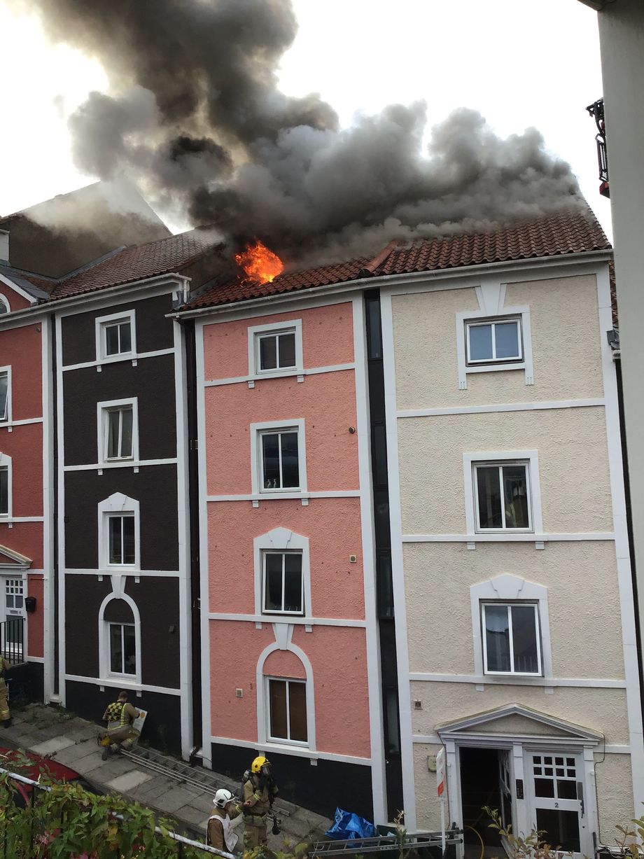
|
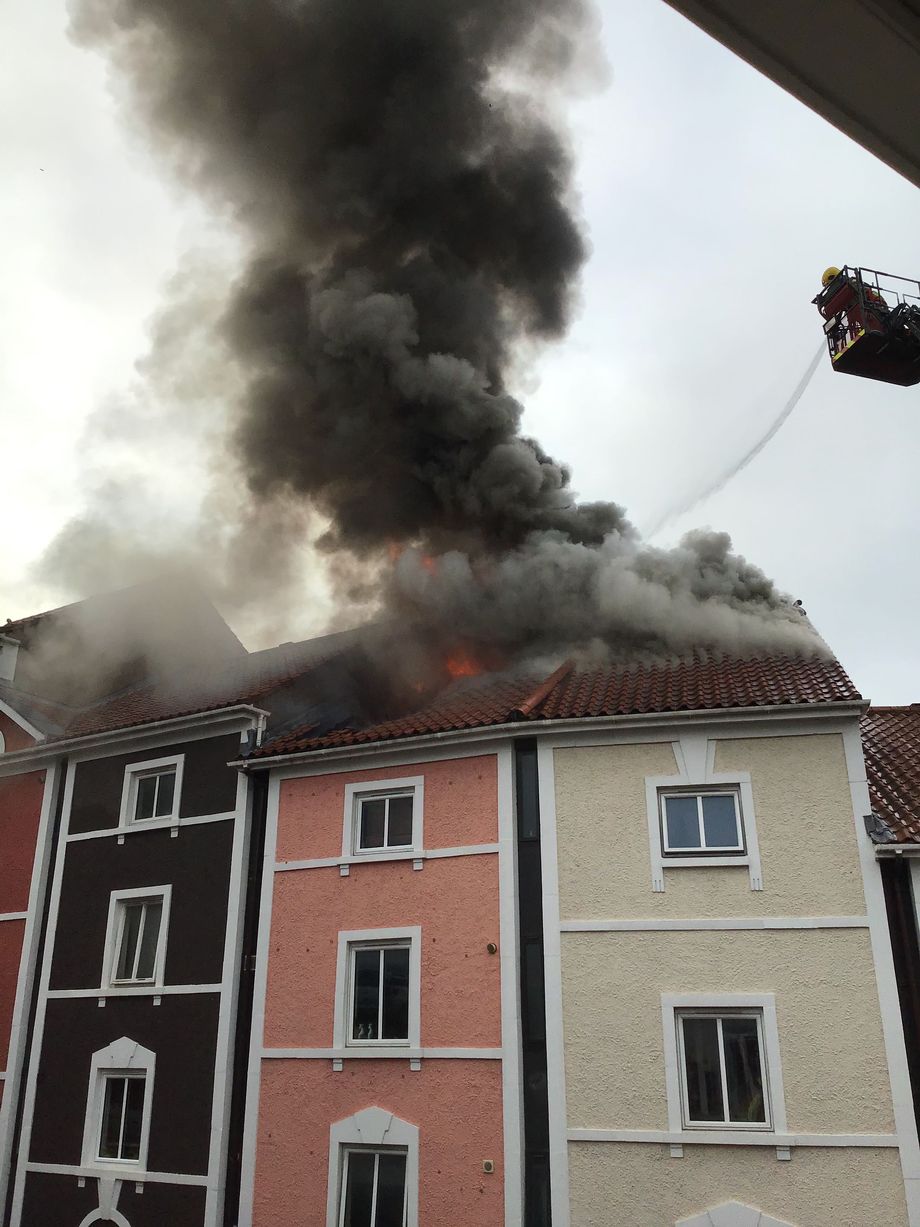
|
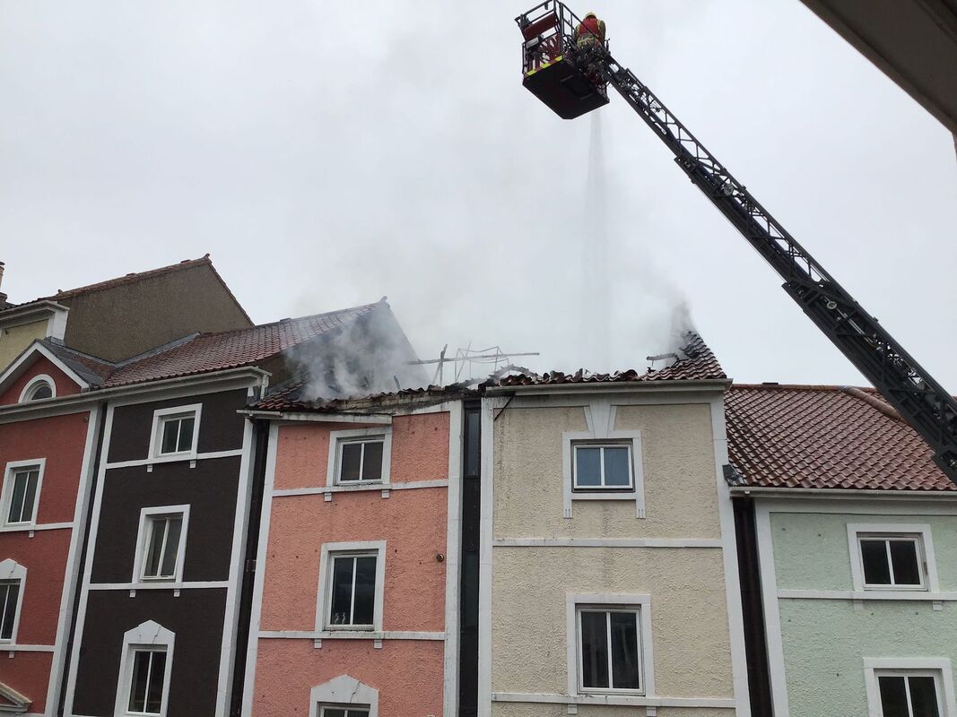
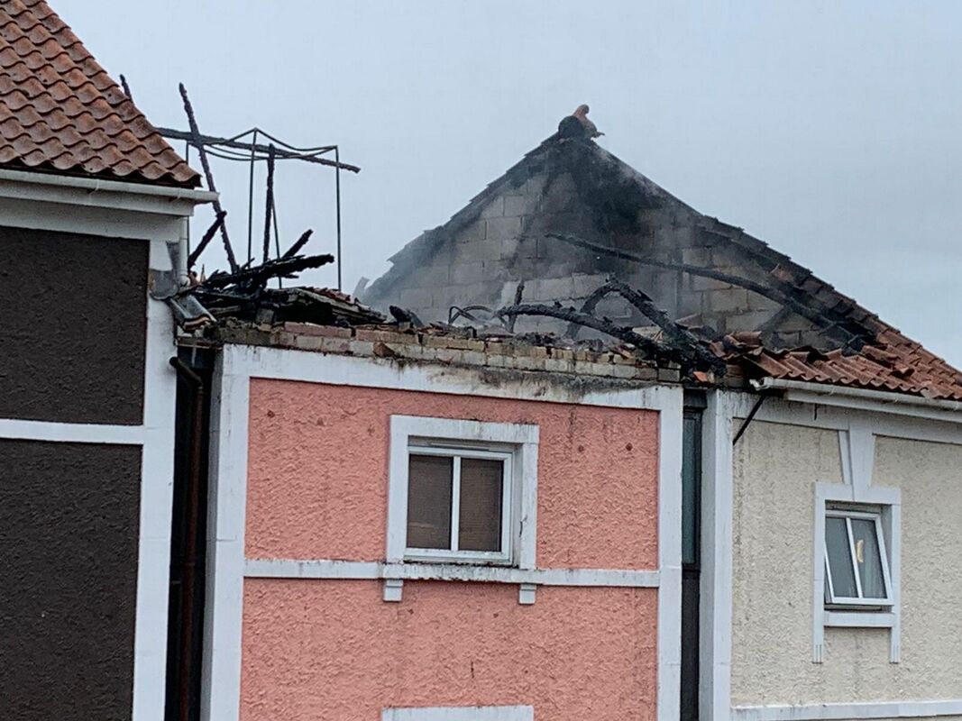

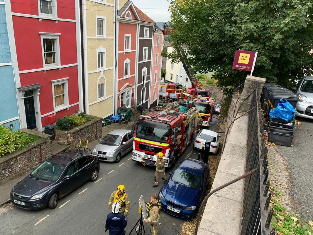
27 September 2020 (09:57) - Village pub suffers second fire in two days
A Suffolk pub is closed after having to call firefighters for the second time in two days due to an electrical fire.Three fire crews were called to The Mariners Freehouse in Trimley St Mary at 9.57am today (Sunday, September 27) to reports of a fire in the fuse box. Two crews from Ipswich and one from Felixstowe attended the incident, while police have closed High Road outside the pub. No injuries or major damage has been reported, but crews are still on the scene waiting for an electrician. The pub said on Facebook: “We’ve had another small fire this morning and lost all electric so won’t be able to open today. Sorry for any inconvenience and will keep you posted during the day.”
On Friday afternoon, the pub was evacuated shortly after lunch after a fire was discovered on the first floor. Four crews were called to the scene. The pub later announced that the cause of the blaze was a tumble dryer.
Formerly known as Mariners Inn, New Inn and Three Mariners, the building dates from the late 18th century and is Grade II listed. It was renamed from the Three Mariners to the Mariners Free House in September 2015, when it passed into new ownership. The pub was originally a wooden hut on another site "on the High Road near Station Road". The license probably moved after the original building was burned down. The 1904 Woodbridge licensing records show that the Three Mariners' license was issued in 1853. Whether this was when it was first licensed or when it got a full (i.e. not just beer) license isn't clear, though the latter seems more probable. Up until the Second World War, the pub's sign was a lifebelt hanging from a jacket.
The name was changed from the New Inn to remember Thomas Cavendish, who was born in Trimley St Martin and was the first man to command a ship that deliberately circumnavigated the world (previous circumnavigators had done so accidentally). It was apparently renamed to celebrate his return to Trimley from his circumnavigation.
News Source: Ipswich Star
The Mariners Freehouse in Trimley St Mary
Listing Details
|
Entry Name: The Three Mariners
Listing Date: 25 May 1983 Grade: II Source: Historic England Source ID: 1198290 English Heritage Legacy ID: 285007 Location: Trimley St. Mary, East Suffolk, Suffolk, IP11 County: Suffolk District: East Suffolk Civil Parish: Trimley St. Mary Built-Up Area: Trimley St Mary Traditional County: Suffolk Lieutenancy Area (Ceremonial County): Suffolk Church of England Parish: Trimley St Martin Church of England Diocese: St.Edmundsbury and Ipswich |
Coordinates
Latitude: 51.9847 / 51°59'4"N Longitude: 1.3138 / 1°18'49"E OS Eastings: 627642 OS Northings: 236988 OS Grid: TM276369 Mapcode National: GBR WRJ.GZF Mapcode Global: VHLC8.QCDW Plus Code: 9F33X8M7+VG |
27 September 2020 (09:01) - Fire breaks out at pub in Chipping Sodbury
Firefighters have been battling a fire at a town centre pub in Chipping Sodbury this morning. They were called to the Royal Oak pub in Broad Street at just after 9am to reports of a fire. On arrival crews found a small fire in the kitchen. Crews are currently tackling the blaze and no one has been injured. A spokesman for Avon Fire and Rescue Service said: “We were called to the Royal Oak pub in Chipping Sodbury at 9.01am today. Two crews from Yate and one from Kingswood attended. There have been no injuries reported.”
The Royal Oak is a late 16th / early 17th century coaching house inn and is Grade II listed. It lies within the Chipping Sodbury Conservation Area.
News Source: Bristol Post / Bristol Live
The Royal Oak is a late 16th / early 17th century coaching house inn and is Grade II listed. It lies within the Chipping Sodbury Conservation Area.
News Source: Bristol Post / Bristol Live
Listing Details
|
Entry Name: Royal Oak Public House
Listing Date: 29 July 1983 Grade: II Source: Historic England Source ID: 1129251 English Heritage Legacy ID: 34081 Location: Sodbury, South Gloucestershire, BS37 County: South Gloucestershire Civil Parish: Sodbury Built-Up Area: Chipping Sodbury Traditional County: Gloucestershire Lieutenancy Area (Ceremonial County): Gloucestershire Church of England Parish: Chipping Sodbury St John the Baptist Church of England Diocese: Gloucester |
Coordinates
Latitude: 51.5381 / 51°32'17"N Longitude: -2.3921 / 2°23'31"W OS Eastings: 372901 OS Northings: 182206 OS Grid: ST729822 Mapcode National: GBR 0NJ.G1T Mapcode Global: VH95T.HL7R Plus Code: 9C3VGJQ5+65 |
25 September 2020 (13:44) - Village pub evacuated following fire on first floor
The Mariners Freehouse in Trimley St Mary was evacuated after lunch when a fire broke out on the first floor. Firefighters were called to the pub in High Road at 1.44pm today (Friday, September 25) to reports of a blaze inside the building. Four crews were called to the scene and had to use water jets to put out the blaze. No one was hurt and crews were able to leave shortly after 2.40pm.
The Mariners reassured its customers on social media after the fire, saying: “Just had a small incident here. Fire brigade have been absolutely fantastic. Everyone evacuated safely... customers and crew all safe. We’re now clearing up and should be open a little later today. If anything changes we’ll be back in touch. Sorry for any inconvenience to drivers on the High Road...and hope to see you very soon...” The road was briefly closed outside the pub while the incident was dealt with, but reopened quickly after.
On Saturday, they said via Facebook: “At 1.40pm yesterday we had to call the fire brigade as the tumble dryer was on fire. We were extremely lucky that one member of our crew had gone upstairs and saw it. Two crew members attended to it best they could whilst not putting themselves in danger. We promptly evacuated our customers and crew and waited for the fire brigade to attend. The chief fire officer said the quick actions of our staff saved the pub. As owners, we would like to say a massive thank you to all our crew especially David and Rob for acting so quickly and professionally throughout the terrible ordeal.”
Formerly known as Mariners Inn, New Inn and Three Mariners, the building dates from the late 18th century and is Grade II listed. It was renamed from the Three Mariners to the Mariners Free House in September 2015, when it passed into new ownership. The pub was originally a wooden hut on another site "on the High Road near Station Road". The license probably moved after the original building was burned down. The 1904 Woodbridge licensing records show that the Three Mariners' license was issued in 1853. Whether this was when it was first licensed or when it got a full (i.e. not just beer) license isn't clear, though the latter seems more probable. Up until the Second World War, the pub's sign was a lifebelt hanging from a jacket.
The name was changed from the New Inn to remember Thomas Cavendish, who was born in Trimley St Martin and was the first man to command a ship that deliberately circumnavigated the world (previous circumnavigators had done so accidentally). It was apparently renamed to celebrate his return to Trimley from his circumnavigation.
News Source: Ipswich Star

The Mariners Freehouse in Trimley St Mary
Listing Details
|
Entry Name: The Three Mariners
Listing Date: 25 May 1983 Grade: II Source: Historic England Source ID: 1198290 English Heritage Legacy ID: 285007 Location: Trimley St. Mary, East Suffolk, Suffolk, IP11 County: Suffolk District: East Suffolk Civil Parish: Trimley St. Mary Built-Up Area: Trimley St Mary Traditional County: Suffolk Lieutenancy Area (Ceremonial County): Suffolk Church of England Parish: Trimley St Martin Church of England Diocese: St.Edmundsbury and Ipswich |
Coordinates
Latitude: 51.9847 / 51°59'4"N Longitude: 1.3138 / 1°18'49"E OS Eastings: 627642 OS Northings: 236988 OS Grid: TM276369 Mapcode National: GBR WRJ.GZF Mapcode Global: VHLC8.QCDW Plus Code: 9F33X8M7+VG |
24 September 2020 (18:30) - Raging fire engulfs Walsall town centre factory
There were dramatic scenes as flames tore through a derelict town centre factory - sparking road closures and a mass evacuation. Fire engulfed historic William House - a former leatherworks in Walsall - shortly before 6.30pm today - September 24. At the height of the blaze, 50 firefighters were at the scene, battling the flames on Marsh Street as they came perilously close to spreading to neighbouring flats. Residents in Crown Lofts, a nearby apartment building, were evacuated as fire crews bravely brought the blaze under control. As of 9pm, eight fire engines and a hydraulic platform remained at the scene. Footage taken from nearby flats show the extent of the fire, as flames pour from the building and smoke is sent billowing into the air. It shows how close the huge blaze came to spreading to the nearby apartments. The fire-ravaged site is close to Walsall Art Gallery and the town Wharf, as well as a variety of bars and restaurants.
West Midlands Fire Service ordered residents to keep their windows shut and stay away from the area. In a series of tweets they wrote: "We are dealing with a fire in a derelict building in Marsh Lane, Walsall. Six fire engines and one hydraulic platform, with 40 firefighters are dealing with the incident. Please keep windows shut if you live in the area." Later they added: "The fire is contained and is under control, as a precaution we have evacuated Crown Lofts.
In 2018, plans to build 236 luxury apartments by demolishing three derelict industrial premises in Walsall - including William House - were submitted to planners. The proposals by Total Homes and Developments would have seen historic Greatrex House, William House and Navigation Street offices, situated in St Matthew's Ward close to the town centre canal basin and New Art Gallery, razed to make way for the one and two-bedroom flats. Last year, a fire ravaged Greatrex House, on nearby Navigation Street - just yards from today's blaze on Marsh Lane.
William House is a three storey building and was part of the Argyle Leatherworks, built between 1903 and 1917. It was hit by an earlier deliberately started fire at the end of May of 2012.
News Source: Birmingham Mail / Birmingham Live
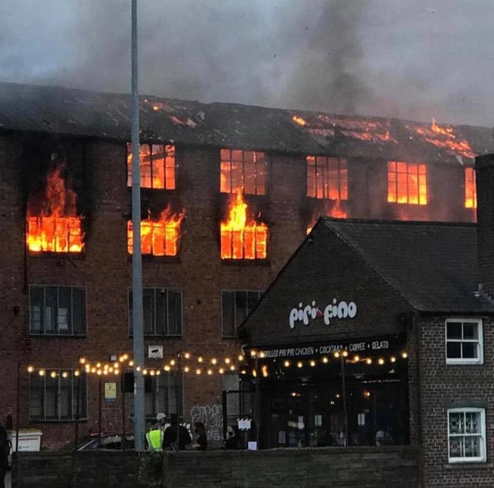
The fire in Walsall. Photo: Your Walsall
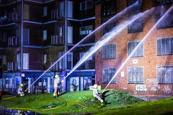
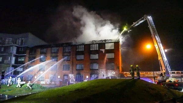
24 September 2020 (15:07) - Fire crews battle garage fire that spread to home in Thornfalcon near Taunton for eight hours
A garage fire which spread to a thatched property near Taunton saw firefighters tackling the blaze for eight hours - and left one man in need of treatment for smoke inhalation. Six crews - from Taunton, Bridgwater, Wellington and Ilminster, along with the water carrier from Bridgwater an aerial ladder from Taunton, a command unit from Street, a welfare appliance from Burnham and a high-volume pump from Exeter - attended the incident, in Thorn Lane, Thornfalcon, at just after 3pm yesterday (September 24).
The blaze was found in the rear of the building, on the ground floor, with crews fighting to stop it spreading to the thatched roof. At around 4pm, crews confirmed one detached two-storey house of traditional construction with a combined tiled and thatch roof was alight. "Fire crews are at work with 8 breathing apparatus wearers in an effort to stop the spread to the thatched area of the property," a Devon and Somerset Fire and Rescue Service spokesperon said. "Fire crews also requested the attendance of an Ambulance for one male casualty suffering from smoke inhalation."
A 4.40pm, the crews confirmed the fire involved a garage and the first floor of the property and that Western Power Distribution had isolated the power supply to the property, while the oil supply had also been isolated. "Fire crews requested the attendance of a structural engineer from Somerset West and Taunton Council (at 4.45pm)," the spokesperson added. By 5.20pm, the firefighters were 'making good progress cutting away and damping down with breathing apparatus wearers, roof ladders and safety at height equipment', the spokesperson added. The crews left the scene at just after 11.15pm, and were set to return this morning to inspect the property. They confirmed the property was 15% damaged by fire and 50% damaged by smoke.
The property is Harman's Cottage, a Grade II listed, early 17th century house. It is a good example of a 17th century 2-room plan house, with later additions in the 19th and 20th centuries that do not affect the integrity of the original house.
News Source: Somerset County Gazette.
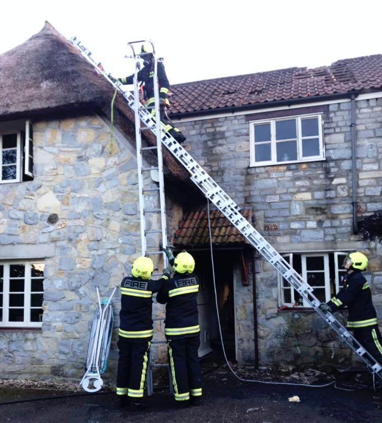
SCENE: Fire crews battled the blaze, near Taunton, for eight hours. PICTURE: Taunton Fire Station
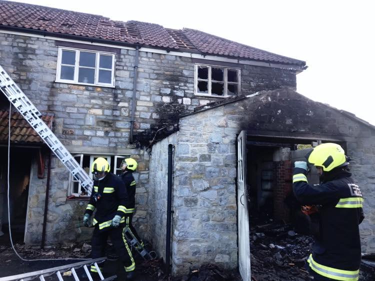
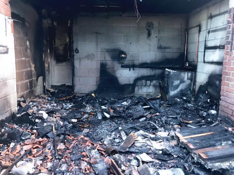
Listing Details
|
Entry Name: Harmans Cottage
Listing Date: 14 April 2004 Grade: II Source: Historic England Source ID: 1390997 English Heritage Legacy ID: 492638 Location: Thornfalcon, Somerset West and Taunton, Somerset, TA3 County: Somerset District: Somerset West and Taunton Civil Parish: Thornfalcon Traditional County: Somerset Lieutenancy Area (Ceremonial County): Somerset |
Coordinates
Latitude: 51.0089 / 51°0'31"N Longitude: -3.0308 / 3°1'50"W OS Eastings: 327778 OS Northings: 123783 OS Grid: ST277237 Mapcode National: GBR M4.JMZH Mapcode Global: FRA 46JG.528 Plus Code: 9C3R2X59+HM |

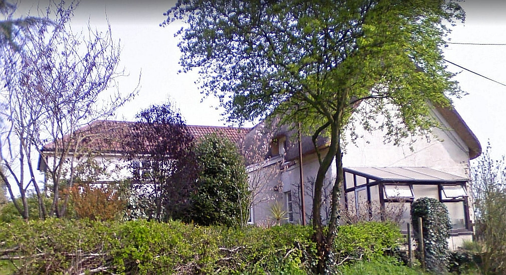
23 September 2020 (23:26) - Fire destroys derelict Bournemouth hotel
Two hotels have been evacuated after a fire broke out at a derelict hotel in Bournemouth. More than 110 firefighters attended the scene at the four-storey former Woodcroft Tower Hotel overnight. Dorset & Wiltshire Fire and Rescue Service said it was called to Gervis Road at about 23:30 BST on Wednesday. The fire service said about 160 guests from the two hotels - Britannia and Hotel Celebrity - were taken to other hotels for the night. The blaze from the derelict building spread to the roof of neighbouring hotel, Britannia, "but this was quickly brought under control", the fire service added. Incident commander Andrew Laskey said: "There were no people in the building that was derelict. "We're still tackling the fire - it's being kept under control and avoiding any spread at the moment."
Eyewitness Colin Billing, who lives nearby, said: "I smelled smoke, looked out and saw lots of thick smoke coming from the old hotel and dialled 999. Shortly [afterwards] the building was well alight with fire crews tackling the blaze from streets on two sides of the building." Mr Billing added he later saw "sparks and cinders in the air" ignite the roof of the Britannia hotel. The fire service said about 50 firefighters remained at the scene. People have been advised to avoid the area and residents asked to close windows and doors due to the smoke. Surrounding roads - Bath Hill, Grove Road, Gervis Road and Meyrick Road - have all been closed. Crews are expected to remain at the scene throughout the day.
A hotelier whose business is next door to the fire-ravaged derelict building has described it as "a disaster waiting to happen." Ken Robins, who owns the Hotel Celebrity, said the former Orchid Gardens building has been boarded up for many years and has been a fire risk. Mr Robins has already voiced concerns since the 57-bedroom Woodcroft Tower Hotel was boarded up in 2013 when the business went into administration. He said today, "We have been complaining for years about the totally inadequate precautions taken by the hotel owners to make the property safe and to ensure people cannot easily access the grounds of the hotel and the hotel building. For such a major conflagration despite the hotel being empty for several years there must still be considerable flammable materials on site." Mr Robins said squatters and drug dealers have accessed the building on many occasions and that there have been several fires. He said he has attempted to prevent access to the site himself because he feared for the safety of nearby properties.
The hotel started life as a large detached private residence called Woodcroft, built in the 1870s. It became the Woodcroft Boarding Establishment / Hotel before the turn of the century. An extension block was built in the 1930s and the name was changed to the Woodcroft Tower Hotel. In 2008 it was sold and it reverted back to being called the Woodcroft Hotel. In 2012 it traded briefly as the Orchid Garden Hotel, part of the Legacy Inns Chain. The building lies within the East Cliff Conservation Area.
News Source: BBC News
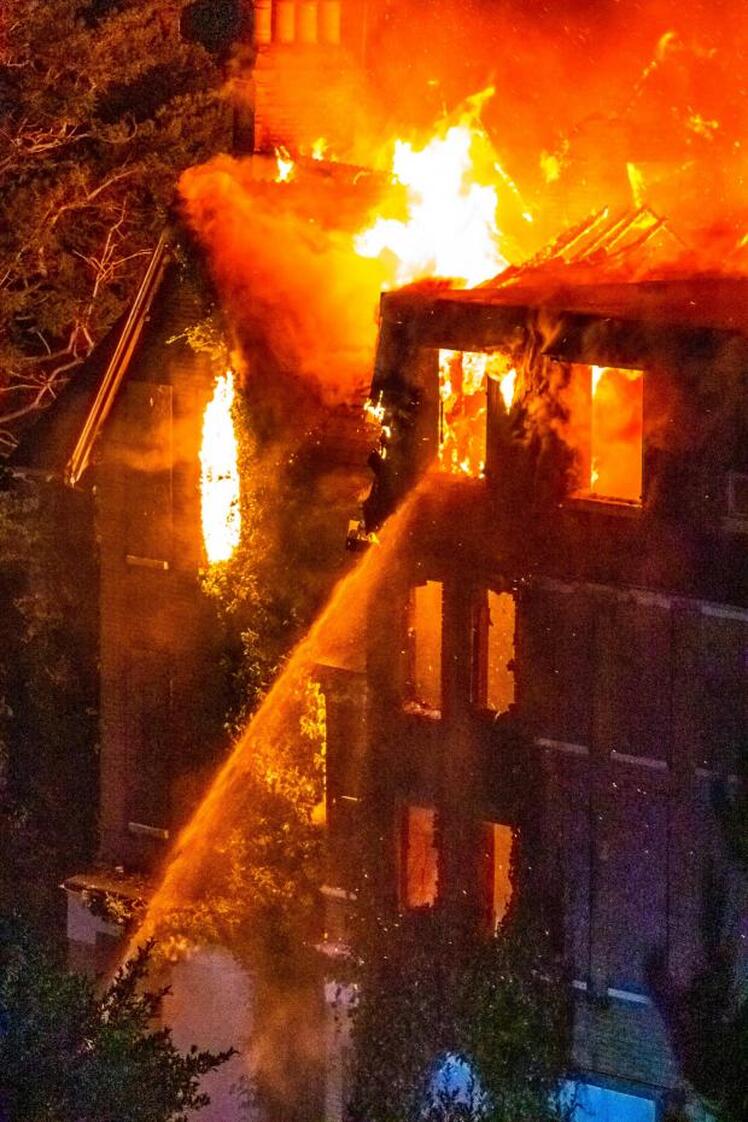
The fire at the former Woodcroft Hotel
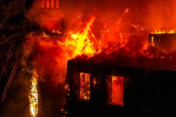
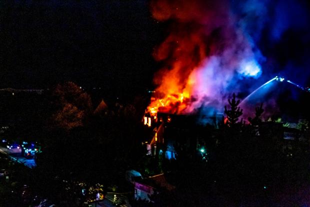
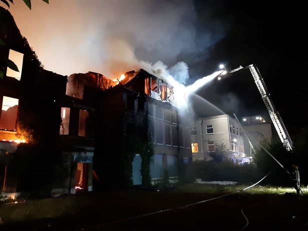
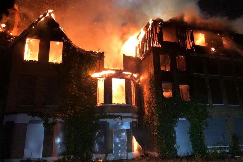
This 1938 Bournemouth Guide advert describes the amenities at the hotel.
23 September 2020 (16:43) - Firefighters tackle pub blaze in North Yorkshire village
Police have cordoned off a road in North Yorkshire as firefighters tackle a pub blaze. North Yorkshire Fire & Rescue Service posted on Twitter that crews are in attendance at a fire in Appleton-le-Street, near Malton
The service tweeted: Due to a building fire, Appleton-le-Street in Malton is closed. Please avoid the area whilst we deal and nearby residents are advised to keep windows and doors shut. An aerial ladder platform is being used along with four main jets. We will be at the scene for some time yet.” Crews from Malton, Pickering, Sherburn, Helmsley and the ALP from Scarborough responded to a report of a kitchen fire at 4.43pm," they added.
The fire is at The Cresswell Arms in Appleton-le-Street and North Yorkshire Roads Policing Group confirmed road closures are in place. They posted on Facebook: "We are currently on scene along with Ryedale Police and North Yorkshire Fire & Rescue Service at a large fire on the B1257 at Appleton-le-Street. Diversions are in place, please avoid the area."
The Cresswell Arms is a traditional country inn dating back to the 1800s when it was flanked by a blacksmith and a butcher.
News Source: Express Live / Yorkshire Live
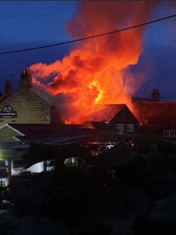
The scene of the fire at the Cresswell Arms - photo North Yorkshire Police Roads Policing Group
Near Miss
23 September 2020* (?) - St Nicholas Church, Laindon, targeted by vandals
23 September 2020* (?) - St Nicholas Church, Laindon, targeted by vandals
An 800-year-old church was targeted by callous vandals who set fire to cemetery land, destroyed it’s benches and damaged gravestones. Andrei Petrine, vicar at St Nicholas Church on Church Road, Laindon, near Basildon,was horrified to discover vandals had once again targeted the site - a place where not only families lay their loved ones to rest, but also where war graves are kept. It wasn’t until a few days after the attack that Mr Petrine discovered the damage caused by the alcohol-fuelled yobs - trouble which escalated from jumping on benches to lighting up logs in the cemetery grounds.
He explained: “It turns out one bench was broken a few days ago, another on Sunday, and between Tuesday and Thursday last week they set fire to a pile of logs which spread to a large area of the cemetery, affecting gravestones and turning some of the marble black. We expect youngsters came over to drink with cans of beer and started jumping on benches, breaking them. It was such a shock when I found the damage on Saturday. People have their loved ones here and this is a beautiful sacred place, it’s historical and has been here for hundreds of years. There are even war graves for people who have served and lost their lives for their country, people come here to walk the dogs, have lunch or see the views, so it is upsetting. It’s the first time we’ve seen anything on this scale, but we have regular vandalism including litter, graffiti, attempted break-ins with chisels and metal bars, and the stones have been smashed before too.”
The church is now calling on the community to keep a watchful eye. Mr Petrine hopes that with the aid of residents and church-goers CCTV and lighting could be installed at the site. The 47-year-old from Laindon continued: “Our resources are never enough anyway, but especially at this time. It’s something the church will need help with, but not just now - it constantly needs to be maintained, guarded and protected. We’d like a volunteer group here on a regular basis to help with this.”
St Nicholas Church is a Grade I listed building.
News Source: Southern Standard
Vandalism - the burnt land and damage caused to the benches at St Nicholas Church after it was damaged by yobs
Listing Details
|
Entry Name: Church of St Nicholas
Listing Date: 24 March 1950 Last Amended: 6 January 1975 Grade: I Source: Historic England Source ID: 1338377 English Heritage Legacy ID: 112306 Location: Basildon, Essex, SS15 County: Essex District: Basildon Town: Basildon Electoral Ward/Division: Laindon Park Built-Up Area: Basildon Traditional County: Essex Lieutenancy Area (Ceremonial County): Essex Church of England Parish: Laindon St Nicholas with Dunton Church of England Diocese: Chelmsford |
Coordinates
Latitude: 51.5792 / 51°34'45"N Longitude: 0.4347 / 0°26'4"E OS Eastings: 568792 OS Northings: 189515 OS Grid: TQ687895 Mapcode National: GBR NKX.W62 Mapcode Global: VHJKT.HK4Q Plus Code: 9F32HCHM+MV |
21 September 2020 (20:07) - Katie Price’s mansion set on fire leaving firefighters to tackle blaze at ‘cursed’ home
Katie Price's 19th century mansion went up in flames last night as firefighters tackled a blaze at her "cursed" home. Neighbours were convinced her house in West Sussex was burning down and firefighters rushed to the scene. The side of the £2 million house appeared to go up in flames after a caretaker built a bonfire right next to the side of her home.
Katie Price's representative said: "I can confirm there was a fire on the grounds but no serious damage to the building. Eyewitnesses reported to the emergency services that the house was on fire but thankfully it was brought safely under control before any serious damage was done to the building."
West Sussex Fire and Rescue Service said they had been alerted to the incident, which turned out to be a large bonfire. A spokesman said: "We received a call at 8.07pm on Monday to reports of a fire at Worthing Road, Dial Post. The fire was a controlled burn and so further action was necessary from the fire service.”
This is not the first time the sprawling property in Dial Post, near Horsham, has caught fire. Damage was caused to a bedroom when a candle set fire to curtains on 14 September 2018.
News Source: The Sun
Katie Price's 19th century mansion
21 September 2020 (18:30*) - Houses evacuated after Chepstow explosion and fire
Police, the fire service and the air ambulance have all attended a house fire in Chepstow following an explosion. Witnesses said they heard a loud bang and found a house in Lower Church Street on fire, and saw windows scattered across the street. One neighbour was in their back garden at the time and was showered with debris.
One resident, Martin Hall, an architect at Hall & Bednarczyk in Chepstow, said: "I was on a conference call and heard a massive bang. I looked out my window and saw all the windows had gone straight across the street." Another said they saw a man in the house thrown through the window and on the street. He was sitting up and talking," they added. Gwent Police said the man, who sustained serious injuries, was taken to Morriston Hospital in Swansea. Karie Atkins, who owns one of the houses next door, was walking his dog in Sedbury at the time of the explosion. He said: "I thought it was from the barracks. I looked over and could see the flames and could see it was coming from the street. As soon as I saw that I ran to see if anyone was hurt."
South Wales Fire & Rescue sent six fire engines to the scene after the reports of the incident just after 6.30pm. An air ambulance also landed, but left without collecting anybody. Police have cordoned off the area and are evacuating neighbouring houses. A spokesman for Gwent Police said: "Officers are currently in attendance to a fire on Lower Church Street, Chepstow. South Wales Fire and Rescue Service are at the scene. Houses in the area are being evacuated. A cordon is currently in place. The public are advised to stay away from the area at this time."
Richie Jones, gas emergency service manager for Chepstow at the company, said: "We were called to reports of an explosion at a property in the Lower Church Street area of Chepstow this evening and immediately sent a team of engineers to the scene. On arrival we found that the property had been damaged and emergency services were in control of the scene. We are working with the emergency services to make the area safe and to investigate the cause of the explosion."
All the terraced houses along Lower Church Street were built in the late 18th century. Many of them are Grade II listed, including the house next door to the explosion. The street lies within the Chepstow Conservation Area.
News Source: South Wales Argus
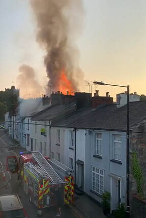
|
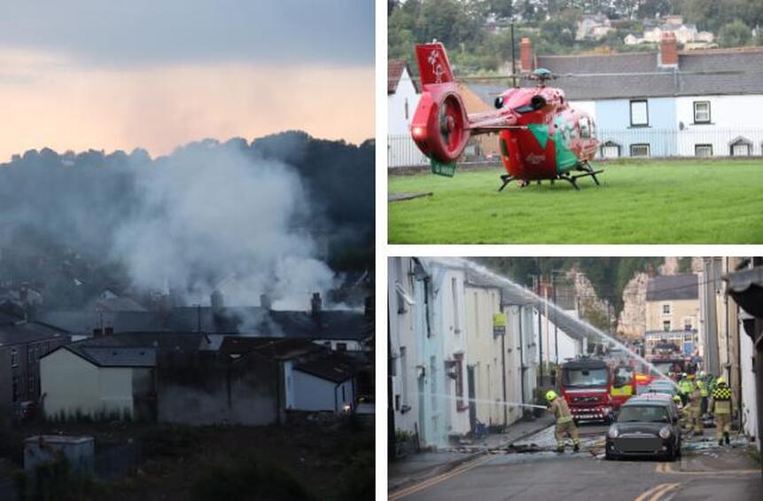
Picture: Ollie Barnes
|
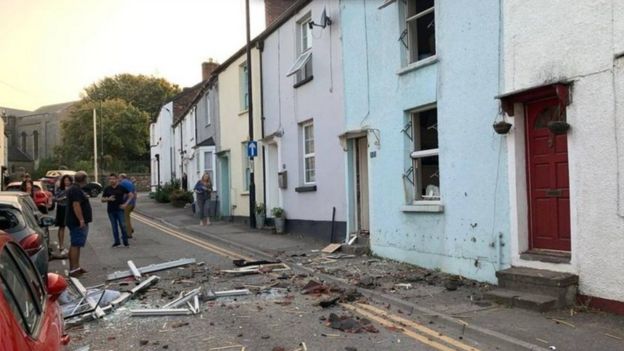
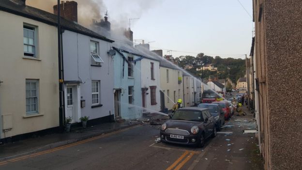
21 September 2020 (01:19) - Suspected deliberate fire at old Hanbury Hotel pub in Griffithstown
Firefighters were called to a suspected deliberate fire at the Hanbury Hotel in Griffithstown, Pontypool, in the early hours of this morning. A report of the fire in the empty and boarded-up building in Windsor Road was received by South Wales Fire and Rescue Service at shortly after midnight. "Crews from New Inn attended the scene and extinguished the fire. The incident is suspected to have been deliberate," said a South Wales Fire and Rescue Service spokeswoman. The incident concluded at approximately 1.19am."
The building has fallen into a state of disrepair having been empty for more than a decade, and nearby residents are concerned it is unsafe, and has become an eyesore. Griff Williams, 53, said: “It would be good if they used it for flats. They need to just use the building as it’s a lovely building. It was quite a lively pub when it was open. It’s an eyesore and there is an alarm that goes off every now and again, but no-one seems to do anything about it. There were people working there but that was a long time ago.”
Janet McCormack, 80, said: “It’s an eyesore and they have had to board it up. About 10 years ago I saw something about it being put up for sale. I don’t know when they are doing something with it. It really is an eyesore. I don’t think they would knock it down. It would be a nuisance living here when the work would be going on, but it would be well worth it. It would be lovely to see it get sorted out.”
Libbi Prestidge, 24, said: “It’s a really nice building and it should be used for something. I thought it was going to be turned into flats. I would like to see it get turned in to flats. There are quite a lot of new people moving in to the area so that would be good.” Another local resident said: “It’s an eyesore. There are kids who get in there. It’s a mess. Kids do get in there. I have heard the alarm go off once or twice.”
The 19th century Hanbury Hotel in Griffithstown once served the busy rail and steel industries of the area. Pontypool Road sheds (86G) were less a quarter of a mile from it, with RT Baldwins steel works also on the door step. The Hotel didn't last very long, but the premises remained a public house serving the Griffithstown communities. The ASLEF Union was formed at the hotel. The first recorded meeting of the 'Associated Society of Locomotive Steam Enginemen and Firemen' was held on 7 February 1880
News Source: South Wales Argus
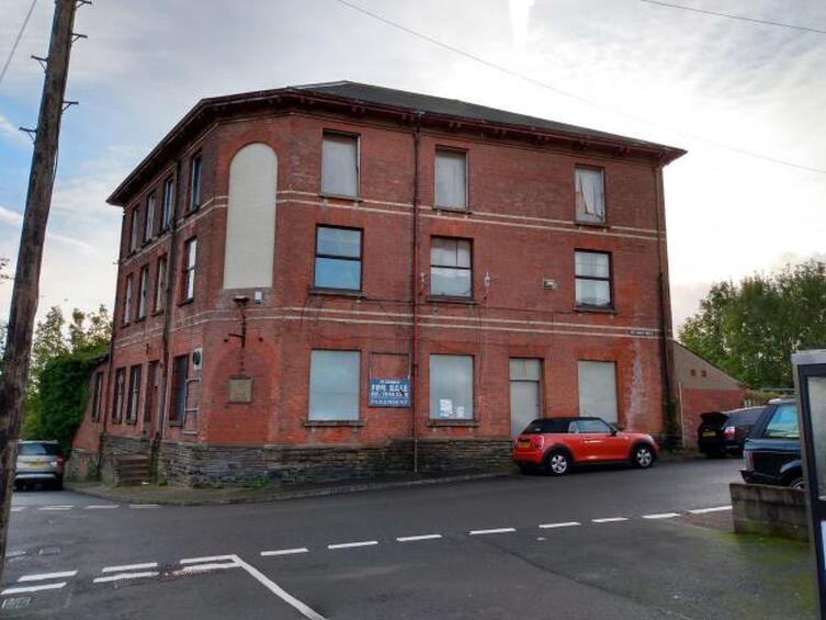
The Hanbury Hotel, Griffithstown.
20 September 2020 (22:13) - Whalley Range 'explosion': Pictures show devastated flat after huge fire service response
A flat has been gutted by fire after reports of an explosion in Whalley Range. Pictures from the scene show the devastating aftermath of the blaze at a three-storey property on Mayfield Road. Local residents reported hearing a loud bang, before seeing around ten fire engines at around 10.20pm on Sunday (September 20). The second and third floor windows of the property have been completely blown out following the incident. A pile of rubble can be seen on the ground below. Fire crews had taped off a section of the road on Monday morning, while they continued to assess the damage to the building. The cause of the fire has not been confirmed but the M.E.N understands it it not being treated as suspicious. Nobody is believed to have been injured.
A spokesperson for GMP confirmed they were called just after 10.20pm to reports of a fire on Mayfield Road. All emergency services were in attendance," they said. A spokesperson for Greater Manchester Fire Service said: "Crews were called at 22:13 on Sunday, 20 September. Crews from Moss side, Salford, Gorton and Withington were called to an incident on Mayfield Road. The fire involved a first floor domestic flat alight on arrival. Firefighters are still in attendance."
Whalley Range, which sits around two miles southwest of Manchester’s centre, was one of the city’s earliest suburbs built by banker and businessman Samuel Brooks. It is thought to have been named after the town of Whalley in Lancashire, where Samuel was born, and the layout he established remains today, with large houses on tree-lined avenues. Samuel Brooks bought 39 Lancashire acres of land in Moss Side from Robert Fielden and another 42 from the Egerton Estate and created Whalley Range in 1834. The area is now encompassed by Whalley Range Conservation Area. Brooks called the area ‘a desirable estate for gentlemen and families’, where people could escape the city’s dirt and congestion. Roads were laid out and plots sold with certain conditions to ensure development was appropriate to Samuel’s vision. The land was locally known as Jackson’s Plant’s or Woodall’s Moss, and was part of the Manor of Withington.
News Source: Manchester Evening News
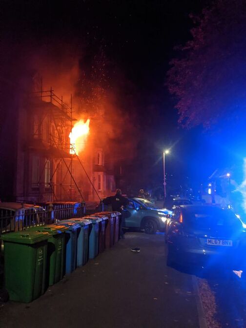
|
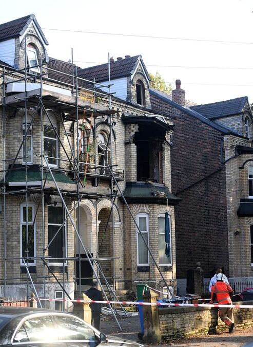
|
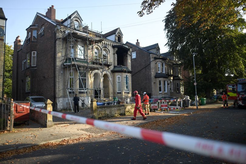
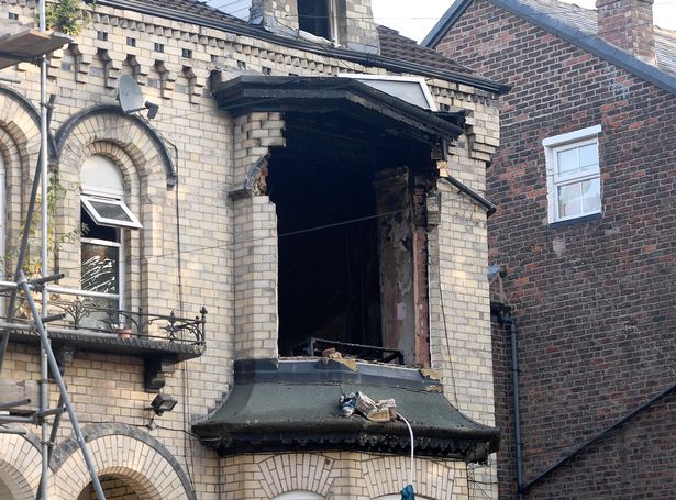
20 September 2020 (12:40) - Tumble dryer fire at Shanklin’s Fisherman’s Cottage Pub
Firefighters from Shanklin and Ventnor are tackling a tumble dryer fire at a pub on Shanklin Esplanade this afternoon (Sunday). Two appliances are currently on the scene at The Fishermans Cottage having been called out at around 12:40. It has been confirmed that the tumble dryer is located on the 1st floor of the property. The incident is said to be under control and confined to the appliance and there is no threat to the thatch structure.
Shanklin’s Grade II listed Fisherman’s Cottage Public House was formerly a cottage, built in about 1817 by a Mr W Colenutt who opened a path through Shanklin Chine and started to charge visitors a fee. He was also the first operator of bathing machines on the beach. A Hot Brine Bath from the Fisherman’s Cottage is now displayed within the Chine. The building was altered and extended in 20th century. Built of stone rubble with half-hipped thatched roof and a red brick chimney stack. the pub lies within the Shanklin Conservation Area
News Source: Island Echo
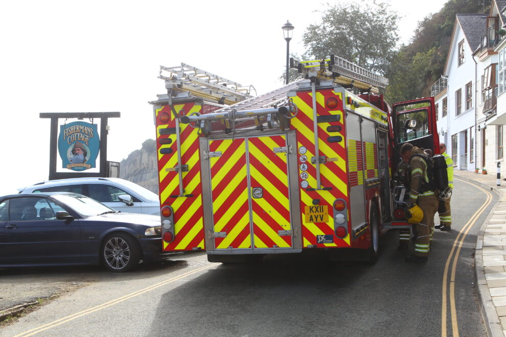
Fire crews outside the Fisherman's Cottage
Listing Details
|
Entry Name: Fisherman's Cottage Public House
Listing Date: 14 February 1992 Grade: II Source: Historic England Source ID: 1365376 English Heritage Legacy ID: 310247 Location: Shanklin, Isle of Wight, PO37 County: Isle of Wight Civil Parish: Shanklin Built-Up Area: Shanklin Traditional County: Hampshire Lieutenancy Area (Ceremonial County): Isle of Wight Church of England Parish: Shanklin St Blasius Church of England Diocese: Portsmouth |
Coordinates
Latitude: 50.6263 / 50°37'34"N Longitude: -1.174 / 1°10'26"W OS Eastings: 458525 OS Northings: 81054 OS Grid: SZ585810 Mapcode National: GBR 9DS.Q0C Mapcode Global: FRA 87FF.2GF Plus Code: 9C2WJRGG+GC |
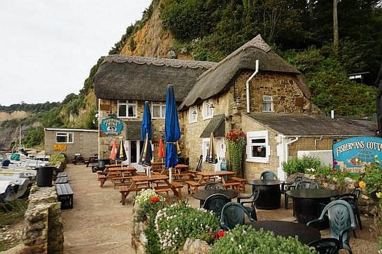
20 September 2020 (04:47) - Fire destroys White Horse pub in Chadwell Heath
A fire has destroyed a disused pub in Chadwell Heath. About 40 firefighters were called to the blaze at the White Horse pub in the High Road at 4.47am this morning (September 20). A hue of orange smoke could be seen coming from the building in the dark of night as crews continued to target the flames. A London Fire Brigade spokesperson said: “Most of the building was destroyed by the fire.” The brigade’s 999 control centre received 10 calls about the blaze which was brought under control by 7.17am today. Crews from Dagenham, Ilford, Romford and Hainault fought the flames and were still at the scene damping down two hours later. At this stage it is not known whereabouts in the pub the fire started and the cause remains unknown. An investigation has been launched. Police were called in to manage traffic, but a Met spokesperson said the blaze is not being treated as suspicious. The area remains completely blocked off, where a police cordon has been erected around the site.
The Locally Listed former coaching inn shut its doors after 400 years in August 2017. People who drank here said the pub had been allowed to deteriorate in the run up to the closure. In May 2016 the management had recently altered, and they were noted by some regulars as being rude and incapable of pulling a pint. It was also reported by this person that, "... senior management have deliberately placed incompetents in charge to drive away custom, and ruin the business with a view to selling the land". Other drinkers noted that the public house was being run down, with missing light bulbs, a shabby drinking room and filthy toilets, without proper facilities to wash and dry hands. One drinker noted, "...you had to peel your feet off the floor when you were walking to the bar because it was so dirty.”
Developer Ebury Holdings had promised to reopen the venue, following the site’s redevelopment. Andy O’Sullivan, who had been lined up to be landlord, said in February last year: “I’m excited to welcome back the community to this much loved pub. I’m looking forward to bringing back the spirit of the White Horse once again.” A planning application to build more than 50 homes at the pub was submitted at that time. The bid was approved subject to a legal agreement in May. The founder of Ebury Holdings, David Kaye, noted, "We are delighted to submit this application... (it is) the opportunity to reopen the White Horse alongside new homes."
News Source: Barking and Dagenham Post
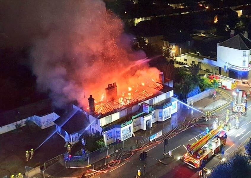
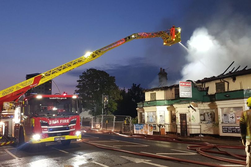
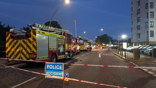
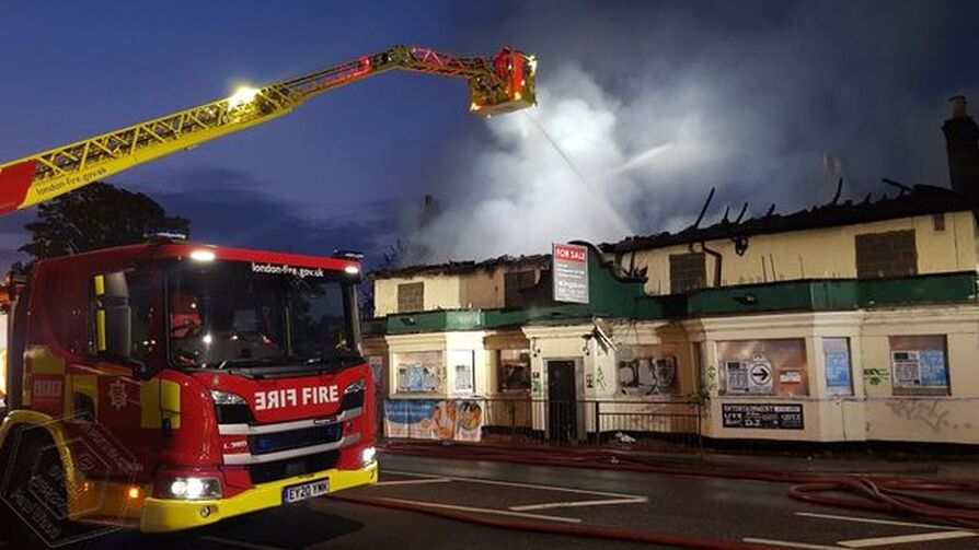
The fire is believed to have started in the early hours (Image: Paul Wood)
Building History
(Researched by Heritage & Ecclesiastical Fire Protection)
Many histories state that the current pub building is not very old, being found on the location of a former structure. There is no disputing that this was the oldest alehouse site in Chadwell Heath, with the earliest account here from July 1602, when an Edward Crowe was victualler. The inn can be found fully documented in the old county directories from 1826 onwards. A string of landlords have stepped behind the bar, and are found from the early 19th century. The 'Westcoate' family were behind the bar for about 20 years from around 1840 to about 1860.
It used to be opposite St Chads church but when the road needed to be widened there wasn't enough room so the High Road was moved to the other side of the White Horse and the back became the frontThe alehouse was reconstructed c.1899-1900 to the front, rear and sides, but an earlier building can still be seen, behind these changes and survives intact. Its architecture suggests that this is from the early 19th century, but it may well precede this. The White Horse was a former coaching inn on what was known as the 'Great Essex Road', being a staging post, whereby the horses would have been changed and watered or rested. It also served as a resting point for weary travellers, hence the name 'Hotel'. Later it became the omnibus terminus. In the 1920s, a lovely landscaped garden, including a rose pergola and lily pond were fashioned. The pond was stocked with fish. In the 1930's the stables were still alongside the pub and an outside urinal was still in use.
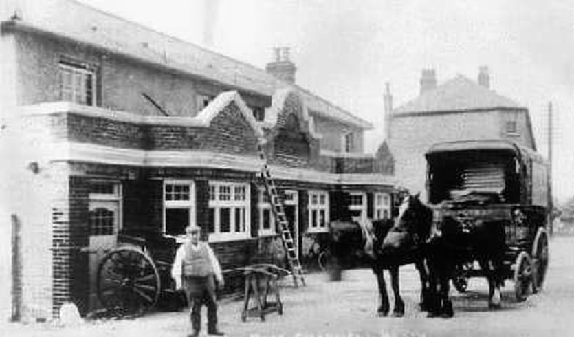
19 September 2020 (22:18) - 20 firefighters battle blaze at derelict Willenhall factory
Twenty firefighters battled a blaze at a derelict factory site in Willenhall. Firefighters spent almost two hours tackling the blaze which happened last night. The alarm was first raised at 10.18pm to the fire on Stafford Street. It is not yet clear how the blaze started. West Midlands Fire Service remained on site until 12.12am today. Crews from Willenhall, Bilston, Fallings Park and Walsall fire stations attended. They used four pieces of breathing apparatus equipment, a hydraulic platform and a water jet to tackle the blaze. Road closures were in place while the firefighting operation took place.
The fire was at the former Legge Locks factory, parts of which date back to the late 19th century. The site also suffered a major fire in February 2016.
Joseph Legge OBE JP was born in Willenhall in 1860 and founded Legge Locks in 1881, at the age of twenty. In 1888, Mr. Legge purchased the business of the late Joseph Collett and Sons, situated in Stafford Street, Willenhall and surrounded by vacant plots of land, which Joseph Legge with exemplary foresight, gradually acquired. Tools and patterns accumulated and the range of products was widened to include locks for buildings, cabinet locks and locks for travelling cases. The firm set up its own foundries for brass and malleable iron and, for those days a good, plating shop. By 1914, 250 people were being employed and the firm’s products were finding their way to ready markets in Australia, New Zealand, South Africa and India.
News Source: Express and Star
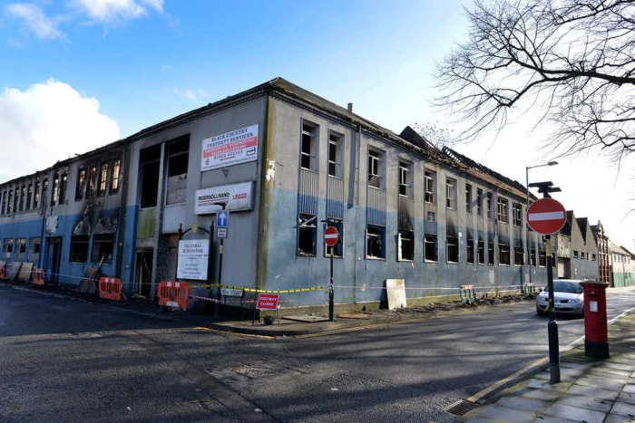
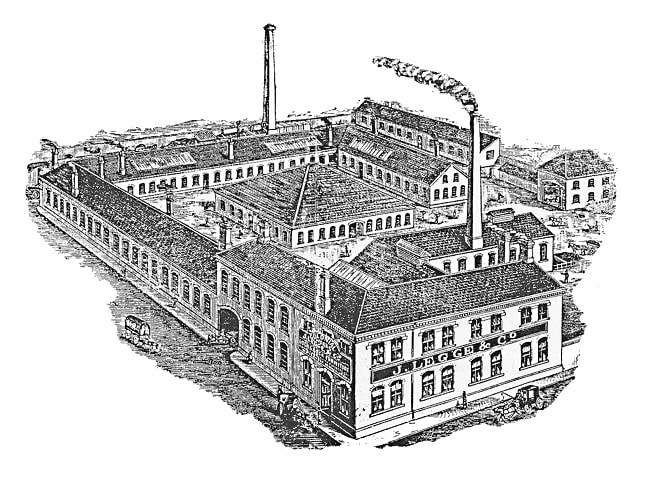
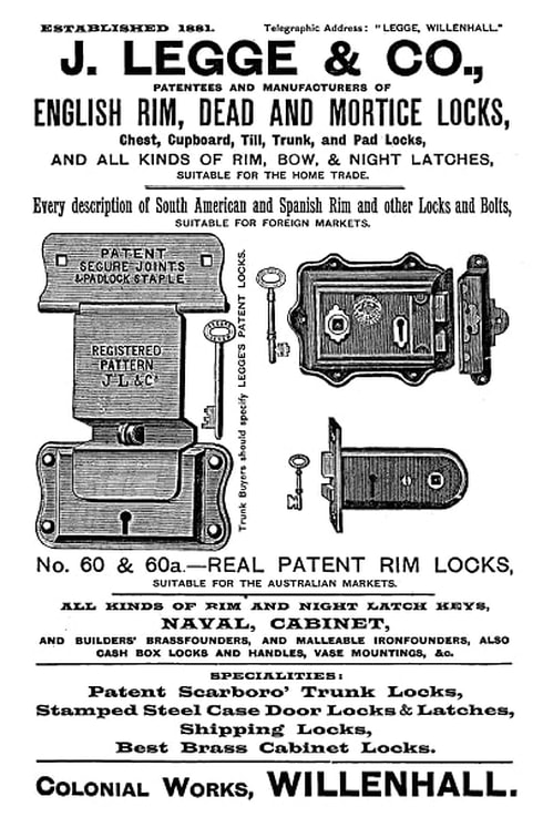
An 1896 advertisement
19 September 2020 (18:16) - Oswaldtwistle fire: Firefighters attend Stone Bridge Lane warehouse blaze
Five fire engines from across the county were called to the scene of a derelict warehouse fire in Oswaldtwistle on Saturday evening. The engines from Hyndburn, Blackburn and Darwen arrived at the scene on Stone Bridge Lane at around 6.16pm to find the building ablaze. Firefighters used two jets, two breathing apparatus and a stinger to extinguish the blaze. No injuries were reported.
The building was originally Stone Bridge Mill, built in the first half of the 19th century. It was owned by Robert Watson, a local cotton magnate, who also owned Rhyddings Mill. He was in partnership with John Bullough (of Howard & Bullough fame) and John Fish from 1847 operating Stonebridge. In 1848, the partnership was dissolved with James Bullough. Later that year the looms were sold to the trustees of James Simpson. Finally, in 1851 the partnership was dissolved with John Fish. It appears that during this time, the weaving mill was demolished and replaced by the spinning mill, still called Stone Bridge Mill.
News Source: This is Lancashire
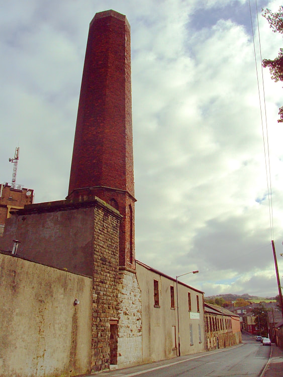
Stone Bridge Mill
Near Miss
19 September 2020 (16:25*) - Liverpool Central Station evacuated as smoke fills corridors
19 September 2020 (16:25*) - Liverpool Central Station evacuated as smoke fills corridors
There were dramatic scenes at Liverpool Central railway station this afternoon as the station was evacuated over fire concerns. Passengers were told to leave the platforms after a fire alarm activated at the city centre site just before 4.30pm. Merseyrail tweeted to say trains would not be stopping at the station as a precaution.
Merseyside Fire and Rescue Service said it was not alerted to any issues at the station, though images showed passengers covering their faces on what looked like smoke-filled the platforms. Visibility was clearly poor as passengers moved away from the platforms before being locked out, with shutters preventing anyone from moving past the Timpson and Sainsbury's branches within the station complex.
Passenger, Arlo Clyne, said he believed the smoke came from a train. He said, "The far end tunnel leading from Lime Street was flooding thick grey smoke onto platform three. It wasn’t clear if the train was on fire or if the tunnel behind it was in trouble. People and security guards looked on in disbelief as those waiting started to board the already smoking train. It was a good minute or two before the smoke alarms started to sound and passengers finally realised that there was something very wrong with this service." According to the witness, there was then a rush to evacuate the station. He said: "The smoke quickly overtook the train, platform and both escalators. All electronic fire doors locked into place as security staff ushered people out of the station." Pictures show smoke billowing up the escalators, filling the corridors of the station and masked passengers riding the escalator in a haze. Merseyrail tweeted: "Due to a fire alarm activation at both Lime Street and Liverpool Central, trains will not call at either station until further notice."
Two North West Ambulance Service vehicles were parked outside the station but there were no initial reports of anyone needing treatment. While the scenes looked dramatic, the situation was quickly dealt with and at 5pm, Merseyrail tweeted: "Services are now calling at all underground stations following an earlier fire alarm activation. Some services may be subject to delay until a normal timetable can be restored."
In an update on Thursday (24th), Zoe Hands, Chief Operating Officer at Merseyrail, said: “On Saturday afternoon a piece of debris became entangled with one of our trains travelling into Liverpool city centre.The item of debris itself came into contact with the electrified line, leading to the smoke that was seen inside the train and station. As soon as this became apparent, all passengers were evacuated safely. I apologise for any concern or discomfort caused. If passengers have any particular concerns about the incident, I would encourage them to contact our Customer Relations team at [email protected].”
Liverpool Central Low Level underground terminal station opened on 11 January 1892, at the end of the Mersey Railway's route, via the Mersey Railway Tunnel from Birkenhead, when the route was extended from James Street station. The Mersey Railway platforms were underground, accessed from stairs within the High Level station and situated in roughly the same position as the escalators accessing the Northern Line today. The Mersey Railway tunnel entering Central Low Level from the north of the station was aligned with the High Level station's approach tunnel from the south. This was to ensure minimum engineering work if ever the two tunnels were to be linked up—as did occur in the 1970s.
News Source: Echo
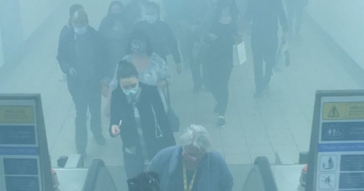
Smoke billowing up the escalators in Liverpool Central
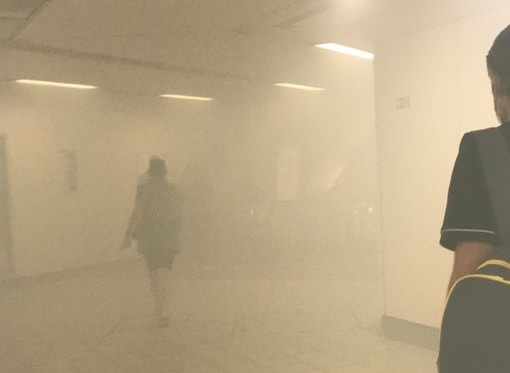
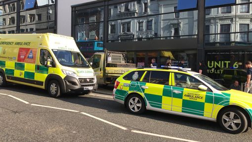
Near Miss
18 September 2020 (10:00*) - Fire in Enniskillen town centre
18 September 2020 (10:00*) - Fire in Enniskillen town centre
A fire has broken out in Enniskillen town centre this morning (Friday). Northern Ireland Fire and Rescue Service (NIFRS) entered the Donaldson's amusements premises on Townhall Street. Eyewitnesses saw smoke billowing from a couple of buildings on Townhall Street. Currently, there are two Northern Ireland Fire and Rescue Service vehicles at the scene at Townhall Street. Police Service Northern Ireland (PSNI) officers are also on the scene.
The block where the fire was is sandwiched between two listed buildings in the Enniskillen Conservation Area. One is the Grade B1 Northern Bank building, built in 1899, and on the opposite side, the former offices of the Fermanagh Times. This is now Bogues Jewellers and is a Grade B2 listed building, constructed in the late 19th century.
News Source: The Impartial Reporter
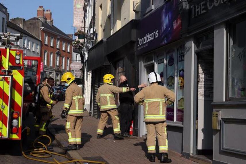
NIFRS entering Donaldson's Amusements
Listing Details
|
HB Ref No: HB12/17/012
Extent of Listing: (FRONT BOUNDARY RAILING - DELISTED) Address : NORTHERN BANK 24 TOWNHALL ST. ENNISKILLEN CO.FERMANAGH Survey 1: B1 Date of Listing: 26/08/1977 Current Use: BANK Former Use: BANK Conservation Area: Yes HB Ref No: HB12/17/011 Address : FERMANAGH TIMES OFFICE 14 TOWNHALL ST. ENNISKILLEN CO.FERMANAGH Survey 1: B2 Date of Listing: 26/08/1977 Current Use: SHOP/OFFICE Former Use: OFFICE Conservation Area: Yes |
Coordinates
IG Ref: H2362 4401 IG Ref: H2360 4403 |
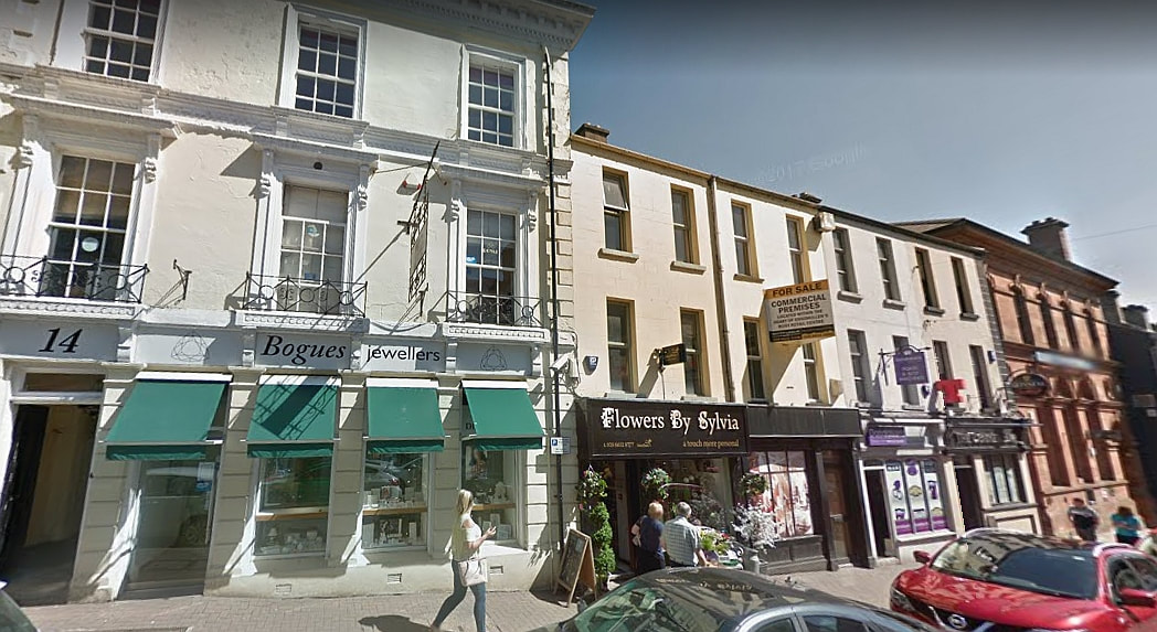
Credit: Google
18 September 2020 (01:04) - Terraced house in Forest Gate completely destroyed by fire
Firefighters tackled a fire at a two-storey mid terraced Forest Gate house, which was completely destroyed by the fire early this morning. Eight fire engines and around 60 firefighters were called to the blaze at the property on Windsor Road at 1.04am. Two adults and two children left the terraced property before the brigade arrived, and were treated for smoke inhalation at the scene by London Ambulance Service. Luckily the family were awoken by smoke alarms fitted in the property, which alerted them to the fire and they were able to get out. Two dogs also left the property. The fire, the cause of which will be investigated, was under control at 2.41am. Fire crews from Stratford, Leytonstone, Plaistow, East Ham, Ilford, Leyton and Poplar fire stations attended the scene.
All the houses in Windsor Road are categorised as “Positive Buildings” in the Woodgrange Estate Conservation Area. The Woodgrange Estate is a late Victorian speculative housing development with a character that clearly distinguishes it from other residential areas. Built between 1887 and 1892 by developer Thomas Corbett and sons, it has a consistent theme of distinctive house styles set in a markedly spacious and green setting. The Woodgrange Estate comprises four main east-west streets: Hampton Road; Osborne Road; Claremont Road and Windsor Road, all of which link to Woodgrange Road to the west. It was built as a desirable suburb for the middleclass city commuter. Corbett paid £40,000 (equivalent to £3,800,000 in 2019) for land associated with Woodgrange Farm, Essex, in 1877, which was formerly used as a market garden serving London.
News Source: Newham Recorder
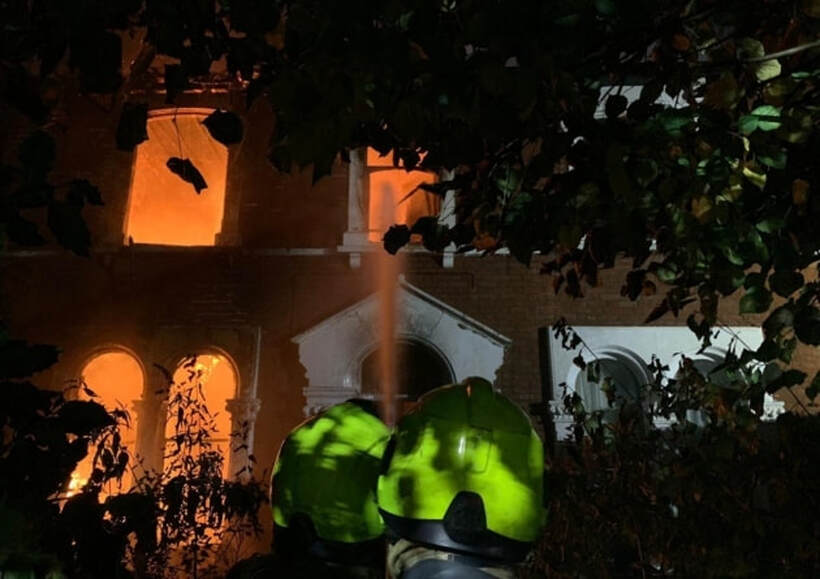
Around 60 firefighters fought the blaze (Image: London Fire Brigade.)
17 September 2020 (22:15) - Four fire crews tackle church fire overnight
Four fire crews were called to All Saints Church in Sutton to reports of a fire in the vestry. Firefighters were called just after 10.15pm yesterday, Thursday, September 17, to reports of fire at the church on Ellamsbridge Road. Crews attempted to gain entrance to the building which was locked and found a fire in the ground floor of the vestry. They extinguished the fire and checked elsewhere in the building for any sign of further fires. The cause of the fire is believed to be accidental. Firefighters left the scene after 1am.
In March it was announced that the 127-year-old church was facing financial hardship and asked the community to rally to help save its future. The church said it costs £40,000 a year to run All Saints and income in 2019 was £28,000. The balance came from reserves which are now exhausted, meaning the church needs £12,000 to keep going for the year.
All Saints said the church is not under a threat of closure from the Diocese of Liverpool or the bishops, who are supportive of the campaign. If unable to raise the funds to pay the bills then the church can’t continue as it needs to heat, light and maintain the building and support the costs of the clergy who minister there.
The Diocese of Liverpool said: "Like so many communities Sutton has suffered a loss of services with shops closing and other facilities moving out. The church is for all and it wants to remain as a community hub, serving and supporting the people of Sutton. The church needs people from the community to assist in the campaign. If together they can save the church and secure its future then together they can develop a vision that means All Saints can stay at the heart of the community."
All Saints is Grade II listed and was built between 1891 and 1893, and designed by the Lancaster firm of architects, Paley, Austin and Paley. The land and a donation of £1,000 (equivalent to £110,000 in 2019) were given by the lord of the manor, William Pilkington of the Pilkington glass manufacturing firm. The foundation stone was laid by Pilkington's daughter on 4 August 1891, and the church was consecrated on 14 October 1893 by the Rt Revd John Ryle, Bishop of Liverpool. The architects planned for a tower on the crossing, but this was never built. The estimated final cost of the church was £6,800, and it provided seating for 600 people.
News Source: St Helens Star
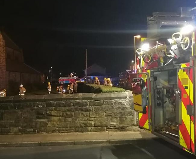
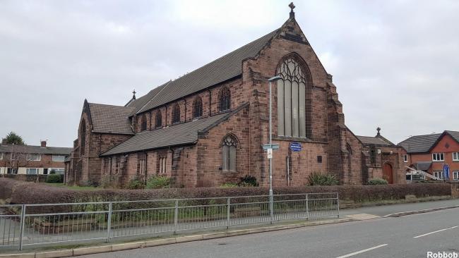
Listing Details
|
Entry Name: Church of All Saints
Listing Date: 2 June 1988 Grade: II Source: Historic England Source ID: 1260566 English Heritage Legacy ID: 216397 Location: St. Helens, WA9 County: St. Helens Electoral Ward/Division: Sutton Built-Up Area: St Helens Traditional County: Lancashire Lieutenancy Area (Ceremonial County): Merseyside Church of England Parish: Sutton St Nicholas Church of England Diocese: Liverpool |
Coordinates
Latitude: 53.4373 / 53°26'14"N Longitude: -2.7033 / 2°42'11"W OS Eastings: 353375 OS Northings: 393621 OS Grid: SJ533936 Mapcode National: GBR 9XKP.JK Mapcode Global: WH875.FVYS Plus Code: 9C5VC7PW+WM |
17 September 2020 (17:30) - Fire at 15TH CENTURY Gloucestershire TYTHE BARN treated as suspected arson
A fire at a Gloucestershire wedding venue is being treated as suspected arson. The blaze happened at Tithe Barn in Bishop's Cleeve on Thursday September 17 and firefighters from Gloucestershire Fire and Rescue Service were called to the scene on Cheltenham Road at around 5.30pm and the area was cleared by about 6.10pm.
Nolan Ursell, a witness at the scene, initially spotted smoke coming from the building and went to investigate. "Having seen smoke coming from the side of tithe barn I mentioned to my colleagues and thought that is not right. On investigation I saw the bottom of the side doors were alight due to dead leaves in flame and proceeded to try and put it out with the help of another colleague and assistant of Mario, the hand car wash owner, who helped with buckets of water. Initially that put the visible fire out but on further investigation doors were still smouldering and a lot of smoke was coming from the front of the building. At this point I wasn't taking any chances as the one door where most prominent fire was had a gas meter sign and still showing signs of ignition. 999 was called and the guys did the rest."
A spokesman for Gloucestershire Fire and Rescue Service said: "The fire was behind Tithe Barn and involved leaves and plastic behind the building. The call came in at 17.30. There were two appliances and the area was cleared by 6.10pm." Police attended to the scene at around 5.30pm. A spokesman said: "Police were called to Cheltenham Road, Bishop’s Cleeve at around 5.45pm yesterday, Thursday 17 September, following reports of a fire. The fire is currently being treated as a suspected arson. Anyone who witnessed this, has information or lives in the area and has CCTV footage can provide information online by completing the update a crime report form, quoting incident 391 of 17 September. You can also call police on 101."
The building is a 15th century Grade II listed Cotswold stone Tithe Barn, with an oak beamed roof.
News Source: Gloucestershire Live

Tithe Barn in Bishop's Cleeve
Listing Details
|
Entry Name: The Old Tithe Barn and Attached Boundary Wall
Listing Date: 4 July 1960 Grade: II Source: Historic England Source ID: 1340152 English Heritage Legacy ID: 135123 Location: Bishop's Cleeve, Tewkesbury, Gloucestershire, GL52 County: Gloucestershire Civil Parish: Bishop's Cleeve Built-Up Area: Bishop's Cleeve Traditional County: Gloucestershire Lieutenancy Area (Ceremonial County): Gloucestershire Church of England Parish: Bishop's Cleeve St Michael and All Angels Church of England Diocese: Gloucester |
Coordinates
Latitude: 51.9467 / 51°56'48"N Longitude: -2.0631 / 2°3'47"W OS Eastings: 395761 OS Northings: 227578 OS Grid: SO957275 Mapcode National: GBR 2LL.TFP Mapcode Global: VHB1J.6B6J Plus Code: 9C3VWWWP+MQ |
Building History
(Researched by Heritage & Ecclesiastical Fire Protection)
The Bishops Cleeve Tithe Barn is at the gateway to the original village, near Cheltenham’s famous racecourse under the edge of Cleeve Hill and the Cotswold escarpment. It was built in the 15th century as a Tithe Barn for the Bishop of Worcester opposite Cleeve Hall, then a summer residence of the Bishop. It was the first of its kind in England, and is constructed of Cotswold Stone with a Cotswold stone roof supported on an oak hammer beam roof structure.
At the end of the 19th Century the south end of the barn was destroyed by fire and cleared away but most of the original structure including the north end and central entrance remains. The Tithe Barn is now a Grade II Listed Building and an important part of the built heritage of Bishops Cleeve.
In 1953 the Tithe Barn was transferred to the villagers and the Parish Council became the Custodial Trustees. Following fundraising activities and with the aid of sponsorship from local business a programme of restoration of the exterior and improvements to the interior was carried out . The refurbished building was ceremonially opened in 1956 by the then Speaker of the House of Commons William S Morrison 1st Viscount Dunrossil, then conservative MP for Cirencester and Tewkesbury. The conversion to a Village Hall provided a Main Hall on the first floor with a sprung Canadian Maple wood floor for dancing, which it was claimed could accommodate 150 couples or 200 seated. Current fire regulations have now reduced this to 150. On the ground floor there are rooms for a library, a doctors surgery and, where the bar is now, a NatWest Bank, though not called that then.
The Tithe Barn has been in popular use as a Village Hall since then and has been kept in good condition over the last 50 years. When the Barn was converted the population of Bishops Cleeve had risen from 704 in 1876 (when one William Taylor was the Constable) to 4000 in 1950. It now serves a community of 10,000, larger than that of Tewkesbury, the borough town.
Since then it has been the venue for numerous village clubs and societies and many many weddings and anniversaries. It has seen various arts, music, drama (the home of Cleeve Players for many years), and jazz events. The trustees have concluded a four phase extension and refurbishment project that maintains the historic outline of a tithe barn and has used an agricultural style to provide a lift, two new meeting rooms, two easy access lavatories, one with baby changing facility, and new bar with new cooled store room and a new kitchen off the main Hall.
17 September 2020 (14:30*) - Residents escape bathroom blaze near The Royal Crescent in Bath
A large firefighter presence was called out to a property fire near to The Royal Crescent in Bath today (September 17). Three fire engines were spotted outside a building on Marlborough Buildings at around 2.30pm. A firefighter at the scene said they dealt with a fire in a bathroom and nobody was hurt. Although the occupants of the property looked shaken when they were sat on the street below, they were all unharmed. Traffic was being directed elsewhere while the crews tackled the fire.
Marlborough Buildings is a terrace of thirty-four houses, some stepped steeply uphill, overlooking Royal Victoria Park to rear. They were built between 1788 and 1794, are all Grade II listed and lie within the Bath Conservation Area and the UNESCO World Heritage Site.
News Source: Somerset Live
Marlborough Buildings is a terrace of thirty-four houses, some stepped steeply uphill, overlooking Royal Victoria Park to rear. They were built between 1788 and 1794, are all Grade II listed and lie within the Bath Conservation Area and the UNESCO World Heritage Site.
News Source: Somerset Live
Firefighters dealing with a fire in Marlborough Buildings, Bath
Listing Details
|
Entry Name: Nos 1 to 12 (consec) 13, 14 and 15, 16 to 29, 30 to 34 and attached railings and gates
Listing Date: 12 June 1950 Last Amended: 15 October 2010 Grade: II Source: Historic England Source ID: 1396353 English Heritage Legacy ID: 511758 Location: Bath and North East Somerset, BA1 County: Bath and North East Somerset Electoral Ward/Division: Kingsmead Built-Up Area: Bath Traditional County: Somerset Lieutenancy Area (Ceremonial County): Somerset |
Coordinates
Latitude: 51.3866 / 51°23'11"N Longitude: -2.3705 / 2°22'13"W OS Eastings: 374315 OS Northings: 165345 OS Grid: ST743653 Mapcode National: GBR 0QH.1HD Mapcode Global: VH96L.VDPX Plus Code: 9C3V9JPH+JR |
16 September 2020 (20:30*) – Fire crews called to blaze started by homemade smoker in Emsworth restaurant
Fire stations in Havant and Cosham sent crews to the incident at “36 On the Quay” restaurant, in South Street, Emsworth, at 8.30pm last night. Firefighters spent more than an hour battling the blaze, with the emergency services turning up just as the fire started to spread across the building, according to one firefighter at the scene. He said: ‘They had a store room and it started there – there were old fridges out there. Fortunately we got there just before it broke out. There was some smoke damage and the fire had begun to damage a little of cladding on the front of the building.’
A survey of the damage and conversations with the owner have led fire crews to believe the fire started in a homemade smoker in the store room. The firefighter added: ‘I believe it started in a smoker – the owner mentioned burning hay and logs in it. It was a homemade smoker, it looked like it was a fridge that had been converted. It was quite badly fire damaged.’ No one was injured in the incident.
The restaurant is a Grade II listed 18th century building. It was formerly The Old Anchor public house.
News Source: The Portsmouth News
The restaurant is located in South Street, Emsworth.
Listing Details
|
Entry Name: The Old Anchor
Listing Date: 21 July 1975 Grade: II Source: Historic England Source ID: 1092110 English Heritage Legacy ID: 135500 Location: Havant, Hampshire, PO10 County: Hampshire District: Havant Town: Havant Electoral Ward/Division: Emsworth Built-Up Area: Emsworth Traditional County: Hampshire Lieutenancy Area (Ceremonial County): Hampshire Church of England Parish: Warblington St Thomas a Becket Church of England Diocese: Portsmouth |
Coordinates
Latitude: 50.8447 / 50°50'40"N Longitude: -0.9376 / 0°56'15"W OS Eastings: 474891 OS Northings: 105559 OS Grid: SU748055 Mapcode National: GBR CF1.XDN Mapcode Global: FRA 86XV.Y9P Plus Code: 9C2XR3V6+VW |

15 September 2020 (05:34) - Birdham Road closed in Chichester due to house fire
A road was closed this morning while firefighters tackled a large blaze at a property. Crews were called just after 5.30am to a house fire in Birdham Road near Chichester. At one stage, ten fire engines were at the scene of the incident and the A286 at Dell Quay was closed both ways while crews battled the fire. People were warned to avoid the area, while nearby residents were told to keep their doors and windows shut.
The fire was brought under control by 10am and fire engines were reduced to six as crews remained at the scene damping down. West Sussex Fire and Rescue Service said: "We were called to a large fire at a property on Birdham Road, Apuldram, at 5:34am this morning. The cause of the fire is under investigation."
The house is called “Crouchers” and is Grade II listed, built in the late 18th or early 19th century.
News Source: The Argus
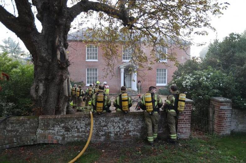
Firefighters at the scene of the fire in Birdham Road, Chichester. (Photos: Eddie Mitchell)
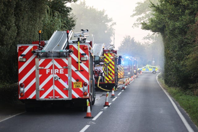
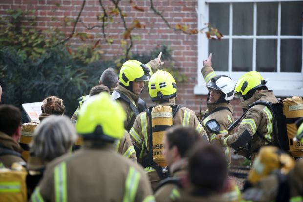
Listing Details
|
Entry Name: Crouchers
Listing Date: 5 June 1958 Grade: II Source: Historic England Source ID: 1354452 English Heritage Legacy ID: 300570 Location: Appledram, Chichester, West Sussex, PO20 County: West Sussex District: Chichester Civil Parish: Appledram Traditional County: Sussex Lieutenancy Area (Ceremonial County): West Sussex Church of England Parish: Apuldram St Mary Virgin Church of England Diocese: Chichester |
Coordinates
Latitude: 50.8147 / 50°48'53"N Longitude: -0.8031 / 0°48'11"W OS Eastings: 484417 OS Northings: 102368 OS Grid: SU844023 Mapcode National: GBR DGY.V2Y Mapcode Global: FRA 966Y.8XT Plus Code: 9C2XR57W+VQ |
Near Miss
14 September 2020 (23:30*) - St Luke's Church Hall fire: Police cordon off area after blaze
14 September 2020 (23:30*) - St Luke's Church Hall fire: Police cordon off area after blaze
Alarms blaring into the night are what alerted police to the Barton Hill church fire last night. A spokesperson for Avon and Somerset Constabulary said that patrolling police officers heard an alarm sounding at St Luke's Church in Barton Hill, Bristol, and went off to investigate. They then reported a fire at about 11.30pm on Monday September 14, 2020.
Queen Ann Road was closed in Barton Hill while a fire burned in the church hall of St Luke's Church. Pictures show police are still at the scene this morning (September 15) as enquiries take place to establish the cause of the fire. The area is cordoned off by police tape and a police car was pictured outside the church.
Avon Fire and Rescue Service said that they sent five crews to the blaze from Temple Hicksgate and Kingswood. The fire was in the office of the church and on the ground floor. Six breathing apparatus used and one high pressure hose reel to extinguish fire, a turntable ladder was also used and four 45 mm hose reels. It is reported to have stemmed from the ground floor store room and that the fire and rescue service were on scene for about two hours tackling the flames.
St Luke's church was begun in 1842 and completed in 1850 to the designs of S.T.Welch. It is in the style of the Commissioners' churches of the 1820/30s, a Georgian Gothick. It is now Grade II listed. The two-storey church hall was built in the tasteless modern style that was the fashion in 1965. This building was joined onto the tower and an airy foyer created to the church, but clashing terribly with the sober grey stone of the original structure.
News Source: Bristol Post
Pictures show police are still at the scene this morning (Image: Mike Lloyd)
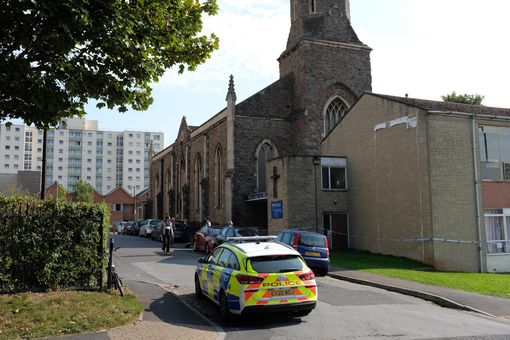
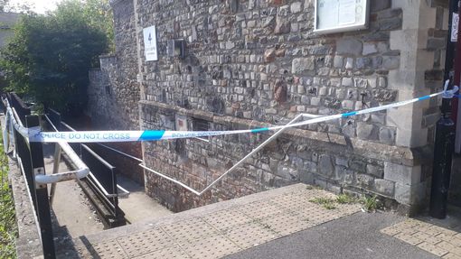
|
Entry Name: Church of St Luke and Attached Side Railings
Listing Date: 30 December 1994 Grade: II Source: Historic England Source ID: 1292262 English Heritage Legacy ID: 380239 Location: Bristol, BS5 County: Bristol Electoral Ward/Division: Lawrence Hill Built-Up Area: Bristol Traditional County: Gloucestershire Lieutenancy Area (Ceremonial County): Bristol Church of England Parish: Barton Hill St Luke with Christ Church and St Matthew, Moorrfields Church of England Diocese: Bristol |
Coordinates
Latitude: 51.4545 / 51°27'16"N Longitude: -2.5639 / 2°33'50"W OS Eastings: 360914 OS Northings: 172981 OS Grid: ST609729 Mapcode National: GBR CHK.0G Mapcode Global: VH88N.HPXW Plus Code: 9C3VFC3P+QC |
14 September 2020 (22:28) - Man dead after fire in Greenock petrol bomb house attack
A man has burned to death after apparently attempting to petrol bomb a house in Greenock and accidentally setting himself alight. His movements were captured on a CCTV camera at the property in Union Street late on Monday night.
Footage showed him stumbling around the back of the property while carrying what appears to be a filled watering can. Pools of liquid appear on the ground before the man stands at the entrance of the back close. The footage then suddenly glows bright white as the man is engulfed in flames. It is understood that the man who died at the scene was 46-year-old George Miller of Greenock.
Area Commander James McNeil of the Scottish Fire and Rescue Service said: “We were alerted at 10.28pm on Monday, September 14 to reports of a fire that had taken hold within a ground floor flat in Union Street, Greenock. Operations Control mobilised three appliances to the scene and firefighters removed a male casualty from the building who was very sadly pronounced dead at the scene. Our thoughts are very much with his family, friends and the wider community at this difficult time. A joint investigation alongside Police Scotland will take place in due course."
In the aftermath of the horrific blaze, police tape was placed around the front of the property as a tent was erected in the garden. Officers stood guard at the scene yesterday morning. A Police Scotland spokesperson said: "Police were called around 10.35pm on September 14, following the report of a fire at a property in Union Street, Greenock. Emergency services attended and a 46-year-old man was pronounced dead at the scene. Enquiries continue - however, at this time, the death is not believed to be suspicious and officers are not looking for anyone else in connection with this."
The attack on the property follows a petrol bomb murder bid at a property on the same part of Union Street earlier this year. Back in July, Drew Darling was said to have hurled burning Molotov cocktails at a property in the same street. Prosecutors said that he set fire to cloth within glass bottles containing an accelerant to the danger of a man and woman within the property. The charge alleged that Darling ‘did attempt to murder them’.
Monday’s incident involved No 12 Union Street, which is a Category C listed building, built soon after 1825. It lies in the Greenock West End Conservation Area. The property is also adjacent to the Category B listed St John the Evangelist Episcopal Church, which dates from 1877.
News Source: Mirror
Man burned to death after attempting to petrol bomb house in Greenock
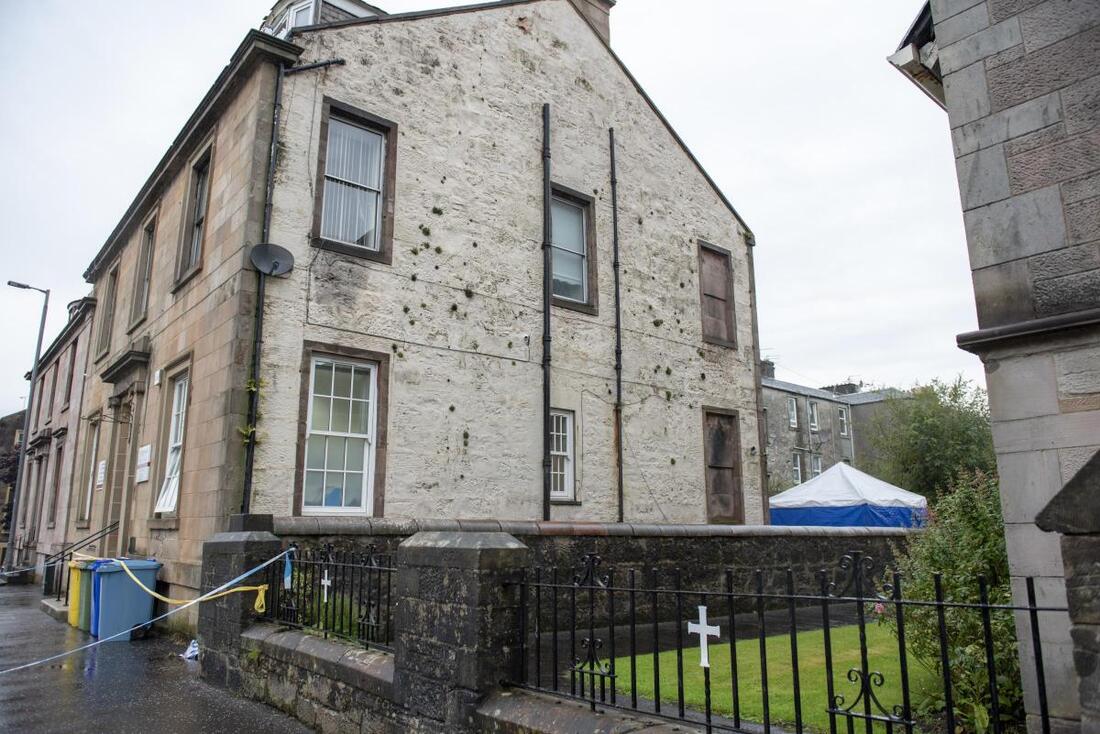
Listing Details
|
Entry Name: 12 Union Street.
Listing Date: 13 May 1971 Category: C Source: Historic Scotland Source ID: 378371 Historic Scotland Designation Reference: LB34154 Building Class: Cultural Location: Greenock County: Inverclyde Town: Greenock Electoral Ward: Inverclyde North Traditional County: Renfrewshire |
Coordinates
Latitude: 55.9513 / 55°57'4"N Longitude: -4.7658 / 4°45'56"W OS Eastings: 227406 OS Northings: 676597 OS Grid: NS274765 Mapcode National: GBR 0C.Y3B6 Mapcode Global: WH2M9.RPS0 Plus Code: 9C7QX62M+GM |
Near Miss
14 September 2020 (07:09) - Huge fire ravages derelict Hull building as black smoke seen across the city
14 September 2020 (07:09) - Huge fire ravages derelict Hull building as black smoke seen across the city
Huge smoke plumes could be seen across the city centre this morning as a blaze tore through a derelict building. Fire crews rushed to the scene in St Peter Street at 7.09am after an old structure on the banks of the River Hull became enveloped in the flames. Evidence of the fire could be seen around the city as a cloud of thick black smoke formed in the air. One witness, watching the cloud from C4DI in the Fruit Market said: "I can’t see any flames, just the very black looking smoke, which is being produced at an alarming rate."
Humberside Fire and Rescue Service sent four crews and four fire engines from central, east Hull, north Hull, and west Hull to deal with the blaze. Almost two hours since the initial call fire fighters remain at the scene where they are using apparatus to dampen down the building. A Humberside Fire and Rescue Service spokesperson said: "We’re in attendance at a derelict building which is on fire in St Peter Street. We have four engines there with four crews from central, east Hull, north Hull and west Hull. It’s a single story derelict building 10m by 10m fully involved in fire."
The fire was adjacent to the Grade II listed former Buoy shed built for Trinity House in 1901. From the mid 15th century Hull Trinity House was responsible for setting out the buoys to aid navigation in the River Humber. The building was last used as a base by specialist underwater civil engineering firm Northern Divers. The site includes a Victorian era crane.
News Source: Hull Daily Mail / Hull Live
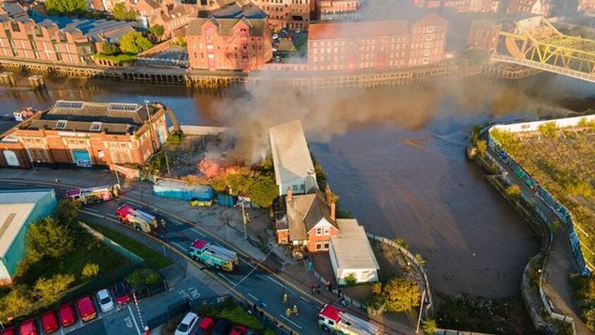
Aerial shots of the scene in St Peter Street
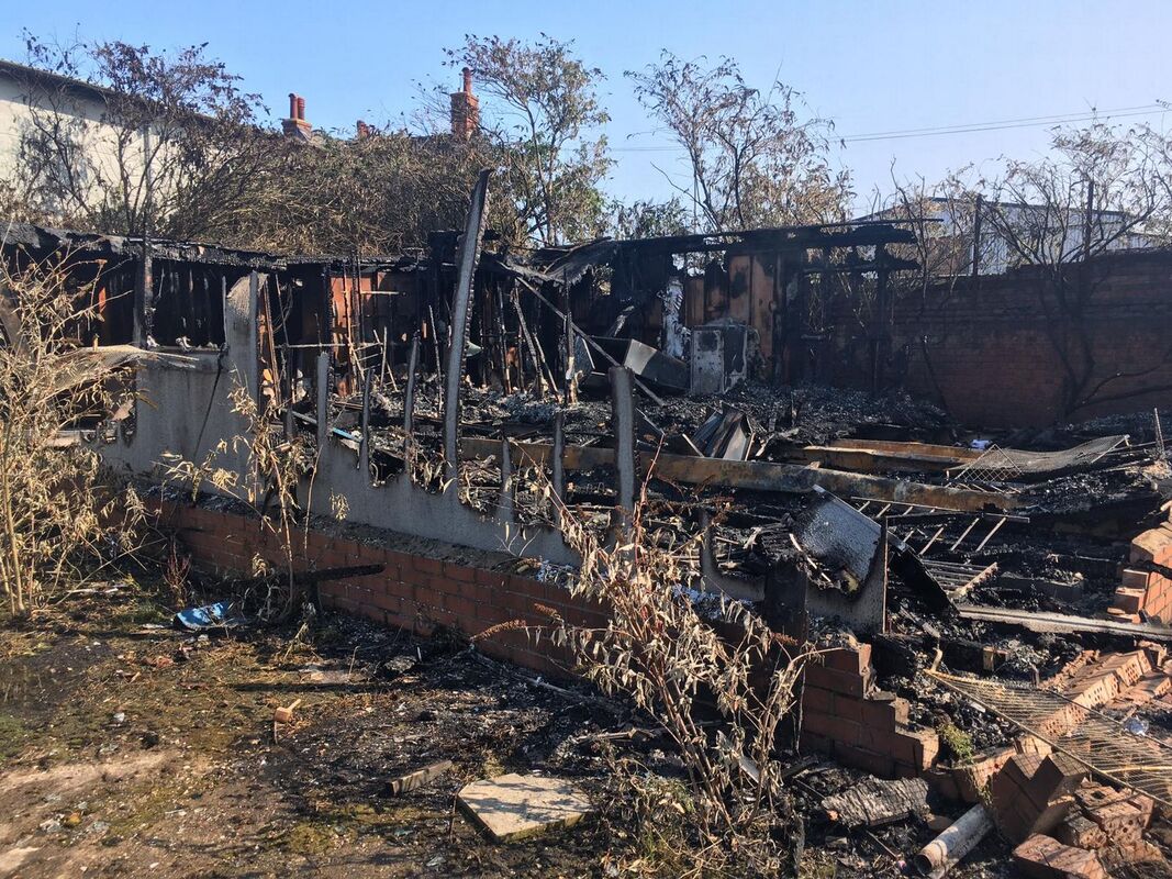
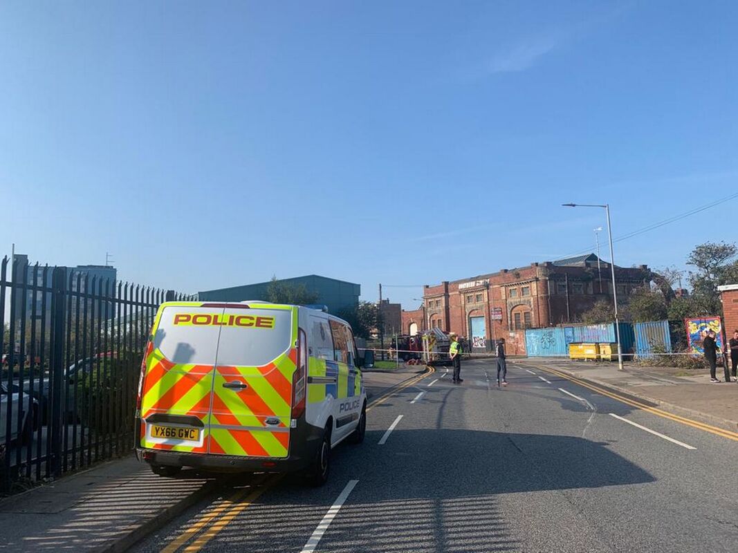
Listing Details
|
Entry Name: Former Trinity House Buoy Shed
Listing Date: 21 January 1994 Last Amended: 22 January 2019 Grade: II Source: Historic England Source ID: 1197668 English Heritage Legacy ID: 387817 Location: Kingston upon Hull, HU9 County: City of Kingston upon Hull Electoral Ward/Division: Drypool Parish: Non Civil Parish Built-Up Area: Kingston upon Hull Traditional County: Yorkshire Lieutenancy Area (Ceremonial County): East Riding of Yorkshire Church of England Parish: Hull, Drypool St Columba Church of England Diocese: York |
Coordinates
Latitude: 53.744 / 53°44'38"N Longitude: -0.3281 / 0°19'41"W OS Eastings: 510360 OS Northings: 428808 OS Grid: TA103288 Mapcode National: GBR GQP.B9 Mapcode Global: WHGFR.X5Y4 Plus Code: 9C5XPMVC+HQ |
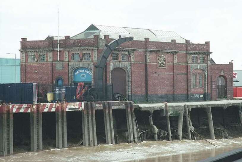
The former Buoy shed built for Trinity House in 1901
13 September 2020 (10:53) - Fire breaks out at home near Rye - twice
Firefighters were called to a house fire in Brede on Sunday morning (September 13). East Sussex Fire and Rescue Service confirmed four appliances were sent to the fire at 10.53am. A spokesperson said: "The service was called to reports of a curtain alight at the house on Cackle Street. There are no reports of injuries. An eyewitness said firefighters left the property at approximately 1pm, before returning a short time later, after being called back by residents who had spotted smoke. The fire service said the incident was then escalated to six fire engines, as of 2.30pm. Smoke was also seen billowing from the roof of the building. The incident was scaled back to one engine at 9.50pm, the fire service said.
On Monday (September 14), pictures from the scene showed much of the building had been badly damaged during the blaze. A fire service spokesman said: "This morning a reinspection of the incident took place and a further re-inspection will be carried out later today (14 September). As with all fires of this type, a full fire investigation will be carried out in due course." Crews used a breathing apparatus, one hose reel jet and firefighting foam to tackle the flames.
The house involved is known as Brede Cottage and is an 18th century Grade II listed building.
News Source: Hastings Observer
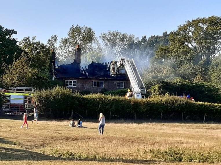
Firefighters tackle the blaze
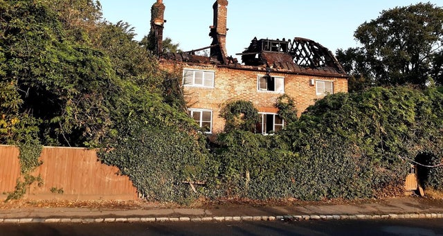
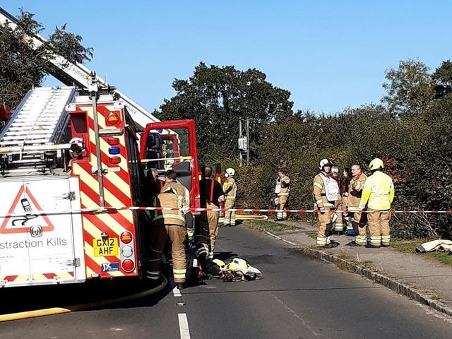
Listing Details
|
Entry Name: Brede Cottage
Listing Date: 13 May 1987 Grade: II Source: Historic England Source ID: 1277224 English Heritage Legacy ID: 292386 Location: Brede, Rother, East Sussex, TN31 County: East Sussex District: Rother Civil Parish: Brede Built-Up Area: Cackle Street Traditional County: Sussex Lieutenancy Area (Ceremonial County): East Sussex Church of England Parish: Brede St George Church of England Diocese: Chichester |
Coordinates
Latitude: 50.9407 / 50°56'26"N Longitude: 0.5952 / 0°35'42"E OS Eastings: 582424 OS Northings: 118899 OS Grid: TQ824188 Mapcode National: GBR QXJ.TJG Mapcode Global: FRA D64M.7QW Plus Code: 9F22WHRW+73 |
10 September 2020 (22:30*) - Emergency services tackle house fire in Stonehouse, Plymouth
A home has been damaged following a fire in the Stonehouse area of Plymouth late last night. The fire service were called to George Place just after 10.30pm following reports that a blaze had broken out in the kitchen of a maisonette on the street. Footage filmed by eyewitnesses show smoke rising high into the sky as emergency services tackled the fire.
Fire crews from Greenbank, Camels Head and Crownhill attended the incident and extinguished the blaze. A Devon and Somerset Fire and Rescue Service spokesperson said: "Two fire appliances from Greenbank, one from Camels Head along with the aerial ladder platform from Crownhill attended a report of a kitchen fire at George Place, Plymouth. On arrival the fire was located in the kitchen of a maisonette on the top floor. To deal with the incident fire crews used two breathing apparatus, one high pressure hose reel, one jet, a positive pressure ventilation fan and a thermal image camera."
The flat fire was in the former East Street Board School building, which opened in 1883. The building was converted into 11 rent-to-buy flats in 2018.
News Source: Plymouth Herald / Plymouth Live
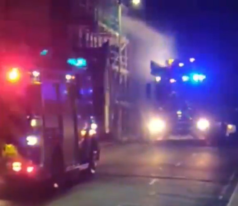
Emergency services tackle the fire at George Place
Building History
(Researched by Heritage & Ecclesiastical Fire Protection)
The East Street Board School run by the East Stonehouse School Board was formally opened at 11am on the morning of Thursday January 11th 1883 by the Chairman of the Board, the Reverend P R Scott. Also present were the Reverend S Hobbs, Mr J S Williams, and Mr S H Phillips, the Clerk to the Board. Constructed in Pomphlett limestone, the building was designed in the Gothic style by Mr H J Snell of Plymouth and built by Messrs Palk and Partridge.
There were two entrances, both actually off Quarry Street, one to the girls' and infants' school and the other to the board room and offices. The infants' classes were held on the ground floor. To the right of the entrance vestibule was a cloak-room, and beyond that were the mistress' room, a large school-room with lavatory, two class-rooms and a store room. The school-rooms were fitted with "dual desks", also designed by Mr Snell. Also on the ground floor was the Board room and a waiting room. It was noted at the time that each of these rooms had a fire-proof strong room attached.
Two spacious staircases led upstairs to the girls' department. It consisted of a large school-room and two class-rooms similar in design to those on the ground floor. There was also a room for the mistress, a store room, lavatories, and a cloak-room. The fittings throughout the schools were of pitch-pine and were constructed by Messrs Tremain & Sons of Plymouth. Behind the school was a large playground.
There were at the opening, 120 girls attending in addition to the 160 children transferred from the old infants' school. It was the intention of the Board to erect a boys' school on some adjacent ground.
The cost of the school was given as £2,598 for the buildings, £95 for the fittings, and £936 for the purchase of the land, which was part of Battery Quarry.
On the day of the opening the children were all assembled in the girls' school-room under the charge of their eight teachers and assistants. The Chairman, in his opening address, said that he was pleased to see that the new Code of Education being introduced included cookery. He asked:
'What was the use of working men having wives who perhaps could do grand crochet work or struggle through a piece of music on the piano, but who could not cook a mutton chop or make a loaf of bread to save their lives?' 'There was a great tendency nowadays, especially among girls, to aim at being above their class' he continued. 'They should never be ashamed of belonging to the working class, but learn all they could at school, so that they might grow up to a good and useful womanhood'.
In 1889, when the girls' school came under Miss Emma Masters and the infants' under Miss Emma Phipps, 156 girls and 220 infants attended the School.
At the East Stonehouse School Board meeting on Friday November 11th 1898 approval was given to the motion by Mr E T Wood, seconded by the Reverend W Robinson, that Miss Copeland, of Landewednack, Cornwall, should be appointed assistant mistress of the East Street infants' department. At the same meeting Mr (Thomas) Peain, assistant master in the boyrs' department, applied for an increase in his salary of £90. He told the meeting that he had been with the Board for nearly eighteen years. A decision as to whether or not to award him an extra £10 a year was deferred to the next meeting. (Mr Peain came originally from Millbrook, Cornwall.)
It was enlarged in 1901 to take 580 children. The girls' school came under Mrs Alice Gidley and the infants' under Miss Mary Southerd. The average attendance at that time was 174 girls and 238 infants.
Following the transfer of responsibility for education from the East Stonehouse School Board to the Devon Education Authority in 1903, this became the East Street Elementary School. In 1914 it was transferred to the Plymouth Education Authority.
By 1935 the former Saint Matthew's Sunday School premises in George Place had been taken over for the boys' school. At that time the Headmaster of the boys' school was Mr A Hill; the Headmistress of the girls' school was Miss E Henry; and the Headmistress of the infants' school was Miss B Scott.
After the Second World War the East Street premises became the Valletort Secondary Modern School. It was finally closed in July 1970. It later became The Ship Hostel for homeless people which closed in 2011. The building stood empty for seven years, and then was converted into 11 rent-to-buy flats in 2018.
10 September 2020 (16:30) - Brighton seafront fire: Emergency at King's hotel
Emergency services have been called to Brighton seafront over a fire at a hotel. Fire engines, ambulances and police have been called to the scene in King's Road. East Sussex Fire and Rescue Service said it was called at 4.30pm over fears of a "fatal" fire. A spokesman said: "We were called at 4.30pm to King's Road in Brighton. There has been a fire in a ground floor bathroom." A Sussex Police spokesman told The Argus the incident involved a "small fire in a room". The incident is not being treated as suspicious, and the force confirmed one person has been treated for smoke inhalation.
The Kings Hotel was built in 1848 as furnished lodgings, owned by T H King until it became [Mrs] King's private hotel in 1874. It was known as Oriental Terrace until 1895.
News Source: The Argus
The Kings Hotel was built in 1848 as furnished lodgings, owned by T H King until it became [Mrs] King's private hotel in 1874. It was known as Oriental Terrace until 1895.
News Source: The Argus
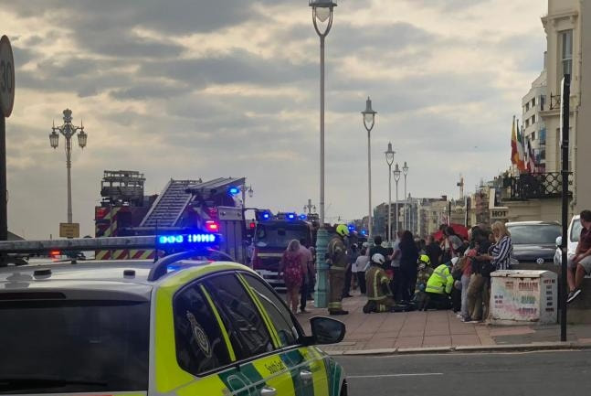
Emergency services are at King's Road in Brighton
Building History
(Researched by Heritage & Ecclesiastical Fire Protection)
In the 20th century, the Kings Hotel was regarded as a Jewish and kosher hotel, which had a succession of Jewish owners. The King's Hotel was also infamous for a fatal fire (when the Barnetts were owners) when part of the hotel was burned down on the 26th January 1967, claiming three victims – two elderly women and an elderly man. Gerard Sayer the hotel lift-boy, later to become the singer known as Leo Sayer, was involved in an act of bravery during the fire. A contemporary new report stated that, 'Hotel staff came into work this morning still shaken by the tragedy. Back at work as usual was the hero of the fire slightly-built Gerard Sayer, the 18 year old hall porter and lift boy. Gerard took his lift up to the third floor through smoke and choking fumes and tried to save two elderly guests. He was rescued himself by ladder. Gerard of Upper Shoreham Road Shoreham, said this morning "I didn't really think about the risk at the time, I had the lift and I used it."
The fire in 1967
|
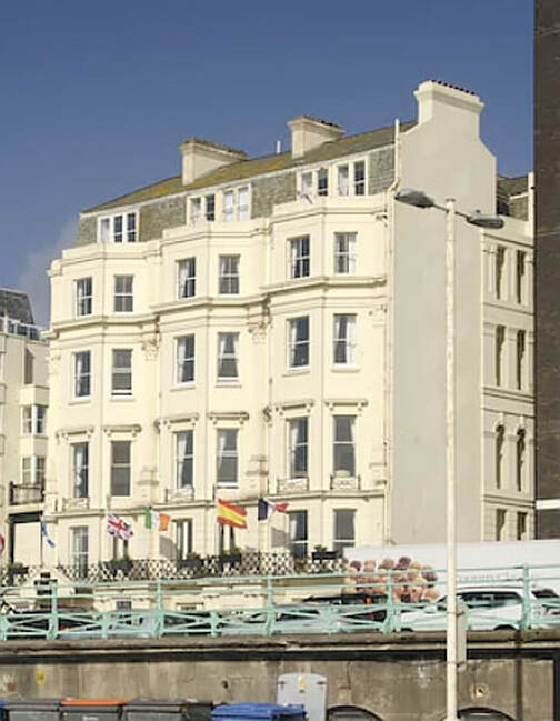
The hotel now
|
9 September 2020 (16:14) - Flat fire on Rosebery Avenue in Holborn
Firefighters, wearing breathing apparatus, rescued a woman from a flat fire on Rosebery Avenue in Holborn. They found the woman unconscious on the sofa of her fourth floor flat and gave her emergency care before she was taken to hospital. Station Commander Alan Brand, who was at the scene, said: “Firefighters worked incredibly hard and fast to rescue the woman and deal with the small fire on the fourth floor. They administered emergency care to the woman before the ambulance arrived. She was taken to hospital by London Ambulance Service crews.” Part of the flat was damaged by the fire. There was smoke damage throughout the property.
The Brigade was called at 4.14pm to Gray’s Inn Buildings and the fire was under control by4.46pm Fire crews from Soho, Islington, Lambeth and Bethnal Green fire stations attended the scene. There was a working smoke alarm in the flat which was sounding. The fire was discovered by a passer-by who called 999. The cause of the fire is believed to be the unsafe disposal of a cigarette.
Gray's Inn Buildings were the first buildings to go up in Rosebery Avenue. Erected in 1887–8 by the Artizans', Labourers' & General Dwellings Co., the two groups of model dwellings could together accommodate just over 1,000 people. The flats were 'associated', having shared WCs and sculleries, which made them both unpopular and difficult to adapt as tenants' expectations rose.
Gray's Inn Buildings were occupied from the early 1970s until 2003 as a squat, whilst becoming increasingly derelict. Only the Victorian façade remains, and the newly constructed buildings behind it now consist of 104 social housing units and a basement comprising an office/studio and community centre.
News Source: UKNIP 247
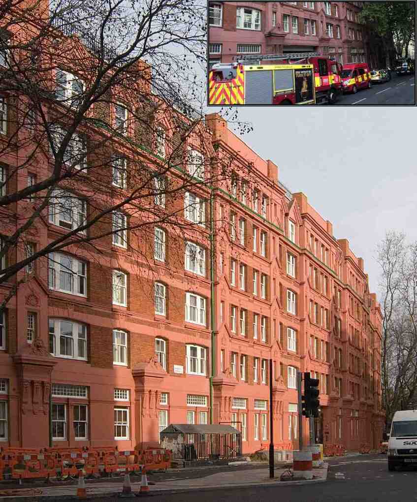
8 September 2020 (21:25) - Firefighters called to Kendal's Brew Brothers cafe after tumble dryer catches fire
A town centre cafe was forced to close to customers the day after a fire started at the back of a shop. Firefighters were called out to the Brew Brothers cafe in Kendal after a fire started in the shop’s basement. Crews spent over an hour and a half at the site after the fire broke out on Tuesday night. They used a host of specialist equipment at the scene in the operation. Firefighters said the blaze started in a tumble dryer.
A spokesman from Cumbria Fire and Rescue Service said: “At 21.25pm hours, three fire engines attended a fire at Dowkers Lane, Kendal. The fire involved a tumble dryer in the cellar of a commercial property. Firefighters used four breathing apparatus, one hose reel jet, a thermal imaging camera, and one positive pressure ventilation unit to extinguish the fire. Crews were detained approximately one hour and forty five minutes.”
The shop was closed to customers on Wednesday. In a post circulated on social media, Brew Brothers said there had been a ‘minor’ fire at the site, in Highgate. Brew Brothers bosses said: “To all our wonderful customers. Unfortunately Brew Brothers will be closed as we had a minor fire at the back of the shop. We are unsure how long it will take. We will keep you updated.” Further posts on Facebook revealed the fire was caused by a two-month old washer drier unit that was faulty. Brew Brothers said that little damage was caused to the kitchen, but there had been some smoke damage that required cleaning up.
The Brew Brothers cafe, which sells a range of food and drinks, opened for business in 2014. The building is Grade II listed and was built in 1792 for Maude, Wilson and Crewdson Bank. It lies within the Kendal Conservation Area.
News Source: The Westmorland Gazette
Brew Brothers, Kendal
Listing Details
|
Entry Name: No 69 (Including Nos 69a and 69b)
Listing Date: 14 April 1969 Grade: II Source: Historic England Source ID: 1145708 English Heritage Legacy ID: 75379 Location: Kendal, South Lakeland, Cumbria, LA9 County: Cumbria Civil Parish: Kendal Built-Up Area: Kendal Traditional County: Westmorland Lieutenancy Area (Ceremonial County): Cumbria Church of England Parish: Kendal Holy Trinity Church of England Diocese: Carlisle |
Coordinates
Latitude: 54.3259 / 54°19'33"N Longitude: -2.7474 / 2°44'50"W OS Eastings: 351490 OS Northings: 492514 OS Grid: SD514925 Mapcode National: GBR 9L8F.01 Mapcode Global: WH82W.RJXK Plus Code: 9C6V87G3+93 |
8 September 2020 (16:13) - Fire under railway arches in Wapping
Six fire engines and around 40 firefighters were called to a fire at a business under railway arches on Cable Street in Wapping. Part of a railway arch unit used for rickshaw storage was damaged by the fire. There were no reports of a any injuries. Station Commander Mark Jordan, who was at the scene, said: "The fire broke out in a business under the railway arches.There were no road closures in place but traffic was heavy so we advised people to avoid the area if possible. Trains on the DLR ran at reduced speeds."
The fire was accidental and believed to have involved lithium batteries. The Brigade was called at 1613 and the fire was under control by 1719. Fire crews from Whitechapel, Shoreditch, Shadwell, Dockhead, Millwall and Poplar fire stations were at the scene.
The viaduct the London and Blackwall Railway, with its large impressive arches, was built between 1838 and 1840. It was 20ft high with a 4,020-yard (3,676m) run of around 285 semi-elliptical or three-centred arches, mostly 30ft in span, extending from the Minories to West India Dock Road. It was built of yellow-stock brick with a continuous corbelled stone cornice above the arcade. Slightly projecting piers were mostly 3ft 6in. wide, broader beside road bridges. The railway opened between Minories and Blackwall on July 6th, 1840, and extended from Minories to Fenchurch-street on August 2nd, 1841.
News Source: London Fire Brigade
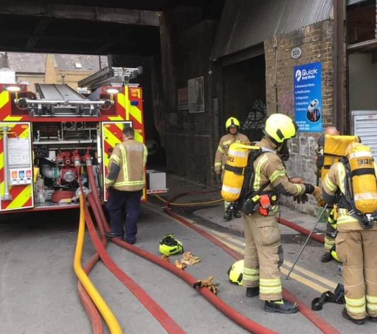
Part of a railway arch unit used for rickshaw storage was damaged by the fire.
Building History
(Researched by Heritage & Ecclesiastical Fire Protection)
Originally called the Commercial Railway, the London and Blackwall Railway (L&BR) in east London, England, ran from Minories to Blackwall. Anyone who has travelled on the Docklands Light Railway to Bank or Tower Gateway will have no doubt enjoyed the view from the train high above ground level. It might be a surprise to many that one of the most modern London railways is travelling on viaducts which are over 160 years old and are part of the intriguing story of the First Docklands Railway. A newspaper report from 1840 provides some of the details about the innovative London and Blackwell Railway.
“London and Blackwall Railway 1840
A new and important addition to the vast internal resources of this country was made on Saturday by the opening of the London and Blackwall Railway, running between the Minories and the river at Blackwall, presenting to the commercial world an immense saving of time, risk, and expense. The tedious and perilous navigation from Blackwall to London Bridge may now be entirely avoided, which heretofore has occupied more than one-fifth of the whole passage to Gravesend, and the Pool itself may at the same time be relieved from the dangerous presence of the large steamers and other vessels which may henceforth transmit their passengers and cargoes to the heart of the City, by the medium of this railway in the space of ten minutes.
Another feature of interest in this railway is the novel nature of its mode of operation. The carriages being propelled by the agency of an enormous rope instead of by steam, a medium which, for a short distance, appears to be effective and perhaps more pleasant and agreeable in the motion than the latter power. The process is this-:
The trains are propelled to Blackwall by means of two stationary engines of 120 horse power each which are worked in shafts sunk into the earth to 4 the right and left of the lines. To these engines fly-wheels, or as they are technically termed ” drums, ” are attached, each of which is of the ponderous weight of forty-three tons, and are twenty-two feet in diameter. A ” tail ” rope is fastened to the drums, which is wound and unwound at each end by the stationary engines, there being also two engines of seventy-horse power each sunk beneath the Blackwall terminus. As the train proceeds to the latter place the drums at the London terminus unwind the rope by which the carriages are to be again drawn to London: and to prevent the rope flying across the sheaves on which it runs too rapidly, and thus becoming entangled, in consequence of no weight being attached to it, an ingeniously contrived break is placed on the platform by the side of the railway. at which a man is employed to regulate the unwinding of the rope. The rope is not an endless one, similar to ‘that employed at the Euston Square station of the Birmingham railway, but it is in two parts, namely, one for propelling carriages to Blackwall, and the other from that place. It was manufactured by Sir Joseph Huddart and Co. of Limehouse, and cost upwards of £1,200. The drums take 80 turns to every mile of the ropes, each of which is three miles and half in length.
The electric telegraph is the next object of attraction, and it is enclosed in a neat mahogany case, which is so far as it is seen, above the ground and a small bell announces when the train is to be put in motion. The telegraph is the invention of Messrs. Cook and Wheatstone, and enables parties at each end of the railway to ‘hold conversation with each other. At each of the intermediate stations one of the telegraphs is placed to enable the servants of the railway to communicate with the engineers of the terminus and it was stated that notice of any impediment or casualty might be given at an intermediate station to one of the termini, and from thence conveyed to the other end of the line in the short space of three seconds.
The Blackwall terminus is roofed in a light and elegant manner, and every precaution appears to have been taken to preserve the carriages and protect the travellers from the weather at inclement seasons. At the London terminus the roof is only temporary, as it is intended to complete,as soon as possible, the remainder of the line to Fenchurch-street, where a grand terminus will be erected. Adjoinging the Blackwall terminus, capacious offices and store-rooms have been built immediately fronting the river, the Brunswick Wharf and property, belonging to Sir Robert Ingram having been purchased for that purpose. The architectural part of the railway is neat and unostentalious and was designed by William Tite, Esq, the successful candidate for the building of the New Royal Exchange. The line proceeds on a series of arches from the Minories to the West India Docks, across the Regent’s-canal and the Lea. The span of the arches crossing the canal and river is from thirty to forty feet, and from the West India Docks the line runs upon an embankment, and the ground falls into a very rapid decline of 1 to 150. So that from the Marsh to the Blackwall terminus the embankment is but a few inches in height. The difference is the level of the line from one end to the other is l8 feet. The three intermediate stations, namely the Stepney, the Limehouse, and the Marsh, are exceedingly neat externally, and conveniently fitted up internally for passengers who have to wait for the trains.
The railway is fenced in with a light and ornamental iron palisade, and the ironwork also presents a more pleasing view to the eye as Mr Jackson, the builder, had the contract for the London end, Mr Webb for the centre, and Messrs Peto and Glissell for the Blackwall terminus of the railway. The length of the railway at present is three miles and a quarter, when it is carried on to Fenchurch-street it will be three miles and a half. The works hitherto have cost about £150,000. The stationary engines, it was said cost about £30,000.
The carriages are of a deep blue colour picked, out with gold, and the panels bear the City arms surmounted by a steam vessel, the whole encircled with the words, “The London and Blackwall Railway Company” The first class carriages are of the usual description, except that there are no elbows to the seats. They are each divided into three compartments, and are intended to hold thirty-two passengers. The fare to either of the stations will be 6d. by the first class, and 3d by the second class. The second class carriages are of the same construction as those of the Manchester and Leeds Railroad, and are termed by engineers, ” Stand-up,” there being no seats to them, and the passengers having to stand during the journey.”
The line opened in 1840, and the company changed its name to the London and Blackwall Railway on completion of an extension to Fenchurch Street in 1841. A line from Stepney linking it with the Eastern Counties Railway at Bow was opened in 1849, became known as the London and Blackwall Extension Railway (LBER).
In 1849, it was decided the rope mechanism was too inefficient and the railway converted to steam, other branch lines were added including the Millwall Extension Railway which served the Millwall Docks and later the line was extended to North Greenwich ( Island Gardens).
Towards the end of the 19th century and early 20th century the line took passengers and goods to the various docks and to Blackwall that had for centuries been a major embarkation and imbarkation point in London. However , passenger traffic was closed on the railway in 1926 as a result of competition from trams. The carrying of goods carried on until 1968 before that was closed down and much of the track ripped up.
Remarkably, the first Docklands Railway may have closed but much of its infrastructure was reused as part of the Docklands Light Railway. When the Docklands Light Railway opened in 1987, it used much of the L&BR line between Minories (Tower Gateway) and Westferry. When you are using the DLR between these points or walking next to the large impressive arches, the viaducts give a few clues to their origins has part of the track of one of London’s earliest railways.
1868 Map of the railway line.
7 September 2020 (15:45) - Historic former care home damaged after electrical fault sparks fire
A former nursing homes which dates back to the 17th Century has been damaged following a fire. Emergency services were called to the former Plas Coch Nursing Home off Rhyl Road in St Asaph on Monday afternoon after the property's roof caught fire.
A fire service spokesman said they sent three crews and an aerial ladder platform to the scene at around 3.54pm. They said: "We were called to a fire in the roof space at an unused care home which was caused by a fault in the electrical wiring. Crews used six breathing apparatus and two hose reel jets. The fire caused 20 percent fire damage to the roof space."
The property dates back to 1667 and is Grade II listed. It was once owned by the Mostyn family and was turned into a nursing home after the Second World War (1948) but it has since closed its doors.
News Source: Daily Post / North Wales Live
Fire crews called to blaze at Plas Coch House in St Asaph (Inset image: Ugc)
Listing Details
|
Entry Name: Plas Coch Rest Home (main block only)
Listing Date: 24 November 1987 Last Amended: 24 November 1987 Grade: II Source: Cadw Source ID: 1482 Building Class: Domestic Location: Situated to N of the city and reached by a short drive, faces S. County: Denbighshire Community: St. Asaph (Llanelwy) Community: St. Asaph Traditional County: Flintshire |
Coordinates
Latitude: 53.2644 / 53°15'51"N Longitude: -3.4569 / 3°27'24"W OS Eastings: 302924 OS Northings: 375149 OS Grid: SJ029751 Mapcode National: GBR 4Z9P.DH Mapcode Global: WH65H.W61R Plus Code: 9C5R7G7V+Q7 |
6 September 2020 (22:30*) - 1950's tennis pavilion destroyed in Thorpe Bay fire
A devastating fire has torn through a thatched tennis club pavilion built in the 1950s. Bosses at the Thorpe Bay Lawn Tennis Club have been left shocked after the late night blaze destroyed the former junior pavilion. The outbuilding, which had been used for storage by the groundsman, went up in flames on Sunday night. The club’s equipment inside, including tennis rackets and balls and the groundsman’s ride-on mower, have all been lost in the fire. The building, which had a thatched roof, had been used as a pavilion for junior members up until 2016.
Paul Marks, in charge of the club’s facilities, said two of the 16 courts will have to be closed to stop players inhaling smoke. The 58-year-old said: “It’s a real shame. It was a feature of the club. We used to have four of the thatched pavilions, this was the last one standing. All of our lessons will be taking place as normal. People have been coming back to tennis a lot more since lockdown. We’re thankful nobody was hurt. We believe it’s an electrical fault, and police have told us it wasn’t arson or caused by vandalism. They also ruled out a rogue firework landing on the roof. We will need a new building now because the groundsman keeps everything going.” The club is in touch with their insurers. Paul thanked the fire service and police for their work in extinguishing the fire, adding: “We stood and watched them work for four hours. The club are so grateful to them.”
Firefighters were called to the scene in Thorpe Bay at around 10.30pm, with the fire extinguished three hours later. A spokesman from the fire service said: “Firefighters were called to a fire involving a outbuilding in Thorpe Bay. When fire crews arrived they reported that the building, which has a thatched roof, was completely on fire. Firefighters managed to extinguish the fire by 1.20am. One crew stayed at the scene for a further few hours to ensure all hot spots were fully extinguished. An investigation will be carried out to find the cause of the fire.”
A number of comments were left on the Club’s Facebook page. Dan J. Love said: “I remember this hut, it used to be the cadet hut when I was younger.....it's a shame this has happened, hope you try and save it” Vivienne Kiernander said: “This is so sad. A piece of TBLTC'S history gone. Horrible.” Gill Woods wrote: “Such a shame. Loved that thatched hut. A piece of history gone.”
News Source: Echo
Tennis pavilion from the 50s destroyed in overnight fire
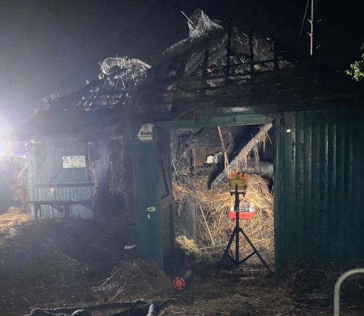
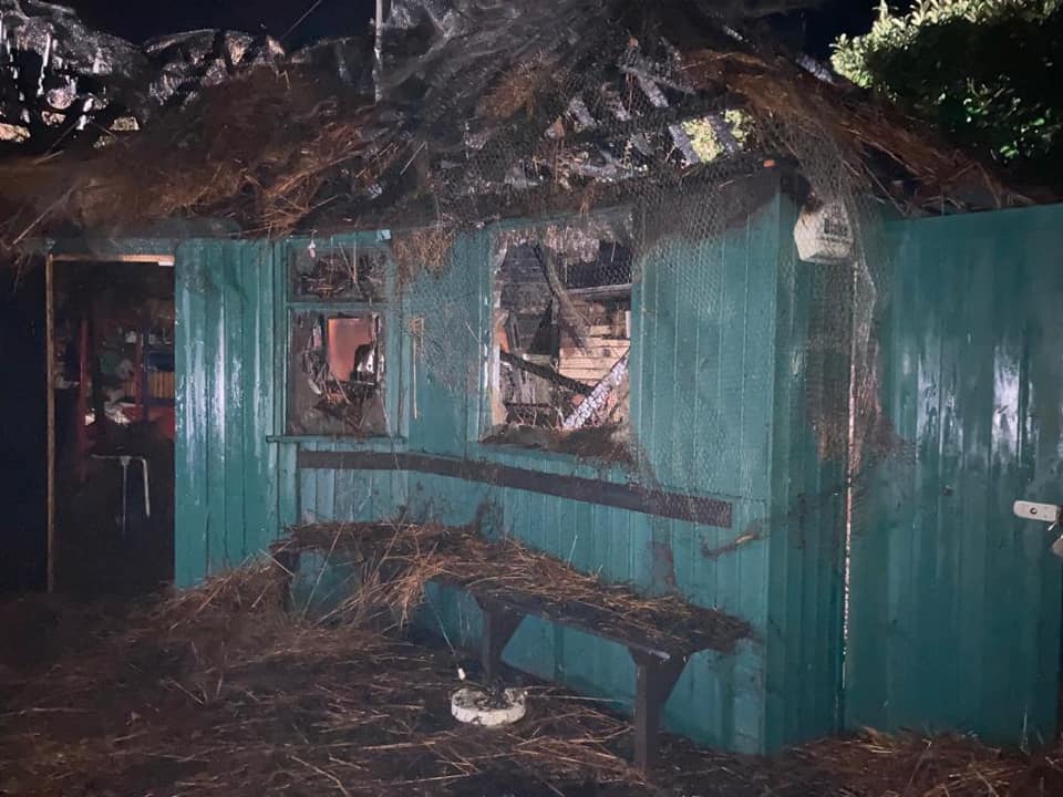
6 September 2020 (11:36) Old Brick Workshop in narrow escape during fire at Poole
The owner of an art gallery reckons her premises were minutes from being destroyed in a massive fire. Alison Cosserat is now in a race against time to open for a major exhibition of artists' work this month. She is hoping the Old Brick Workshop, on Poole Trading Estate, will welcome visitors for the first time since lockdown during Somerset Arts Weeks from September 19.
Two appliances from Wellington, one from Taunton and the aerial ladder platform from Taunton were sent to reports of a fire on the industrial estate. On arrival of the first crew, a request was made for further assistance from another 3 appliances, send from Taunton, Wiveliscombe and Cullompton. The incident command unit from Honiton, welfare unit from Ivybridge, incident support unit from Bovey Tracey, water carrier from Bridgwater and environmental protection unit from South Molton were also mobilised. Crews confirmed the fire involving an articulated trailer unit and adjacent commercial building fully alight. Crews got to work setting up monitor jets awaiting arrival of back up crews.
At 12:26, crews stated the fire involved articulated trailer units, containers with recycling and refrigerators and an adjacent building. Crews were using 5 main jets and the aerial appliance as a water tower. At 13:38, crews stated they were using 4 breathing apparatus sets and 1 fog spike on the containers. The fire was surrounded and crews were making good progress extinguishing the fire. At 15:46, crews scaled back firefighting to 2 main jets and the aerial ladder platform, being fed from a hydrant. At 22:15, relief crews in situ reported making good progress with one ground monitor and one monitor from the aerial ladder.
Miss Cosserat watched helplessly during Sunday's blaze as scores of batteries exploded and shot 50 metres across the site "like fireworks". The fire started in containers full of old electronic equipment outside neighbouring business South West Computer Recycling. She said: "There was a massive mushroom cloud over the building and flames between the end of the building and the railway. There were batteries flying through the air like fireworks. It was lucky the firefighters arrived when they did. It they'd been five minutes later it would probably have been a very different story. The gable end of our building was on fire and all the windows have cracked, while a lot of water from the hoses has come through into our gallery, soaking the floor and walls. The pipework has melted and there are holes where the flames came through." Miss Cosserat added: "We're going to do everything we can to get it going for Somerset Arts Weeks. We've got 12 different artists bringing work to display and it's our first opportunity to open since March I can't hang anything until the place has dried out, but hopefully we can do so on Monday.
The fire raged for nearly 18 hours with relief crews rotating through the night making steady progress extinguishing the fire. The fire was declared to be extinguished at 5am and crews left the scene, to revisit later in the day. The cause of the fire was accidental ignition and destroyed two trailers and a commercial outhouse.
Steve Kingdon, of South West Computer Recycling, faces a £15,000 bill after his trailers containing old phones, laptops and tablets went up in flames. He said: "I feel terrible for interrupting Alison's business. I am sorry for what's happened. We might not be the most liked neighbours at the moment, but I've offered to do everything we can to help. I'm grateful to Devon and Somerset Fire and Rescue Service for working at the weekend to make sure it didn't spread throughout the building." A similar fire almost exactly a year ago to the day saw Mr Kingdon's previous premises burnt to the ground. He said: "We handle 200 tonnes of this stuff a month. That's a lot of batteries, which do explode - they're an absolute nightmare, but we try to handle everything as safely as we can."
The Old Brick Workshop was once part of the historic, Poole Brickworks of William Thomas & Co, an enormous 19th-century brick manufacturer. It is on a rural industrial estate on the edge of Wellington, Somerset. This particular building was built in 1938.
News Source: Somerset County Gazette

The fire in Wellington destroyed two trailers and a commerical building (Image: Ilminster Fire Station)

Alison Cosserat in front of the remains of the scrapyard buildings
|
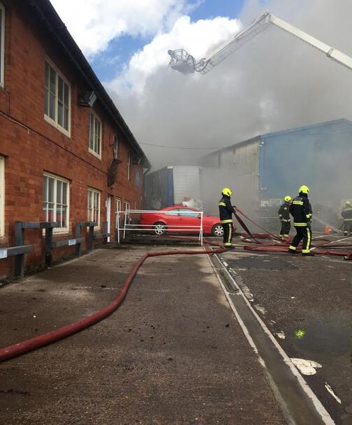
Firefighters battle the blaze
|
Near Miss
4 September 2020 (19:51) - Fire breaks out in Whitstable town centre near Gladstone Road
4 September 2020 (19:51) - Fire breaks out in Whitstable town centre near Gladstone Road
An investigation is under way into a major blaze in Whitstable town centre on Friday night. Fire crews attended the scene at just after 7.50pm after reports of a blaze in a derelict property behind Gladstone Road - just off the town's main high street. At its peak, four fire engines, police and paramedics were on the scene with surrounding roads closed. Flames and smoke could be seen around the town. The fire was in a derelict building close to Whitstable and Seasalter Endowed C of E Primary School.
A spokesman for Kent Fire and Rescue Service said: "Initial reports of a person inside the property were thankfully proved inaccurate and there are no reports of any injuries. The cause of the fire has not been determined." One person said: "I believe it as an old derelict bungalow situated next to the endowed school, behind Howard's kitchen in Gladstone Road."
The building involved in the fire lies close to a row of Locally Listed buildings along the High Street. They all lie within the Whitstable Town Conservation Area.
News Source: Kent Online

The fire service, police and paramedics are at the scene
|
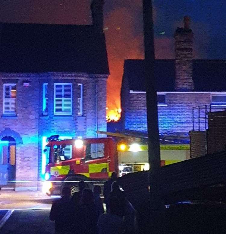
|
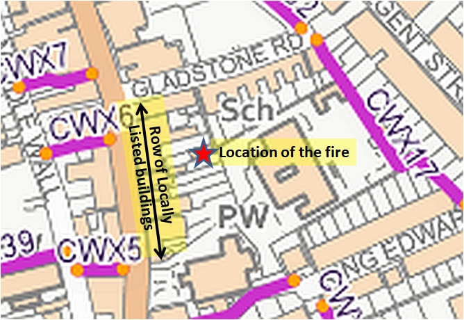
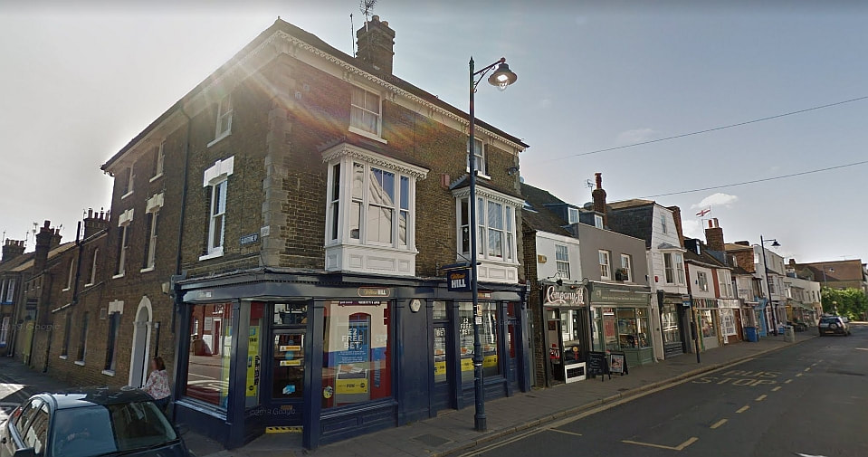
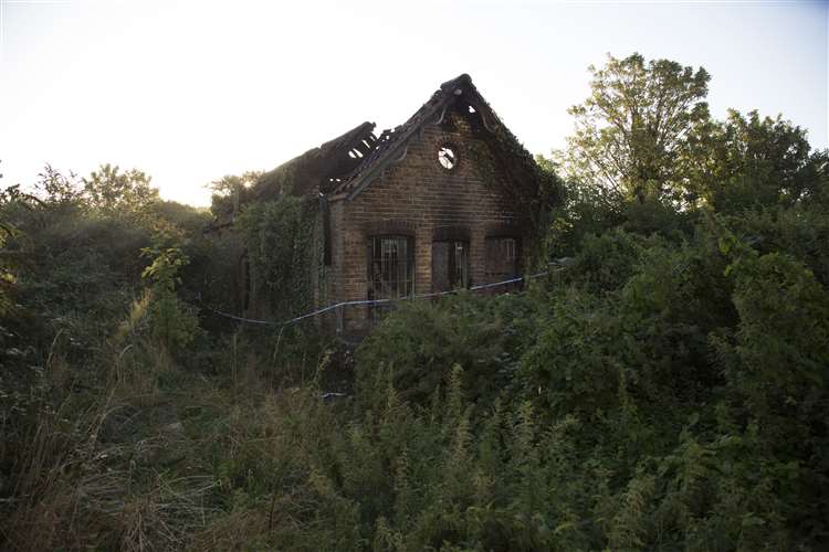
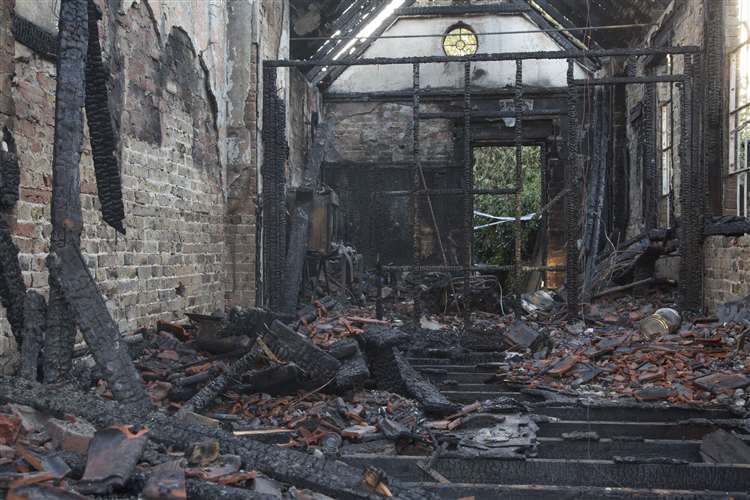
2 September 2020 (04:50) - Basingstoke crew called to fire at derelict Odiham building
Fire crews Odiham attended an overnight fire at a derelict building on Odiham High Street, where two floors were alight. Hampshire Fire and Rescue Service received the report at 4:50am on Wednesday, September 2. The crews worked through the early hours of the morning to extinguish the fire, which had impacted both the ground and first floors. In a tweet, Hartley Wintney fire station said the building was currently “under construction”, with a picture showing the firefighters, who used four breathing apparatus, three jets and tactical ventilation.
The fire service statement said: "Crews from Basingstoke, Hartley Wintney and Odiham were mobilised at 4.50am this morning to a derelict building on the high street in Odiham. The fire involved the ground and first floor and was extinguished using four breathing apparatus, three jets and tactical ventilation.The scene was left with the homeowner and the stop message came in at 6.41am. SGN [gas company] were also in attendance to isolate the building."
The 18th century building is Grade II listed and lies within the Odiham Conservation Area. It was most recently home to Barclays Bank. The town of Odiham in north Hampshire contains one of most outstanding collections of historic buildings in the county, with almost continuous listed buildings along both sides of High Street.
News Source: Basingstoke Gazette
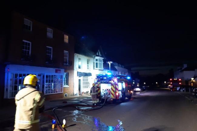
Firefighters at the scene in Odiham (Image: Hartley Wintney fire station)
Listing Details
|
Entry Name: Barclays Bank
Listing Date: 26 June 1987 Grade: II Source: Historic England Source ID: 1339907 English Heritage Legacy ID: 136999 Location: Odiham, Hart, Hampshire, RG29 County: Hampshire District: Hart Civil Parish: Odiham Built-Up Area: Odiham Traditional County: Hampshire Lieutenancy Area (Ceremonial County): Hampshire Church of England Parish: Odiham All Saints Church of England Diocese: Winchester |
Coordinates
Latitude: 51.2542 / 51°15'15"N Longitude: -0.9395 / 0°56'22"W OS Eastings: 474105 OS Northings: 151095 OS Grid: SU741510 Mapcode National: GBR C86.99D Mapcode Global: VHDXS.NQPW Plus Code: 9C3X7336+M6 |
2 September 2020 (01:58) - Blaze tears through derelict Derbyshire pub
Pictures have been released showing efforts to tackle a "serious" blaze which has severely damaged a former pub. Firefighters from Shirebrook Fire Station were called out to the incident in Wood Lane, Church Warsop, in the early hours of Wednesday, September 2. In total, four fire engines were scrambled to the scene as well as an aerial ladder platform from Nottinghamshire. The striking images show the extent of the blaze as it ripped through the building, causing severe damage to the site. A tweet from Shirebrook Fire Station reads: "We were first in attendance at a derelict building. This was a well developed that required a further four fire engines and the aerial Ladder platform from Nottinghamshire Fire and Rescue Service. #OneTeam."
A spokesperson said: "We attended at 1.58am. A lot of crews attended from various different stations including Shirebrook, Warsop, Edwinstowe and Mansfield, as well as the aerial ladder platform from Mansfield. It was a derelict public house and was fully evolved in the roof. The messages don't say what caused the fire. It was a very serious incident. The building consisted of two floors. It was severely damaged by the fire. Four main jets, one hose reel jet and one aerial ladder platform were in use."
The building involved in the incident was the former Church Warsop Sports & Social Club, originally known as the Miners’ Welfare. The building of the village of Church Warsop began in 1926 by the Staveley Coal and Iron Company to house colliery workers and their families working at the Warsop Main Colliery located in nearby Warsop Vale. The Miners’ Welfare was built about 1928, but has been extensively altered over the decades, and therefore not considered a heritage asset by the council. However the building has been at the hub of the village's social life right from the start.
News Source: Derby Telegraph / Derbyshire Live
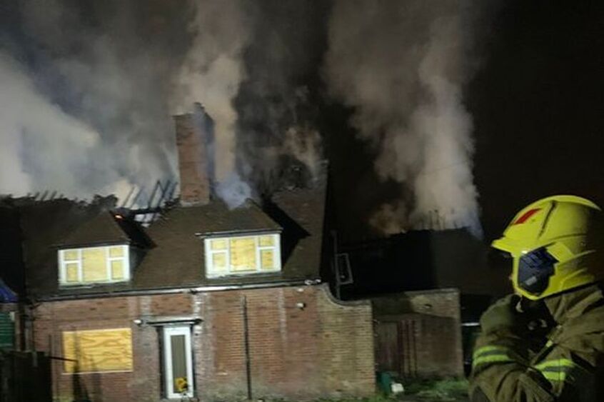
The blaze has severely damaged a former pub.
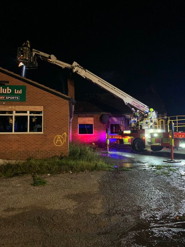
|
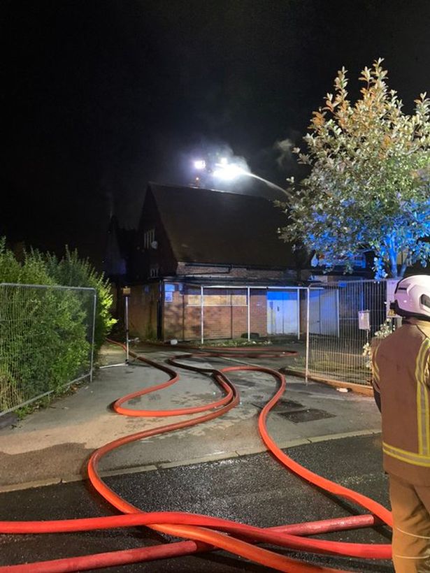
|
1 September 2020 (17:30) - Ilminster fire: Firefighters from across Somerset battling blaze at Rose Mill
At least ten fire crews battled a fire that broke out on an Ilminster industrial estate. The blaze started on the Rose Mill estate off Station Road, Ilminster, at around 5.30pm yesterday (September 1). The fire was described at the time of the call as a "large incident" by fire services and it went on to burn for at least six hours. There were 10 fire engines at the scene at the height of the fire, as well as two aerial ladder platforms and two water bowsers. The fire service said the blaze was at "an industrial building used for engineering." Firefighters managed to get the flames under control and, by 11pm, the crews on scene had reduced to three fire engines and one aerial platform ladder. Fire engines from Taunton, Chard, Ilminster, Martock, Crewkerne, Yeovil, Axminster all attended. An extra crew attended from Ottery St Mary in Devon later in the night.
Fire crews are expected to remain on scene this morning with the police for investigation work, according to Devon and Somerset Fire and Rescue. It is understood that the fire was at one of the Rose Mills Makers businesses at the Rose Mills Industrial Estate. In a Facebook post shared last night, the traders described it as a "terrifying afternoon" and said it is not yet clear how much damage has been done. Rose Mills Makers is a trio of creative businesses - one for glass splash backs, another for hand-crafted accessories, and another for beauty and holistic therapies.
The final update supplied by fire services, which came at 6.45am this morning (September 2) indicated that while the fire had been extinguished, the roof of the property has been 100 per cent damaged by fire, and there was 60 per cent smoke and water damage to the interior of the building. Crews remain on scene dealing with hotspots and the cause of the fire is currently under investigation.
The owners of a business heavily affected by the fire say the damage done has been "devastating". Glow, a beauty salon based on the Rose Mills estate off Station Road, Ilminster, is owned by Sam Cobb and her business partner Safina Webster. Sam and Safina said a full refurbishment of their salon would be required after sustaining heavy smoke and water damage throughout, although the building itself remained intact. However, neighbouring buildings were completely destroyed and they said the impact of the fire on the estate had been "devastating". They told Somerset Live: "We've been very lucky to only suffer with smoke and water damage. The fire was contained very well in the valley of the roof. But a full refurb will be required.
An update was also issued on Glow's Facebook page earlier today, indicating it will be "a while" before the business is able to re-open again following the damage. The post said: "It's been an emotional 24 hours here on the Rose Mills Estate. There's a fair bit of water and smoke damage, it will be a while before we can open the doors again, but we're sorting our kit out to be able to offer mobile appointments while we 'rebuild'. Thank you so much to our clients, family and friends for your support, we're so unbelievably grateful."
The main building at Rose Mill was built in the early 19th century and was occupied by the Chard Lace Company. The building is now Grade II listed and is occupied by several craft and artisan companies.
News Source: Somerset Live
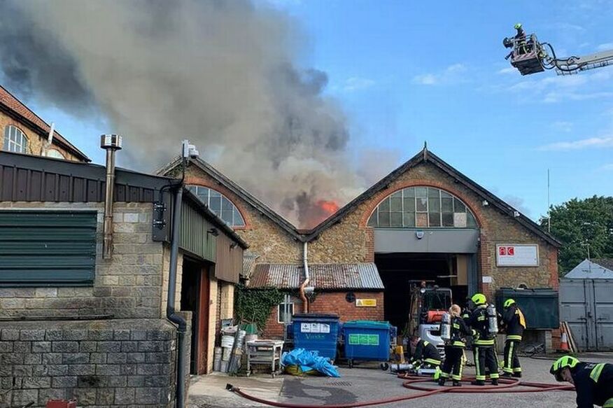
The blaze started on the Rose Mill estate off Station Road, Ilminster, at around 5.30pm yesterday (September 1).
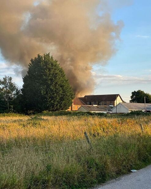
|
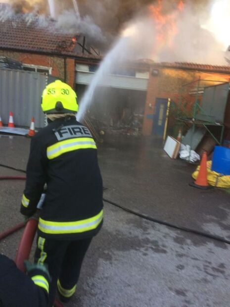
|
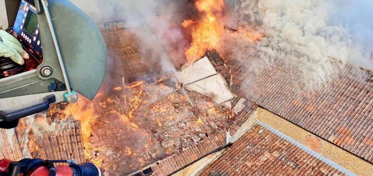
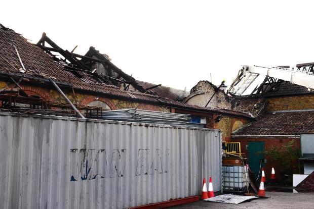
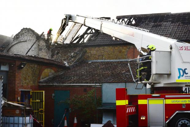
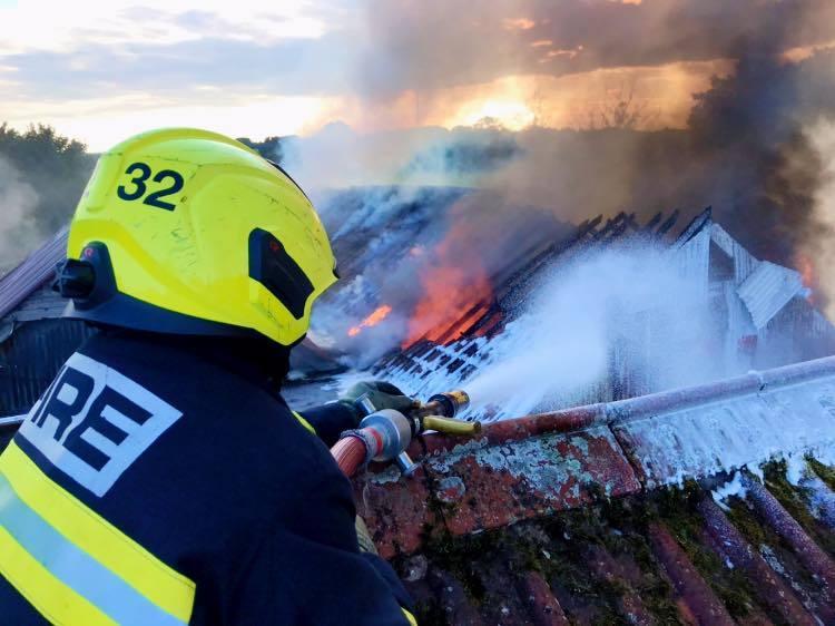
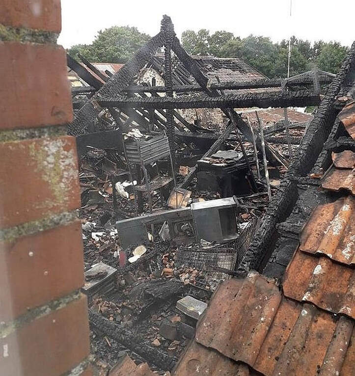
Listing Details
|
Entry Name: Rose Mills (Original Building Only)
Listing Date: 29 October 1987 Grade: II Source: Historic England Source ID: 1057085 English Heritage Legacy ID: 263959 Location: Ilminster, South Somerset, Somerset, TA19 County: Somerset District: South Somerset Civil Parish: Ilminster Traditional County: Somerset Lieutenancy Area (Ceremonial County): Somerset Church of England Parish: Ilminster |
Coordinates
Latitude: 50.9309 / 50°55'51"N Longitude: -2.9345 / 2°56'4"W OS Eastings: 334422 OS Northings: 115024 OS Grid: ST344150 Mapcode National: GBR M8.PNCD Mapcode Global: FRA 46RN.0L8 Plus Code: 9C2VW3J8+95 |
1 September 2020 (07:00*) - Historic Walsall church damaged after thief 'uses blowtorch' in break-in attempt
An historic Black Country church suffered thousands of pounds of damage after a would-be burglar tried to "use a blowtorch" to break through the thick wooden doors. Wardens from St Matthew’s Church in Walsall are appealing for witnesses to the incident after warden John Edlin arrived at the 13th century building yesterday morning to find the doors smouldering.
He said he unlocked them and went inside to find the church “filled with smoke”. Mr Edlin said: “I went in early, about 8am, to meet some roofers who were going to start some work and when I unlocked the door I found the place filled with smoke. So I shut them again and went to find where the fire was coming from. The damage was obviously mainly on the church doors. Luckily I was able to put out the small flames with some water but had it been 15 minutes longer I reckon there could have been some serious damage. We’re absolutely certain the thief tried to use a blowtorch on the door – you can’t just use a match to set fire to thick oak doors, and there was no petrol smell.” West Midlands Police are now investigating the break-in attempt.
Patti Lane, another warden said she was “disappointed” someone could do this to a place of worship. She said: “I’m just very sad about this and disappointed that someone could do this to a place of faith and worship. It’s a very historic, Grade II* listed building and the doors have been in place since 1959 when they were dedicated to a former Mayor of Walsall, Frank Harrison. People always come and tell me that they’ve lived in this town all their lives and still find amazement in the church, so it’s all very disappointing to see this happen.” The earliest surviving reference to the church dates from around 1220.
Mrs Lane said the church had also been full of smoke when the fire was put out and was still circling around the building during the day. She also said there was no clear indication of how much it would cost to replace the doors – but Mr Edlin said it could be in the thousands. Mrs Lane added: “With the pandemic and everything else, there hasn’t been as much money coming into the church as before, so this sort of thing will be a big drain on our limited resources. We would just like to know why and who did this, so we have spoken to the police and given them as much information as we can concerning this.”
A spokesman for West Midlands Police said: "We were called to reports of a wooden door being set alight at St Matthews Church, St Matthews Close, Walsall at about 8.40am on Tuesday, September 1. The fire had been extinguished by a staff member. The door was damaged but no one had got inside the church. Our forensics officers have examined the scene and we are appealing for anyone with information about the incident to get in touch."
News Source: Express and Star
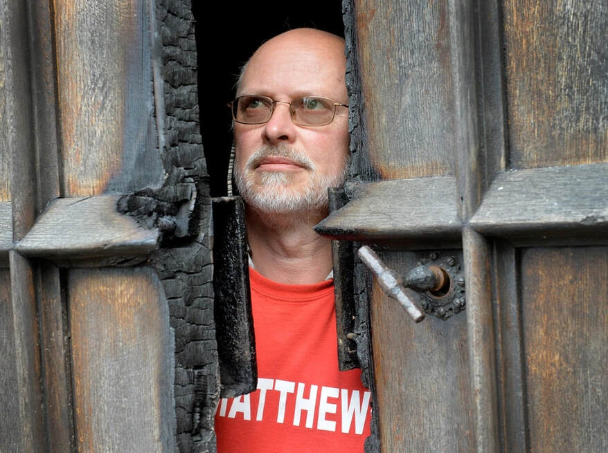
The doors have been part of the church since 1959
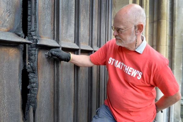
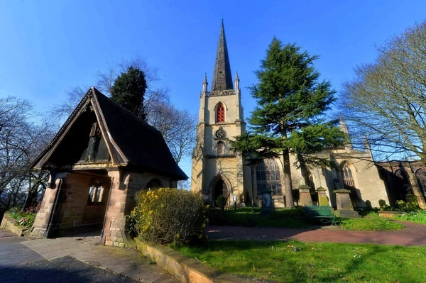
Listing Details
|
Entry Name: Church of St Matthew
Listing Date: 19 November 1951 Grade: II* Source: Historic England Source ID: 1116151 English Heritage Legacy ID: 219061 Location: Walsall, WS1 County: Walsall Electoral Ward/Division: St Matthew's Built-Up Area: Walsall Traditional County: Staffordshire Lieutenancy Area (Ceremonial County): West Midlands Church of England Parish: Walsall St Matthew Church of England Diocese: Lichfield |
Coordinates
Latitude: 52.5825 / 52°34'56"N Longitude: -1.9772 / 1°58'38"W OS Eastings: 401639 OS Northings: 298293 OS Grid: SP016982 Mapcode National: GBR 2G3.94 Mapcode Global: WHBG1.LCN2 Plus Code: 9C4WH2JF+X4 |
Building History
(Researched by Heritage & Ecclesiastical Fire Protection)
Standing at nearly 500 feet above sea level, St Matthew’s Church in Walsall, with its 170-foot towering spire, has been a landmark of the town’s skyline since ancient times. And it’s inside this Grade II* Listed church, at the top of the curving High Street, that you will find the oldest man-made structure in the town of Walsall, as well as other hidden gems. For its inner crypt, with its beautiful ribbed, sandstone, vaulted ceiling, dates back to the 13th century – it has even been suggested that its Norman doorway could date from the previous century.
Originally dedicated to All Saints, it was in the 18th century that it was rededicated to St Matthew. The earliest surviving reference to the church dates from around 1220, when a grant was given by William Ruffus to the Abbey of St Mary in Halesowen, for the patronage of the church. This grant was also confirmed by Henry III in 1258. There are also further links to Halesowen Abbey for the remarkable misericords that are a feature of the choir house are believed to have been rescued from the abbey, whose abbot was the patron of Walsall church, at the time of the Dissolution. And for several hundred years, the vicars at the church were appointed from the priests at the abbey.
The misericords – sometimes named mercy seats – are the small wooden shelves found on the underside of a folding seat in a church. The ones here are regarded as the “finest set of medieval misericords to be found in Staffordshire” and one of the “great treasures” of the church. Other impressive historical features of St Matthew’s are the “well preserved” 15th century carvings in the chancel said to “represent medieval wood carving at its best”, and it’s 15th century octagonal font, with an 18th century alabaster rim and lead lining. But the church’s oldest effigy dates back to 1399 and is of Sir Roger Hillary of Bescot, who was a 14th century knight, and its peal of 12 bells, includes four which date back to 1553. The church has been altered, rebuilt, redecorated and extended several times over the years, and in 1945 the patronage was transferred to the Bishop of Lichfield. The graveyard is known to contain the names of many well-known Walsall families.
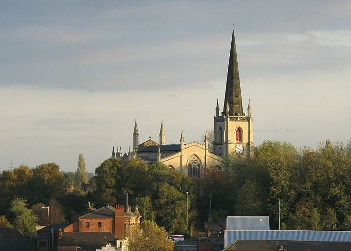
Heritage & Ecclesiastical Fire Protection
Preventing Fire, Protecting Life, Preserving Heritage
Click HERE for Expert Specialist Fire Safety Risk Assessments for Historic and Listed Buildings
Preventing Fire, Protecting Life, Preserving Heritage
Click HERE for Expert Specialist Fire Safety Risk Assessments for Historic and Listed Buildings
Phone: 07840 351458 Email: [email protected]
August - 33 Fires & 8 Near Misses
Heritage & Ecclesiastical Fire Protection
Preventing Fire, Protecting Life, Preserving Heritage
Click HERE for Expert Specialist Fire Safety Risk Assessments for Historic and Listed Buildings
Preventing Fire, Protecting Life, Preserving Heritage
Click HERE for Expert Specialist Fire Safety Risk Assessments for Historic and Listed Buildings
Phone: 07840 351458 Email: [email protected]
July - 38 Fires & 9 Near Misses
Heritage & Ecclesiastical Fire Protection
Preventing Fire, Protecting Life, Preserving Heritage
Click HERE for Expert Specialist Fire Safety Risk Assessments for Historic and Listed Buildings
Preventing Fire, Protecting Life, Preserving Heritage
Click HERE for Expert Specialist Fire Safety Risk Assessments for Historic and Listed Buildings
Phone: 07840 351458 Email: [email protected]
June - 44 Fires & 11 Near Misses
Heritage & Ecclesiastical Fire Protection
Preventing Fire, Protecting Life, Preserving Heritage
Click HERE for Expert Specialist Fire Safety Risk Assessments for Historic and Listed Buildings
Preventing Fire, Protecting Life, Preserving Heritage
Click HERE for Expert Specialist Fire Safety Risk Assessments for Historic and Listed Buildings
Phone: 07840 351458 Email: [email protected]
May - 31 Fires & 9 Near Misses
Heritage & Ecclesiastical Fire Protection
Preventing Fire, Protecting Life, Preserving Heritage
Click HERE for Expert Specialist Fire Safety Risk Assessments for Historic and Listed Buildings
Preventing Fire, Protecting Life, Preserving Heritage
Click HERE for Expert Specialist Fire Safety Risk Assessments for Historic and Listed Buildings
Phone: 07840 351458 Email: [email protected]
April - 50 Fires & 8 Near Misses
Heritage & Ecclesiastical Fire Protection
Preventing Fire, Protecting Life, Preserving Heritage
Click HERE for Expert Specialist Fire Safety Risk Assessments for Historic and Listed Buildings
Preventing Fire, Protecting Life, Preserving Heritage
Click HERE for Expert Specialist Fire Safety Risk Assessments for Historic and Listed Buildings
Phone: 07840 351458 Email: [email protected]
March - 36 Fires & 6 Near Misses
Heritage & Ecclesiastical Fire Protection
Preventing Fire, Protecting Life, Preserving Heritage
Click HERE for Expert Specialist Fire Safety Risk Assessments for Historic and Listed Buildings
Preventing Fire, Protecting Life, Preserving Heritage
Click HERE for Expert Specialist Fire Safety Risk Assessments for Historic and Listed Buildings
Phone: 07840 351458 Email: [email protected]
February - 34 Fires & 6 Near Misses
Heritage & Ecclesiastical Fire Protection
Preventing Fire, Protecting Life, Preserving Heritage
Click HERE for Expert Specialist Fire Safety Risk Assessments for Historic and Listed Buildings
Preventing Fire, Protecting Life, Preserving Heritage
Click HERE for Expert Specialist Fire Safety Risk Assessments for Historic and Listed Buildings
Phone: 07840 351458 Email: [email protected]
January - 31 Fires & 13 Near Misses
Phone: 07840 351458 Email: [email protected]
Deeside, Flintshire, North Wales, CH5 1PE
Heritage & Ecclesiastical Fire Protection is a trading style of Dragon Fire Safety
Heritage & Ecclesiastical Fire Protection is a trading style of Dragon Fire Safety
