88 Fires & 22 Near Misses in Heritage Buildings Recorded
on the 2019 Database in March & April.
(A Fire is defined as an uncontrolled and unwanted burning event (including explosion) causing damage to a heritage building and/or contents by at least one of the following: flame, heat, smoke or blast)
(A Near Miss is defined as an event in a heritage building that had the potential to start a fire, or a fire adjacent to a heritage building that, without intervention, could have spread to that building)
Fires Index < Click here
hOME / About / Places of Worship / Heritage Buildings / Domestic listed properties / Country estates / grant /CONTACT US / Fires
|
“It is impossible to find words in which to express our grief over the destruction by fire of the glorious Abbey Church of Selby in Yorkshire. Although the church should be restored, it will be a building without the charm of age and the historic evidences of its structural growth through eight centuries which lent it interest and made it venerable.”
Church Times, 26th October 1906 |
Subscribe to our newsletterOur Newsletter is out now with articles on all things related to fires, fire prevention, protection and restoration of heritage buildings - See this and our previous Newsletters HERE. "Our Heritage Under Fire" brings interesting, informative and enlightening news and comment for everyone who has an interest in the protection of the UKs built heritage.
Subscribe by clicking the button below to be added to our mailing list. Don't miss an issue. You are signing up only to receive our newsletter, we will not use your contact details, nor pass them on to third parties, for any other purpose. You may unsubscribe from the list at any time. |
Click on the HEADLINE to expand the article.
Heritage & Ecclesiastical Fire Protection
Preventing Fire, Protecting Life, Preserving Heritage
Click HERE for Expert Specialist Fire Safety Risk Assessments for Historic and Listed Buildings
Preventing Fire, Protecting Life, Preserving Heritage
Click HERE for Expert Specialist Fire Safety Risk Assessments for Historic and Listed Buildings
Phone: 07840 351458 Email: hello@fireprotect.me.uk
April - 50 Fires & 10 Near Misses
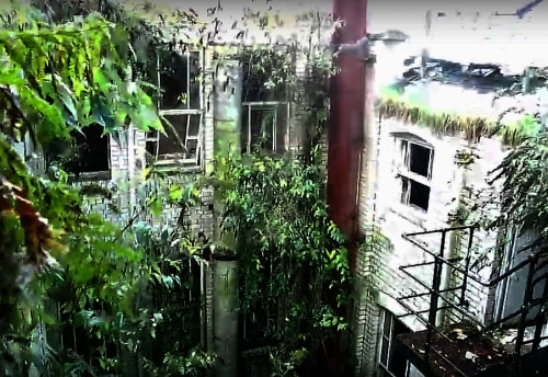
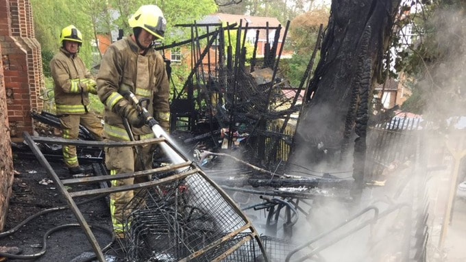
30 April 2019 (21:00) - Man suffers burns after being rescued from derelict building fire
A man suffered burns after he was rescued from the second floor of a large boarded up property building during a fire in Oldham town centre. Three fire engines rushed to the scene after the blaze broke out around 9pm on Union Street, near the tram stop. They spent one hour on the scene putting out the fire. A spokesman for Manchester Fire and Rescue Service said: "We were called at 9pm to reports of a fire involving a derelict building. We sent three fire engines. We rescued one casualty from the second floor of the building. He has been taken to hospital. We used two hose reels, fire breathing apparatus, dust masks and hand lamps." It was unclear whether the man had been sleeping in the building or was an intruder. A spokeswoman for North West Ambulance Service said: "We took one patient to hospital for burns." The spokeswoman said it was unclear how badly injured the man was.
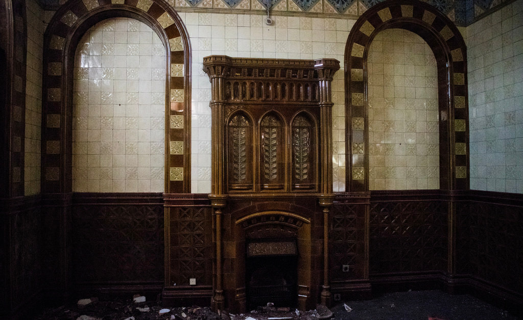
The fire was in the Grade II listed Prudential Assurance Buildings which have been empty since at least 2012.The building was designed by Albert Waterhouse and built in 1889. Prudential Assurance wanted a similar style to all their buildings so Waterhouse created a 'homely' styled structure that would feel welcoming to the public that would use their services. The interior of the main hall has ornate plaster panelled ceiling and tiled walls. The building was later used as a child care service run by the council, Oldham Play Care Association, and also, for a period of time, there was a nightclub in the basement called Holy City Zoo.
News Source: Manchester Evening News
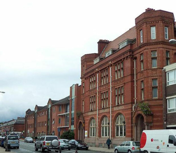
The former Prudential Assurance Buildings have been empty since at least 2012.
Listing Details
|
Entry Name: Prudential Assurance Buildings
Listing Date: 23 January 1973 Grade: II Source: Historic England Source ID: 1282574 English Heritage Legacy ID: 388950 Location: Oldham, OL1 County: Oldham Electoral Ward/Division: Coldhurst Built-Up Area: Oldham Traditional County: Lancashire Lieutenancy Area (Ceremonial County): Greater Manchester Church of England Parish: Oldham St Mary with St Peter Church of England Diocese: Manchester |
Coordinates
Latitude: 53.5405 / 53°32'25"N Longitude: -2.1123 / 2°6'44"W OS Eastings: 392657 OS Northings: 404877 OS Grid: SD926048 Mapcode National: GBR FWPH.HK Mapcode Global: WHB9B.J8CM |
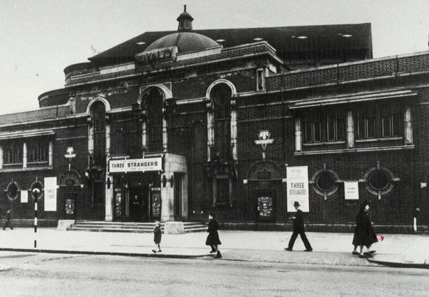
30 April 2019 (19:27) - Harborne Royalty Cinema hit by fire for second time in seven months
The Art Deco Harborne Royalty Cinema has been hit by fire yet again tonight - for the second time in seven months. It is now the third time since November 2017 that the future of the Grade II listed building has been ablaze. Four appliances have been attending tonight's first floor blaze. Reports locally suggested there were 'three seats of fire'. Although firefighters with breathing apparatus were called for, it's not thought that anybody was inside the building. A spokesman for West Midlands Fire Service said: "The alarm was raised at 7.27pm. We sent four appliances to the scene from Bournbrook, Woodgate Valley, Ladywood and Kings Norton. Hopefully it is not going to be as serious as last time."
The future of the site has been in abeyance for years while various interested parties have tried to come to a common agreement. It is more than 50 years since the building screened a movie, The authorities would not make it entirely entry proof as buildings were less valuable than life. But that policy appears to have led to the risk of fires breaking out which in turn puts firefighters at risk when they arrive at the scene.
The biggest fire was on September 19, 2018 which gutted much of the building. Around 50 firefighters spent all night tackling the inferno at the upper end of High Street, using hose reel jets and a hydraulic platform. Investigations were hampered by the high winds from Storm Ali. Ten months earlier, firefighters attended a fire at 7.30am on Wednesday, November 15, 2017, when they said they prevented a major fire from breaking out with just 15 minutes to spare. Firefighters said intruders had lit a fire inside ‘to keep warm’ and seemingly then tried to get it going by placing a door on top of it causing the hall to fill with smoke.
The building’s owner had plans to retain the frontage and to create luxury flats at the back but its planning application didn’t win favour with Birmingham City Council because of its listed status. In 2017 owner True Pearl Ltd's representative, Chris Pengilly, said he had been working with local societies and the council to make sure the site was redevelopment in a way that suited many people. Mr Pengilly said then it could cost £15 to £20 million to redevelop the whole site. “The building was listed in 2011 and True Pearl submitted a planning application 18 months ago for a development of more than 50 luxury apartments with some community use,” he said.
News Source: Birmingham Live
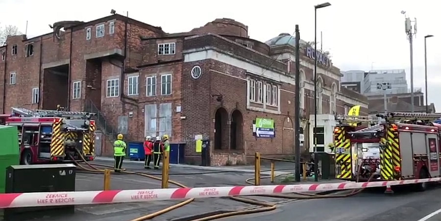
The Art Deco Grade II listed Harborne Royalty Cinema has been hit by another fire.
Listing Details
|
Entry Name: The Royalty (Gala Bingo)
Listing Date: 2 August 2011 Grade: II Source: Historic England Source ID: 1401284 Location: Birmingham, B17 County: Birmingham Electoral Ward/Division: Harborne Parish: Non Civil Parish Built-Up Area: Birmingham Traditional County: Staffordshire Lieutenancy Area (Ceremonial County): West Midlands Church of England Parish: Harborne St Peter Church of England Diocese: Birmingham |
Coordinates
Latitude: 52.4577 / 52°27'27"N Longitude: -1.9544 / 1°57'15"W OS Eastings: 403195 OS Northings: 284418 OS Grid: SP031844 Mapcode National: GBR 5MJ.BV Mapcode Global: VH9Z2.2HN8 |
Building History
(Researched by Heritage & Ecclesiastical Fire Protection)
The site where the cinema would be built had been the location of a terraced row of dwellings from at least 1890, as shown on the First Edition Ordnance Survey Map of that year. The row was demolished to make way for the cinema by 1930, and the new building, set back from the road edge, is shown on the Fourth Edition Ordnance Survey Map of 1938.
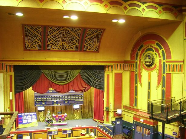
The Royalty Cinema was designed by celebrated picture house architect Horace G Bradley and opened on 20th October, 1930 with Maurice Chevalier starring in ‘The Love Parade’ in the early years of cinema exhibition with sound. Musicals and epics became increasingly popular in the 1920s, and evermore opulent and grand theatres were constructed for their exhibition. The cinema was originally operated by a local independent company named Selly Oak Pictures Ltd. However, it was taken over by Associated British Cinemas (ABC) in March 1935. Sadly, ABC closed the cinema on the 2nd of November, 1963. It was then converted into a Bingo Club. The building was Grade II listed on August 2, 2011 and it closed as a bingo hall in 2012.
The building has been abandoned ever since. In 2012 a cannabis farm was found in the attic of the now abandoned cinema after police noticed a suspicious smell and spotted unusual behaviour at the building. In March, 2017, an 11-minute video was posted on YouTube showing youths inside the building. Scenes included one running across the balcony seats in the video which was called Exploring the Royalty Cinema (Abandoned). Six years later it was being destroyed by fire on September 19, 2018.
Architectural: the Royalty is an assured and well-realised design with quality features including some Art Deco detailing, by a cinema architect of note; Interiors: the Art Deco fittings are of a high quality, representative of an era of resplendent cinema design, the detailing is of special note; Intactness: the building is well-preserved, especially considering its long use as a bingo hall; Rarity: relatively few cinemas of this period survive in such a complete form.
(Researched by Heritage & Ecclesiastical Fire Protection)
The site where the cinema would be built had been the location of a terraced row of dwellings from at least 1890, as shown on the First Edition Ordnance Survey Map of that year. The row was demolished to make way for the cinema by 1930, and the new building, set back from the road edge, is shown on the Fourth Edition Ordnance Survey Map of 1938.
The Royalty Cinema was designed by celebrated picture house architect Horace G Bradley and opened on 20th October, 1930 with Maurice Chevalier starring in ‘The Love Parade’ in the early years of cinema exhibition with sound. Musicals and epics became increasingly popular in the 1920s, and evermore opulent and grand theatres were constructed for their exhibition. The cinema was originally operated by a local independent company named Selly Oak Pictures Ltd. However, it was taken over by Associated British Cinemas (ABC) in March 1935. Sadly, ABC closed the cinema on the 2nd of November, 1963. It was then converted into a Bingo Club. The building was Grade II listed on August 2, 2011 and it closed as a bingo hall in 2012.
The building has been abandoned ever since. In 2012 a cannabis farm was found in the attic of the now abandoned cinema after police noticed a suspicious smell and spotted unusual behaviour at the building. In March, 2017, an 11-minute video was posted on YouTube showing youths inside the building. Scenes included one running across the balcony seats in the video which was called Exploring the Royalty Cinema (Abandoned). Six years later it was being destroyed by fire on September 19, 2018.
Architectural: the Royalty is an assured and well-realised design with quality features including some Art Deco detailing, by a cinema architect of note; Interiors: the Art Deco fittings are of a high quality, representative of an era of resplendent cinema design, the detailing is of special note; Intactness: the building is well-preserved, especially considering its long use as a bingo hall; Rarity: relatively few cinemas of this period survive in such a complete form.
30 April 2019 (18:24) - Richmond fire: 100 firefighters battle blaze at hotel and spa in south-west London
A large fire has broken out at a spa and hotel in south-west London. About 100 firefighters and 15 engines were at the scene battling the blaze in Richmond on Tuesday evening. Dramatic footage showed smoke billowing into the sky as flames tore through the building in Richmond Hill.The whole of the roof of the spa building is alight and part of the third floor of the adjoining Grade II listed hotel is also on fire, London Fire Brigade confirmed.
Crews were scrambled to the hotel just before 6.30pm and remained there into the night. Staff from Richmond, Twickenham, Kingston and other surrounding fire stations were at the scene. Station Manager Mike Cotton said: "Crews are working hard in challenging conditions to bring the fire under control. The fire is in an annexe building and has been producing a lot of smoke. We would urge residents and businesses in the immediate area to keep windows and doors closed while we continue to tackle the fire." The cause of the blaze was not immediately clear.
The fire could be seen for miles around, with one posting online that he could see ‘smoke blowing across the Thames and into East Twickenham’.
The building comprises the following 3 properties, once separate buildings now amalgamated to form the hotel: No 146 - Late 18th century house; No 148 - Late 18th century house; No 150 - Early 18th century house;
News Source: Evening Standard
Around 100 firefighters are tackling a large blaze at a spa joined to a hotel in west London.
Listing Details
|
Entry Name: Richmond Hill Hotel Mansfield Place
Listing Date: 10 January 1950 Grade: II Source: Historic England Source ID: 1249957 English Heritage Legacy ID: 432173 Location: Richmond upon Thames, Greater London Authority, TW10 County: London District: Richmond upon Thames Electoral Ward/Division: Ham, Petersham and Richmond Riverside Built-Up Area: Richmond upon Thames Traditional County: Surrey Lieutenancy Area (Ceremonial County): Greater London Church of England Parish: Richmond Church of England Diocese: Southwark |
Coordinates
Latitude: 51.4518 / 51°27'6"N Longitude: -0.2972 / 0°17'49"W OS Eastings: 518416 OS Northings: 173911 OS Grid: TQ184739 Mapcode National: GBR 81.7RG Mapcode Global: VHGR2.SRRX |
Near Miss
30 April 2019 (07:42) - Lorry fire in town centre closes major route
30 April 2019 (07:42) - Lorry fire in town centre closes major route
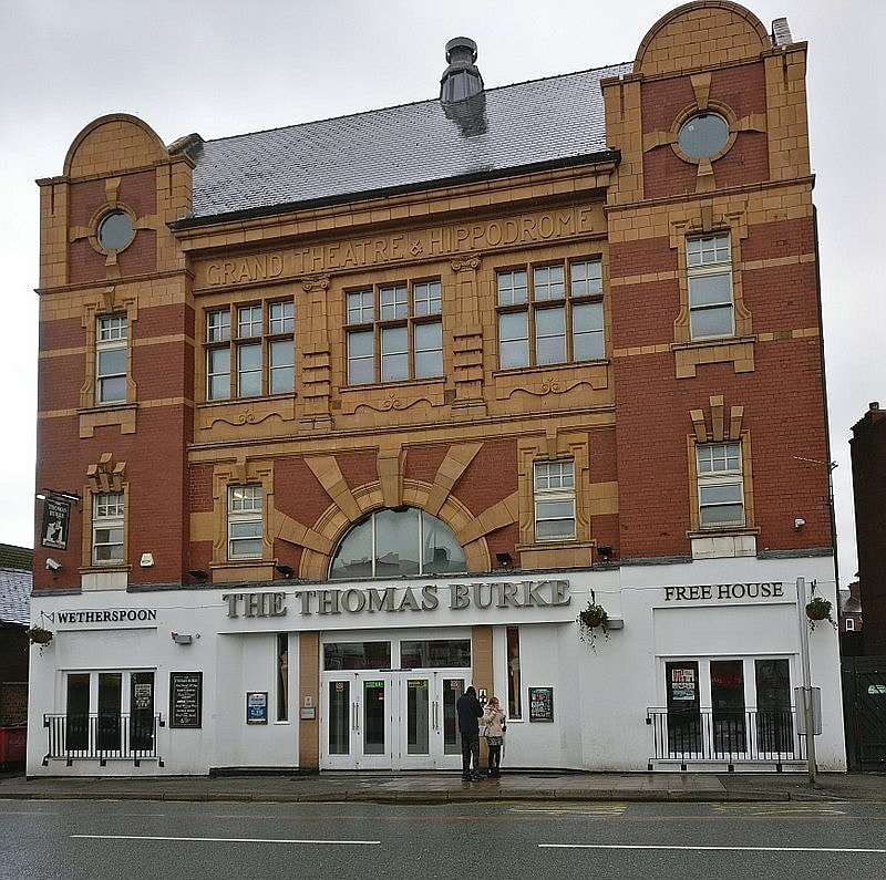
A town centre road was shut during the morning rush hour due to a lorry being on fire. Leigh Road was closed in both directions in the middle of Leigh between Prescott Street and the Thomas Burke pub. However, the route re-opened to traffic shortly after 9am.
Firefighters were called to the large vehicle which was ablaze on Leigh Road at around 7.42am on Tuesday. A spokesman for Greater Manchester Fire and Rescue Service said fire pumps using two hose reels were used to deal with the fire. Firefighters remain at the scene. Police have also been in attendance
The lorry fire was outside The Thomas Burke, a JD Wetherspoon pub. The pub occupies the building that was once The Grand Theatre and Hippodrome cinema that opened in 1908, and remains a major landmark in Leigh. The building lies within the Leigh Town Centre Conservation Area.
News Source: Leigh Journal

Police and fire at the scene of the incident
Building History
(Researched by Heritage & Ecclesiastical Fire Protection)
The Grand Theatre and Hippodrome was built in 1908 on the site of the old Avenue Mill of 1827, also known as Walker's Silk Mill, which had been demolished in 1906. Externally little altered except at ground floor level since opening, the Hippodrome has a well preserved four storey façade making a bold statement on a prominent y-junction site; Edwardian baroque in red brick and buff terracotta. Symmetrical, in five bays, the outer two slightly advanced as short towers with segmental gabled tops. The altered central entrance has a broad semi-circular arch with exaggerated voussoirs forming a sunburst effect. This contained a charming stained glass window, now plain glass. Three mullioned windows above divided by rustic-banded pilasters. Slated roof with a little cowled feature on the ridge. Low fly tower.
In 1939 the theatre closed for radical modernisation which had little effect on the external appearance. The auditorium was remodelled in Art Deco style. In early 1955, after thirty-three years as a cinema, the Hippodrome returned to live entertainment as a variety theatre but was sold in 1956 to the Rank Organisation, who redecorated the interior and reopened it as an Odeon cinema. It was twinned by Classic in 1969 and closed as Laserquest in 1989. In 1996 there was a proposal to reopen as a cinema but the building was again sold in 1998. The ground floor was converted to a club and bar with strident painted decorations and a lumpy cladding to the entrance canopy. In 2007 permission was granted for conversion to a pub, a use in which it still survives.
Near Miss
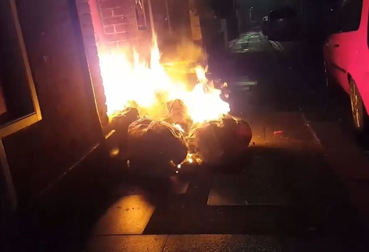
29 April 2019 (23:58) - Police investigate spate of bin fires in Swaffham
29 April 2019 (23:58) - Police investigate spate of bin fires in Swaffham
A string of arson attacks which took place over an hour and a half in Swaffham have prompted a police investigation. Five different incidents of bins deliberately being set on fire in Market Place were recorded overnight on Monday April 29 and Tuesday April 30. One crew from Swaffham was called out to the fires, with the first one taking place at 11.58pm and the last at 1.41am. Police were also called out to assist the fire service.
Following CCTV inquiries, one male was arrested but was later released without charge. The incidents are being treated as linked and police are continuing to investigate. Breckland engagement officer PC Paula Gilluley said: “Our local Safer Neighbourhood Teams and our new Breckland Neighbourhood Policing Team take incidents such as this very seriously. We continue to work in partnership with the town council and our partner agencies to bring a multi-faceted approach to tackling and not tolerating anti-social behaviour in the area.”
Speaking about incidents of anti-social behavior in the town, mayor of Swaffham Colin Houghton said: “It has got slightly worse. We have had these little incidents from time to time but not a lot compared to some other market towns. There have been little incidents at the recreation ground. It's nothing like a crime wave but there have been these regrettable incidents. The town council has a good relationship with the local police with our SNAP meetings. We work together closely.”
Residents reported seeing mess left behind by the fires in Market Place. However, Mr Houghton said that the town would be cleaned up following the incidents.
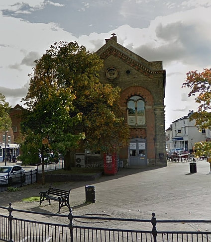
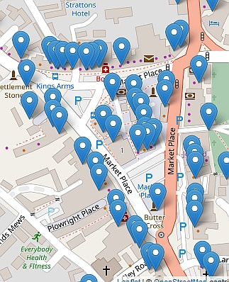
The triangle of roads that make up Swaffham’s Historic Market Place is awash with listed buildings (see map). These bin fires can so easily spread to any one of them and therefore this has been classed as a near miss incident. The Market Place lies within the Swaffham Conservation Area.
News Source: EDP24
Following CCTV inquiries, one male was arrested but was later released without charge. The incidents are being treated as linked and police are continuing to investigate. Breckland engagement officer PC Paula Gilluley said: “Our local Safer Neighbourhood Teams and our new Breckland Neighbourhood Policing Team take incidents such as this very seriously. We continue to work in partnership with the town council and our partner agencies to bring a multi-faceted approach to tackling and not tolerating anti-social behaviour in the area.”
Speaking about incidents of anti-social behavior in the town, mayor of Swaffham Colin Houghton said: “It has got slightly worse. We have had these little incidents from time to time but not a lot compared to some other market towns. There have been little incidents at the recreation ground. It's nothing like a crime wave but there have been these regrettable incidents. The town council has a good relationship with the local police with our SNAP meetings. We work together closely.”
Residents reported seeing mess left behind by the fires in Market Place. However, Mr Houghton said that the town would be cleaned up following the incidents.
The triangle of roads that make up Swaffham’s Historic Market Place is awash with listed buildings (see map). These bin fires can so easily spread to any one of them and therefore this has been classed as a near miss incident. The Market Place lies within the Swaffham Conservation Area.
News Source: EDP24
Police are investigating after a spate of arson attacks in Swaffham Market Place. (Photo: Ian Burt)
29 April 2019 (14:49) - Dramatic footage shows fire rip through Berwick home
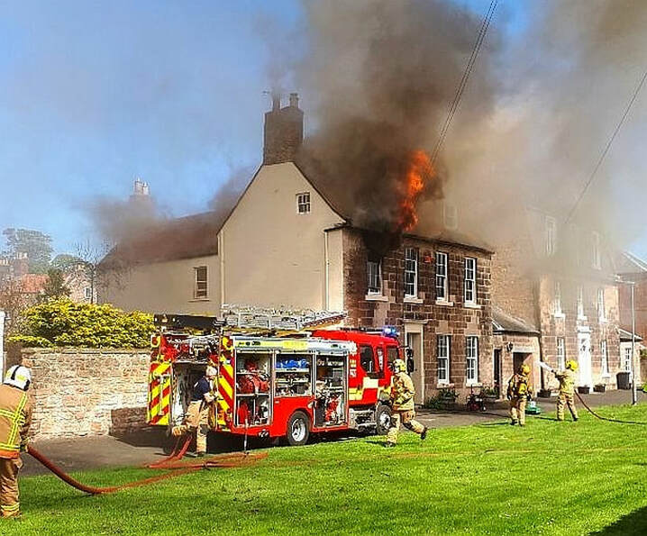
Emergency services from both sides of the border rushed to tackled a house fire in Berwick on Monday. Five fire engines were called to fight a blaze in a home on The Avenue in the north Northumberland town. The property was empty and no-one is believed to have been hurt. Dramatic video shows flames ripping through the property, in a fire which raged on for more than two hours on Monday afternoon.
Scottish fire fighters were called in to aid those from Northumberland, while equipment also had to be requested from Tyne and Wear Fire and Rescue service. A fire service spokesperson said: "Northumberland Fire and Rescue Service is currently dealing with a house fire on The Avenue in Berwick upon Tweed. The service received a call at 14.49hrs. Five fire pumps are currently in attendance - two from Berwick, one from Belford and two from Scottish Fire and Rescue service stations at Eyemouth and Coldstream. An aerial ladder platform has been requested from Tyne and Wear Fire and Rescue and this is currently on its way. There is no-one in the property."
Lynwood House is a Grade II listed late Georgian house.
News Source: Chronicle Live
Fire at a house in The Avenue, Berwick (Image: John Haswell)
Listing Details
|
Entry Name: 3, Avenue
Listing Date: 26 May 1971 Grade: II Source: Historic England Source ID: 1371225 English Heritage Legacy ID: 237256 Location: Berwick-upon-Tweed, Northumberland, TD15 County: Northumberland Civil Parish: Berwick-upon-Tweed Built-Up Area: Berwick-upon-Tweed Traditional County: Northumberland Lieutenancy Area (Ceremonial County): Northumberland Church of England Parish: Berwick Holy Trinity and St Mary Church of England Diocese: Newcastle |
Coordinates
Latitude: 55.7669 / 55°46'0"N Longitude: -2.0008 / 2°0'2"W OS Eastings: 400046 OS Northings: 652617 OS Grid: NU000526 Mapcode National: GBR G1GR.MK Mapcode Global: WH9YK.79HV |
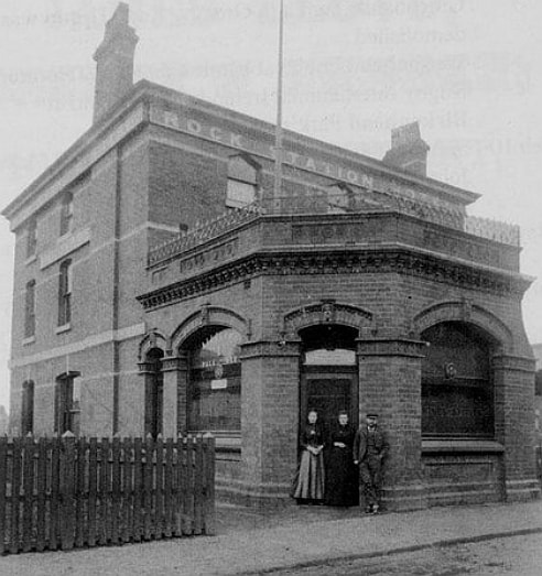
29 April 2019 (00:15) - Fire at former Rock Ferry pub treated as arson
Police are investigating an arson attack at a former Rock Ferry pub. Emergency services were called at around 12.15am today (Monday, April 29) following reports that a fire had broken out at the former The Rock Station pub on Highfield Road. On arrival firefighters found smoke coming from the disused three storey building and used high pressure hose reel jets to extinguish the flames. The scene was stood down at 2.35am.
It is believed that the fire was started deliberately and an investigation is underway to find those responsible. Anyone who may have witnessed the event or remembers seeing something suspicious is asked to contact Merseyside Police.The pub closed in 2017.
The pub was built as a railway hotel and plans to knock down the iconic Wirral pub, built in1862, and replace it with dozens of flats faced significant opposition last year. Cllr Moira McLaughlin said, “That building has been there for a long time. Our main concern is that they want to build 25 flats on the site and that will turn into a house of multiple occupation. 25 on a fairly small plot is too many. They are going to be basic accommodation bedsits. We have lost a lot of pubs all over the country so we must be realistic with what we want this site to become. People aren’t opening pubs at the moment. It’s a very attractive building - I would prefer for it to become a better development using the existing building, and not to knock it down.”
The plans have also had negative feedback on a Facebook. Ricky Jones wrote: “I’m genuinely sick and tired of all the pubs being turned into flats, shops or simply being knocked down! Why not invest in these kinds of areas??? Why are they just being left to rot! It’s disgusting.”
News Source: Wirral Globe

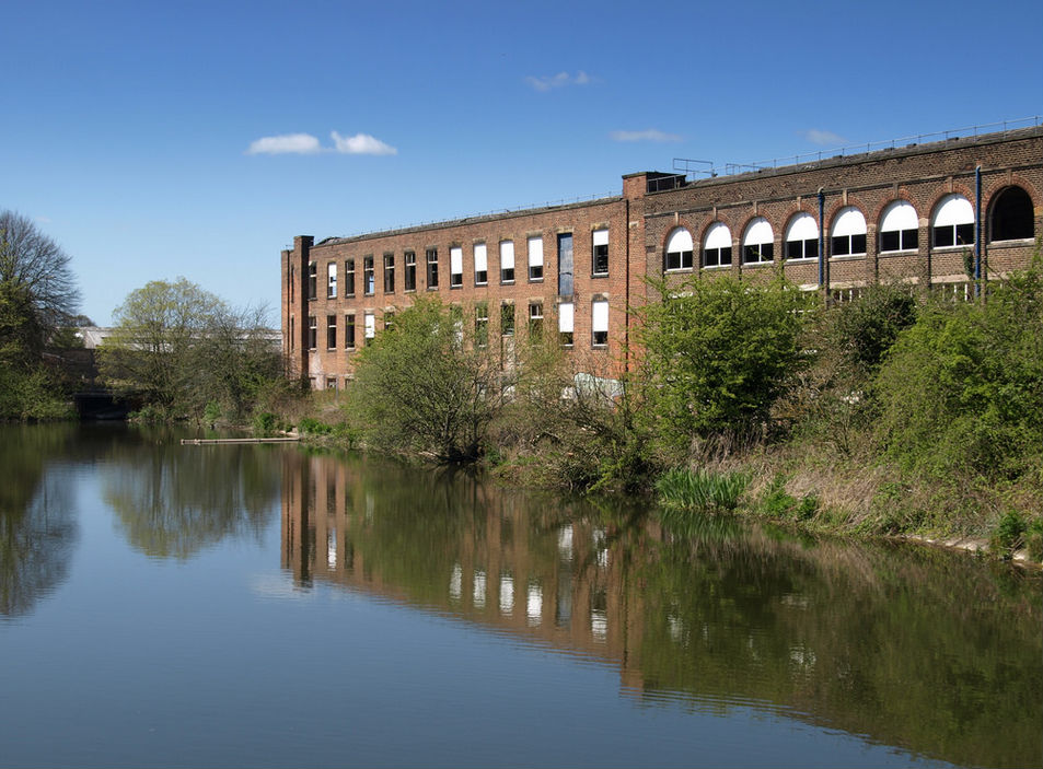
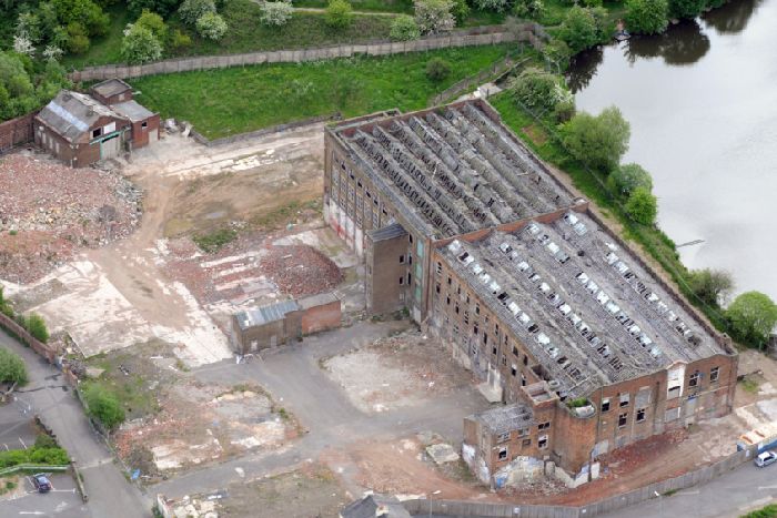
28 April 2019 (17:34) - Fire at derelict Bond Worth carpet factory in Stourport
A derelict former carpet factory site in Stourport was reinspected by firefighters this morning after a blaze on Sunday afternoon. Emergency services were called to the derelict two-storey building opposite Lichfield Street, which formed part of the former Bond Worth carpet factory, at 5.34pm on Sunday, April 28. Two crews from Kidderminster and another from Stourport were sent to the scene, alongside an aerial ladder platform from Worcester.
Firefighters used two jets to extinguish the fire. Police were also on scene while road closures were in place and people were warned to avoid the area. Crews then returned to reinspect the site just after midnight, and found several hotspots. After four hours of damping down, Hereford and Worcester Fire and Rescue Service closed the case at 4.26am. A fire service spokesman there will be no investigation into the cause of the fire.
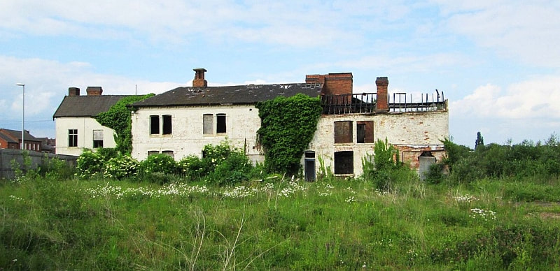
Although in a very poor condition, this is a Locally Listed building, known as “The White House”, and was once offices for the Bond Worth (Carpets of Worth) mill site, which has been derelict for about 20 years. It became offices in the early 20th century, but it is thought to date to the late 19th century and was originally a house.
News Source: The Shuttle
Firefighters used two jets to extinguish the fire. Police were also on scene while road closures were in place and people were warned to avoid the area. Crews then returned to reinspect the site just after midnight, and found several hotspots. After four hours of damping down, Hereford and Worcester Fire and Rescue Service closed the case at 4.26am. A fire service spokesman there will be no investigation into the cause of the fire.
Although in a very poor condition, this is a Locally Listed building, known as “The White House”, and was once offices for the Bond Worth (Carpets of Worth) mill site, which has been derelict for about 20 years. It became offices in the early 20th century, but it is thought to date to the late 19th century and was originally a house.
News Source: The Shuttle
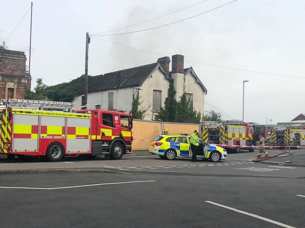

Part of the former Bond Worth carpet factory, Severn Road, Stourport-on-Severn Photo: P L Chadwick)
28 April 2019 (13:45) - Major smoke plume from fire at buildings near former Vernon mill in Penwortham
Smoke has been seen billowing across Penwortham during Sunday afternoon. Emergency services are heading for the scene of what is understood to be a major fire at, or close to, the former Vernon mill building off Factory Lane and the Old Tram Road. Outbuildings were on fire and smoke can be seen drifting. A spokesman for the fire service said: “Four fire engines from Penwortham, Preston and Bamber Bridge attended a fire in a derelict building on Factory Lane in Penwortham. Firefighters used two jets to extinguish the fire.”
Although Penwortham Mill is an unloved building, awaiting demolition for more than a decade, it is an historic building, dating back to 1785 – See Building History below.
News Source: Blog Preston
Although Penwortham Mill is an unloved building, awaiting demolition for more than a decade, it is an historic building, dating back to 1785 – See Building History below.
News Source: Blog Preston
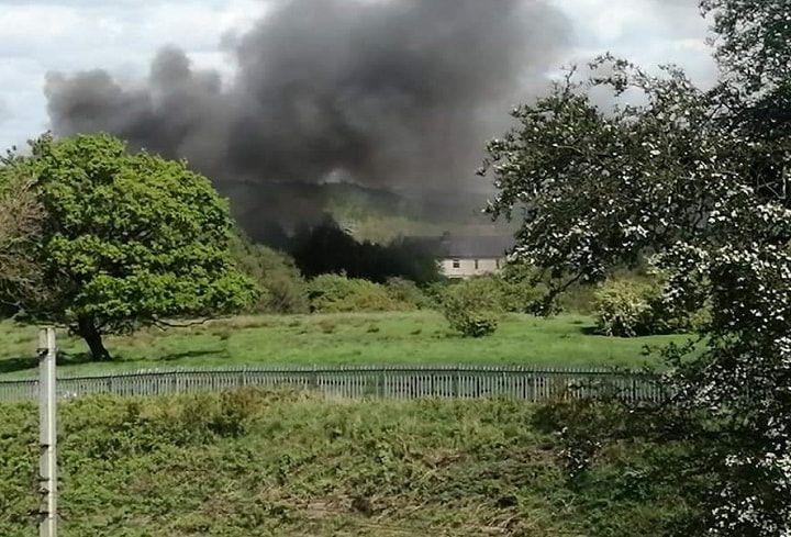
A plume of smoke rises from the old mill site
Building History
(Researched by Heritage & Ecclesiastical Fire Protection)
In 1785, John Watson built Penwortham Mill on Factory Lane. This was a textile factory which included weaving and fabric production. The mill was a traditional brick-built Lancashire cotton mill over four storeys, once common across Preston. Whilst John Horrocks's first mill in Dale Street, Preston, was known as the Yellow Factory, on account of its faded whitewash, Penwortham factory was always the White Factory. The factory was originally powered by a water mill running off a stream that fed into the Ribble. The stream later fed an enormous reservoir - 'Vernons Lodge'.
Many of the workforce came from Penwortham workhouse, a short distance along factory Lane. Owners of large textile mills purchased large numbers of children from workhouses and orphanages in all the larger towns and cities, including London. By the late 1790s, about a third of the workers in the cotton industry were children and known as pauper apprentices.
The mill had five different tenants between 1807 and 1851. An advertisement in a newspaper in May 1811 said, “To be Let: The capital and extensive cotton factories with the appropriate machinery therein, situate in Walton, near Preston, formerly in the possession of Mr.Watson and late of Messrs Cooper and Sherrington ... A number of cottages will be let with the mills ... the machinery is ready for immediate use'.
By 1825 the mill was being run by 'Thomas German and Co. Penwortham Mills', becoming German and Petty by 1828. A small but distinct, community grew up around the mill, and by the 1841 census 250 people occupied the 44 houses.
By 1910 the site was occupied by 'Vernon and Co. Ltd. Cotton Spinners and Manufacturers of Surgical Dressings, Cotton Wools, lint etc’, products that were in massive demand during the First World War. Enlarged in 1920 the mill remained in the same ownership; the last survivor of the cotton mills of Preston and district closed in 2006 after the company relocated to brand new premises. The works, with its cluster of factory houses, mill lodge and cricket field, still preserves a lot of the aura of an early nineteenth century cotton mill community. But the factory now stands idle and is earmarked for demolition and house building by Bovis Homes of Manchester.
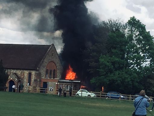
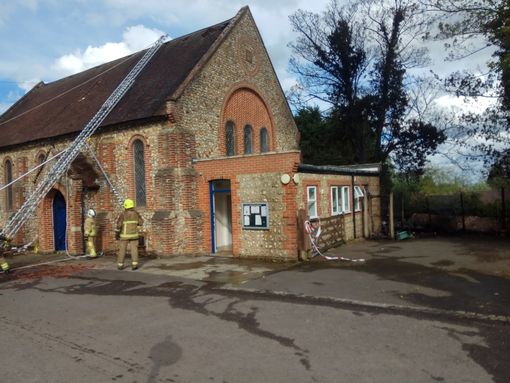
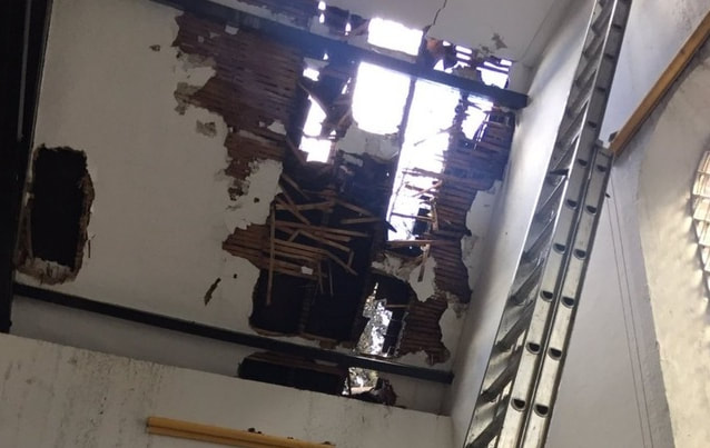
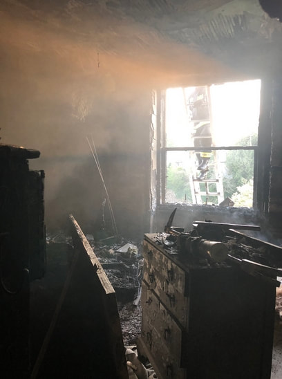
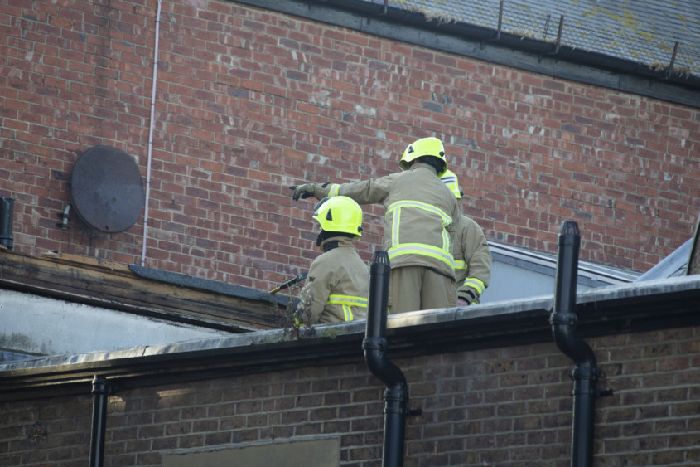
25 April 2019 (14:30) - Smoke pours from roof as fire breaks out at Farnham church
A fire has broken out at a Grade II listed church in Farnham on Thursday afternoon (April 25). Smoke was seen rising from the Hale Methodist Church in Upper Hale at around 2.30pm.There are three fire engines in attendance and firefighters are currently tackling the blaze.
Coralie Dejonghe, 20, from Farnham, saw smoke rising from the 19th century church when she left her house. She said: “I left my house and I saw all this smoke rising and it was really dark. As I got closer it was getting darker and darker and when I arrived I could feel the heat. The amount of smoke was so impressive. You could just see all these people coming out of their houses to take pictures.” She added, “The kitchen is completely ruined. The windows are smashed. The fire really started raging inside the church. When I arrived I could still see some fire in front of the church, but now the fire is under control and the only thing we can see is smoke. There are firefighters on the roof. They are cutting through the roof and splashing water on the smoke.”
A Surrey Fire and Rescue Service spokesman said: “We received a call this afternoon at around 2.30pm to a report of a fire at Hale Methodist Church, Farnham. Three fire engines were sent alongside some specialist units. They arrived on the scene around 14.45pm.” Police officers at the scene say no one has been injured in the fire, according to a witness. There are reports of six fire engines, along with five police cars at the scene. The road is reportedly blocked and drivers are seeking alternative routes.
At 5.25pm, a witness said the fire seems to be under control. However, “there is a substantial amount of damage, especially in the backyard of the church”. Katie Robinson, who lives in Farnham, arrived after the fire was put out. She said: “Well we got there after the fire was put out, but prior to that I noticed my house was smelling smoky - I assumed someone had lit a bonfire. Then I heard so many sirens going off to then realise something serious must have happened. I can’t see anything from my house but I could hear it all. So we went to investigate. There were approximately five fire engines and lots of smaller fire vehicles and police cars. Would seem that something must have caught fire to the fence between the church and the courtyard on the other side. Which then went up the tree and onto the church roof. Only by going on what I could see. The fire brigade were removing tiles from the roof to extinguish any further flames within the roof.”
News Source: Surrey Live
Listing Details
|
Entry Name: Hale Methodist Church
Listing Date: 29 December 1972 Grade: II Source: Historic England Source ID: 1044612 English Heritage Legacy ID: 290961 Location: Farnham, Waverley, Surrey, GU9 County: Surrey District: Waverley Civil Parish: Farnham Built-Up Area: Aldershot Traditional County: Surrey Lieutenancy Area (Ceremonial County): Surrey Church of England Parish: Badshot Lea and Hale Church of England Diocese: Guildford |
Coordinates
Latitude: 51.2335 / 51°14'0"N Longitude: -0.7948 / 0°47'41"W OS Eastings: 484242 OS Northings: 148950 OS Grid: SU842489 Mapcode National: GBR D9X.PVF Mapcode Global: VHDY2.58P6 |
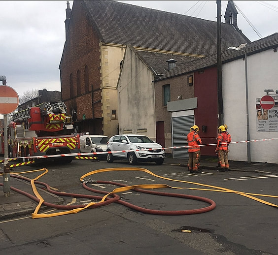
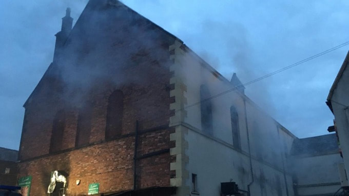
25 April 2019 (05:45) - Bury fire: Firefighters tackle supermarket blaze in old church building
Six fire engines have been battling the flames at Kashmir Superstore since 5.45am this morning. Bury residents are being told to keep their doors and windows shut as firefighters tackle a fire at a supermarket. Flames took hold of the Kashmir Superstore, on Kershaw Street, off Rochdale Road, in the early hours of this morning, which occupies an historic former Wesleyan Methodist church, built before 1895.
Greater Manchester Fire and Rescue Service shared images of a cloud of smoke billowing from the Asian food superstore this morning. Rochdale Road has been closed in both directions, from Bond Street to Albert Street, while firefighters attend the scene. A spokesman for GMFRS said six appliances remain at the scene, but added crews are making good progress. A firefighter at the scene said, at 7.30am, they are currently dampening down, looking for hotspots inside the building, which is around 30m by 15m. There’s a lot of food and other materials inside. He said the fire caused ‘extensive’ damage to the building. Kind hearted Salvation Army volunteers are giving out food and drinks to firefighters who have been battling with the flames since the early hours.
Station Manager Adrian Taylor said: “When the crews arrived there was a quantity of cardboard on fire and the fire had taken hold. It went through a vent in the side which then involved the ground and first floor. Crews entered the front and rear, they were confronted by hot temperatures and cramped conditions due to high fire loading because of stock. Police and fire are launching a joint investigation into the cause of the fire. The crews have stopped the fire spreading in arduous conditions. At its height we had seven fire appliances and one aerial appliance. We are dampening down. We expect to be here most of the morning.”
Owner of the supermarket Abid Ali, 38, said: “We think it was caused from cardboard at the back. I was called early on and I came down at 5.30am. It was shocking. We have all the stock for Ramadan, it’s quite bad inside. It’s a big shock, it’s upsetting. I’ve owned the business for four years. When I came there was smoke coming from the building, slowly firefighters took control. The firefighters have done a good job.”
News Source: Manchester Evening News
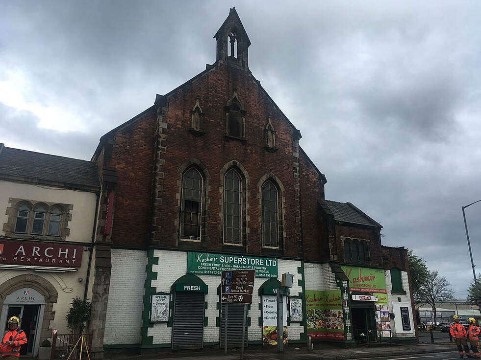
The Kashmir Supermarket occupies the old Wesleyan Methodist church building.
25 April 2019 (02:00) - Anguish after fire at Post Office in Canterbury
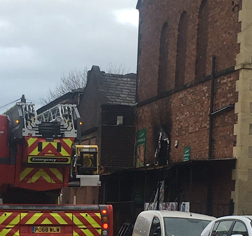
A Londis owner has spoken of her anguish after a "traumatic" fire at her shop in the early hours of this morning. Grandmother-of-two Kirti Patel, 60, has run Longport Londis in Canterbury for 37 years. For the last three-and-a-half, she has also operated a Post Office from the back of the store - working long hours to keep the services running from 7am until 8pm daily. But after a fire broke out in bin bags outside just before 2am - just a fortnight after the shop was targeted by thieves - Mrs Patel says she is worried about the future of her store.
Kieran Scopes, 23, one of about six tenants who live in two flats above the shop, says he was alerted to the fire when he smelled smoke from his bedroom. He said: "It was lucky I was already awake - my whole room was filled with smoke and I could hear bangs from outside so I ran out. About six bin bags in the street outside were completely up in flames. I got lots of water to throw on them. Then a policeman arrived in a car and jumped out with a fire extinguisher, which put the fire out. If I had been asleep, I'm not sure how long it would have gone on for."
Mrs Patel says she believes the fire was started deliberately. She said: "I know this has happened on purpose. There is a lot of indication. They've damaged all my property - the walls outside have been damaged, the smoke has gone into every single room in my tenants's flats upstairs, and smoke has come all through the shop. It has been very traumatic for me. It's not good - we are upset that this is happening too often now."
Just two weeks ago, the same shop was targeted by a group of thieves who stole more than £300 of stock - which Mrs Patel says she struggled to replace. "When this kind of thing happens, it is just so upsetting and makes it so much harder for me." If Kieran hadn't been upstairs the night this happened, I know my shop would have been on fire completely. Luckily, he acted really fast and I give him a big credit." Police say they are now investigating the fire.
The shop, together with the attached house, are Grade II listed and were built in the mid 19th century.
News Source: Kent Online
The shop, together with the attached house, are Grade II listed

Listing Details
|
Entry Name: 15-17, Longport
Listing Date: 7 September 1973 Grade: II Source: Historic England Source ID: 1097017 English Heritage Legacy ID: 439687 Location: Canterbury, Kent, CT1 County: Kent District: Canterbury Town: Canterbury Electoral Ward/Division: Barton Built-Up Area: Canterbury Traditional County: Kent Lieutenancy Area (Ceremonial County): Kent |
Coordinates
Latitude: 51.2774 / 51°16'38"N Longitude: 1.0873 / 1°5'14"E OS Eastings: 615417 OS Northings: 157664 OS Grid: TR154576 Mapcode National: GBR TY2.ZMS Mapcode Global: VHLGM.S5N3 |
24 April 2019 (17:30*) - Fire at the Grand Opera House in York
Fire crews have been called out to the Grand Opera House in York this evening. A curtain caught alight during a rehearsal of the smash hit musical Rock of Ages which is in York for one week. The building has been evacuated and the fire service says the fire is out. A number of fire engines are at the scene and a damping down operations is going on. There are no reports of any injuries.
A spokesperson said on their Facebook page: "Please bear with us. Tonight's performance of Rock of Ages will not go ahead due to an incident at the theatre. We will keep you all informed when we have an update. Everyone is safe. We will be in touch with customers as soon as possible. Thank you for your understanding."
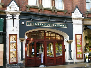
Grand Opera House is designated a Grade II listed building.
News Source: Minster FM
A spokesperson said on their Facebook page: "Please bear with us. Tonight's performance of Rock of Ages will not go ahead due to an incident at the theatre. We will keep you all informed when we have an update. Everyone is safe. We will be in touch with customers as soon as possible. Thank you for your understanding."
Grand Opera House is designated a Grade II listed building.
News Source: Minster FM
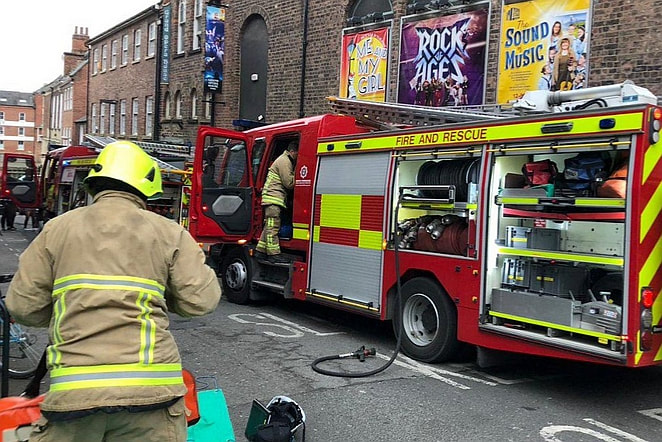
Firefighters outside the Grand Opera House in York

Listing Details
|
Entry Name: Grand Opera House
Listing Date: 28 February 1986 Last Amended: 14 March 1997 Grade: II Source: Historic England Source ID: 1257908 English Heritage Legacy ID: 463303 Location: York, YO1 County: York Electoral Ward/Division: Guildhall Built-Up Area: York Traditional County: Yorkshire Lieutenancy Area (Ceremonial County): North Yorkshire Church of England Parish: York All Saints, Pavement Church of England Diocese: York |
Coordinates
Latitude: 53.9572 / 53°57'25"N Longitude: -1.0823 / 1°4'56"W OS Eastings: 460311 OS Northings: 451625 OS Grid: SE603516 Mapcode National: GBR NQWP.G6 Mapcode Global: WHFC3.BSVP |
Building History
(Researched by Heritage & Ecclesiastical Fire Protection)
The buildings that comprise the Grand Opera House York were not originally intended to be a theatre. The tall section was built as York’s Corn Exchange in 1868 and was meant to be used as a concert hall from time to time. The auditorium was originally a warehouse opening onto Kings Street. In 1902 after the Corn Exchange failed, the buildings were converted into the Grand Opera House by William Peacock. The theatre opened on January 20th 1902 with Little Red Riding Hood starring Florrie Ford. In 1903 the name became The Grand Opera House and Empire because new regulations banned smoking in serious theatre but allowed it in music hall type theatres and smoking was fashionable at the time. The theatre remained in the hands of William Peacock’s family until 1945.
The programmes were very varied; pantomime, music hall, variety, serious theatre, amateur opera, plays, reviews, and silent films. Many famous people appeared here including Florrie Ford, Charlie and Sydney Chaplin, Gracie Fields, Lillie Langtry, George Robey, Cecily Courtneidge and Jimmy Jewel.
The theatre is now run by ATG (Ambassador Theatre Group) and was designated a Grade II listed building in 1986. It has a capacity of 1,000.
Near Miss
24 April 2019 (00:10) - Wheelie Bin Fire Causes Damage To Whitby Shop
24 April 2019 (00:10) - Wheelie Bin Fire Causes Damage To Whitby Shop
A coffee shop in Whitby is closed today after a fire spread to its shop. Firefighters from Whitby and Robin Hood's Bay were called to Costa Coffee on Baxtergate at around 12.10am today (Wednesday 24th April). It was originally called in as a report of a number of bin bags on fire against the building. On arrival, crews found out it was actually due to a wheelie bin fire which spread to the exterior of the shop. It also caused 15% of damage to the inside. The firefighters used two breathing apparatus, one hose reel and a thermal imaging camera. The cause is believed to be accidental due to a dropped cigarette.
The fire was just a metres away from the 18th century Grade II listed Black Swan Inn, which stands immediately across the narrow street from Costa Coffee.
News Source: Yorkshire Coast Radio
The fire was just a metres away from the 18th century Grade II listed Black Swan Inn, which stands immediately across the narrow street from Costa Coffee.
News Source: Yorkshire Coast Radio
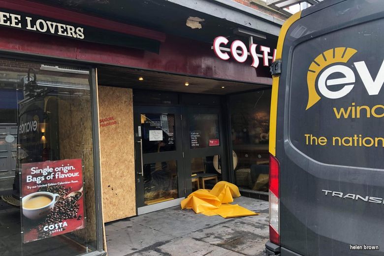
Damage caused to the building from the wheelie bin fire.
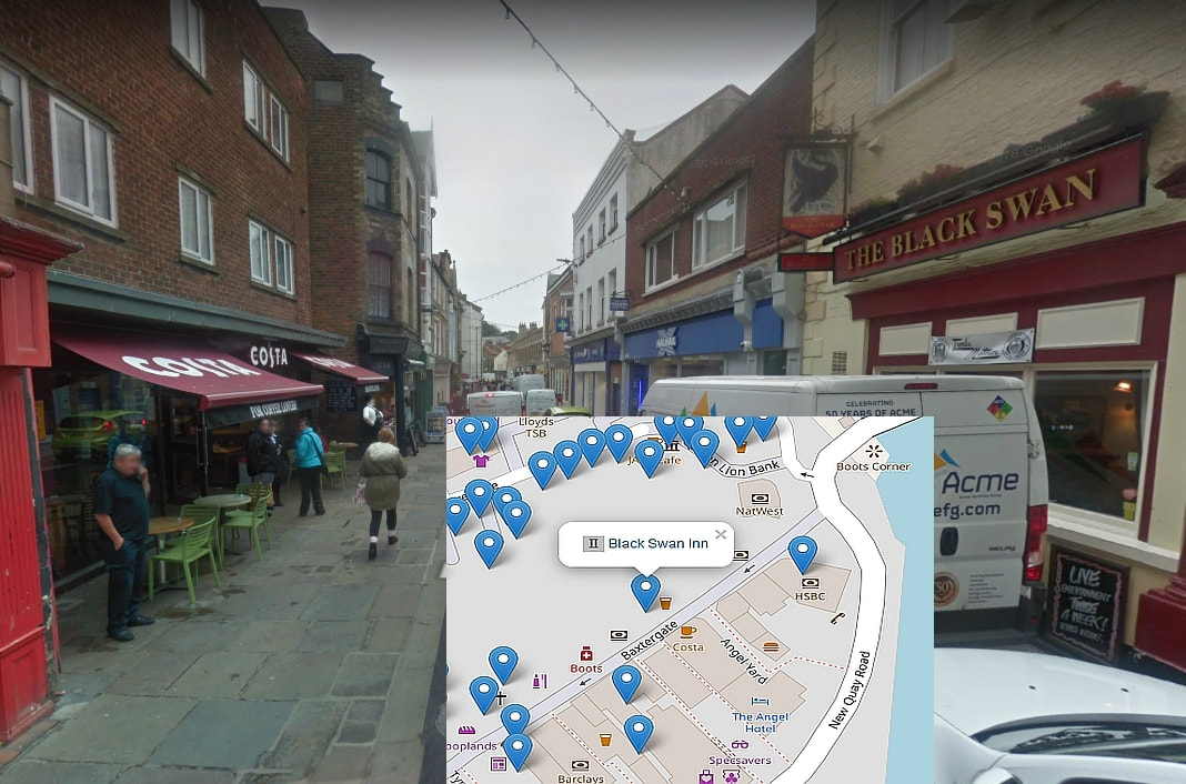
The proximity of The Black Swan to the wheelie bin fire outside Costa Coffee
Listing Details
|
Entry Name: Black Swan Inn
Listing Date: 4 December 1972 Grade: II Source: Historic England Source ID: 1148350 English Heritage Legacy ID: 326548 Location: Whitby, Scarborough, North Yorkshire, YO21 County: North Yorkshire District: Scarborough Civil Parish: Whitby Built-Up Area: Whitby Traditional County: Yorkshire Lieutenancy Area (Ceremonial County): North Yorkshire Church of England Parish: Whitby St Mary Church of England Diocese: York |
Coordinates
Latitude: 54.4863 / 54°29'10"N Longitude: -0.6144 / 0°36'51"W OS Eastings: 489859 OS Northings: 510990 OS Grid: NZ898109 Mapcode National: GBR SJ4K.SK Mapcode Global: WHG9Y.JHML |
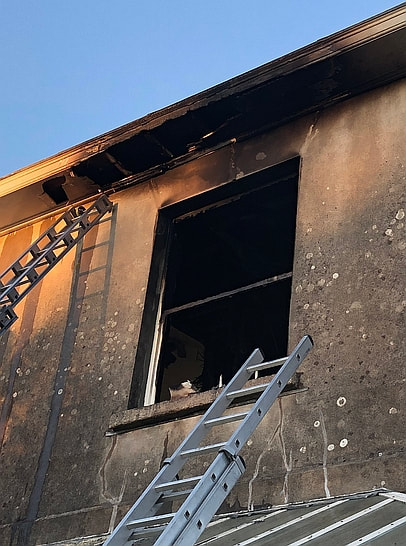
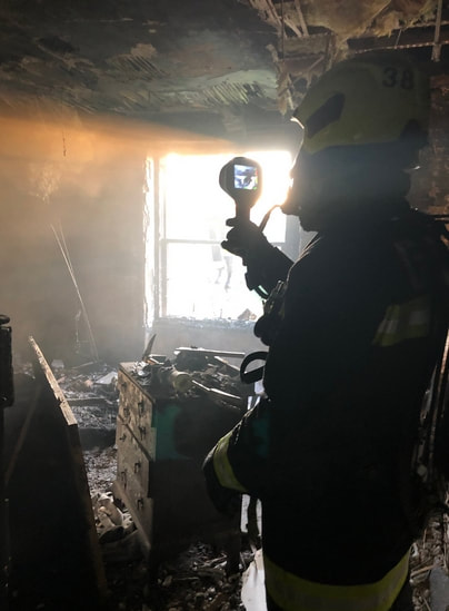
21 April 2019 (18:00) - Sun reflecting off mirror caused major house firE in Modbury
A warning has gone out to home owners after a fire badly damaged a house in South Devon. Ten fire fighters were called to Brownston Street in Modbury just after 6pm on Sunday after reports of a large house on fire. Fire control said they received multiple calls to a domestic fire. Pictures show smoke coming from the roof. The fire is thought to have started due to the sun reflecting from a mirror.
Once the crew got to the incident, the officer in charge made pumps ten and aerial ladder platform one. Fire Control sent both fire engines from Greenbank, one fire engine from Plympton, the incident command unit from Totnes, one fire engine from Plymstock, one fire engine from Buckfastleigh, one fire engine and the aerial ladder platform from Crownhill, one fire engine from Camels Head and the welfare unit from Crediton.
The fire started in the back bedroom of the home and Gerald Taylor, area manager for Devon & Somerset Fire and Rescue Service, said the fire was under control just after 8pm. Adding: "Initial cause looks like low evening sun hitting mirror in bedroom and reflected light beam setting curtains on fire. Please think about mirror safety." Crews remained on the scene at 8.30pm with three breathing apparatus, one hose reel jet, one triple extension ladder, one 10.5 metre ladder, one thermal imaging camera, one attack jet and one covering jet to extinguish the fire. No one was injured in the fire.
The building is known as Hillcrest and is Grade II listed. It is a Georgian building, constructed in the early 19th century and lies within Modbury Conservation Area.
News Source: Plymouth Live
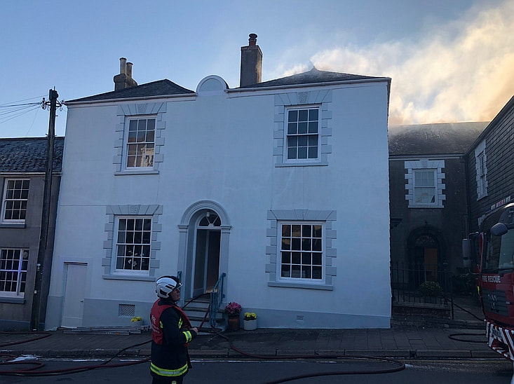
Firefighters at the large Georgian house in Modbury, South Hams, Devon.
Listing Details
|
Entry Name: Hillcrest
Listing Date: 25 January 1990 Grade: II Source: Historic England Source ID: 1108088 English Heritage Legacy ID: 99680 Location: Modbury, South Hams, Devon, PL21 County: Devon District: South Hams Civil Parish: Modbury Built-Up Area: Modbury Traditional County: Devon Lieutenancy Area (Ceremonial County): Devon Church of England Parish: Modbury St George Church of England Diocese: Exeter |
Coordinates
Latitude: 50.3505 / 50°21'1"N Longitude: -3.8865 / 3°53'11"W OS Eastings: 265881 OS Northings: 51761 OS Grid: SX658517 Mapcode National: GBR Q9.7HD5 Mapcode Global: FRA 28R3.MPB |
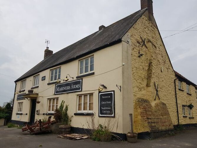
21 April 2019 (15:45) - Man arrested on suspicion of arson following fire at historic Gloucestershire pub
A historic pub in Gloucestershire was subject to fire damage over the weekend in what police suspect to be an arson attack. The Mariners Arms which is on Salter Street in Berkeley, is believed to be more than 500 years old and is currently vacant. It was once a popular place for the men who worked on the boats in the area to go for a pint after work.
The building is believed to be one of the oldest in the town dating back to at least 1476. The Mariners Arms is Grade II listed and stands on the site of an early monastic building and there are two stone windows in the pub dating from about 1390, which were probably salvaged from the monastery. The interior retains many of its original beams.
The old pub was 50 per cent smoke damaged and five per cent fire damaged, a fire service spokesperson said. Two fire crews attended the incident at 3.45pm on Sunday and left the scene just after 5pm. Police arrived at the pub after the fire service reported the fire to them. A Gloucestershire Police spokesperson said: “The fire service informed us that they were in attendance at a fire which had broken out at The Mariners Arms in Berkeley on Sunday afternoon. Officers attended and a 45-year-old man from Berkeley was arrested on suspicion of arson and has since been released under investigation. Enquiries are ongoing.”
News Source: Gloucestershire Live
A man has been arrested on suspicion of arson following a fire at the Mariners Arms in Berkeley.
Listing Details
|
Entry Name: The Mariners' Arms
Listing Date: 30 March 1960 Grade: II Source: Historic England Source ID: 1222111 English Heritage Legacy ID: 414130 Location: Berkeley, Stroud, Gloucestershire, GL13 County: Gloucestershire District: Stroud Civil Parish: Berkeley Built-Up Area: Berkeley Traditional County: Gloucestershire Lieutenancy Area (Ceremonial County): Gloucestershire Church of England Parish: Berkeley St Mary the Virgin Church of England Diocese: Gloucester |
Coordinates
Latitude: 51.6914 / 51°41'29"N Longitude: -2.4623 / 2°27'44"W OS Eastings: 368140 OS Northings: 199287 OS Grid: ST681992 Mapcode National: GBR JX.4MB7 Mapcode Global: VH87K.8RM6 |
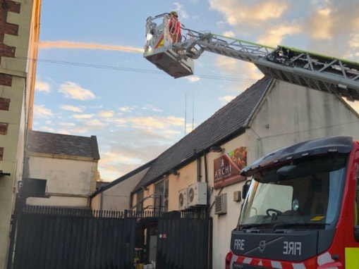
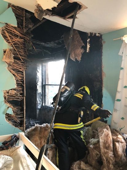
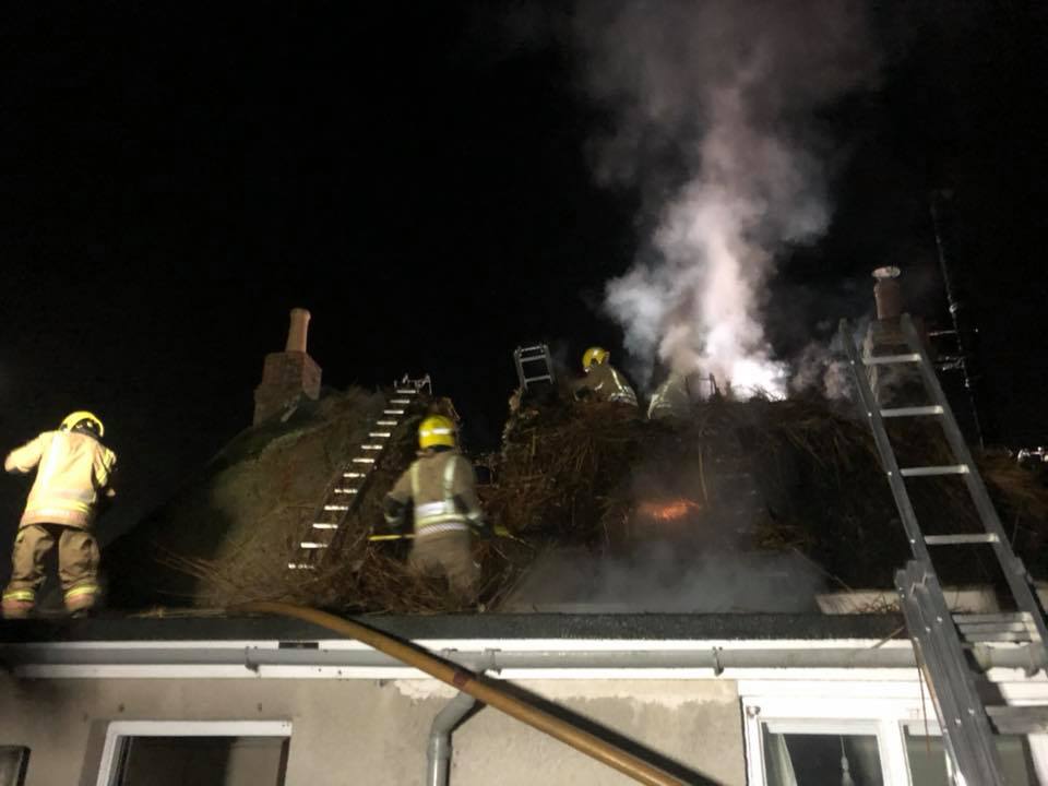
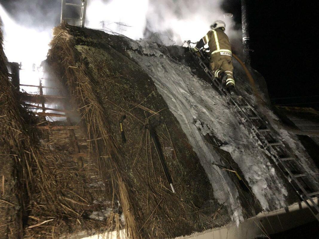
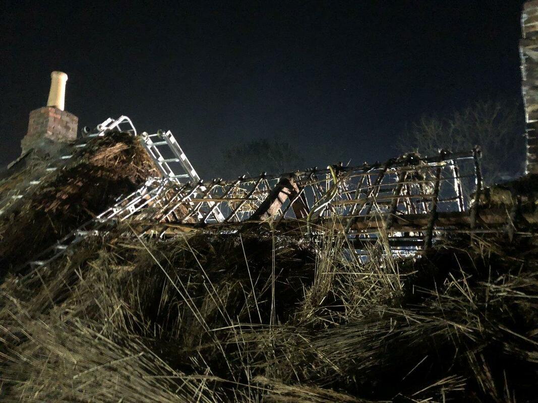
20 April 2019 (20:39) - Firefighters from across Dorset tackle thatch fire in Purbeck
Firefighters from across Dorset were tackling a fire at an historic thatched cottage in Purbeck. The fire service was called at 8.40pm last night (April 20) to the incident at New Line, Norden near Wareham. Initially, crews from Wareham, Swanage, Poole (x2), Westbourne, Redhill Park plus a high rise from Westbourne, an Incident Support Unit from Poole, a Water Carrier from Poole Fire Station and several officers were mobilised to the fire to carry out various roles.
Sandbanks Ferry was also integral with this incident by assisting with transporting several crews from the Bournemouth and Poole area across to the Purbeck area. When the first crew from Wareham Fire Station arrived, the roof of the house was well alight. Further fire engines were requested which attended from Wimborne (x2), Sturminster Newton, Blandford and Springbourne Fire Stations. To extinguish the fire a fire break was established in the roof and crews proceeded to strip away the thatch. The fire was extinguished using two main lines, six hose reel jets and a compressed air foam hose, and was under control by 10.43pm.
Crews also salvaged property from inside the premises for the occupier. The Red Cross also assisted with this incident by sending their Fire Emergency Support vehicle to provide help and assistance for the occupiers. Firefighters have now left the scene, however a team will be going back to reinspect again in the morning.
Swanage Fire Station said: " We attended a 10 pump thatch fire near Wareham. On arrival the roof was well alight and all crews worked very hard to make a fire break and strip the roof of the thatch which helped reduce the damage to the inside of the property."
News Source: Dorset Echo
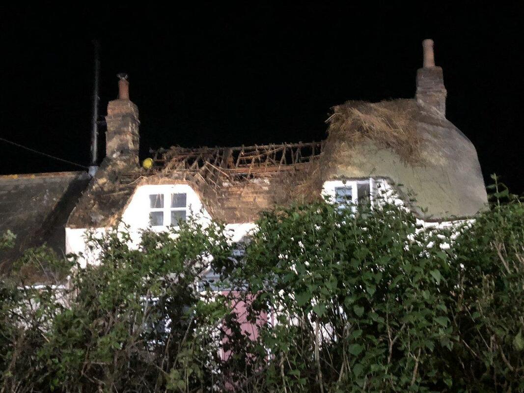
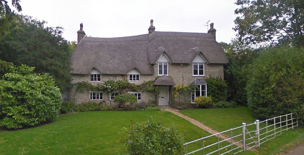
Grade II listed Folke Cottage (Credit: Google)
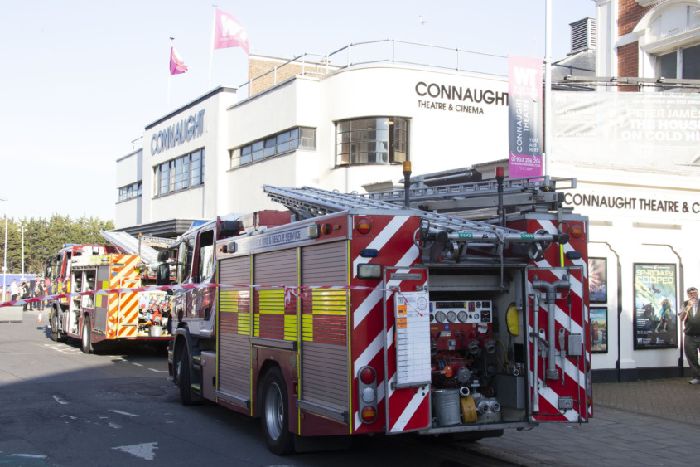
19 April 2019 (17:40) - Firefighters attended a fire at the Connaught Theatre in Worthing
Crews were called to a fire in the insulation in the roof of the Union Place building at 5.40pm, a spokesman confirmed. Customers and staff were evacuated from the building while crews used two breathing apparatus and one hose reel to extinguish the fire. The cause was found to be accidental ignition, confirmed the spokesman. Firefighters left the scene at around 7pm. The cinema is back open as usual today.
The Connaught Theatre is on Worthing Borough Council’s list of Local Interest Buildings. The present frontage to the theatre was added in 1935 by local architect, A T W Goldsmith. The front of the building originally sported wall tiles, which was a common feature of cinemas of this period. In the 1980's the tiles were replaced with the present render as part of a refurbishment of the whole theatre. It is an important building within the town and one of the better examples of its period, with continuous horizontal bands of glazing on the upper level and corner windows.
News Source: Worthing Herald
Building History
(Researched by Heritage & Ecclesiastical Fire Protection)
The Connaught Theatre occupies the former Picturedrome cinema, which was built in 1914 on the site of Stanmore Lodge and opened in July of that year. Its seating capacity was 850 in a single tier, with four boxes at the rear, and the auditorium was octagonal. In 1926, Swiss impresario Carl Adolf Seebold, who owned other cinemas in Worthing and who had been the Picturedrome's musical director since it opened, bought it.
In 1916, Connaught Buildings were built next to the cinema, and an entrance passageway was built from the street to the Picturedrome through the new building. The Connaught Buildings (and later Connaught Hall and Theatre) seem to have taken its name from Prince Arthur, Duke of Connaught and Strathern and Earl of Sussex. The new premises housed the Connaught Hall, which in 1917 became a venue for vaudeville entertainment. It was licensed as a theatre in April 1931 by Walter Lindsay, formerly a theatre director in London; the first full season of repertory theatre began in the autumn of 1932. Terence De Marney became director of Connaught and Bill Fraser became involved in the theatre.
The two venues coexisted until 1935; in that year the Worthing Repertory Company, which had been outgrowing the Connaught Buildings, moved next door to the Picturedrome, renamed the building the Connaught Theatre and commissioned an architect to extend the façade of the building in an Art Deco style. Carl Seebold contributed £60,000 (£4,091,000 as of 2019) towards the cost of the work. The first production, a play called Theatre Royal, was given on 30 September 1935; it formed the centrepiece of a special opening week programme, and was very successful. The establishment of the Connaught in former cinema premises represented an unusual reversal of the contemporary tendency for theatres to be converted into cinemas—a trend seen throughout Britain in the 1930s.
A temporary closure during World War II was followed by a period in which the theatre was managed on Seebold's behalf by a group associated with the J. Arthur Rank Organisation, who pursued a policy of employing young actors who later became important figures in film, television and theatre. Ownership passed from Seebold to other commercial interests in April 1950, when he sold the lease for £35,000 (£1,178,000 as of 2019). In 1956, Winston Churchill visited the theatre to see his daughter Sarah perform in Terence Rattigan's play Variation on a Theme.
The theatre began to struggle, and closed in 1966, but campaigners successfully petitioned Worthing Borough Council to buy and run it instead. Productions began again in 1967 and the capacity was increased to its present 512 seats when the auditorium was revamped in 1972. The council agreed to provide more funding for the theatre after it was forced to close temporarily on two more occasions in the 1970s. The remodelling in 1972 introduced film projection facilities, which have been used regularly since 1987.
19 April 2019 (11:50) - Chimney fire in thatched property near Sherborne
There was a call out to Folke, near Sherborne at 11.50am on Friday. A statement from Sherborne Fire Station said: "Both appliances (were) mobilised along with the aerial ladder platform and supporting appliance from Yeovil Fire Station, to a chimney fire at a thatched property in Folke. Crews used chimney rods and a thermal imaging camera to insure the fire was fully extinguished. The ALP was also used to check the chimney from above. Thankfully all these actions were a precautionary measure. A clean chimney can help prevent fires and structural damage to your property. Regular cleaning of your chimney or flue will eliminate the build-up of soot and clear obstructions such as bird or animal nests, leaves and debris."
Folke Cottage is an early 18th century house and is Grade II listed.
News Source: Somerset Live
Folke Cottage is an early 18th century house and is Grade II listed.
News Source: Somerset Live
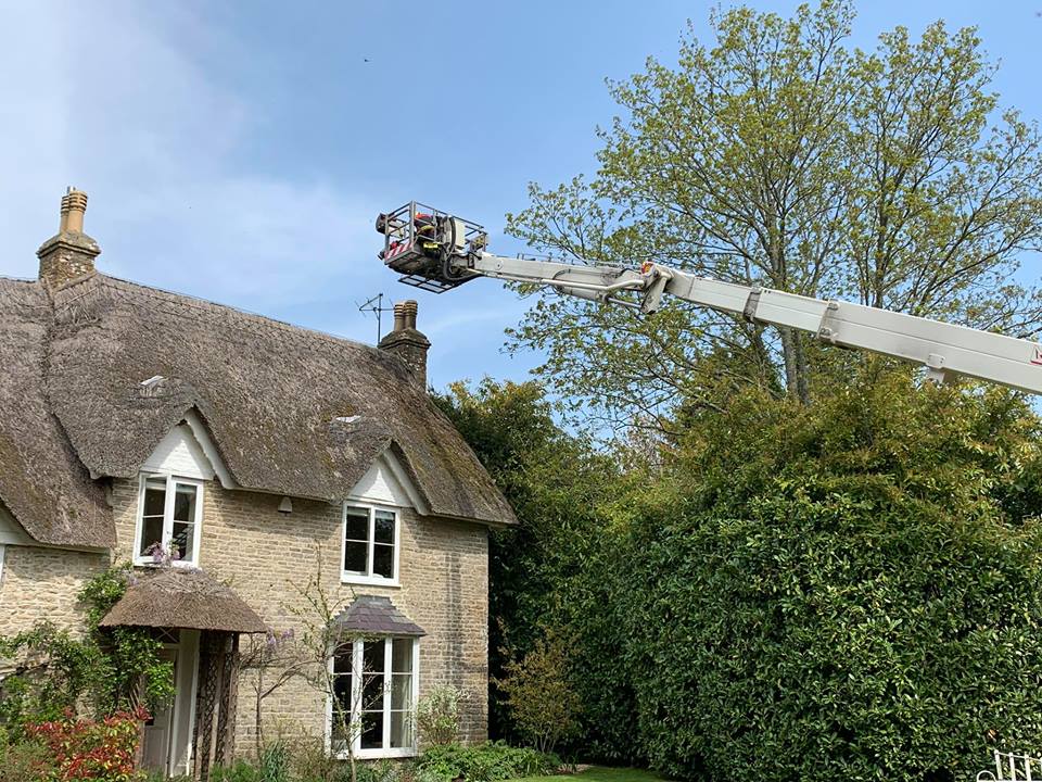
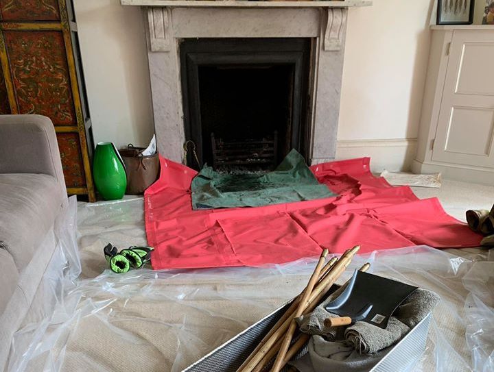

Grade II listed Folke Cottage (Credit: Google)
Listing Details
|
Entry Name: Folke Cottage
Listing Date: 21 May 1984 Grade: II Source: Historic England Source ID: 1324146 English Heritage Legacy ID: 104809 Location: Folke, Dorset, Dorset, DT9 County: Dorset District: West Dorset Civil Parish: Folke Traditional County: Dorset Lieutenancy Area (Ceremonial County): Dorset Church of England Parish: Folke St Lawrence Church of England Diocese: Salisbury |
Coordinates
Latitude: 50.9199 / 50°55'11"N Longitude: -2.4863 / 2°29'10"W OS Eastings: 365912 OS Northings: 113497 OS Grid: ST659134 Mapcode National: GBR MW.Q7X9 Mapcode Global: FRA 56PN.TDT |
19 April 2019 (02:45) - Crews tackle blaze at former Burnley Baptist Church buildings
A historic Sunday School building in Burnley was damaged during a fire on Friday morning. Police called in firefighters at 2.45am after they had seen smoke coming from the building which is believed to have been the former Sunday School building, which dates back to 1845. The building adjoins the old Burnley Lane Baptist chapel. Nearby houses on Hebrew Road at the back of the building were evacuated and there were road closures in place.
Caroline Harrison, station manager at Nelson, was the incident commander and believes the incident could have been so much worse. She said: “We sent crews with breathing apparatus in to try to tackle the fire but it was discovered the building was in an unsafe condition and there were some signs of structural collapse inside. Those crews were removed for their safety and we dealt with the fire from the outside. We believe it was an old school building because of the sign on the outside but it was used for storage. One of the good things we did was stopping it spreading to the chapel building next to it, as there was a door connecting them. The chapel was filled with tyres and if they had caught fire we could have been talking about evacuating properties in a 200-metre radius due to toxic fumes and environmental concerns. The fire is out but we are dealing with the smouldering wood in the property. We are continuing to work with the police to try to establish the cause of the fire.”
The blaze was in a three-storey derelict building and it affected all floors of the building and roof. Firefighters used an aerial ladder platform to attack the fire from the roof level. Damian Sharples, 34, of Colne Road, praised firefighters for their quick response to prevent the blaze spreading. He said: “I saw some blue lights when I looked out of the window and could see the property on fire. We have only been here for about a month and it does not really surprise me. There have been a few incidents at the back of the houses and also at the nearby school. I am just happy that the police and fire service managed to clear it.” Cllr Shah Hussain, who represents the Daneshouse with Stoneyholme ward, said: “It is very sad to see historic buildings like this being damaged. I want to praise firefighters for the job they did.”
Built as a Baptist Sunday school in 1845 with an integral dwelling, and later converted to an institute, the building is Grade II listed. This was also a near miss for the adjoining Ebeneezer Baptist Church Hall, built in 1872 and also Grade II listed. The buildings have been unoccupied since 2008. In 2014 Police uncovered a cannabis farm in the church hall building.
News Source: Lancashire Telegraph

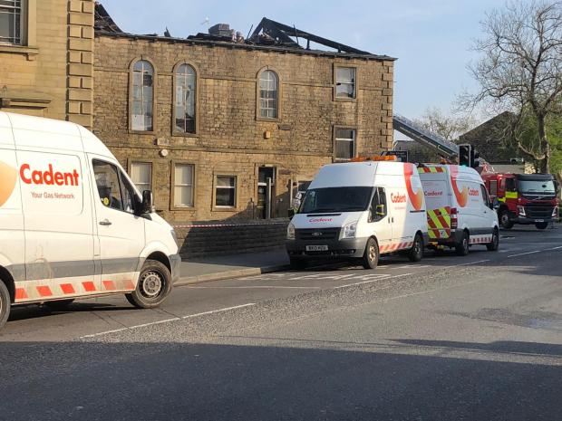
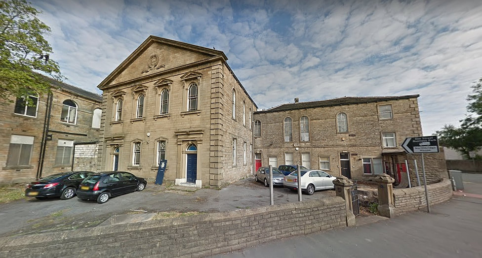
The chapel and Sunday school before the fire (Credit: Google)
Listing Details
|
Entry Name: Burnley Lane Baptist Church and Institute
Listing Date: 29 September 1977 Grade: II Source: Historic England Source ID: 1270968 English Heritage Legacy ID: 467041 Location: Burnley, Lancashire, BB10 County: Lancashire District: Burnley Town: Burnley Electoral Ward/Division: Daneshouse with Stoneyholme Built-Up Area: Burnley Traditional County: Lancashire Lieutenancy Area (Ceremonial County): Lancashire Church of England Parish: Burnley St Andrew with St Margaret Church of England Diocese: Blackburn Entry Name: Burnley Lane Baptist Church Hall Listing Date: 22 September 1978 Last Amended: 19 November 1997 Grade: II Source: Historic England Source ID: 1270969 English Heritage Legacy ID: 467042 Location: Burnley, Lancashire, BB10 County: Lancashire District: Burnley Town: Burnley Electoral Ward/Division: Daneshouse with Stoneyholme Built-Up Area: Burnley Traditional County: Lancashire Lieutenancy Area (Ceremonial County): Lancashire Church of England Parish: Burnley St Andrew with St Margaret Church of England Diocese: Blackburn |
Coordinates
Latitude: 53.7976 / 53°47'51"N Longitude: -2.2397 / 2°14'22"W OS Eastings: 384309 OS Northings: 433502 OS Grid: SD843335 Mapcode National: GBR DSSJ.XD Mapcode Global: WHB7X.KTP2 Coordinates Latitude: 53.7974 / 53°47'50"N Longitude: -2.2398 / 2°14'23"W OS Eastings: 384298 OS Northings: 433476 OS Grid: SD842334 Mapcode National: GBR DSSJ.WH Mapcode Global: WHB7X.KTM7 |
18 April 2019 (20:17) - Fire at thatched cottage in North Cadbury
Eight fire crews from across Somerset were called to a fire at a thatched property between Yeovil and Wincanton on Thursday evening. The incident occurred at Woolston Road, North Cadbury just after 8pm.
A statement posted by Wincanton Fire Station said: “A call was received at Fire Control reporting that flames and sparks from a chimney were landing on the thatch roof of a domestic property. Fire Control immediately mobilised 8 fire engines from Castle Cary, Wincanton, Yeovil, Somerton, Martock along with two from Sherborne from Dorset and Wiltshire Fire and Rescue. An Aerial Ladder Platform and Water Carrier from Yeovil, a Welfare Unit from Burnham on Sea, an Incident Command Unit from Street and a High Volume Pump from Wellington were also mobilised. A Hazardous Materials and Environmental Protection Officer, a Command Support Officer and three additional officers were also sent. Shortly after arrival of the first appliances at the scene, the Welfare Unit and the High Volume Pump were returned en-route as they were not going to be needed at the incident.
2100: This is a two story detached property with a fire in the chimney which is suspected to have spread to the thatch. Crews are at work in three sectors, using triple extension ladders, roof ladders, safety at height equipment, fog spikes and thermal imaging cameras. The loft space is being checked with chimney gear and a thermal imaging camera.
2118: Fire confirmed as being confined to a small section of the chimney which has been extinguished. Crews are monitoring using a thermal imaging camera and a fog spike, The Aerial Ladder Platform is also being used to monitor the roof from height.
2230: Crews have been working hard and have been able to prevent any fire spread and save the thatch. A 135 ladder, a triple extension ladder and safety at height equipment is being used to monitor the incident. The incident has now been scaled back to just two appliances.
2340: The temperature of the thatch has dropped to acceptable levels and due to the efforts of all the crews involved, there is no longer a risk to the thatch and crews will be leaving the incident.
The cottage has 15th century origins and is Grade II* listed. It also lies within North Cadbury Conservation Area.
News Source: Somerset Live
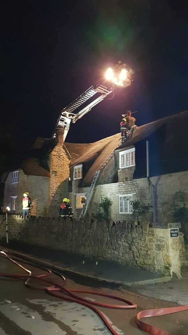
Eight fire crews were called (Image: Wincanton Fire Station)
Listing Details
|
Entry Name: 21, Woolston Road
Listing Date: 24 March 1961 Grade: II* Source: Historic England Source ID: 1056206 English Heritage Legacy ID: 262096 Location: North Cadbury, South Somerset, Somerset, BA22 County: Somerset District: South Somerset Civil Parish: North Cadbury Built-Up Area: North Cadbury Traditional County: Somerset Lieutenancy Area (Ceremonial County): Somerset |
Coordinates
Latitude: 51.0434 / 51°2'36"N Longitude: -2.5212 / 2°31'16"W OS Eastings: 363555 OS Northings: 127247 OS Grid: ST635272 Mapcode National: GBR MT.GK21 Mapcode Global: FRA 56LC.CL4 |
18 April 2019 (12:50) - Dramatic thatched roof fire extinguished near Stowmarket
Fire fighters have put out a dramatic thatched roof fire near Stowmarket which saw 22 crew members attend. The service was called at around 12.50pm today to reports of smoke coming from the roof of a property in Tile Row, Moats Tye and 10 engines were mobilised from across Suffolk to the scene. Nine engines attended the house and four remain to ensure the fire doesn't start up again.
The fire was in the roof space of the property and firefighters used ladders to access the roof, stripping the thatch away to access the roof space below. They also used thermal imaging cameras to locate the seat of the fire so that they could target it and prevent it from catching the rest of the roof. A fire break has been used to prevent the spread of the ongoing fire.
Sue Meek, her heavily-pregnant daughter Sarah-Jane and Sarah-Jane's partner Bradley Benson could only look on in horror as thatchers working on the roof tried to battle the fire at the house, before the arrival of the fire service. Firefighters had to rip away a large part of the new thatch to create a fire-break before they could start using water to douse the flames. Mrs Meek said: “All I could do was stand there and watch thinking 'my house is on fire'. It's heartbreaking. Today was the final day of eight weeks of having the thatch done, I was so looking forward to being able to sit down and have a glass of wine and admire the new roof. Now it's all been ripped to pieces.”
Mrs Meek, whose carpenter husband Ray was working 60 miles away in Billericay in Essex at the time and rushed back, said she was in the garden of the house - a former chapel and meeting house, parts of which date back to the 16th century - when she noticed the power to a pond-pump suddenly go off. “I thought it had tripped at first but then I looked up and saw the thatchers on the roof trying to damp a fire down.They said they had no idea what had caused it, just that they had heard a bang,” she said. “I ran into the house and shouted to Sarah-Jane and Bradley to get the pets and get out, and then I rang the fire brigade.”
The fire started at around 12.50pm and Mrs Meek said although it did not appear to have caused any structural damage there was a lot of mess on the top floor from where the firefighters had tackled the flames from underneath. But she added: “I'm just so glad no-one has been hurt. The thatchers were brilliant, they could have come off the roof but instead tried to put the fire out until the fire brigade got there, who also did a brilliant job.” Sarah-Jane said she was due to give birth in two weeks and had been playing music in her bedroom with Bradley when the power went off. “Mum was down by the pond when she shouted that the thatch was on fire and to get out,” she said. “We just couldn't believe it. I'm two weeks away from giving birth and supposed to be keeping as calm as possible - we just don't know what's going to happen now.”
Station Commander Mark Walker of Bury St Edmunds fire station was the incident commander. He said tackling the fire had involved six fire engines plus an aerial platform from Ipswich, an incident command vehicle from Ixworth and a water bowser from Newmarket. The fire was confined to the roof of the property and firefighters used ladders to gain access, stripping the thatch away to access the roof space below. They also used thermal imaging cameras to locate the seat of the fire so that they could target it and prevent it from catching the rest of the roof. “It was a small fire in the thatch confined to an area around the eletrical intake,“ he said. “We are still investigating the cause and the UK power networks will also investigate. The crews were forced to make a break in the thatch by cutting a channel two metres back from the fire, we couldn't extinguish it straight away because of the electrical issue. Making a break allowed us to contain the fire until we could isolate the power into the house and we were then able to put it out.”
The house is Grade II listed and was originally built, possibly as three houses, in the 17th century, but then converted to a Gospel Hall in the 19th century. Converted into a single house in the 20th century.
News Source: EADT
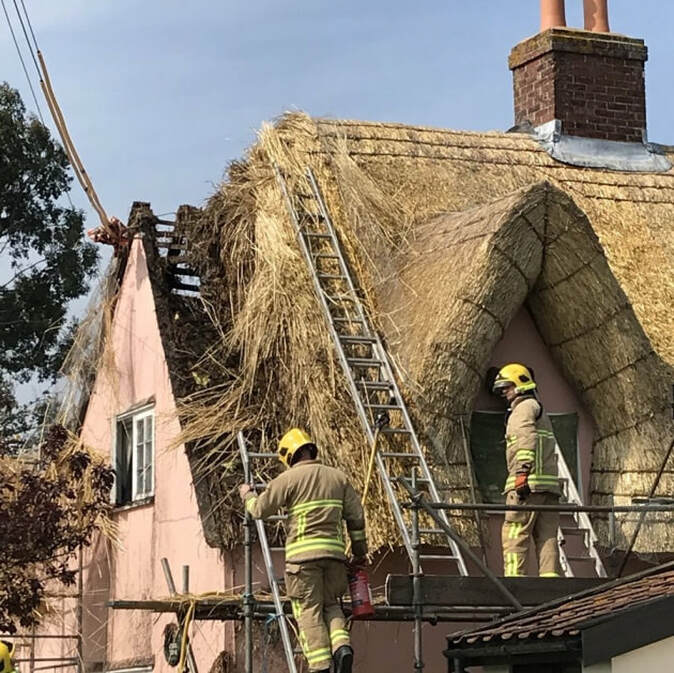
Thatch fire in Moats Tye (Picture: Suffolk Fire and Rescue Service)
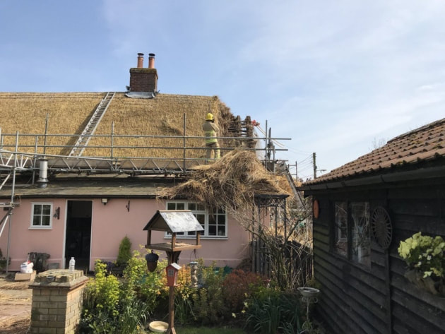

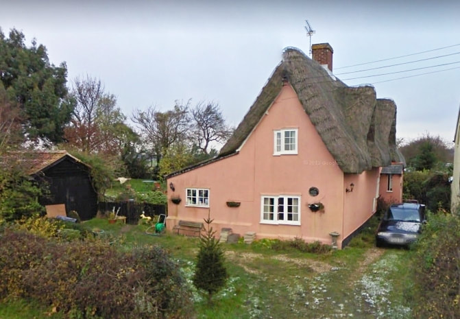
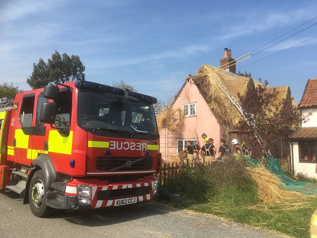
Listing Details
|
Entry Name: Moats Tye Gospel Hall
Listing Date: 22 January 1988 Grade: II Source: Historic England Source ID: 1352172 English Heritage Legacy ID: 279841 Location: Combs, Mid Suffolk, Suffolk, IP14 County: Suffolk District: Mid Suffolk Civil Parish: Combs Traditional County: Suffolk Lieutenancy Area (Ceremonial County): Suffolk Church of England Parish: Combs St Mary Church of England Diocese: St.Edmundsbury and Ipswich |
Coordinates
Latitude: 52.159 / 52°9'32"N Longitude: 0.987 / 0°59'13"E OS Eastings: 604409 OS Northings: 255396 OS Grid: TM044553 Mapcode National: GBR SJZ.QB1 Mapcode Global: VHKDP.2Z4T |
17 April 2019 (20:00) - The Old Ship evacuated after fire starts in skittle alley
A pub in Weymouth had to be evacuated due to a fire. The incident happened at The Old Ship at Upwey on Wednesday night. Dorset & Wiltshire Fire and Rescue Service was called at 8pm. A spokesman for the fire service said: “One crew from Weymouth, two crews from Dorchester and the aerial ladder platform from Weymouth attended. Crews found a small fire in a light fitting and lagging above. The fire was extinguished by removal. The stop message was received at 8.27pm and all crews were back to their stations by 8.45pm.”
Kate Knight, the pub’s licensee, said the fire started in the skittle alley due to a problem with a set of lights. She added: “The fire alarm went off and the pub had to be evacuated. Luckily it wasn’t raining.” Station manager Sean Blizzard, who attended the incident, said: “This was a small fire, but I would like to take the opportunity to remind people to ensure light fittings and halogen lamps have space around them to allow them to cool down after use.”
Set in the beautiful village of Upwey, the 17th century pub is steeped in history and features in Thomas Hardy’s novel ‘Under the Greenwood Tree’. Strangely, the pub is unlisted but it lies within the Upwey Conservation Area.
News Source: Dorset Echo
The Old Ship inn at Upwey
17 April 2019 (09:02) - Fire at Boston town centre coffee shop
Firefighters were called to a fire at a coffee shop in Boston town centre this morning (Wednesday, April 17). Appliances from Boston and Leverton, including one equipped with an aerial ladder platform, attended the outbreak at Caffè Nero, in Strait Bargate. They were called to the incident – a fire in an air conditioning unit – shortly after 9am. Moderate damaged was caused by heat and smoke to the unit, a spokesman for the fire service said. Caffè Nero has been approached for a comment, but are yet to respond.
Caffè Nero occupies an early 19th century Georgian building. It is not listed, but is designated as a “Sensitive Building” in the Townscape Heritage Project area within Boston’s Town Centre Conservation Area.
News Source: Boston Standard
Caffè Nero occupies an early 19th century Georgian building. It is not listed, but is designated as a “Sensitive Building” in the Townscape Heritage Project area within Boston’s Town Centre Conservation Area.
News Source: Boston Standard
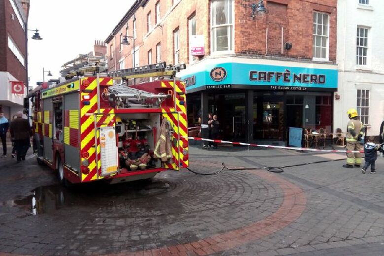
The scene in Strait Bargate this morning.
Near Miss
17 April 2019 (08:00*) - Commuter train catches fire at Basingstoke station
17 April 2019 (08:00*) - Commuter train catches fire at Basingstoke station
A commuter train service caught fire while at Basingstoke railway station this morning. The 07.59 South Western Railway service to London Waterloo caught fire while at platform three of the station with flames visible outside one of the carriages. Train users were evacuated from the service. Services to London Waterloo are unaffected by the earlier fire.
Hampshire and Fire Rescue Service has said none of its services was called to the incident. A SWR spokesperson said: "As soon as staff were aware of the issue, passengers were safely evacuated from the train onto the platform at Basingstoke station. The emergency services were not called as the small fire extinguished itself shortly after 08.00 and there were no reports of smoke inhalation. We will investigate the cause of this incident and have sent the train to the depot so that it is now out of passenger service.”
The railway station, including platforms, platform buildings, canopies, subways, and station buildings are Locally Listed. They date mainly from 1903/4 but incorporate remnants from an earlier smaller station of 1855, which itself replaced what is thought to have been an earlier temporary station of 1839.
News Source: Basingstoke Gazette
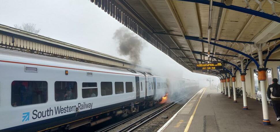
The 07.59 South Western Railway service to London Waterloo caught fire
16 April 2019 (23:34) - Road closed due to huge fire at historic building
A huge fire has destroyed an historic Georgian building in Devon, and a main road remains closed this morning with firefighters from across Devon still at the scene.The blaze, at a Grade II listed property in Bradninch, near Cullompton, was first reported shortly after 11.30pm last night. West End Road, the main route through the village in Mid Devon, remains closed in both directions - and Devon and Somerset Fire and Rescue Service say the incident in ongoing. All the house's residents were accounted for, but Search and Rescue teams were called in to monitor the building's structure. The house lies within the Bradninch Conservation Area.
A spokesperson for the fire service said: "After numerous calls to the control room stating there were flames coming from the roof of a property in Bradninch, three fire appliances from Cullompton, Middlemoor and Danes Castle were mobilised to the incident along with an aerial ladder platform from Danes Castle and an officer. Due to the number of calls being received fire control mobilised a 4th fire engine from Tiverton. Very shortly after the first fire engine was in attendance they requested a further two fire engines which came from Tiverton and Danes Castle along with an incident command unit from Honiton, a welfare pod from Crediton and a further two officers after stating the roof was well alight on the large domestic property."
Western Power were requested to isolate the power line close to the building. Information from the incident suggested there was a fire involving the loft space and flames had broken through the roof. Crews were at work with two hose reel jets to extinguish the fire. Just after midnight, crews were searching the ground floor of the property to isolate utilities and begin salvage operations.
Just before 2am the fire service reported that the building consisting of two floors measuring approximately 50m by 10m, used as a domestic property, has 100% roof damage, 50% damage to the first floor and 30% damage to the ground floor. At this time there was 1 aerial appliance in use, 2 hydrants, 1 water bowser, 3 hose reel jets, 2 main jets, 2 breathing apparatus wearers and salvage was complete. Western power were in attendance isolating power, a cordon was in place due to roof collapse and police were also in attendance due to the size of the incident. A neighbour gave firefighters access to their swimming pool to supplement their water supply.
By 4am good progress was being made and 6 fire engine relief with fresh crews from Exmouth, Wellington, Witheridge, Chulmleigh, Okehampton and Dulverton were now in attendance as well as a new incident command unit from Wiveliscombe and relief personnel from Crediton for the welfare pod were in attendance. At about 6.30am there was a partial collapse to the rear of the property.
At the scene today fire chiefs have confirmed that the lack of water and narrow access in the main road through the village made the blaze difficult to fight. Luckily the occupants of the house heard smoke alarms and were able to safely evacuate the building at around 11.30pm. Crews remain at the scene today and the road is closed until the structure has been made safe. Station Manager Kevin Patterson said, The guys have done a really good job but unfortunately part of the roof has collapsed and some of the wall at the rear. The aerial ladder gives us a birds eye view but because of the roof collapse it is very difficult for us to get in there and gauge how bad the damage is. We are now scaling back our operation here - checking for hot spots and making safe." He said the cause of the fire was not yet known.
News Source: Plymouth Live
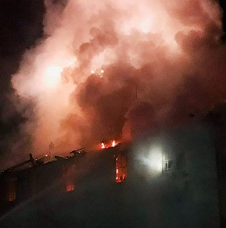

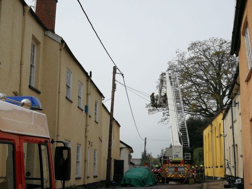
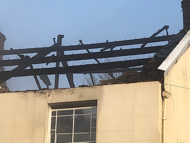
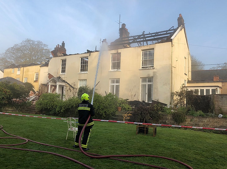
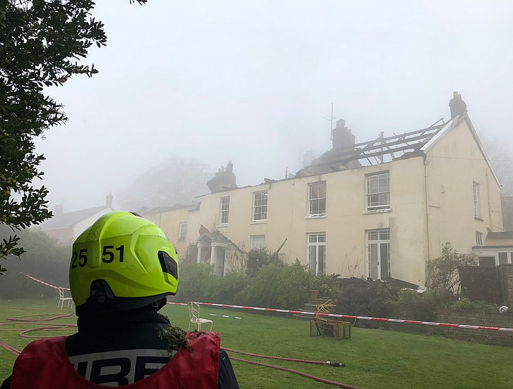
Listing Details
|
Entry Name: Earlsland
Listing Date: 11 June 1986 Grade: II Source: Historic England Source ID: 1168483 English Heritage Legacy ID: 95241 Location: Bradninch, Mid Devon, Devon, EX5 County: Devon District: Mid Devon Civil Parish: Bradninch Built-Up Area: Bradninch Traditional County: Devon Lieutenancy Area (Ceremonial County): Devon Church of England Parish: Bradninch St Disen Church of England Diocese: Exeter |
Coordinates
Latitude: 50.825 / 50°49'29"N Longitude: -3.4265 / 3°25'35"W OS Eastings: 299621 OS Northings: 103796 OS Grid: SS996037 Mapcode National: GBR LL.X9RW Mapcode Global: FRA 36QX.DWQ |
16 April 2019 (16:14) - Grade II listed building damaged by fire in picturesque village
A Grade II listed building has been badly damaged after a fire in Dorney. Firefighters from Slough , Langley and Maidenhead were sent to the fire in Lock Path, in the small village of Dorney in South Bucks. They arrived at around 4.14pm on Tuesday, April 16 to find the two-storey building on fire. When firefighters arrived all occupants of the building, which is used as cottages and flats, had evacuated. The fire started in a ground floor kitchen but due to the age of the building it quickly spread to the roof space.
A spokeswoman from the Royal Berkshire Fire and Rescue Service said: "Six firefighters in breathing apparatus used two hose reels and a jet to tackle the blaze. The crews worked for around two hours tackling the fire before extinguishing and remaining on the scene damping down to ensure that all areas affected were completely extinguished. Overall, they were on the scene for around three and a half hours. "The ground floor of the property was roughly 20 per cent damaged by the fire, the roof was roughly five per cent damaged by the fire and the whole property was damaged by the smoke." The firefighters were supported by a multi-role vehicle and three fire officers.
It is believed that the property involved is a 16th century former coach house, in the grounds of the Old Place (a Grade II listed cottage), now converted into self catering holiday flats and cottages. It lies within the Boveney Conservation Area.
News Source: Windsor Express
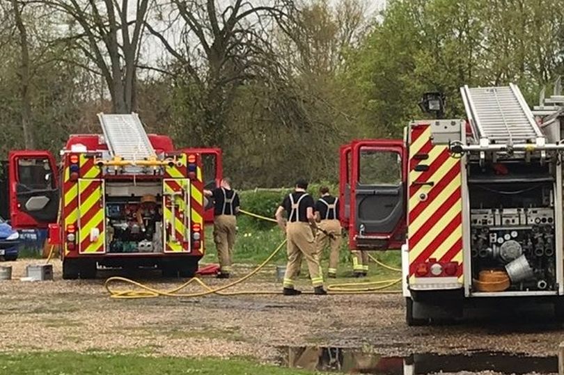
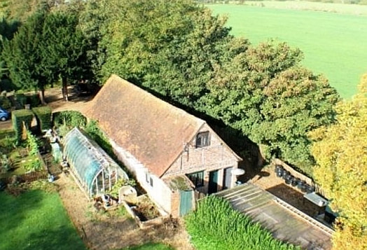
Listing Details
|
Entry Name: Barn Garage to North East of the House of the Old Place
Listing Date: 26 April 1985 Grade: II Source: Historic England Source ID: 1309417 English Heritage Legacy ID: 44031 Location: Dorney, South Bucks, Buckinghamshire, SL4 County: Buckinghamshire District: South Bucks Civil Parish: Dorney Traditional County: Buckinghamshire Lieutenancy Area (Ceremonial County): Buckinghamshire Church of England Parish: Eton Church of England Diocese: Oxford |
Coordinates
Latitude: 51.4919 / 51°29'30"N Longitude: -0.6478 / 0°38'52"W OS Eastings: 493973 OS Northings: 177861 OS Grid: SU939778 Mapcode National: GBR F8B.K17 Mapcode Global: VHFT7.QRDP |
15 April 2019 (18:15) - Fire service fight chimney fire at Ancient pub
Firefighters are tackling a chimney fire in a historic pub in Thornham Magna. Suffolk Fire and Rescue Service were called at 6.15pm to reports of a fire in the chimney space of The Four Horseshoes Inn, in Wickham Road. Five fire engines from Diss, Harleston, Stradbroke, Eye and Debenham were all deployed to the call and firefighters remain on scene. The fire has been contained to the chimney flue and has not spread to the thatched roof of the pub, however fire officers are planning to remain on scene to ensure the fire does not spread any further. There are no reported injuries and the ambulance service have not been called.
The pub is one of the oldest buildings in Suffolk. It was originally a house, latterly three dwellings, and some parts date back to 1150. It is Grade II* listed.
News Source: EADT
The pub is one of the oldest buildings in Suffolk. It was originally a house, latterly three dwellings, and some parts date back to 1150. It is Grade II* listed.
News Source: EADT
Thankfully the chimney fire at the Four Horseshoes Inn did not spread to the thatched roof.
Listing Details
|
Entry Name: Remains of Plymouth Castle
Listing Date: 25 January 1954 Last Amended: 9 November 1998 Grade: II Source: Historic England Source ID: 1322013 English Heritage Legacy ID: 473554 Location: Plymouth, PL1 County: City of Plymouth Electoral Ward/Division: St Peter and the Waterfront Parish: Non Civil Parish Built-Up Area: Plymouth Traditional County: Devon Lieutenancy Area (Ceremonial County): Devon |
Coordinates
Latitude: 50.3659 / 50°21'57"N Longitude: -4.1345 / 4°8'4"W OS Eastings: 248289 OS Northings: 53955 OS Grid: SX482539 Mapcode National: GBR RCM.CR Mapcode Global: FRA 2872.F2L |
15 April 2019 (14:37) - Fire at Wetherspoons pub in Newark
Firecrews are currently at a report of a fire at the Sir John Arderne pub in Newark Market Place. A cordon has been set up around the Wetherspoons pub. A spokesman for Nottinghamshire Fire and Rescue Service said two engines from Newark Fire Station were on scene and the call came in at 2.37pm.
Firecrews have left now the Wetherspoons Sir John Arderne pub in Newark Market Place after putting out a fire in the basement.The fire in the basement and was put out by crews using a hose reel and fire extinguishers. No one was injured. Firefighters had dealt with the incident by 3.27pm.
It was later discovered that a discarded cigarette started the fire. The nub was dropped and fell through a grate, causing a fire in a disused basement at the Sir John Arderne in Newark Market Place. Wetherspoons said the the grate will be covered up.
The Wethersppons building was built in 1826 and became the Newark Stock Library (see History below). It is a Grade II listed building.
News Source: Newark Advertiser
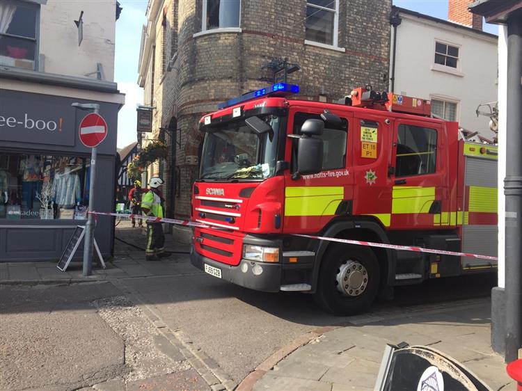
Listing Details
|
Entry Name: Ritz Video
Listing Date: 29 September 1950 Grade: II Source: Historic England Source ID: 1196277 English Heritage Legacy ID: 385080 Location: Newark, Newark and Sherwood, Nottinghamshire, NG24 County: Nottinghamshire District: Newark and Sherwood Civil Parish: Newark Built-Up Area: Newark-on-Trent Traditional County: Nottinghamshire Lieutenancy Area (Ceremonial County): Nottinghamshire Church of England Parish: Newark-upon-Trent with Coddington Church of England Diocese: Southwell and Nottingham |
Coordinates
Latitude: 53.0766 / 53°4'35"N Longitude: -0.8091 / 0°48'32"W OS Eastings: 479875 OS Northings: 353926 OS Grid: SK798539 Mapcode National: GBR CLN.08B Mapcode Global: WHFHH.JXXS |
Building History
(Researched by Heritage & Ecclesiastical Fire Protection)
J. D. Wetherspoon took over the distinctive grey brick building that had been lying empty for some months since the Ritz video store relocated to Lombard Street. Many local people however will remember it as the home of Wilkinsons furniture store which occupied the building from the 1920s until the early Seventies. For 98 years before that however it was home to one of Newark's first true libraries - the Newark Stock Library.
Established in March 1825 - more than 50 years before (Sir) William Gilstrap gave the first Free Public Library to the town - the Newark Stock Library was set up by a consortium of the town's leading citizens as a private venture to provide books "of established character and excellence" in all the main fields of human knowledge. It operated entirely on a subscription basis whereby the right to become a member and borrow books had to be bought. This of course had the effect of restricting access to those better off members of the community who could afford to pay the five guinea annual fee.
Run by a committee of 20 of its members the first task of the newly established stock library was to acquire suitable premises. These were found in the Market Place in a building previously occupied by the Misses Millhouse and their millinery business. It is not clear precisely where the Millhouses' shop was located although judging by subsequent entries in the committee's minute book it cannot have been far from the stock library's eventual home in the Ritz video building. It was in 1828 that the Stock Library received an offer from Henry Willougby, 6th Lord Middleton, to take over the upper part of a building he had recently erected in the northwest corner of the Market Place.
The ground floor already housed an institution known as the Middleton Newsroom (an entirely separate concern providing a club-like atmosphere where members could peruse copies of the latest news sheets from London and elsewhere). Its proprietors were anxious to locate a suitable tenant for the upper storey. The Stock Library with its high degree of respectability seemed ideal; a view with which the library's own management committee agreed. The building into which the Stock Library moved in 1828 had been designed by the architect William Fowler of Winterton near Brigg. Two years earlier Fowler (1761-1832) had been responsible for designing the original buildings at the Mount School in Newark and was further known for his solid and dependable work on houses for the more affluent farmers in a number of nearby Lincolnshire villages.
With the Stock Library happily ensconced in its new premises it embarked on what turned out to be almost half a century of expansion - a golden age before the openings of William Gilstrap's new Free Library during which annual reports show a small (by today's standards) but loyal membership of about 200 bringing in sufficient money to allow the book stock to be expanded to about 5,000 volumes. In 1861 the committee agreed to the building of an extension eastwards onto Church Street bringing the building to the size and dimensions we see today. The new accommodation allowed for the creation of a separate reading room on the first floor with the ground floor of the extension being let out as a shop (to Mr Upton a jeweller).
The announcement in 1881 that William Gilstrap intended to donate a new Free Public Library to the town appears initially to have caused the Stock Library only minor concern although ultimately it was to prove responsible for its downfall. A frantic resuscitation of the Stock Library's collection was initiated with the book stock being increased to about 16,000 volumes and incorporating many new popular novels in a blatant attempt to attract new subscribers. By the late 1880s however it was clear that Sir William Gilstrap's Free Library on Castlegate was significantly out-performing the old Stock Library and there were fears among the committee that with subscriptions falling and inadequate funds to purchase new books a spiral of decline was inevitable.
Economies had to be found and in addition to such measures as purchasing second-hand books the committee found itself in 1918 with the opportunity to reduce staff costs following the retirement of the then librarian Mr J. Buxton. In this pre-equal pay era the committee found it could all but half its expenditure on the librarian's salary by appointing a woman to the post. Such cost-cutting exercises allowed the Stock Library to continue for a further five years but by 1923 the decline in membership and use had reached such a level that the committee reluctantly agreed that there was no option but to bring the Newark Stock Library to a close. The building was sold to Messrs. Wilkinsons furniture store (who were by then already tenanting the ground floor) in whose hands it continued right through to the early 1970s.
15 April 2019 (12:24) - Fire at pub on Plymouth's Barbican
Firefighters from four different stations rushed to a fire at a pub in Plymouth this afternoon. A 999 call came in at around 12.24pm, reporting that there was smoke coming from the cellar of The Fisherman's Arms on Lambhay Street. Crews from Plympton, Greenbank, Ivybridge and Crownhill were dispatched to the blaze, but once crews from Greenbank and Crownhill had arrived, it was discovered there was a "small fire caused by an overheating fuse board". The manager of the pub confirmed that the pub is back open as usual, after it had to "close for an hour or so whilst Western Power changed the fuse board".
A spokesperson for Devon and Cornwall Fire Service said: "Fire Control mobilised two appliance from Greenbank and one each from Plympton and Ivybridge with the aerial appliance from Crownhill to smoke coming from the cellar. On arrival firefighters discovered a small fire caused by an overheating fuse board, power was isolated and western power called as it involved cabling on the supply side of the meter. At this point the Plympton and Ivybridge crews were returned on-route."
Reputedly the second oldest pub in Plymouth and steeped in history, it also has one of the last surviving remnants of the original Plymouth Castle wall - Grade II listed and a Scheduled Ancient Monument - located within the pub (there are many stories of hauntings).
News Source: Plymouth Live
The Fisherman's Arms Pub, The Barbican, Plymouth
Listing Details
|
Entry Name: Remains of Plymouth Castle
Listing Date: 25 January 1954 Last Amended: 9 November 1998 Grade: II Source: Historic England Source ID: 1322013 English Heritage Legacy ID: 473554 Location: Plymouth, PL1 County: City of Plymouth Electoral Ward/Division: St Peter and the Waterfront Parish: Non Civil Parish Built-Up Area: Plymouth Traditional County: Devon Lieutenancy Area (Ceremonial County): Devon |
Coordinates
Latitude: 50.3659 / 50°21'57"N Longitude: -4.1345 / 4°8'4"W OS Eastings: 248289 OS Northings: 53955 OS Grid: SX482539 Mapcode National: GBR RCM.CR Mapcode Global: FRA 2872.F2L |
15 April 2019 (05:45) - 200 year old Ye Olde Harrow pub damaged by fire
Two former pubs close to Sheffield city centre have been damaged by fires within a matter of hours.
At 5.45am this morning (15th) a fire took hold in the 200 year old Ye Olde Harrow pub in Broad Street. The road was closed for a short while as fire crews used hose reels to put the flames out. The cause is under investigation. A little over 12 hours earlier at 4.15pm yesterday (14th) a fire took hold in the Ye Olde Harrow pub a short distance away (see separate entry).
The pub has been closed for many years. Fifteen pubs once stood on Broad Street, and only the Ye Olde Harrow still stands but it is in a very sorry state, gutted and just waiting for the "Coup de Grâce" to end its long life.
From the small amount of information available it would appear that the Ye Old Harrow was constructed during the Georgian period and opened in 1822. A former tenant reported several strange experiences during their time in this pub, including encountering a dark figure, doors which closed themselves and items which disappeared and reappeared up to a month later. A former occupier of the site remembered the shadow and closing doors from the 1970s.
News Source: The Star
The 200 year old pub was in a very delapidated condition even before the fire.
15 April 2019 (05:20) - Former Green Dragon Pub in St Helens destroyed in massive fire
A fire broke out at a former pub this morning, Monday. Firefighters were sent to the derelict Green Dragon pub on Gartons Lane in Sutton Manor at 5.20am where the property was well alight. The fire has mainly affected the roof of the property. Four fire engines and a combined platform ladder were sent to the scene. Jubits Lane and Chester Lane have been closed off by police.
Klare Brereton, who lives four doors down from the former pub said: "I woke at 20 past 6 and it was being tackled then. But my elderly neighbour said it was about 5 this morning. I’ve been observing it since and it’s not slowing down. It’s awful, such a beautiful old building that has sadly been refused planning as a nursery then a car wash. Vandalism has sadly been done to the building and youths were in there last week, throwing things at cars from the upper windows. We're all very saddened by this."
Fire crews have been liaising with a building surveyor and peeling back the remaining roof tiles to allow them to continue to extinguish the flames. An investigation into the cause of the fire will take place once all the flames have been extinguished. Three engines and the combined platform ladder are still in attendance. Nearby residents and businesses are advised to keep windows and doors closed. By 4pm, all firefighting actions had ceased. Crews have carried out hot spotting on all areas of the building and there are no further signs of fire. Crews are making up equipment that is no longer in use and are preparing to hand over the site to St Helens Council. Crews have removed debris from the roadway in preparation for the roads to be re-opened. Two fire engines and the combined platform ladder remain at the scene and crew members are removing loose roof tiles.
The 104 year old pub began trading in 1915 and closed in 2014. It caught fire on three occasions in May 2016.
News Source: St Helens Star
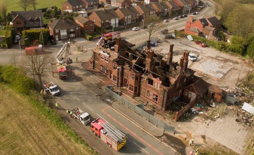
The remains of the former Green Dragon after the fire
Building History
(Researched by Heritage & Ecclesiastical Fire Protection)
Plans for Green Dragon were first submitted to St.Helens Corporation on May 26th 1913 and June 23rd 1913 by local architects J. M. Wilson and Son with the council granting building permission on June 25th. The pub makes its first appearance in an electoral register in 1915 with George Williamson as licensee, who also kept the Royal in Westfield Street. - On March 6th 1919 the St Helens licensing magistrates rejected an application from the Green Dragon for a spirit licence in addition to their beer licence. This prompted 184 residents to sign a petition calling for a change of heart. The Green Dragon’s own Tontine Society also sent in a letter of complaint. The magistrates decided to re-consider the application at their next annual meeting.
Ken Highcock described the early 1950s when his mother worked at the Green Dragon. He said the sawdust on the floor in the bar area was swept clean every day and spittoons were emptied and polished ready for the opening-time rush from the miners at Sutton Manor Colliery. Joseph Maddison was licensee at this time. The Green Dragon had an amateur Rugby League team, which in 1975 were admitted to the North West Counties Division 3.
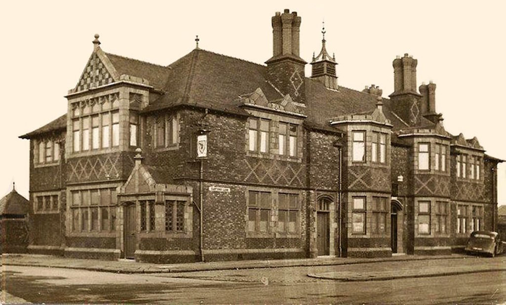
14 April 2019 (20:41) - Fire at former North Worcestershire Golf Club in Northfield
A golf course's derelict clubhouse has been severely damaged in a fire overnight. About 40 firefighters tackled the blaze after the 20:41 BST callout to the former North Worcestershire Golf Club in Birmingham. Crews worked on different sections of the building to tackle severe flames, West Midlands Fire Service said. Fifteen firefighters remained at the site on Hanging Lane, Northfield, on Monday to check for hotspots. The cause of the fire is set to be investigated.
Cllr Olly Armstrong, Labour, Northfield thanked firefighters, saying: “The local community and I are as always, thankful and proud of our firefighters swiftness and bravery in putting the fire out.” He added: “It is a great shame that the golf course clubhouse has mysteriously burnt down days after the government decision to build/not to build on the green grounds was delayed once again.”
The club closed in 2016 due to financial difficulty and the clubhouse suffered an earlier severe deliberate fire on the 18th September 2017, just three weeks after Bloor Homes had planning permission for a 950 home housing development rejected by Birmingham City Council. The roof of the club house was totally destroyed, as well as 30% of the first floor. At the time, Cllr Ian Cruise, Independent, Longbridge said: “I’m saddened to hear of the fire that has all but destroyed the club house at North Worcestershire Golf Course, as the building as well as the course has been a part of the local area for over 100 years.”
Following the arson, the council approved demolition of the clubhouse in January 2018, but this has not yet been carried out. Bloor Homes have submitted an appeal to the government’s Planning Inspectorate to overturn the council’s decision on their proposals for a housing development on the site, reducing the number of homes in the plan to 800. Following a public enquiry, a decision on the appeal was originally expected from the Secretary of State for Housing, Communities and Local Government, James Brokenshire MP in March but no decision has yet been reached.
The club was founded in 1907 and the present clubhouse opened 100 years ago, in 1919.
News Source: BBC News
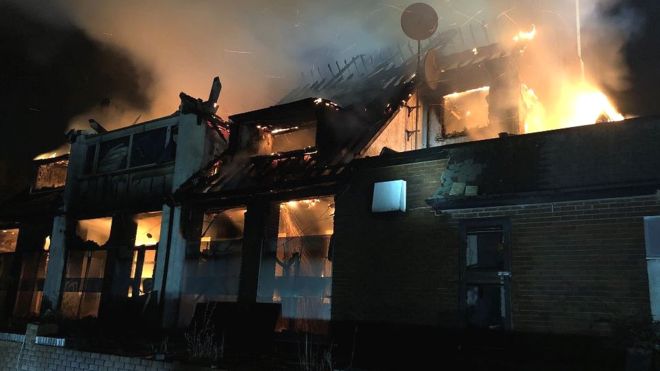
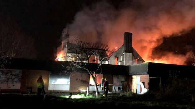
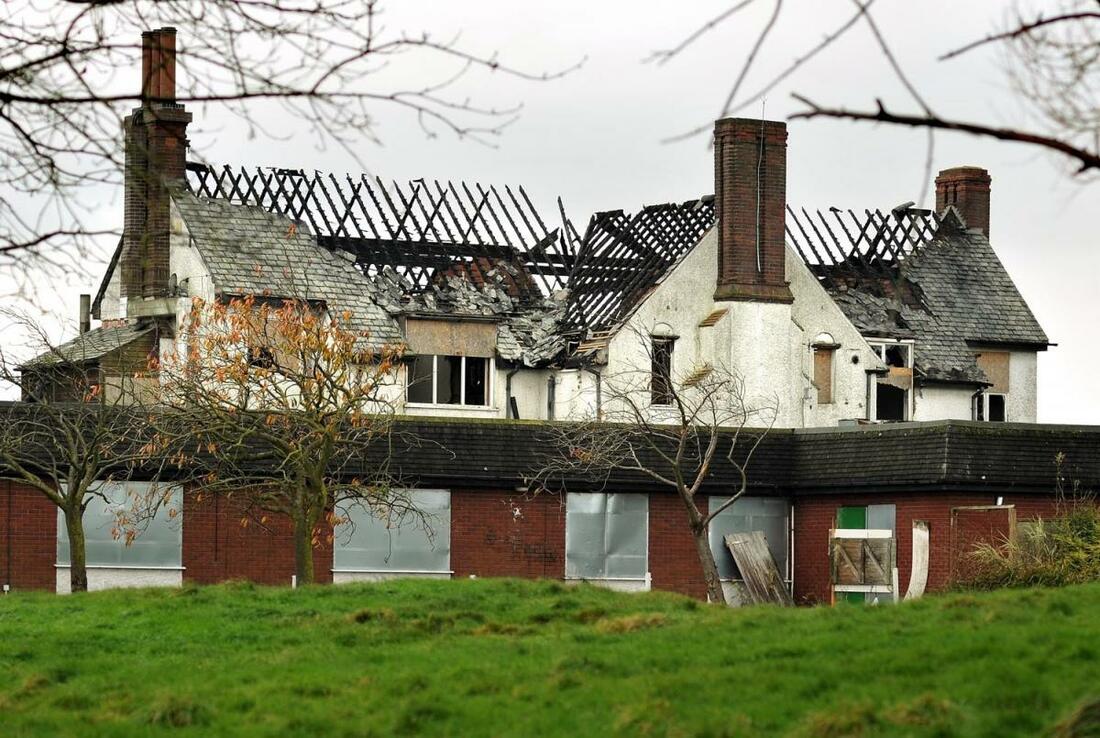
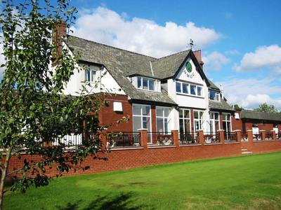
14 April 2019 (16:15) - Picture shows fire engulfing former Sheffield pub
Two former pubs close to Sheffield city centre have been damaged by fires within a matter of hours.
Arsonists set fire to the former Old Durham Ox in Cricket Inn Road yesterday (14th) at 4.15pm. Firefighters wearing breathing apparatus went into the building and used hose reels to put the blaze out. A little over 12 hours later at 5.45am this morning a fire took hold in the Ye Olde Harrow pub a short distance away (see separate entry).
The Durham Ox is situated at 15 Cricket Inn Road, off Broad Street. This 150 year old pub opened in 1862 and closed in 1993. The pub bears the name Durham Ox after the bull calf bred by Charles Colling ay Ketton Hall in 1796. Originally christened "The Ketton Ox" it becane a national celebrity as "The Durham Ox" when in 1801 the titanic animal was purchased for the very large sum of money by John Day of Harmston near Lincoln. He took the beast on tour of the country in a specially constructed carriage pulled by 4 horses. It was on show in London for a whole year alone. The bull died 15 April 1807.
News Source: The Star
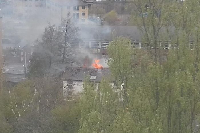
The Durham Ox on fire
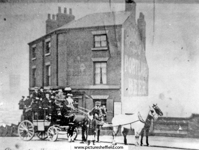
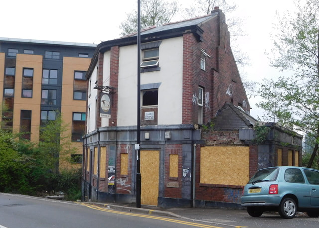
13 April 2019 (22:00*) - Firefighters tackle small blaze at The Entertainer store on Foregate Street, Chester
Crews were called to the scene of a ‘small fire’ The Entertainer over the weekend. At around 10pm on April 13, Cheshire Fire and Rescue Service were called to a report of a smoke alarm sounding at the toy store on Foregate Street. Two fire engines attended, one from Chester and one from Powey Lane, and discovered a fire exit door smouldering on arrival. Firefighters removed the door and extinguished the small fire with water before using a large fan to clear smoke from the store. A spokesman confirmed that the officers were in attendance for more than an hour.
The building is Grade II listed and was built between1904-5. It was designed by Douglas and Minshull as a Cooperative department store, for the Chester Cooperative Society.
News Source: The Standard
The building is Grade II listed and was built between1904-5. It was designed by Douglas and Minshull as a Cooperative department store, for the Chester Cooperative Society.
News Source: The Standard
The Entertainer Store in Foregate Street, Chester
Listing Details
|
Entry Name: 78-94, FOREGATE STREET
Listing Date: 23 July 1998 Last Amended: 11 September 2000 Grade: II Source: Historic England Source ID: 1375805 English Heritage Legacy ID: 469784 Location: Cheshire West and Chester, CH1 County: Cheshire West and Chester Electoral Ward/Division: Chester City Built-Up Area: Chester Traditional County: Cheshire Lieutenancy Area (Ceremonial County): Cheshire Church of England Parish: Chester St John the Baptist Church of England Diocese: Chester |
Coordinates
Latitude: 53.1913 / 53°11'28"N Longitude: -2.8843 / 2°53'3"W OS Eastings: 341009 OS Northings: 366391 OS Grid: SJ410663 Mapcode National: GBR 7B.2V65 Mapcode Global: WH88F.N1PS |
13 April 2019 (18:12) - Fire at thatch cottage in Brighstone
Firefighters have been attending a fire at a thatched cottage in Brighstone this evening (Saturday). Crews were called out to reports of a domestic fire in the west Wight village at 6.12pm. A spokesperson for the fire and rescue service said two crews from Newport Fire Station were dispatched to the scene at Limerstone Road, Brighstone. The fire, which had started on a cooker, was out by the time firefighters arrived. Firefighters isolated the cooker and made sure the property was safe. By 6.30pm, crews were preparing to leave.
At this stage the identity of the cottage is not clear as there are several thatched cottages off Limerstone Road, all of which are Grade II listed.
News Source: County Press
At this stage the identity of the cottage is not clear as there are several thatched cottages off Limerstone Road, all of which are Grade II listed.
News Source: County Press

There are many listed buildings in the area of Limerstone Road
13 April 2019 (16:28) - Joan Collins fire horror as 'terrifying' blaze ravages home
Joan Collins has been treated for smoke inhalation after a 'terrifying' fire tore through her London home yesterday evening. Shocking images taken after the blaze was extinguished show the charred and crumbling interior of the 85-year-old actress's exclusive Belgravia flat. Two fire engines and ten firefighters battled the flames which engulfed the first floor of a seven-storey apartment block. And a video on Collins's Instagram lays bare the damage caused by the fire which has devastated her home. The Golden Globe-winning actress took to Twitter to thank emergency services teams and also her husband, 54-year-old film producer Percy Gibson, who she hailed a 'hero' for fighting the flames before the couple fled from the burning building.
She wrote: “Thank you from the bottom of my heart the marvelous London Fire Brigade who attended to the terrifying fire yesterday in our flat. My hero Percy had already doused the flames consuming the entire wall with handheld extinguisher.” She added: “And thanks also to NHS England Ambulance crew who took care of our smoke inhalation and comforted me. And the wonderful Met Police who kept the street closed and everyone safe.”
London Fire Brigade said the blaze took over an hour to quash but the cause of the fire remains a mystery. The force said: “Two fire engines and around 10 firefighters were called to a fire at a flat in Belgravia. Part of a flat on the first floor of the seven-storey building was damaged by the fire. Two people left the property before the Brigade arrived. The Brigade was called at 4.28pm and the fire was under control by 5.36pm. Two fire engines and a turn table ladder from Soho fire station attended the scene. The cause of the fire is under investigation.” Collins, a Dame, is best known for her role as Alexis Colby in the 1980s soap opera Dynasty. Collins married film producer Percy Gibson, 54, in 2002.
The building is part of the grand terrace of numbers 1 – 31 Eaton Place in Belgravia, London. The terrace is Grade II* listed and was built in the early 19th century. This particular house was lived in by William Thompson, Lord Kelvin, who was a physicist and mathematician. He is best remembered for devising the absolute temperature scale, now called the 'Kelvin scale'.
News Source: Mail Online
London Fire Brigade said the flat (pictured) blaze took over an hour to get under control but the cause of the fire remains a mystery
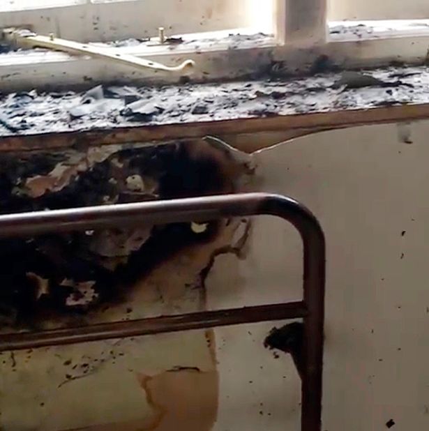
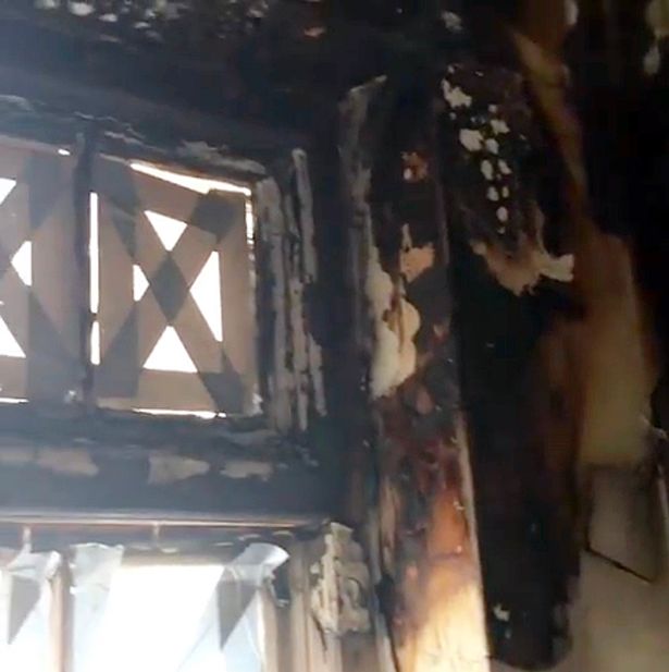
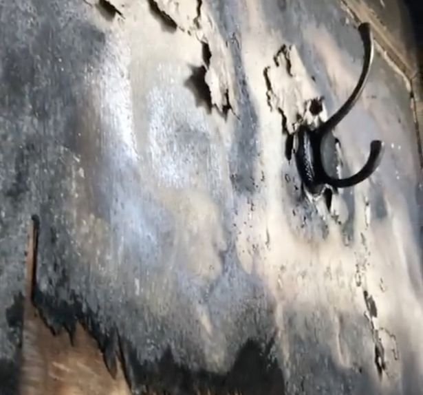
Listing Details
|
Entry Name: Nos. 1-31, EATON PLACE; Nos. 17, 18 AND 19 BELGRAVE PLACE AND ADJOINING MEWS ARCH
Listing Date: 24 February 1958 Grade: II* Source: Historic England Source ID: 1290194 English Heritage Legacy ID: 209563 Location: Westminster, Greater London Authority, SW1X County: London District: City of Westminster Electoral Ward/Division: Knightsbridge and Belgravia Built-Up Area: City of Westminster Traditional County: Middlesex Lieutenancy Area (Ceremonial County): Greater London Church of England Parish: St Peter Eaton Square Church of England Diocese: London |
Coordinates
Latitude: 51.498 / 51°29'52"N Longitude: -0.1517 / 0°9'6"W OS Eastings: 528396 OS Northings: 179290 OS Grid: TQ283792 Mapcode National: GBR BK.35 Mapcode Global: VHGQZ.BM50 |
13 April 2019 (14:45) - Padstow shop fire damages Shipwrights Inn
Firefighters have tackled a blaze at a shop near Padstow harbour in Cornwall. The fire broke out in the Mountain Warehouse shop in North Quay in the Cornish fishing town at 14:45 BST. A spokesman for St Austell Brewery said an adjacent pub - The Shipwrights Inn - was damaged. The building was evacuated and no-one was hurt. At the height of the blaze, retail director for the brewery Steve Worrall, said: "Emergency services are currently at the scene and our staff are awaiting permission from the fire service to re-enter the building. The safety and well-being of our staff and customers is our main priority. Our thoughts are with our neighbours on North Quay affected by today's incident."
Aidan Treglown, who watched the incident unfold from the Harbour Hotel, says he's seen nine fire engines arriving on the scene and fire crews are on the roofs of neighbouring properties trying to hose down the flames. He said the emergency vehicles were struggling to get through the crowds as the fire took hold. He felt it "wasn't very helpful" that pedestrians were getting in the way of the trucks as they tried to navigate the busy harbour. “I was in the restaurant and we saw the fire trucks going down to the harbour. The police set up barriers around the pub so nobody can get to where the fire is but the crowds were causing a bit of a delay. It is always a nightmare in the harbour but getting over there was an issue. The first crews definitely were delayed a few minutes. As the barriers went up the people were condensed into a smaller area of the harbour and it got worse. I don't expect it caused any major delays but it wasn't very helpful."
Shops all along the harbour front were evacuated and the ferry had to be redirected. Mr Treglown said two of the holiday cottages he manages are among those that have been evacuated. "We're having to try and relocate holiday guests," he said. "We're trying to confirm with the fire brigade if they'll be allowed back in." By 4pm, around a dozen fire engines were in the harbour, as well as two police cars and an ambulance. Cornwall Fire and Rescue Service said crews from seven fire stations attended and crews have remained on scene to make sure the fire was out.
The Shipwrights Inn is a Grade II listed 18th century building that was originally warehousing and possibly a ship builders yard.
News Source: BBC News
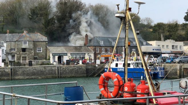
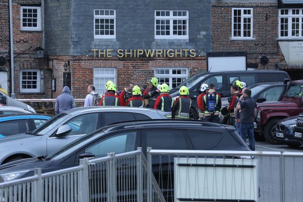
Listing Details
|
Entry Name: The Shipwrights
Listing Date: 24 April 1953 Last Amended: 20 May 1988 Grade: II Source: Historic England Source ID: 1212005 English Heritage Legacy ID: 396520 Location: Padstow, Cornwall, PL28 County: Cornwall Civil Parish: Padstow Built-Up Area: Padstow Traditional County: Cornwall Lieutenancy Area (Ceremonial County): Cornwall Church of England Parish: Padstow Church of England Diocese: Truro |
Coordinates
Latitude: 50.5423 / 50°32'32"N Longitude: -4.9374 / 4°56'14"W OS Eastings: 191967 OS Northings: 75516 OS Grid: SW919755 Mapcode National: GBR ZM.YVPF Mapcode Global: FRA 07KM.L8Z |
13 April 2019 (13:03) - Gas explosion at Derby's Cathedral Quarter Hotel
A gas explosion at Derby’s Cathedral Quarter Hotel saw glass from two windows blown out of the building and on to the street earlier today. Emergency crews were called to the scene, in St Mary's Gate, and a senior firefighter confirmed no-one was hurt in the blast which happened at around 1pm at the four-star, 18th century Grade II listed hotel. Guests were evacuated to the Old Bell Hotel, in nearby Sadler Gate. One eyewitness said he heard a “loud bang” and then saw staff leaving the front door. Firefighters cordoned off the area while they investigated the cause of the explosion and crews were seen sweeping glass from the front of the hotel.
Watch Manager Rick Asher is the incident commander. He said: “We received a call at 1.03pm to reports of a gas explosion at the Cathedral Quarter Hotel. On inspection two of the windows on the first floor have smashed but there is absolutely no damage to anywhere else inside the building. We believe the explosion was caused by a small aerosol gas canister which was in the kitchen area. No one has been hurt and gas engineers have been here to check the situation and ensure everything is safe.”
Passerby Zac Thompson said he was shocked to hear there had been a gas explosion. The 29-year-old said: “You can see how badly damaged the windows are. They must have been blown out from the inside. I’m glad to hear no one has been hurt.” The cordon was partly lifted at around 3.15pm but one car, a Land Rover Discovery, was still behind a smaller cordon. It had glass on its roof and bonnet from the first floor windows which had been blown out.
The hotel lies within the Derby City Centre Conservation Area.
News Source: Derbyshire Live
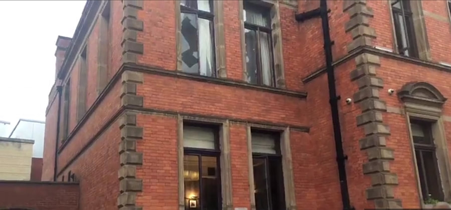
Windows were blown out in the explosion
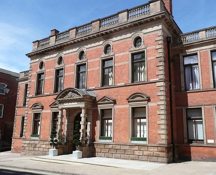
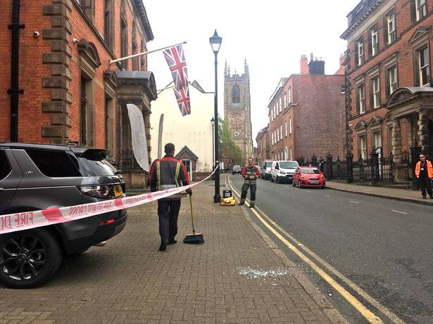
Listing Details
|
Entry Name: Former Rural District Council Offices
Listing Date: 24 February 1977 Grade: II Source: Historic England Source ID: 1229219 English Heritage Legacy ID: 404019 Location: Derby, DE1 County: City of Derby Electoral Ward/Division: Arboretum Built-Up Area: Derby Traditional County: Derbyshire Lieutenancy Area (Ceremonial County): Derbyshire |
Coordinates
Latitude: 52.9246 / 52°55'28"N Longitude: -1.48 / 1°28'47"W OS Eastings: 435058 OS Northings: 336476 OS Grid: SK350364 Mapcode National: GBR PJD.PZ Mapcode Global: WHDGT.7RHB |
Building History
(Researched by Heritage & Ecclesiastical Fire Protection)
Number 16 St. Mary's Gate was built in 1894-5 for the newly established Derbyshire County Council. The building was designed in 1893 by John Somes Story of Derby, the County's architect. It was intended as administrative offices and a police station, the latter being situated at the rear, approached from Walker Lane. The building was opened in 1895. A further, free standing, addition for the Weights & Measures Department was built 1895-96.
In 1954 it was adapted as education offices on lease to Derby Borough. In 1974 it continued in this role under the aegis of the County Council In 1996 it was taken over by the Derbyshire Police and administrative offices and as a police museum. The Finesse Collection bought the building in 2006 and spent 2 years converting it in to Cathedral Quarter Hotel which opened in May 2008.
Many original features remain and have been enhanced and celebrated in the redesign. The grand foyer has been painstakingly restored with specialists working on the original mosaic floor and the Scaglioli marble pillars and staircase. Now with a specially commissioned Scagliola reception desk, the latest design of Romo fabric furniture and a 1st edition two piece bespoke 'Whitehurst' clock designed especially for the development by Smith of Derby. Other original features have been maintained including the bank-vault which now houses a chilled wine cellar with guest viewing window and tasting table.
12 April 2019 (15:55) - Roof fire in Lynsted near Sittingbourne
Kent Fire and Rescue Service was called to a fire in the roof of a property in Lynsted Lane, Lynsted near Sittingbourne. On arrival crews were faced with a well developed fire in the roof of a semi-detached family home. Crews worked hard to tackle the fire and to prevent it from spreading using hose reel jets and a fog spike. Crews also used a height vehicle to gain perspective of the fire and to support inspection of the roof structure.
Firefighters were able to rescue two pet dogs from the property. There were no reported injuries. KFRS Volunteer Response Team and the Red Cross Volunteers were called to help the family with emotion and welfare support. The roof suffered severe fire damage while the rest of the property suffered extensive smoke, heat and water damage. It is believed the fire was started due to a discarded cigarette in the garden, which set fire to dry contents that spread to a log pile, fencing and then to the wooden exterior of the kitchen before making its way to the roof space. It is thought to have been accidental. The alarm was raised by the neighbour who could see the fire in the roof.
Neighbour Kim Webb, 62, said: “It was lucky it was the Easter school holidays as no one was in the house. The family had taken their two children out for the day. I was only home because I was about to take my cat Dolly to the vet. I could smell smoke and thought it was a bonfire. When I went to check I saw an orange ball of flame in the middle of one of the fence panels. By then it was too big for a hose pipe so I called 999. While I was on the phone the fire spread to the low roof. I told the operator ‘Oh God, the house is on fire!’ We were so lucky no one was hurt but I keep thinking about what might have happened. It doesn’t bare thinking about.” A fire wall in the loft stopped the blaze spreading to her part of the house. She added: “The firefighters were wonderful. They were so calm and efficient. They even let me rescue my daughter’s childhood teddy bear Loopy from her bedroom when it was safe.”
A Kent Fire and Rescue Service spokesman said: “It is believed the fire was started by a discarded cigarette in the garden which spread to a log pile, fencing and then to the wooden exterior of the kitchen before making its way to the roof space. The roof was destroyed and the rest of the property was damaged by smoke, heat and water. Firefighters are urging people who smoke to always fully extinguish their cigarettes in ashtrays and to never just thrown them away - especially into the garden.
The semi-detached houses, listed as “Bogle Harnetts”, but known locally as 1 & 3 Harnetts, Bogle, is Grade II listed and dates back to the 15th century. It is one of the oldest in the village. Joanna Harnett of Conyer inherited the building in 1674, referred to as "Som'tye" in 1487. It was clad with white painted brick in 1675 and a plaque with that date placed above the door.
News Source: Kent Online
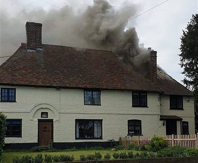
Smoke billows from the 15th century house on fire in Lynsted lane, Lynsted. (Picture: Simon Cooper)
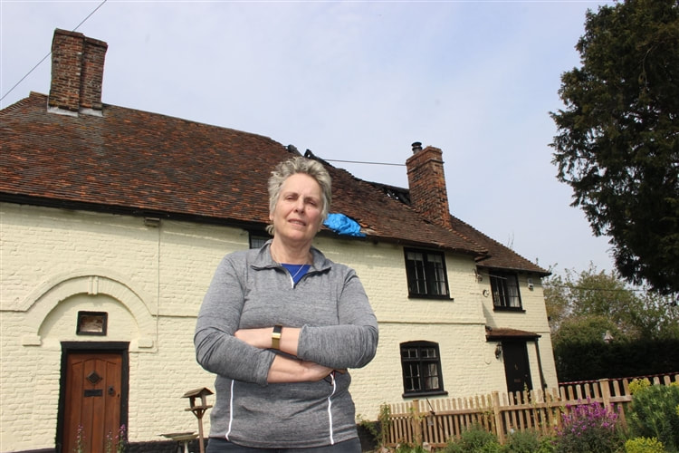
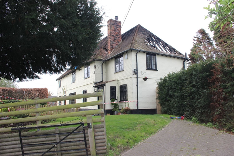
Listing Details
|
Entry Name: Bogle harnetts
Listing Date: 27 August 1952 Last Amended: 21 March 1985 Grade: II Source: Historic England Source ID: 1325953 English Heritage Legacy ID: 176288 Location: Lynsted with Kingsdown, Swale, Kent, ME9 County: Kent District: Swale Civil Parish: Lynsted with Kingsdown Traditional County: Kent Lieutenancy Area (Ceremonial County): Kent |
Coordinates
Latitude: 51.3192 / 51°19'8"N Longitude: 0.7927 / 0°47'33"E OS Eastings: 594697 OS Northings: 161486 OS Grid: TQ946614 Mapcode National: GBR RTN.96T Mapcode Global: VHKJT.P3DK |
Near Miss
12 April 2019 (12:02) - Large firefighter presence seen in Bath city centre as crews tackle paper fire
12 April 2019 (12:02) - Large firefighter presence seen in Bath city centre as crews tackle paper fire
Firefighters were called to Bath this afternoon (Friday, 12 April) to tackle a fire in the city centre. There was a heavy emergency services presence, with several fire engines and personnel attending the scene, but the incident itself was a relatively small one.
A spokesman for Avon Fire and Rescue: "We were called at 12.02pm to reports of a fire at Bath Street. Two crews from bath, one crew from Temple and one crew from Kingswood attended the incident. Firefighters found a fire involving a small amount of paper. At the moment, the cause of the ignition is unknown."
Firefighters appeared to be entering a basement access hatch in the pavement outside Ecco Shoes at number 2 Bath Street. The building comprising of 1 – 8 Bath Street is a Grade I listed Georgian building with a foundation stone dated 1791.
News Source: Somerset Live
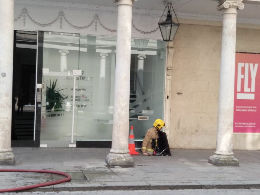
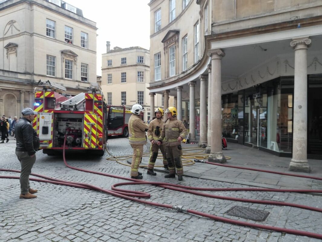
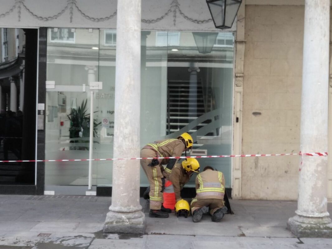
Listing Details
|
Entry Name: 1-8, Bath Street
Listing Date: 12 June 1950 Last Amended: 15 October 2010 Grade: I Source: Historic England Source ID: 1394178 English Heritage Legacy ID: 509577 Location: Bath and North East Somerset, BA1 County: Bath and North East Somerset Electoral Ward/Division: Abbey Built-Up Area: Bath Traditional County: Somerset Lieutenancy Area (Ceremonial County): Somerset |
Coordinates
Latitude: 51.3807 / 51°22'50"N Longitude: -2.3607 / 2°21'38"W OS Eastings: 374994 OS Northings: 164693 OS Grid: ST749646 Mapcode National: GBR 0QH.9ZM Mapcode Global: VH96M.1KCD |
Building History
(Researched by Heritage & Ecclesiastical Fire Protection)
Bath Street was designed by Baldwin and built under the provisions of the 1789 Bath Improvement Act. The first stone was laid on 31 March 1791. The result, linking the Cross Bath and the King’s Bath, was an exemplary piece of neoclassical town improvement showing the influence of the Adams. The colonnades were intended to shelter pedestrians, and showed the influence of thoroughly up-to-date thinking, influenced by French examples, of planned shopping developments.
No. 8 is of particular interest. Built in 1797 to Palmer’s designs (re council minute books) it was opened as Bath Corporation's `House of Antiquities’ in 1800, it was later the house of the Master of the Baths. The statues, of King Coel and King Edgar, are late C15, and were salvaged from the old Guildhall on its demolition in 1775. This museum has been described as `probably the earliest archaeological museum in Britain to be established by a municipal authority’ (Woodward), and shows Bath’s precocious sense of its own past. Extensive alterations to the row have taken place in recent years as part of the resurrection of Bath Spa.
12 April 2019 (09:49) - Fire crews called to Grade II listed property in Shadoxhurst
A wood burner is believed to have started a fire at a Grade II listed house this morning. Fire crews were called to the home in Shadoxhurst, near Ashford just before 10am. It is thought the blaze started when heat from a wood burner set fire to some dust sheets that were close by. Two fire engines attended the property, in Hornash Lane, and used a hose reel jet to put the fire out. Crews left the scene at 10.36pm and no injuries were reported. A spokesman for Kent Fire and Rescue said: "Smoke detectors in the property raised the alarm, and there were no reported casualties.”
It is believed that the building involved is known as “Hornash” and is an 18th century weatherboarded two-storey cottage.
News Source: Kent Online
It is believed that the building involved is known as “Hornash” and is an 18th century weatherboarded two-storey cottage.
News Source: Kent Online
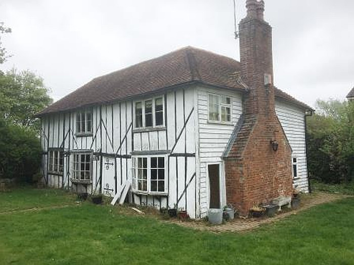
Hornash is a Grade II listed cottage in Shadoxhurst, Kent
Listing Details
|
Entry Name: Hornash
Listing Date: 10 October 1980 Grade: II Source: Historic England Source ID: 1071400 English Heritage Legacy ID: 181154 Location: Shadoxhurst, Ashford, Kent, TN26 County: Kent District: Ashford Civil Parish: Shadoxhurst Built-Up Area: Shadoxhurst Traditional County: Kent Lieutenancy Area (Ceremonial County): Kent |
Coordinates
Latitude: 51.1071 / 51°6'25"N Longitude: 0.8246 / 0°49'28"E OS Eastings: 597829 OS Northings: 137996 OS Grid: TQ978379 Mapcode National: GBR RX6.K9J Mapcode Global: VHKKT.7FSM |
11 April 2019 (03:56) - 17 firefighters tackle Country House blaze in north Norfolk
Seventeen firefighters helped put out a blaze at a terraced property in north Norfolk. A Norfolk Fire and Rescue spokesman said crews from Aylsham, Cromer and Sheringham fire stations rushed to the blaze at Gunton Park, between Cromer and North Walsham, at 3.56pm on Thursday (April 11). The spokesman said the crews were on the scene until 5.36pm, after having used hose reel jets and positive pressure ventilation fans to quell the flames and smoke.
A couple living in part of the Grade II listed country house have thanked their lucky stars after a “horrific” fire they believe was caused by a dog knocking over a floor lamp. Just before 4pm on Thursday, April 11, seventeen firefighters were called in to tackle the blaze at Gunton Hall, a grand 18th Century pile set in the middle of a 1,000 acre deer park between Cromer and North Walsham.Gerard and Jacqui Stamp, both in their 60s, who live in part of the building, said they were shocked to find the blaze consuming their home of 25 years.
Mr Stamp said: “I came down into the old kitchen room and it was full of climbing fire. It was horrific. But it could have been much, much worse.” Mr Stamp, a painter, said he thought the blaze broke out after their dog knocked over an old halogen light, sparking flames which spread to the curtains and throughout the room. He said they were lucky the fire had been contained in that space, which is used as a living room. Mr Stamp said: “We have old halogen uplighters on the ground which get very hot. We think maybe our dog knocked it over and it looks as though the curtains caught on fire. We shut all the doors and I think it actually burned itself out through a lack of oxygen.”
This was not the first time Gunton Hall has faced fire. The building was devastated by a blaze in 1882 and lay derelict for almost a century before architect and developer Kit Martin bought it in 1980. Mr Martin converted the hall into eight separate homes, and the Stamps live in the part of the building that was the stately home’s historic kitchen. Mr Stamp said: “If the fire had got out of that room it could spread to other people’s homes, which would have been terrible.” He said they had not had to move out of their home, but have sealed off the burned out room until it can be cleaned out. Mr Stamp said the fire was a warning to anyone who still had old halogen uplighters. He said: “They get really hot. I’m throwing the rest of mine out now.” Mr Stamp praised the smoke alarm that alerted them of the blaze, and the firefighters from Aylsham, Cromer and Sheringham stations who came to put the blaze out.
News Source: Eastern Daily Press
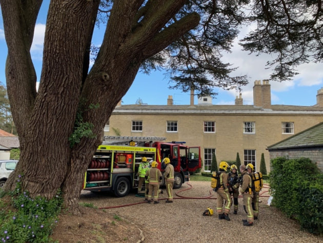
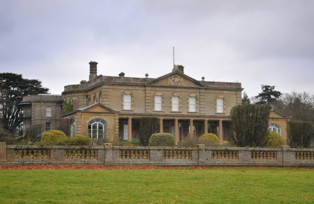
Listing Details
|
Entry Name: Gunton Park
Listing Date: 20 February 1952 Grade: II* Source: Historic England Source ID: 1049868 English Heritage Legacy ID: 224500 Location: Hanworth, North Norfolk, Norfolk, NR11 County: Norfolk District: North Norfolk Civil Parish: Hanworth Traditional County: Norfolk Lieutenancy Area (Ceremonial County): Norfolk Church of England Parish: Gunton with Hanworth Church of England Diocese: Norwich |
Coordinates
Latitude: 52.8584 / 52°51'30"N Longitude: 1.3076 / 1°18'27"E OS Eastings: 622771 OS Northings: 334112 OS Grid: TG227341 Mapcode National: GBR WDW.TNQ Mapcode Global: WHMSH.1FY1 |
Building History
(Researched by Heritage & Ecclesiastical Fire Protection)
Gunton Hall was built for Sir William Harbord in the 1740s by the architect Matthew Brettingham. In 1775 Harbord Harbord, 1st Baron Suffield, Member of Parliament for Norwich, commissioned James Wyatt to make significant additions to the house. The grounds were developed by Charles Harbord, 5th Baron Suffield, employing William Milford Teulon as the landscaper. However, the hall was almost destroyed by fire in 1882 and lay derelict for nearly a century before Kit Martin, an architect, bought the hall in 1980 and converted it into individual houses. It is surrounded by a 1,000 acre deer park. The boathouse was rebuilt as a studio by the artist Gerard Stamp in 2004.
St Andrew's Church, Gunton in woodland to the east of the hall is a redundant Church of England church. The church was built in 1769 and designed by Robert Adam for Sir William Harbord, to replace a medieval church. It is a Grade I listed building, and is under the care of the Churches Conservation Trust.
Gunton Park sawmill is a 1824 sawmill powered by a mill pond on Hagon Beck.
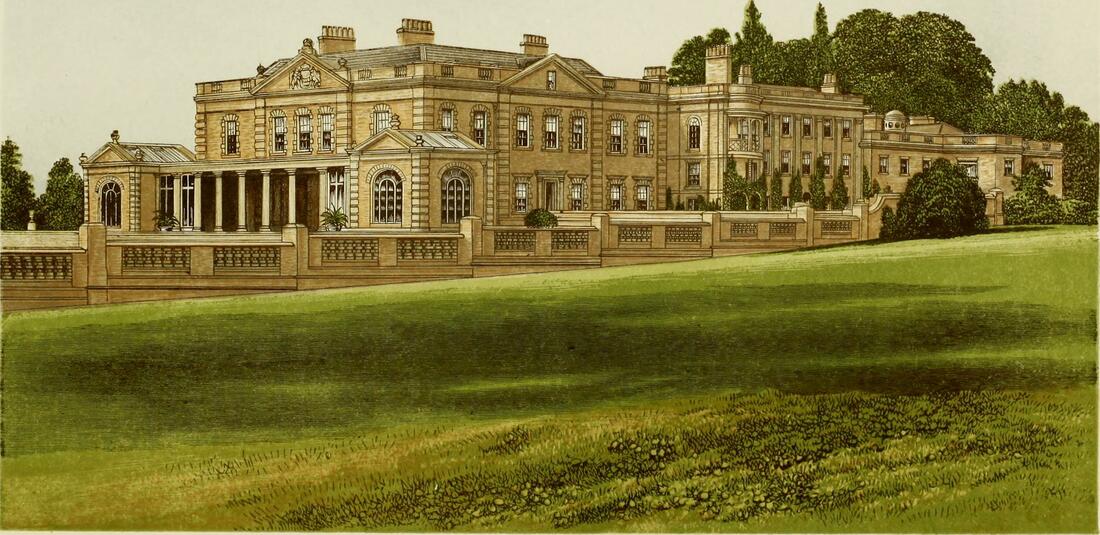
Gunton Hall, 19th-century lithograph
Near Miss
10 April 2019 (08:40) - Electrical blaze explodes on exclusive London street
10 April 2019 (08:40) - Electrical blaze explodes on exclusive London street
It was a heart-stopping moment when a fireball exploded up from the pavement on an exclusive London street and knocked off the hard-hat of a nearby workman who was sprinting away. A video filmed in from Montague Street, Holborn, shows the man desperately dragging a piece of equipment away from a cordoned-off hole in the ground which had smoke billowing out of it. As he scrambles away, sparks begin to flash inside the hole before a huge flame bursts upwards, sending the workman's hat clattering on to the pavement and leaving 100 homes without power.
A witness to this morning's 8.40am explosion said: 'The guys were climbing up the scaffolding when they saw there was a commotion across the road. They saw the smoke and the flames and then there was a lot more fire. Then it died down a little and the chap came running back to clear the equipment away when it exploded. The fire blew his helmet right off - it went sailing across the street. They were absolutely crackers, going back to the fire. The workmen returned to the fire several times to moves equipment and kept replacing the plastic barriers which repeatedly fell to the ground. The source added: 'I don’t know what they were doing - trying to maintain safety? The fire brigade arrived a few minutes later.'
Paul, 28, who also witnessed the explosion, said: 'It was amazing that nobody died.' He added: 'The [surrounding] buildings' power has gone out and one lady who lives nearby came out screaming 'I have no electricity!' A UK Power Network spokesperson said: 'Our engineers are working quickly and safety to restore power to customers in the Montague Street area of London after third party damage to an underground cable around 9am this morning. An initial 72 properties lost electricity, with a further 28 having their supplies turned off for safety reasons during the repair. Supplies have been restored in stages, and we will restore power to the final 39 customers as soon as possible.'
The explosion and fire was on the pavement immediately outside numbers 25 and 27 Montague Street, which is part of a Grade II listed terrace of 18 houses. They were built in1803-6 by WE Allen, to a design by James Burton.
News Source: Mail Online
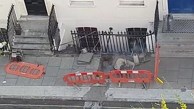
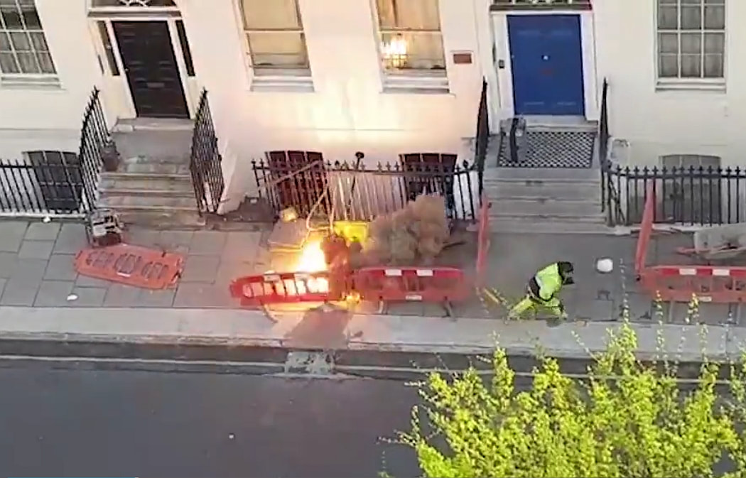
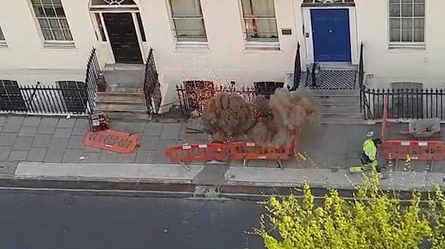
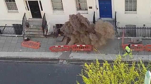
Listing Details
|
Entry Name: Numbers 12-29 and Attached Railings Including Montague Hotel (Numbers 12-20)
Listing Date: 28 February 1969 Last Amended: 11 January 1999 Grade: II Source: Historic England Source ID: 1322131 English Heritage Legacy ID: 477534 Location: Camden, London, WC1B County: London District: Camden Electoral Ward/Division: Bloomsbury Built-Up Area: Camden Traditional County: Middlesex Lieutenancy Area (Ceremonial County): Greater London Church of England Parish: Bloomsbury Way St George Church of England Diocese: London |
Coordinates
Latitude: 51.5198 / 51°31'11"N Longitude: -0.1252 / 0°7'30"W OS Eastings: 530172 OS Northings: 181767 OS Grid: TQ301817 Mapcode National: GBR J9.1C Mapcode Global: VHGQZ.S257 |
10 April 2019 (03:50) - Fire in derelict Rotherham pub treated as arson
Arsonists were behind a fire which broke out in a derelict pub - just weeks after a £350,000 cannabis farm was discovered at the site. The fire at the Masons Arms in Wellgate started at around 3.50am on Wednesday in the upper floor and roof area. Four crews were called to tackle the blaze and used a turntable ladder to access the roof and put out the fire, which was today confirmed as deliberate.
A police spokeswoman said: “The fire is believed to have been started deliberately. It has caused extensive damage to the building and its surroundings and resulted in residents being evacuated and roads being closed for a number of hours.
The pub is at least 150 years old and is recorded in the 1861 census. In the 1960s/70s Dean Andrews, (Actor - famous for his role as DS Ray Carling in the BBC Television drama series, Life on Mars and Ashes to Ashes.), lived here with his publican parents.
News Source: Rotherham Advertiser
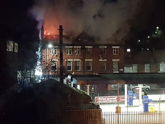
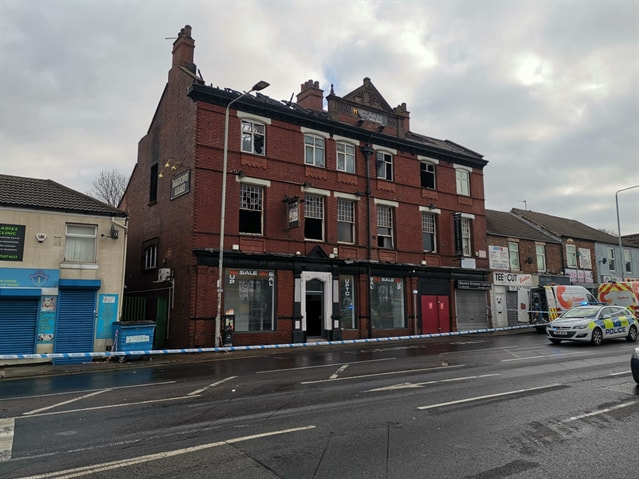
9 April 2019 (14:15) - Kenley Aerodrome fire in old officers' mess building
Firefighters from seven fire stations are dealing with a blaze at the old officers' mess at Kenley Aerodrome, near Caterham. Surrey Fire and Rescue Service tweeted that crews from east Surrey, along with support from Wallington, Croydon and Guildford, were attending the fire. A spokesman for Surrey Fire and Rescue Service said they received a call about the fire at 2.15pm and sent six fire engines and other specialist vehicles. They added that the incident remains ongoing but there were “no reports of injuries at this time”. A Surrey Police spokesman has said it is “too early to speculate on the cause of the fire”. Officers from Surrey and the Metropolitan Police continue to assist the fire service with traffic management in the area.
The same building, which is Grade II listed, was gutted by a fire in 2016 . The aerodrome, a former RAF station, is still used by the Ministry of Defence for glider aircraft. The officers’ mess itself dates from the 1930s and during the Battle of Britain housed personnel from three fighter squadrons, reflecting RAF Kenley’s important role in the defence of Britain. The previous fire, in 2016, gutted the central section of the building, but firefighters were able to prevent the blaze spreading to the two wings of the mess, and the external walls remained standing. As a Grade II listed building, it was due to be rebuilt after the previous fire, but there have also been plans to convert the building into flats.
Alan Morgan, chairman of the Kenley Airfield Friends Group, said: “It’s very, very sad. It’s a historic building here, it’s been set on fire before by kids and despite a lot of warning to various people it’s happened again. We’ve made calls to the owners and to the police on numerous occasions to report incursions by kids. The police were up the weekend before last. It’s a very difficult building to protect, this is the problem. It’s become a clear target for vandals in recent years because it’s empty. I appreciate it’s a difficult place to protect if you’ve got kids determined to cause trouble.” Mr Morgan continued: “It’s very sad. That was the officers’ mess for RAF Kenley, who protected the country from the Germans in 1940. It’s very sad that the offspring of people who owe their freedom to them are trying to destroy it. It’s classic - school holidays start, kids get in there, and the owners have been notified on numerous occasions.”
Rachael Howard, who lives nearby said: “We could see the really thick smoke coming up from behind the Portcullis Club [one of the buildings on the airfield]. People think it’s children that have done it, they did last time. I think this is worse; apparently it’s the whole of the roof and first floor. We saw smoke and flames and obviously the firemen running in and out.” She also said they had seen emergency services at the airfield a few weeks earlier.
The Kenley Aerodrome Conservation Areas were designated on 9th January 2006 as Croydon’s 12th and on 7th December 2005 as Tandridge’s 19th Conservation Areas. The historic aerodrome straddles the boundary between the London Borough of Croydon and Tandridge District Council; its protection requiring the designation of two separate yet abutting Conservation Areas.
In an English Heritage report of April 2000, the RAF airfield at Kenley was described as “the most complete fighter airfield associated with the Battle of Britain to have survived”, making it a battlefield site of particular national historic significance.
News Source: Surrey Live
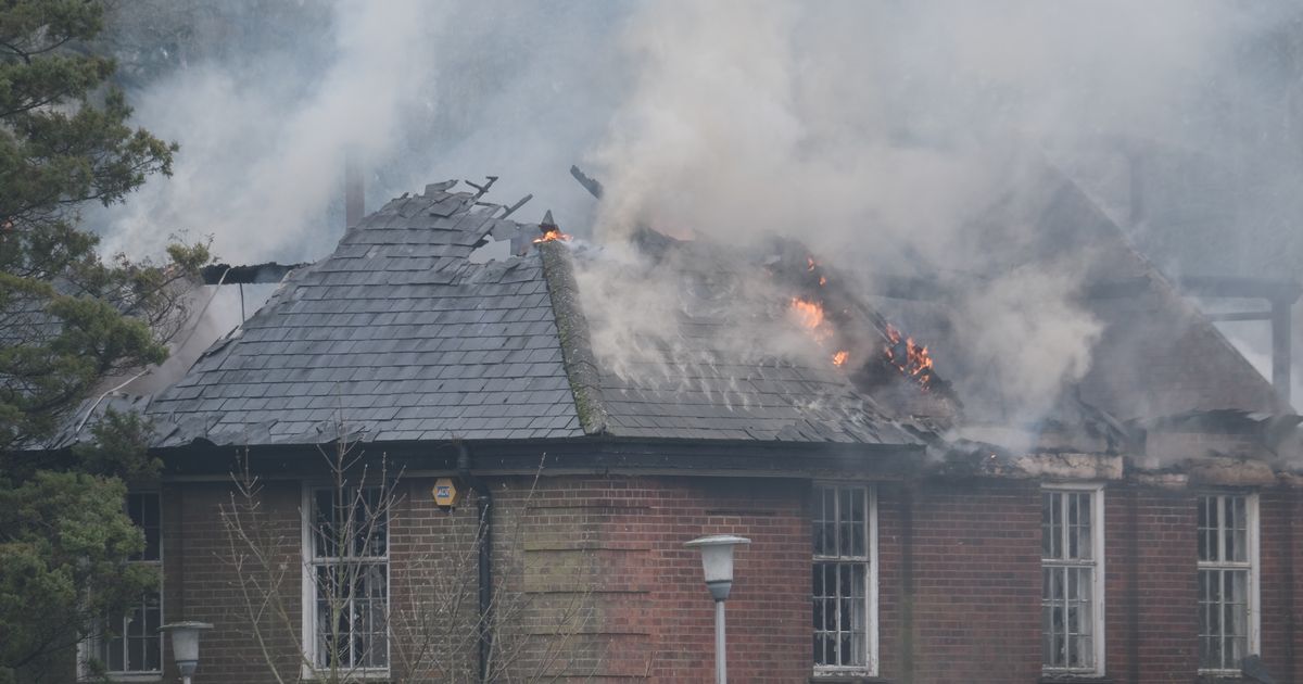
Kenley aerodrome officers mess fire (Picture: Grant Melton)
Listing Details
|
Entry Name: Former Officers Mess at Former RAF Kenley
Listing Date: 10 January 2001 Grade: II Source: Historic England Source ID: 1334947 English Heritage Legacy ID: 486852 Location: Caterham-on-the-Hill, Tandridge, Surrey, CR3 County: Surrey District: Tandridge Civil Parish: Caterham-on-the-Hill Built-Up Area: Croydon Traditional County: Surrey Lieutenancy Area (Ceremonial County): Greater London Church of England Parish: Whyteleafe St Luke Church of England Diocese: Southwark |
Coordinates
Latitude: 51.3028 / 51°18'10"N Longitude: -0.0901 / 0°5'24"W OS Eastings: 533235 OS Northings: 157695 OS Grid: TQ332576 Mapcode National: GBR H1.RYD Mapcode Global: VHGRZ.DJ64 |
Near Miss
9 April 2019 (13:19) - Six fire engines tackle blaze at old Fisons factory
9 April 2019 (13:19) - Six fire engines tackle blaze at old Fisons factory
A major fire broke out at the derelict Fisons factory site in Bramford this afternoon. Emergency services were called to the site in Paper Mill Lane at 1.19pm after reports a fire was raging in a two-storey building on the old fertiliser factory site on the outskirts of Ipswich. There are six fire engines at the scene, coming from Princes Street, Ipswich East and Woodbridge. The fire was in the roof space of the derelict building - which was used as an office when the site was in operation.
Six fire engines were sent to the scene, including crews from Princes Street, Ipswich East and Woodbridge. A spokesman for Suffolk Fire and Rescue Service said the fire has now been extinguished and that crews called a stop on the incident at around 3pm. She said fire crews remained on scene to dampen down the area and check for hotspots. “The fire was in a two storey building measuring around 6m by 15m. The building is derelict and was used as an office building. “The fire was in the roof space.”
Speaking at the scene, station commander Dale Willings said: “We were called at about 1.20pm this afternoon to the derelict old Fisons building. Appliances from Ipswich East and Prices Street attended and further calls were received via our control room so they mobilised an additional fire appliance so we’ve sent Woodbridge as well into the incident.” He said firefighters tackled the fire using water hoses on the front and rear of the building. Mr Willings added the cause of the fire is not yet known but that an investigation would be carried out in due course. A stretch of Paper Mill Lane has been closed to traffic and will remain closed while crews finish dampening down.
The office building stands adjacent to the main Fisons factory building, which is ranked among Britain’s most endangered buildings by the Victorian Society. The wooden structure of the old warehouse is Grade II listed. In January, magistrates ordered the company that owns the site, Paper Mill Lane Properties, to “execute such works as may be necessary to obviate the danger” at the site and prevent further deterioration that could constitute a danger to the public. The company now has until July 28 to complete work at the site to Mid Suffolk’s satisfaction.
News Source: Ipswich Star
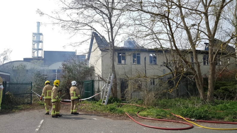
Fire at derelict property near to the old Fisons building. The Grade II listed buildings lie just behind. (Picture: Rachel Edge)
Listing Details
|
Entry Name: North Warehouse at Fisons Horticultural Division Works
Listing Date: 24 January 1986 Grade: II Source: Historic England Source ID: 1263014 English Heritage Legacy ID: 433435 Location: Bramford, Mid Suffolk, Suffolk, IP8 County: Suffolk District: Mid Suffolk Civil Parish: Bramford Traditional County: Suffolk Lieutenancy Area (Ceremonial County): Suffolk Church of England Parish: Bramford St Mary the Virgin Church of England Diocese: St.Edmundsbury and Ipswich |
Coordinates
Latitude: 52.0893 / 52°5'21"N Longitude: 1.1021 / 1°6'7"E OS Eastings: 612615 OS Northings: 247975 OS Grid: TM126479 Mapcode National: GBR TM7.X2G Mapcode Global: VHLBL.2R07 |
9 April 2019 (01:00*) - Vandals smash windows and set fire to historic building
Severe damage has been caused to The Playhouse on the Dartington Hall estate, which was built in 1929 by Dorothy and Leonard Elmhirst as a space for children to have fun in the gardens. Vandals have smashed original leaded windows and set fire to an historic building and the owners say the fire could have rapidly spread through the thatched house. Historic artifacts inside the structure have been damaged after fire spread into the building.
A spokesman said, "It saddens us to say that last night vandals found their amusement by breaking some of the original leaded window panes and lighting a fire on this beloved building. Whilst we don’t know what the perpetrator’s intended outcome was, we do know that the fire somehow spread inside the building, causing damage to some historic contents. Much of the structure is original and with the building being thatched, the outcome could have been catastrophic. Whether it was a barbeque that went wrong or deliberate damage, it is distressing to see such damage to this beautiful wooden thatched Grade II listed building, dating from 1929, and built by our founders the Elmhirsts.”
The spokesman continued, “Dartington is a charity doing its utmost to create a sustainable business model in challenging economic times, and acts such as these are unhelpful to say the least. It’s incredibly important to the Trust that we continue to keep areas such as the Gardens free for everyone to enjoy all year round - please do help us to make that possible by treating the estate with respect."
The building is now used as the Garden Manager’s Office (“The Gardener’s Bothy”). The bothy was originally used for the Nursery School before Aller Park School was completed. Medieval Dartington Hall, near Totnes, was built between 1388 and 1400. The Hall is Grade I listed and the gardens are Grade II* listed, where there is an ancient yew tree, reputed to be nearly 2000 years old, and many other listed buildings and structures.
News Source: Devon Live
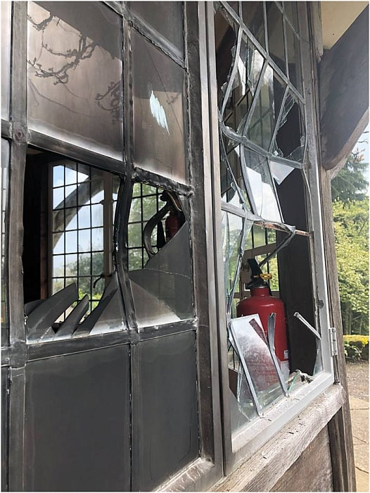
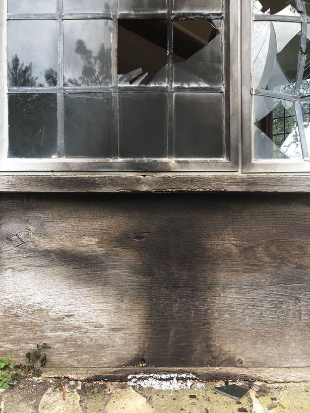
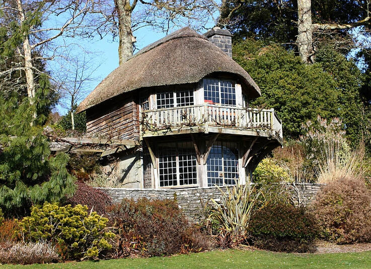
The beautiful Grade II listed playhouse / bothy
Listing Details
|
Entry Name: Gardener's Bothy About 110 Metres South of Dartington Hall
Listing Date: 26 April 1993 Grade: II Source: Historic England Source ID: 1108360 English Heritage Legacy ID: 101048 Location: Dartington, South Hams, Devon, TQ9 County: Devon District: South Hams Civil Parish: Dartington Traditional County: Devon Lieutenancy Area (Ceremonial County): Devon Church of England Parish: Dartington St Mary Church of England Diocese: Exeter |
Coordinates
Latitude: 50.4504 / 50°27'1"N Longitude: -3.6935 / 3°41'36"W OS Eastings: 279862 OS Northings: 62538 OS Grid: SX798625 Mapcode National: GBR QL.L4SK Mapcode Global: FRA 374V.YNZ |
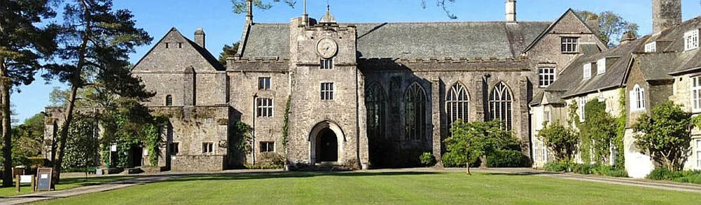
Medieval Dartington Hall
8 April 2019 (18:00*) - Development continues at fire-hit Victory pub and hotel
An investigation has been launched after a fire inside a derelict pub. Emergency services were called to the old Victory pub in Chorley Old Road, Halliwell, on Monday night. A large amount of timber and wood had been set ablaze in the basement and first floor of the building. No one was injured. A spokeswoman for Greater Manchester Fire and Rescue Service said: “We were called shortly after 6pm on Monday to a building fire in Chorley Old Road, Bolton. Fire engines from Bolton Central and Bolton North attended the incident. Firefighters wearing six breathing apparatus, used three hose reels and a positive pressure ventilation fan to extinguish the fire involving a quantity of timber in the basement and first floor of the building. Crews were on scene for approximately 90 minutes.” Two police vehicles also attended.
Work has begun to convert the building into 12 apartments, a shopping unit and a restaurant or café after plans were approved in January this year. The applicant behind the plans, Fisal Mahmood of Bolton-based Mahmood Holdings Limited, has been made aware of the fire. A spokesman from architectural design firm MADP said: "Unfortunately the property was broken into. We believe that a small amount of damage was caused by a fire. This has now been rectified and the project is still continuing."
The former pub and hotel is more than 130 years old, however, the building is currently boarded up. Security measures had been put in place to prevent trespassing. In January this year, planning officers approved an application to change The Victory into 12 apartments, a shopping unit and a restaurant or café. The application was approved subject to several conditions such as retaining certain historic features of the building.
The oldest record of The Victory Hotel dates back to 1882 and alterations were made to the building between 1890 and 1907 when it was owned by John Haslam and Co of Halliwell Cotton Works. 15 years ago, it was reported that 24 large stained-glass panels and a huge mosaic commemorating the life of Lord Nelson were found while the building was being renovated. It was revealed that the panels were covered when the pub was refurbished in the late 1960s because they were seen as being old-fashioned.
News Source: The Bolton News
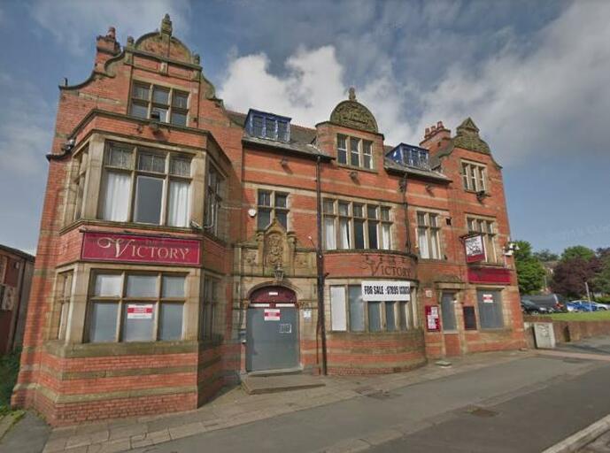
Emergency services were called to the old Victory pub on Chorley Old Road.
Near Miss
8 April 2019 (14:06) - Fire crews battling lorry blaze in North Cave
8 April 2019 (14:06) - Fire crews battling lorry blaze in North Cave
Humberside Fire & Rescue Service are currently battling a lorry fire in North Cave. Crews were called to Westgate at 2.06pm on Monday, after reports of a lorry being on fire in the road. Pictures from the scene show a small lorry with flames and black smoke billowing into the street. A spokeswoman for Humberside Fire & Rescue Service said: "We were called at 2.06pm and we currently have two breathing apparatus and two hose reels in use." It is not yet known what has caused the fire or whether there have been any injuries.
The lorry was parked outside Clondarf House (5, Westgate) which is a mid 18th century Grade II listed building. It was also opposite Glebe House and Westgate House, both Grade II listed buildings.
News Source: Hull Live
The lorry was parked outside Clondarf House (5, Westgate) which is a mid 18th century Grade II listed building. It was also opposite Glebe House and Westgate House, both Grade II listed buildings.
News Source: Hull Live


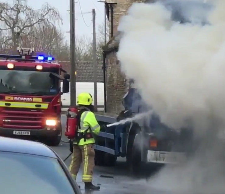
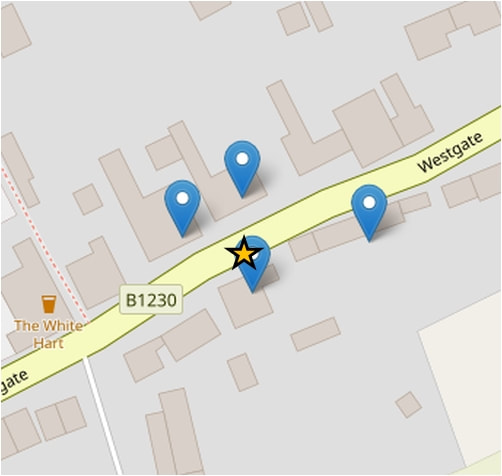
Listing Details
|
Entry Name: 5, Westgate
Listing Date: 16 December 1966 Grade: II Source: Historic England Source ID: 1203470 English Heritage Legacy ID: 165042 Location: North Cave, East Riding of Yorkshire, HU15 County: East Riding of Yorkshire Civil Parish: North Cave Built-Up Area: North Cave Traditional County: Yorkshire Lieutenancy Area (Ceremonial County): East Riding of Yorkshire Church of England Parish: North Cave All Saints Church of England Diocese: York |
Coordinates
Latitude: 53.7801 / 53°46'48"N Longitude: -0.6459 / 0°38'45"W OS Eastings: 489322 OS Northings: 432384 OS Grid: SE893323 Mapcode National: GBR RSXQ.YN Mapcode Global: WHGFF.17PX |
8 April 2019 (a.m.) - Historic Hibaldstow Bridge left unsafe after two vehicles 'deliberately' set on fire on it
A listed bridge known for its architecture and history has been left unsafe after two vehicles were set on fire on top of it. Humberside Fire and Rescue Service was called to Hidaldstow Bridge this morning after a car and a van were torched, with officials saying they believe the fires were started deliberately. Damage has been caused to the bridge's wooden floor and its wrought iron structure. It is now deemed to be unsafe for other vehicles and has been closed, with barriers placed across both sides. The wrought-iron bridge was built in 1889 and has been designated a Grade II listed structure by Historic England.
One fire engine from Kirton in Lindsey attended the incident this morning and crew members used two hose reels to extinguish the fires. The bridge on South Carr Lane crosses the River Ancholme near Hibaldstow and leads to an unpaved road used by farm traffic. A spokesman for Humberside Fire and Rescue Service said: "We were called to Hibaldstow Bridge this morning after reports of two vehicles on fire. The car and van were both totally destroyed. The fire burnt through the wooden bridge, and caused damage to the structure. It is now unsafe for other vehicles. We requested Humberside Police and North Lincolnshire Council attend the incident. North Lincolnshire Council has informed the owners of the bridge. The cause of the fires was deliberate ignition." The bridge is now closed, although large scorch marks can be seen on the timber decking that form the base of it.
Hibaldstow Bridge was declared a Grade II listed bridge in 1987, and is believed to have been built in 1889, probably re-using mid 19th century abutments of an earlier timber swing-bridge. It was constructed by Messrs Porter and Co of Lincoln, ironfounders and designed by Alfred Atkinson, engineer. It was originally commissioned for the Ancholme Drainage and Navigation to replace an early 19th century bridge. A plaque in the middle of the bridge reads: 'Erected by JTB Poster & Co. 1889 Lincoln'.
News Source: Grimsby Live
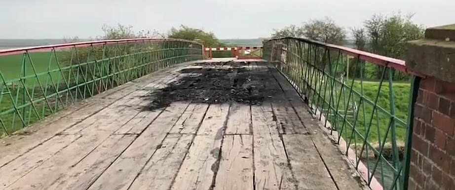
The damage caused to the bridge by the burning vehicles.
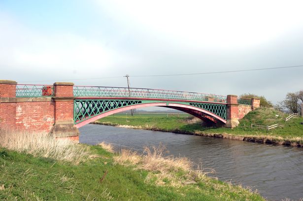
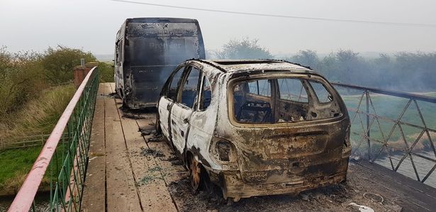
Listing Details
|
Entry Name: Hibaldstow Bridge
Listing Date: 6 January 1987 Grade: II Source: Historic England Source ID: 1346522 English Heritage Legacy ID: 166019 Location: Hibaldstow, North Lincolnshire, LN7 County: North Lincolnshire Civil Parish: Hibaldstow Traditional County: Lincolnshire Lieutenancy Area (Ceremonial County): Lincolnshire Church of England Parish: Hibaldstow St Hybald Church of England Diocese: Lincoln |
Coordinates
Latitude: 53.5006 / 53°30'2"N Longitude: -0.4872 / 0°29'13"W OS Eastings: 500444 OS Northings: 401495 OS Grid: TA004014 Mapcode National: GBR TW1Y.BV Mapcode Global: WHGGV.H87Q |
6 April 2019 (22:17) - Five fire crews called to blaze in central Chichester
Firefighters are tackling a blaze in central Chichester tonight, with five crews currently on scene. The smell of smoke is filling the air in North Street, where the high street area has been cordoned off while firefighters tackle the fire, first reported in St Martins Square at 10.17pm. Firefighters were seen using breathing apparatus and hose reel jets outside the now smoke-filled shoe shop Hotter. A spokesman for West Sussex Fire and Rescue Service confirmed five crews had been called to the incident. He added: "We would urge people to avoid the area to allow crews to bring the fire under control."
An update revealed that a bin was ignited behind Hotter Shoes which spread to the building.
The building is a Grade II* listed building and lies within the Chichester Conservation Area. It is a 16th century building with a 19th century shop front.
News Source: Chichester Observer
An update revealed that a bin was ignited behind Hotter Shoes which spread to the building.
The building is a Grade II* listed building and lies within the Chichester Conservation Area. It is a 16th century building with a 19th century shop front.
News Source: Chichester Observer
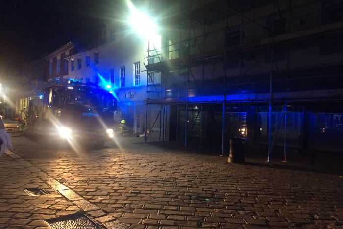
Firefighters at the scene.
Listing Details
|
Entry Name: 86 and 87, North Street
Listing Date: 8 October 1971 Grade: II* Source: Historic England Source ID: 1193602 English Heritage Legacy ID: 300046 Location: Chichester, Chichester, West Sussex, PO19 County: West Sussex District: Chichester Civil Parish: Chichester Built-Up Area: Chichester Traditional County: Sussex Lieutenancy Area (Ceremonial County): West Sussex Church of England Parish: Chichester St Paul Church of England Diocese: Chichester |
Coordinates
Latitude: 50.8367 / 50°50'12"N Longitude: -0.7788 / 0°46'43"W OS Eastings: 486088 OS Northings: 104840 OS Grid: SU860048 Mapcode National: GBR DGS.FXY Mapcode Global: FRA 968W.DFX |
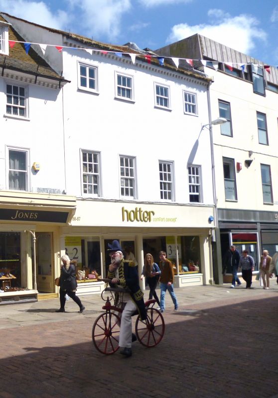
Near Miss
6 April 2019 (21:26) - Spate of fires in Chichester city centre were started deliberately
6 April 2019 (21:26) - Spate of fires in Chichester city centre were started deliberately
A string of fires in a city centre were started deliberately, police believe. Four fires were lit in a four hour period yesterday evening, including one which caused “extensive damage” to a shoe shop.
The first blaze was started in on a building site in Lavant Road, Chichester, at 6.45pm. Another fire broke out in a skip behind the Hole in the Wall pub in St Martin’s Street at 9.26pm and a bin was set alight outside La Havana bar in Little London – an 18th century Grade II listed building.
At 10.15pm, a bin was ignited in North Street and the fire quickly spread to a nearby shoe shop, Hotter Shoes, a Grade II* listed building (see separate listing)
Crime investigator Kim Williams said: “Fortunately no-one was injured in these fires. But major damage was caused to the shoe shop. We would also like to reassure the public we will be working closely with the fire brigade in an effort to catch those responsible for these fires and we will be reinforcing police patrols in the area. We would like to hear from anyone who may have witnessed anything suspicious or has any information about the fires, and who may have started them, to contact us.”
News Source: The Argus
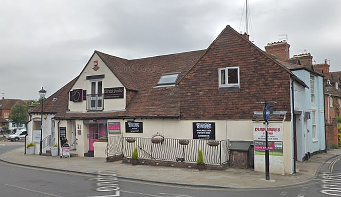
La Havana occupies a Grade II listed building (Credit: Google)
Listing Details
|
Entry Name: 3, 3a and 3b, Little London
Listing Date: 8 October 1971 Grade: II Source: Historic England Source ID: 1026767 English Heritage Legacy ID: 299943 Location: Chichester, Chichester, West Sussex, PO19 County: West Sussex District: Chichester Civil Parish: Chichester Built-Up Area: Chichester Traditional County: Sussex Lieutenancy Area (Ceremonial County): West Sussex Church of England Parish: Chichester St Paul Church of England Diocese: Chichester |
Coordinates
Latitude: 50.8369 / 50°50'12"N Longitude: -0.7761 / 0°46'33"W OS Eastings: 486279 OS Northings: 104862 OS Grid: SU862048 Mapcode National: GBR DGS.GM0 Mapcode Global: FRA 968W.FGX |
Near Miss
5 April 2019 (18:47) - Crews fight fire near north-east castle
5 April 2019 (18:47) - Crews fight fire near north-east castle
Firefighters have extinguished a fire close to a popular north-east tourist attraction.Crews were called to reports of a small fire in the open close to Slains Castle shortly before 7pm on Friday. They used beaters to put out the flames and left the scene a short time later. A spokeswoman for the Scottish Fire and Rescue Service said: “We were called to a report of a fire close to Slains Castle. It was a small fire grass fire in the open. It was reported to us at 6.47pm and the stop message came in at 7.11pm.”
Slains Castle, also known as New Slains Castle to distinguish it from nearby Old Slains Castle, is a Category B listed building and was first built around 1597, with additions and alterations made in 1664 and 1708. The castle was further extended and remodelled in the Tudor style in 1836-37 by John Smith. The castle is famous for its close historical association with Bram Stoker and as the likely inspiration for his legendary character Dracula s castle.
In 1925 the roof was removed along with some architectural features including bay windows and the principal entrance stair. The castle is a ruin with most of the internal and external walls complete to wallhead. It sits at the top of cliffs on the North Sea coast of Aberdeenshire, overlooking the Bay of Cruden to the southwest, and the villages of Port Erroll and Cruden Bay around 1km to the west.
News Source: Evening Express
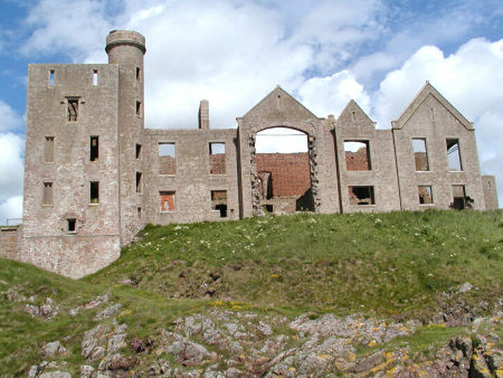
Slain Castle sits at the top of cliffs on the North Sea coast of Aberdeenshire
Listing Details
|
Entry Name: New Slains Castle, Cruden Bay
Listing Date: 11 April 2018 Category: B Source: Historic Scotland Source ID: 406942 Historic Scotland Designation Reference: LB52471 Building Class: Cultural Location: Cruden County: Aberdeenshire Electoral Ward: Peterhead South and Cruden Traditional County: Aberdeenshire |
Coordinates
Latitude: 57.4154 / 57°24'55"N Longitude: -1.8323 / 1°49'56"W OS Eastings: 410174 OS Northings: 836126 OS Grid: NK101361 Mapcode National: GBR P9T3.Z3D Mapcode Global: WHBQM.TWP4 |
4 April 2019 (14:00*) - Fire at Falmouth restaurant
There was a fire at Fuel in Falmouth's Arwenack Street at 2pm today (Thursday April 4). This evening, a spokesman for Falmouth Community Fire Station said: “Crews were mobilised to a cafe kitchen fire this afternoon; swift actions by a member of staff resulted in the fire being quickly extinguished. Crews monitored the kitchen appliances and provided advice on kitchen fire safety.” It is not thought to be a major incident.
This building, which was originally two town houses, was built around 1800 and is Grade II listed. It lies within the Falmouth Conservation Area.
News Source: The Falmouth Packet
This building, which was originally two town houses, was built around 1800 and is Grade II listed. It lies within the Falmouth Conservation Area.
News Source: The Falmouth Packet
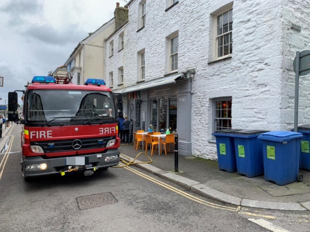
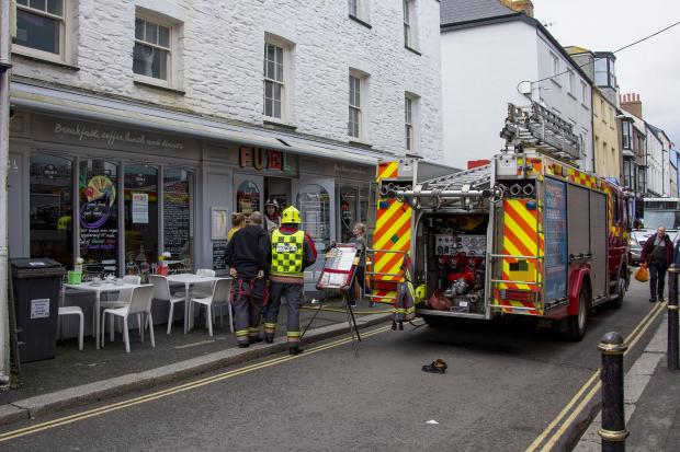
Listing Details
|
Entry Name: 35, 36 and 37, Arwenack Street
Listing Date: 24 April 1996 Grade: II Source: Historic England Source ID: 1270116 English Heritage Legacy ID: 460069 Location: Falmouth, Cornwall, TR11 County: Cornwall Civil Parish: Falmouth Built-Up Area: Falmouth Traditional County: Cornwall Lieutenancy Area (Ceremonial County): Cornwall Church of England Parish: Falmouth King Charles the Martyr Church of England Diocese: Truro |
Coordinates
Latitude: 50.1524 / 50°9'8"N Longitude: -5.0663 / 5°3'58"W OS Eastings: 181050 OS Northings: 32543 OS Grid: SW810325 Mapcode National: GBR ZD.TJCP Mapcode Global: FRA 088M.B28 |
3 April 2019 (14:13) - Fire destroys roof of White Ladies house in Teston Road, Offham
A massive blaze broke through the roof of a derelict house, prompting a huge response from firefighters. Kent Fire and Rescue rushed to a three-storey building in Teston Road, Offham and attempted to put out the flames. The road was blocked off while officers took on the flames. During the incident, a Kent Fire and Rescue spokesperson said: "We are dealing with a fire in a derelict three-storey building in Teston Lane, Offham near West Malling. Six fire engines, a height vehicle and a bulk water carrier are in attendance. Crews are using two main jets and water from a hydrant to tackle the blaze in the roof." Fortunately nobody was hurt. The fire fighters' official stop time was 11.09pm with officers returning to the scene this morning to continue investigating the cause. The roof has been destroyed.
Only a burnt out shell of a building remains of White Ladies house, which has been unoccupied for more than 10 years. Once a mink farm, the Teston Road property is now owned by FCC Environment, formerly Waste Recycling Group. But it was abandoned after the landfill site next to the house began producing dangerous levels of methane gas. According to Offham Parish Council documents, FCC have not used the building since 2006.
The building has local historical significance as the Chairman of The Offham Society, Mike Rowe, explained: "White Ladies was built in the 1910s and the Nicholson family were the first owners of the house. The original name was Quarrenden, an old English apple variety, as it once sat within an orchard. When Lieutenant Colonel Walter Adam Nicholson died in the First World War, his wife had to pay death duties. She was left bitter as she was forced to sell the house and move away."
According to Mr Rowe, the name White Ladies came from the ivory fur used for women's coats, when the house became White Ladies mink farm in the 1960s. But as fur fashion lost popularity, a family - the Chapmans - bought the property and lived there from around 1980. Later in the decade, the quarry next to the house became a landfill site for metropolitan rubbish. As the mounds of waste grew and methane levels crept up, the Chapman family moved out and the building was used as offices from 1991, until the air became so unhealthy that it was abandoned in 2006. White Ladies has lain derelict ever since.
News Source: Kent Online
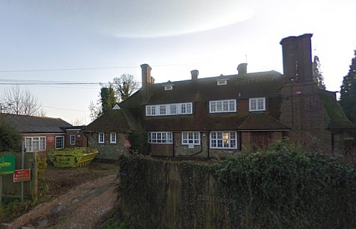
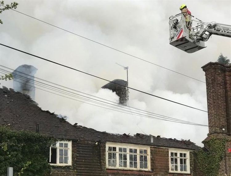
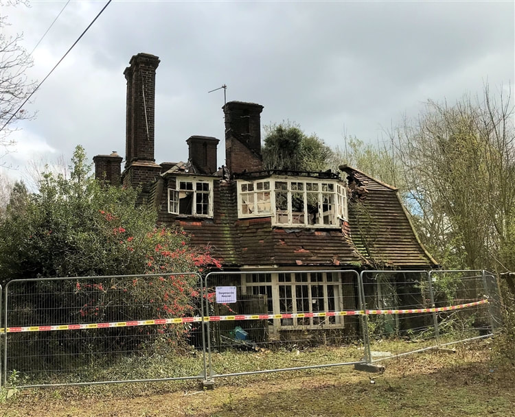
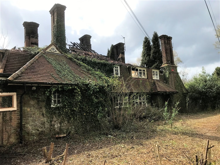
3 April 2019 (13:15) - Calls to demolish fire-hit pub as arsonists strike AGAIN
Families are calling for a derelict historic pub to be pulled down after another arson attack. Crews were called to the former Waggon and Horses in Audley this afternoon after neighbours spotted smoke pouring from the crumbling site. Staffordshire Fire and Rescue Service were called to the scene just after 1.15pm with crews from Sandyford and Newcastle attending. Officers from Staffordshire Police attended at around 1.55pm to manage traffic passing through the area while the blaze was extinguished. The last team of firefighters remained at the scene until around 3.30pm with an investigation concluding the fire was started deliberatley.
The latest incident comes after the pub has been repeatedly targeted after a blaze led to the closure in 2011. It was a popular venue and it had been fully-booked for Sunday lunch the day before the fire. The pub was always closed on Mondays, and it was at around 9pm on Monday the 27th June 2011 that arsonists were reported to have broken into the building and started fires on the upper floor that spread to the roof. Fire crews remained at the scene until 9am and the pub has never reopened.
Last year plans to build homes on the site were back on the table after developers won an appeal against Newcastle Borough Council's decision to turn the scheme down. The authority had said the proposed homes would be too isolated with not enough amenities close by. But Government inspectors sided with developers and ruled the project would be suitable. Now residents living nearby say they are keen to see it finally overhauled.
Kathleen Turner has lived on Nantwich Road for almost 40 years. The 81-year-old said: "I wish it would just be knocked down as it's a real eyesore. When I came out of my house I saw the smoke. When it was open, the pub was popular and it had to be extended at one stage. But now it just needs knocking down." Neighbour Charles Darlington was also sad to see the pub go. The 87-year-old said: "It was a lovely pub and I think a country pub would do well there. I have been here for 60 years and used to go in but it was there long before I was here - they used to have stagecoaches. I saw the smoke coming out today and realised there was a fire. There has been a lot of vandalism there."
The pub dates back to late Georgian times and the earliest known record is from 1818, with the first record of the name "Waggon & Horses" from 1834. The pub was renamed Potters Lodge, before returning to its original name in 2009 when new owners bought and refurbished the venue.
News Source: Stoke on Trent Live
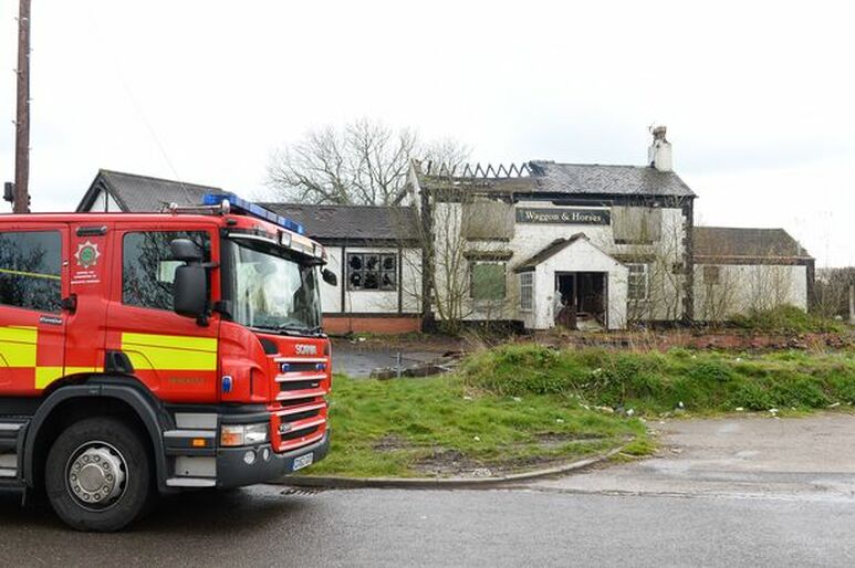
Firefighters at the Waggon and Horses again.
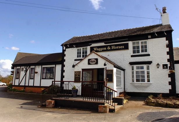
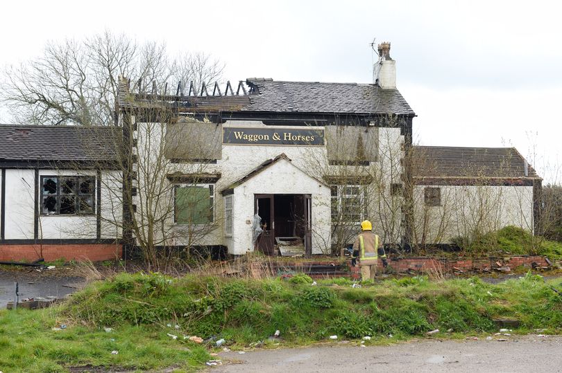
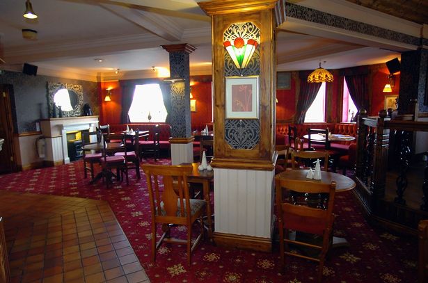
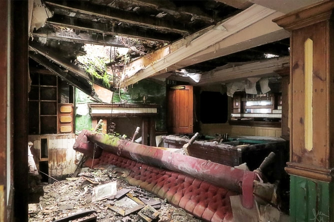
3 April 2019 (05:20) - 230-year-old church in FLAMES as fire breaks out at Blackburn landmark
Firecrews have been called to a huge blaze which has broken out at a historic church in the northwest of England. The fire started at The Bureau Centre for the Arts in Blackburn, Lancs. It is housed in the Grade II listed former Church of St John the Evangelist, opened in July 1789. The building is the oldest church in Blackburn.
Dean of Blackburn Cathedral Peter Howell-Jones shared a picture of the fire, tweeting: "Very sad to see @BureauBlackburn on fire this morning." He added: "Just praying no one was hurt." One Twitter user said: “Sounds like things are exploding as well. Hope everyone including emergency services are/stay safe.”
Eight fire crews were scrambled to the devastating scene, in Victoria Street, at around 5.30am. Nearby Victoria Street, Richmond Terrace and Ainsworth Street have subsequently been closed off. Firefighters remain at the scene putting out the flames — with the source of the fire as yet unknown. The popular venue hosts art galleries, theatre productions, music events and festivals.
News Source: Daily Star
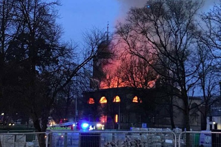
A historic church in Blackburn, Lancs has gone up in flames
Update 14:30: These are the first pictures of the aftermath of a devastating fire that ripped through The Bureau Centre for the Arts. At its peak up to 70 firefighters were battling the inferno that swept through the grade II-listed building at 5.20am. However as the fire was brought under control the operation was scaled back and fire crews were stood down. A fence has been erected around the site as fire investigators inspect the building.
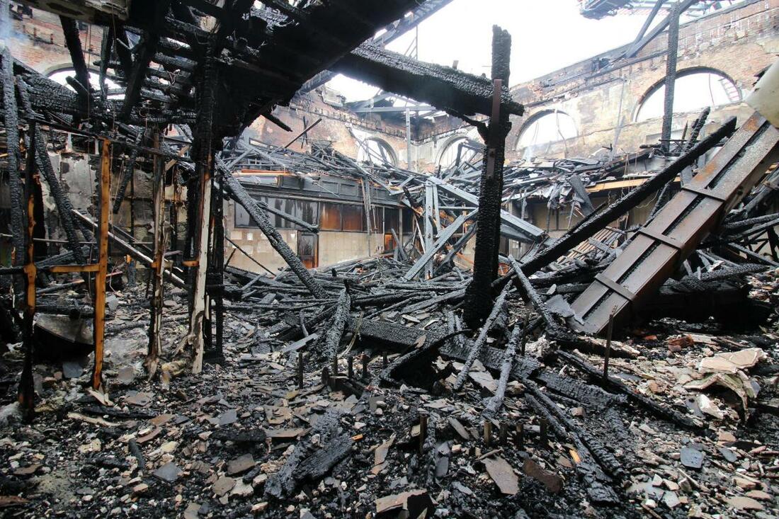
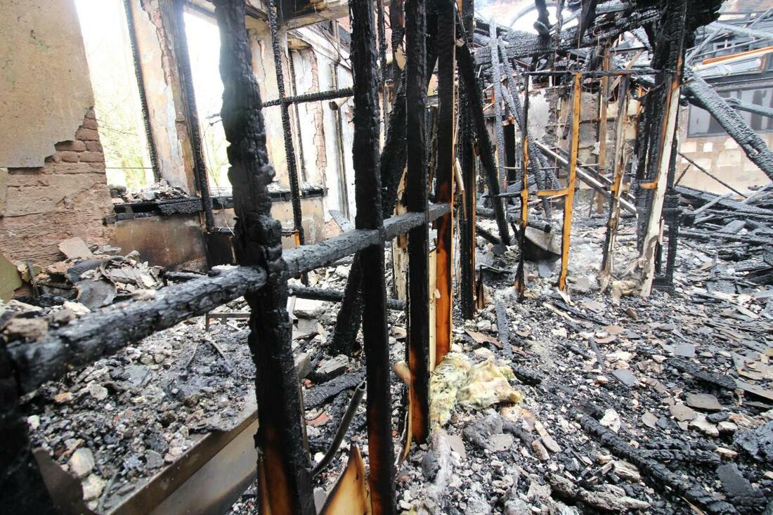
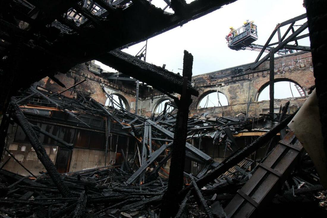
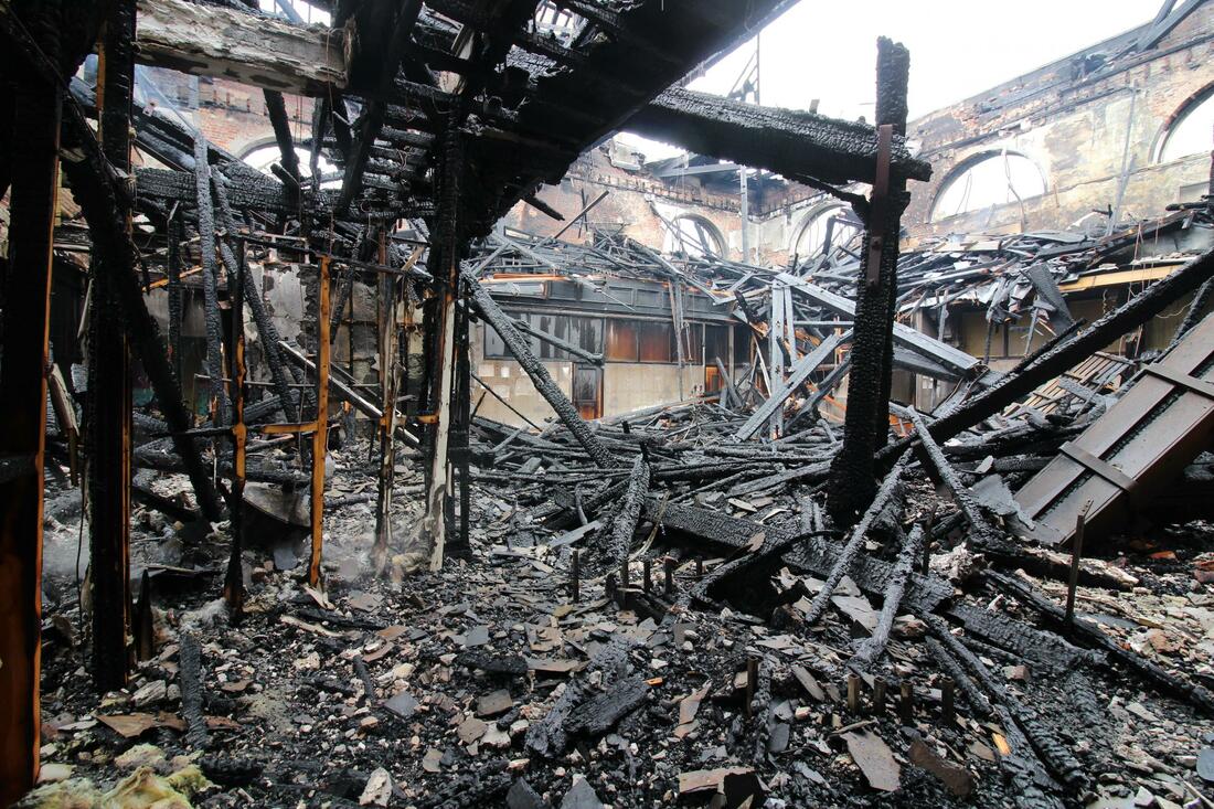
Listing Details
|
Entry Name: Church of St John Evangelist
Listing Date: 28 November 1951 Grade: II Source: Historic England Source ID: 1239170 English Heritage Legacy ID: 416939 Location: Blackburn with Darwen, BB1 County: Blackburn with Darwen Electoral Ward/Division: Shear Brow Built-Up Area: Blackburn Traditional County: Lancashire Lieutenancy Area (Ceremonial County): Lancashire Church of England Parish: Cathedral Church of St Mary the Virgin and St Paul Blackburn Church of England Diocese: Blackburn |
Coordinates
Latitude: 53.7507 / 53°45'2"N Longitude: -2.4821 / 2°28'55"W OS Eastings: 368307 OS Northings: 428362 OS Grid: SD683283 Mapcode National: GBR CT32.F7 Mapcode Global: WH96V.VZ7K |
2 April 2019 (05:47) - Huge hotel fire erupts at Manor House in Alsager
Guests and staff have been evacuated from a popular hotel after a huge blaze. A "large" fire has broken out at the Manor House Hotel in Alsager. The blaze erupted at around 5.47am this morning, reportedly in the kitchen. Four crews were dispatched to the Audley Road hotel. Firefighters from Alsager, Crewe, Congleton and one from Staffordshire found the first floor kitchen area well alight on arrival. All members of staff and guests had been safely evacuated and accounted for before crews extinguished the fire.
A Cheshire Fire and Rescue Service spokesman said: "On arrival at the scene the team discovered a large fire in a first floor kitchen area. All hotel guests and staff had been safely evacuated. Six firefighters, wearing breathing apparatus, used three extended hose reel jets to tackle the fire. They also used one covering jet to help extinguish the fire. Once the fire had been brought under control the team isolated the gas and electric and used a large fan to clear the smoke from within the building. Crews then used a thermal imaging camera to check for any hotspots and continued to damp down at the scene. An investigation into the cause of the fire is currently underway."
Manor House Hotel was originally a farmhouse and dates back to the 17th century. The hotel has retained much of the original character and has also been extended.
News Source: Birmingham Live
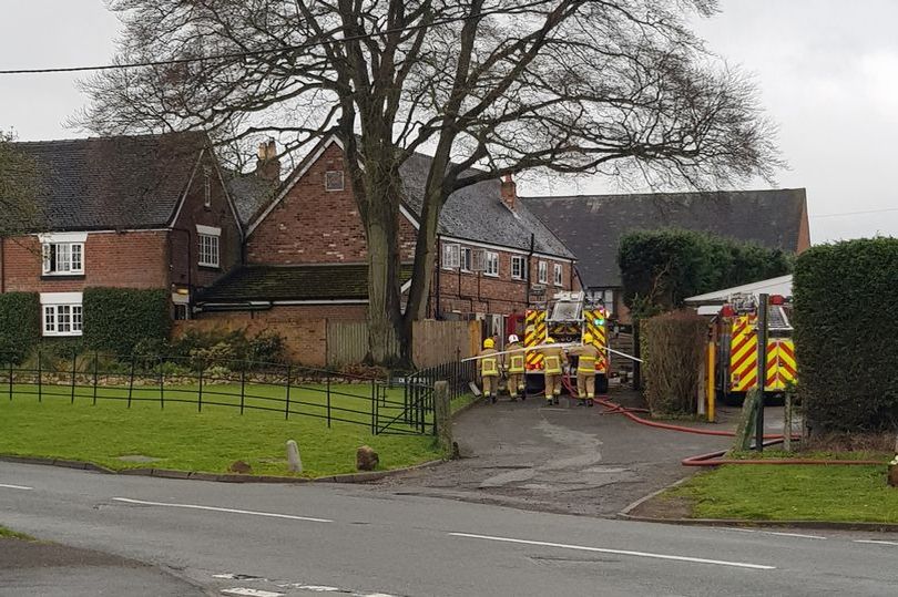
Cheshire Fire and Rescue Service at the scene of the kitchen fire.
1 April 2019 (23:20) - Derelict Rose and Crown pub in Hawridge severely damaged in fire overnight
A derelict country pub has been severely damaged by fire overnight. The blaze broke out at The Rose and Crown pub on Cholesbury Lane in Hawridge at around 11.20pm on Monday night. Firefighters battled the fire overnight, with crews from Amersham, Beaconsfield, High Wycombe, Aylesbury and Berkhamsted at the scene.
The fire was still causing delays in the area this morning, with a number of road closures in place and Thames Valley Police warning of disruption. The 18th century pub, which is on Hawridge and Cholesbury Commons, part of the Chilterns Area of Outstanding Natural Beauty (AONB), closed around 2013. A planning application submitted in 2016 to demolish the pub and redevelop it into four homes was refused by Chiltern District Council and an appeal was dismissed amid concerns from the Planning Inspectorate that it would "harm" the character of the area.
Another planning application was submitted in November last year to demolish the pub and replace it with three homes and a cafe that would be a "social centre" for cyclists enjoying the Chiltern Hills - but a decision has yet to be made.
News Source: Bucks Free Press
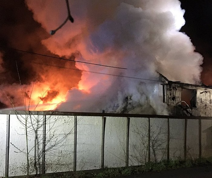
A derelict country pub has been severely damaged by fire overnight.
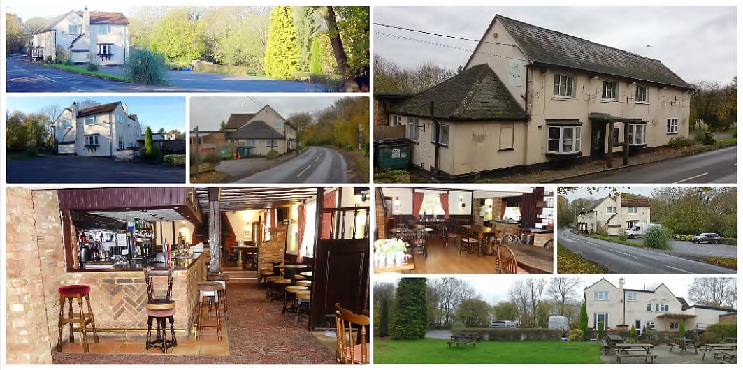
The Rose and Crown pub dates back to the 18th century (Images: Drake & Co.)
Heritage & Ecclesiastical Fire Protection
Preventing Fire, Protecting Life, Preserving Heritage
Click HERE for Expert Specialist Fire Safety Risk Assessments for Historic and Listed Buildings
Preventing Fire, Protecting Life, Preserving Heritage
Click HERE for Expert Specialist Fire Safety Risk Assessments for Historic and Listed Buildings
Phone: 07840 351458 Email: hello@fireprotect.me.uk
March - 38 Fires & 12 Near Misses
31 March 2019 (21:00*) - Fire breaks out in Glasgow’s Princes Square
Scores of Mother's Day revellers had to ditch their meals and drinks as smoke filled a city centre mall. The alarm was raised at Princes Square in Glasgow as an acrid smell poured through the building which is packed with restaurants and bars. Three fire engines were in attendance having accessed the popular nightspot from the Queen Street entrance.
Workers and customers gathered outside after being told to evacuate before fire crews arrived to tackle the blaze. Firefighters could be seen removing ceiling tiles from an area above the main entrance with debris scattered on the floor. One woman, who asked not to be named, said: “We were having a drink and the next thing the place started filling up with smoke. There was a sort of electrical burning smell and we were told to leave our drinks and move outside. It was quite worrying but there was no panic because the staff did a good job keeping everyone calm. I don’t think anyone was in danger but it’s put a bit of a dampener on our night.”
The original buildings of Princes Square consisted of a 4 storey merchant square built in yellow sandstone with a cobbled courtyard and completed in 1841. The then owner, James Campbell, was knighted by Queen Victoria and later became Lord Provost of Glasgow. In celebration of the birth of the Prince of Wales, later to become Edward VII, he named his new square the Prince of Wales Buildings.
The Category B listed buildings were developed by GRE Properties Ltd in the 1980’s to a design by Edinburgh architects, the Hugh Martin Partnership. The brief then was to preserve and restore the original buildings but create a modern shopping and dining centre of quality and distinction with an emphasis on style. The building was reconfigured by enclosing the entire space below a new clear glass domed and vaulted roof. The original cellars of the existing buildings were excavated to provide additional space. Inside the square, new galleries and stairs give access to the upper storeys. The centre is adorned with decorative glass, tiling, lighting, timber and metalwork, designed by artists and craftsmen and opened as a shopping and dining destination in 1988. The writer Bill Bryson referred to Princes Square as "one of the most intelligent pieces of urban renewal".
News Source: The Scottish Sun
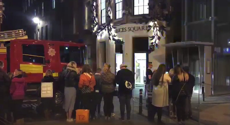
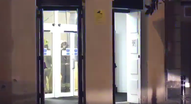
Listing Details
|
Entry Name: 34-58 (Even Nos) Buchanan Street with 7-17 (Odd Nos) Springfield Court, Formerly Prince of Wales Buildings Now Known As Princes Square
Listing Date: 15 December 1970 Category: B Source: Historic Scotland Source ID: 375461 Historic Scotland Designation Reference: LB32634 Building Class: Cultural Location: Glasgow County: Glasgow Electoral Ward: Anderston/City/Yorkhill Traditional County: Lanarkshire |
Coordinates
Latitude: 55.8591 / 55°51'32"N Longitude: -4.2544 / 4°15'15"W OS Eastings: 258996 OS Northings: 665182 OS Grid: NS589651 Mapcode National: GBR 0LM.ND Mapcode Global: WH3P2.MZBP |
Near Miss
31 March 2019 (10:51) - Fire Service called to Cilcain after a wheelie bin caught on fire
31 March 2019 (10:51) - Fire Service called to Cilcain after a wheelie bin caught on fire
North Wales Fire and Rescue Service have attended an incident in Cilcain this morning after a wheelie bin caught on fire. Firefighters were called around 11am and arrived at the scene just by the White Horse Inn in the Flintshire village, swiftly dealing with the incident. One fire engine attended the scene.
A spokesperson from North Wales Fire and Rescue Service has said: “We received a call this morning at 10:51am to a scene where a wheelie bin had caught on fire, by The White Horse Inn in Cilcain. Luckily the building itself did not catch fire or any other properties around it. The issue has now been fully resolved.”
This 400-year-old pub is the last survivor of the five originally to be found in this lovely hillside village, which was the bustling centre of the local gold-mining industry in the 19th century. It lies within the Cilcain Conservation Area.
News Source: The Leader
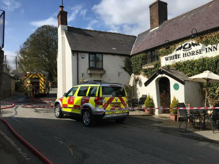
A fire engine attended the scene in Cilcain
31 March 2019 (03:05) - Fire tears through Glasgow church as crews tackle flames
A Fire took hold of a Glasgow church in the early hours of this morning. More than 20 firefighters raced to Belmont Church just after 3am.The fire and rescue service confirmed a well-developed blaze had torn through the building. Six appliances were deployed to the area on Great George Street. There are not believed to be any casualties. An SFRS spokeswoman confirmed that a crew was still at the scene at 10.45pm – almost 20 hours after they were alerted to the fire and a stop message had not been received, meaning the incident is still ongoing. Police Scotland said a joint investigation involving the fire service and police is being carried out to establish the cause of the blaze. A spokeswoman said: “Inquiries are continuing.”
The Category B listed former church dates back to 1894, and has also been known as Lilybank Church, but is being converted into 21 apartments. It lies within the Glasgow West Conservation Area. The architect was James Miller, who was responsible for some of the city’s most iconic buildings.
News Source: The Scottish Sun
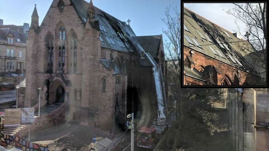
The roof and 2nd floor have sustained extensive damage (Main Photo: Mij Rothera)
Listing Details
|
Entry Name: 121 Great George Street, Extension to Laurel Bank School, Former Belmont Church
Listing Date: 15 December 1970 Category: B Source: Historic Scotland Source ID: 375917 Historic Scotland Designation Reference: LB32871 Building Class: Cultural Location: Glasgow County: Glasgow Electoral Ward: Hillhead Traditional County: Lanarkshire |
Coordinates
Latitude: 55.8748 / 55°52'29"N Longitude: -4.2908 / 4°17'27"W OS Eastings: 256771 OS Northings: 666993 OS Grid: NS567669 Mapcode National: GBR 0CF.8T Mapcode Global: WH3P2.2L0P |
Near Miss
30 March 2019 (19:40) -Exploding e-cigarette battery injures woman at Ship Inn pub in Swanage
30 March 2019 (19:40) -Exploding e-cigarette battery injures woman at Ship Inn pub in Swanage
A woman was lucky to avoid serious injury after an e-cigarette battery exploded in her coat pocket and caught fire. The drama unfolded on Saturday night at a busy pub in Swanage High Street. The woman, whose identity is unknown, was at the Ship Inn when a spare lithium battery was short-circuited by some loose change in her pocket, sparking the explosion. The fire alarm was set off, and pub staff called 999 for an ambulance and the fire service.
Firefighters from Swanage Fire Station were the first to arrive following a call just before 7.40pm. They provided first aid until paramedics arrived. The woman suffered burns to her leg and stomach, but her injuries could have been more severe according to station manager Graham Kewley, of Dorset and Wiltshire Fire and Rescue Service. “The lady affected was lucky not to suffer more serious injuries, as the explosion could have easily resulted in shrapnel-type wounds to the leg. There have been similar incidents elsewhere that have resulted in fatalities, so it is vital that vape users take real care with how they carry and store batteries. We believe that a spare lithium battery in a coat pocket was short-circuited by loose change”.
The woman was treated at the scene for her burns and did not need to be taken to hospital. The manager of the Ship Inn pub, Ross Barby, said when the woman’s battery exploded, nobody knew at first what had happened. “It set off the alarm, and it took us a few seconds to work out what had happened,” he said. “The battery just blew up in her pocket. The lithium battery reacted with the coins in her pocket. We called the fire service and they were in the pub for about 45 minutes. I’ve seen the woman in the pub a few times before, although I haven’t seen her since this happened. She only had a few minor injuries, but it was weird what happened.”
The fire service is offering advice to people who use e-cigarettes. They are warning people never to carry batteries loose or with other items which could cause the battery to short-circuit. People should never leave e-cigarettes on charge and unattended for long periods or overnight. They should only use the supplied charger and not mix components of different e-cigarettes.
The Ship Inn dates back to 1793 and is Grade II listed. It lies within the Swanage Conservation Area.
News Source: Bournmouth Daily Echo
The e-cigarette battery exploded in a customer's pocket in the Ship Inn
Listing Details
|
Entry Name: Ship Hotel
Listing Date: 21 March 1983 Grade: II Source: Historic England Source ID: 1323602 English Heritage Legacy ID: 108201 Location: Swanage, Dorset, Dorset, BH19 County: Dorset District: Purbeck Civil Parish: Swanage Built-Up Area: Swanage |
Coordinates
Latitude: 50.6079 / 50°36'28"N Longitude: -1.956 / 1°57'21"W OS Eastings: 403210 OS Northings: 78687 OS Grid: SZ032786 Mapcode National: GBR 459.Y04 Mapcode Global: FRA 67SG.HSL |
30 March 2019 (13:00*) - Fire crews tackle raging chimney fire at pub in Somerton
A fire in the chimney of a Somerset village pub sent flames into the air on Saturday afternoon. Somerton Fire Station posted on its Facebook page about the chimney fire at the Unicorn Inn, West Street, Somerton, at just after 1pm. Support came from Yeovil, Street and Martock. Three hose reel jets were used, firefighters used breathing apparatus and thermal image cameras as well.
The post read: "Somerton were mobilised to a Chimney Fire at the above location. Once in attendance the officer in charge made pumps 3 which came from Street and Martock and the ALP (Aerial Ladder Platform) from Yeovil as the Chimney was well alight. Crews extinguished the fire using Breathing Apparatus / 3 hose reel jets, 2 thermal image cameras and attacked the fire from the roof and from the hearth. Crews handed over the incident to owner/occupier."
The Unicorn pub building is Grade II* listed. It has late medieval or 16th century origins, and was remodelled mid 17th century, probably to convert it to an inn, as it was recorded as such by 1756. It lies within the Somerton Conservation Area.
News Source: Somerset Live
Flames shoot out of tjhe top of the chimney of The Unicorn pub.
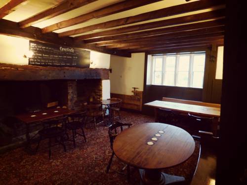
Listing Details
|
Entry Name: The Unicorn
Listing Date: 17 April 1959 Grade: II* Source: Historic England Source ID: 1056646 English Heritage Legacy ID: 263051 Location: Somerton, South Somerset, Somerset, TA11 County: Somerset District: South Somerset Civil Parish: Somerton Built-Up Area: Somerton Traditional County: Somerset Lieutenancy Area (Ceremonial County): Somerset |
Coordinates
Latitude: 51.0538 / 51°3'13"N Longitude: -2.731 / 2°43'51"W OS Eastings: 348863 OS Northings: 128525 OS Grid: ST488285 Mapcode National: GBR MJ.FZY3 Mapcode Global: FRA 565B.FWZ |
30 March 2019 (13:00*) - Firefighters tackling restaurant fire on Greenwich Church Street
Motorists are currently being warned to stay away from Greenwich Church Street as firefighters tackle a blaze. Officers were called this afternoon to a small restaurant fire. There is currently a build up of traffic on the one way system in the centre of Greenwich.
The fire was at Mogul Indian Restaurant which is housed in a Grade II listed building and lies within the West Greenwich Conservation Area.
News Source: News Shopper
The fire was at Mogul Indian Restaurant which is housed in a Grade II listed building and lies within the West Greenwich Conservation Area.
News Source: News Shopper
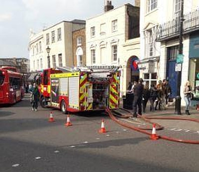
Listing Details
|
Entry Name: Number 10 Including Market Entrance
Listing Date: 8 June 1973 Grade: II Source: Historic England Source ID: 1078992 English Heritage Legacy ID: 200370 Location: Greenwich, London, SE10 County: London District: Greenwich Electoral Ward/Division: Greenwich West Built-Up Area: Greenwich Traditional County: Kent Lieutenancy Area (Ceremonial County): Greater London Church of England Parish: Greenwich St Alfege Church of England Diocese: Southwark |
Coordinates
Latitude: 51.481 / 51°28'51"N Longitude: -0.0093 / 0°0'33"W OS Eastings: 538329 OS Northings: 177660 OS Grid: TQ383776 Mapcode National: GBR L1.GB0 Mapcode Global: VHGR7.S1FH |
29 March 2019 (19:45) - Firefighters from four counties battling thatch fire in Wroughton
More than 70 firefighters have been battling a thatch fire in Wroughton. Roads around Brimble Hill have been closed by police. Dorset and Wiltshire Fire and Rescue Service urged residents to keep their doors and windows shut against the smoke.
In total, 12 pumps are fighting the blaze. Firefighters from Oxfordshire, Berkshire and Gloucestershire are among those assisting Dorset and Wiltshire crews. The fire service was called to The Pitchens from around 7.45pm, after reports of a fire in the thatch roof of a home. It is understood that no one has been injured in the fire.
As of 10.30pm, the fire fighting effort was being scaled back after crews managed to get on top of the blaze. Four fire crews are expected to remain at the scene overnight. Station Manager Dave Geddes said it was as yet too early to determine the cause of the fire. The effort involved in fighting the fire has been considerable: “Quite often thatch fires start internally. You’ve got internal firefighting, plus trying to put out the fire on the roof at the same time. They’re such complex fires you’re also trying to make sure they don’t spread any further.” Although the fire has largely been extinguished, Mr Geddes advised those downwind of the fire to keep their windows closed against the smoke.
The house involved is the Grade II listed Brook House along The Pitchens. Built in the early 19th century, the cottage lies within the Wroughton Conservation Area.
News Source: This is Wiltshire
Update 2 April 2019 - A 'devastating blaze' which consumed a thatch-roofed house in Wroughton and destroyed a family's possessions is being treated as arson by police. It has been revealed that firefighters had been called to the same house around the same time on Thursday and managed to put out the fire quickly that time, but the second fire, on the following evening, caused significant damage to the house.
Det Sgt Justin Downes, from Swindon CID, said: "Luckily nobody was injured in the fire, but this was a devastating blaze which has resulted in the occupants losing all their possessions and they have had to move out of the house. We have been working with Dorset and Wiltshire Fire Service and we believe the fire was started deliberately and are treating it as arson. We want to hear from anyone who may have information about the fire. Were you in the area on either of the evenings and perhaps saw something suspicious, or someone running away from the scene? There is a public footpath which runs alongside the property and is well-used by locals so we hope someone has seen something which could assist with our investigation."
Listing Details
|
Entry Name: Brook House
Listing Date: 20 September 1979 Grade: II Source: Historic England Source ID: 1185762 English Heritage Legacy ID: 318640 Location: Wroughton, Swindon, SN4 County: Swindon Civil Parish: Wroughton Built-Up Area: Wroughton Traditional County: Wiltshire Lieutenancy Area (Ceremonial County): Wiltshire Church of England Parish: Wroughton Church of England Diocese: Bristol |
Coordinates
Latitude: 51.5224 / 51°31'20"N Longitude: -1.7888 / 1°47'19"W OS Eastings: 414752 OS Northings: 180411 OS Grid: SU147804 Mapcode National: GBR 4VT.JL5 Mapcode Global: VHB3L.YZ6S |
28 March 2019 (14:09) - Firefighters called to incident near Oswestry Town Centre
Firefighters were called to a fire in Oswestry on Thursday afternoon. Fire engines from Oswestry and Ellesmere were called to the incident at 2.09pm with reports of a commercial fire on Thomas Savin Road. Crews worked to put out the small fire by isolating electric and put out the blaze using a dry powder extinguisher. The fire was out by 2.41pm.
It is understood that the premises was the Oswestry Health Centre, which occupies part of the former Cambrian Railway Works, built around 1866 and now a Grade II listed building housing a number of commercial buildings. The works undertook most of the casting, fabrication, assembly and repairs for the Cambrian Railways. But whilst many carriages and wagons were built in the workshops, only two locomotives were actually constructed at Oswestry, although many were extensively rebuilt.
News Source: Border Counties Advertizer
The former Cambrian Railway Works in Oswestry (Credit: Google)
Listing Details
|
Entry Name: Former Railway Works and Attached Footbridge
Listing Date: 15 May 1986 Grade: II Source: Historic England Source ID: 1054302 English Heritage Legacy ID: 255542 Location: Oswestry, Shropshire, SY11 County: Shropshire Civil Parish: Oswestry Built-Up Area: Croesowallt Traditional County: Shropshire Lieutenancy Area (Ceremonial County): Shropshire Church of England Parish: Oswestry Holy Trinity Church of England Diocese: Lichfield |
Coordinates
Latitude: 52.8627 / 52°51'45"N Longitude: -3.0475 / 3°2'51"W OS Eastings: 329573 OS Northings: 329982 OS Grid: SJ295299 Mapcode National: GBR 73.RQ78 Mapcode Global: WH89X.592Q |
28 March 2019 (10:06) - Nottinghamshire F&RS attend small fire in Natwest, Newark Market Place
Crews have been called to the scene of a fire in a bank in Newark Market Place. Firefighters were called to the scene of a small fire in Natwest at 10.06am. A spokesperson from Nottinghamshire Fire and Rescue Service said: "The fire was located in a light fitting within the building. Firefighters isolated the electricity supply, extinguished the fire and left the building in the hands of staff. The incident had been dealt with by 10.28am."
The bank building is Grade II listed and was built in 1902. This building stands on the site of the house of Alderman Hercules Clay, which was destroyed in the siege of 1643. There is a ceramic plaque on Market Place side.
News Source: Newark Advertiser
The bank building is Grade II listed and was built in 1902. This building stands on the site of the house of Alderman Hercules Clay, which was destroyed in the siege of 1643. There is a ceramic plaque on Market Place side.
News Source: Newark Advertiser
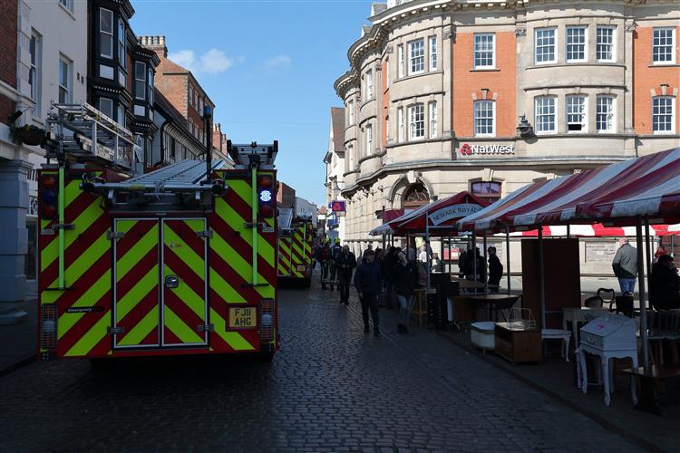
A light fitting caught fire at the Natwest in Newark

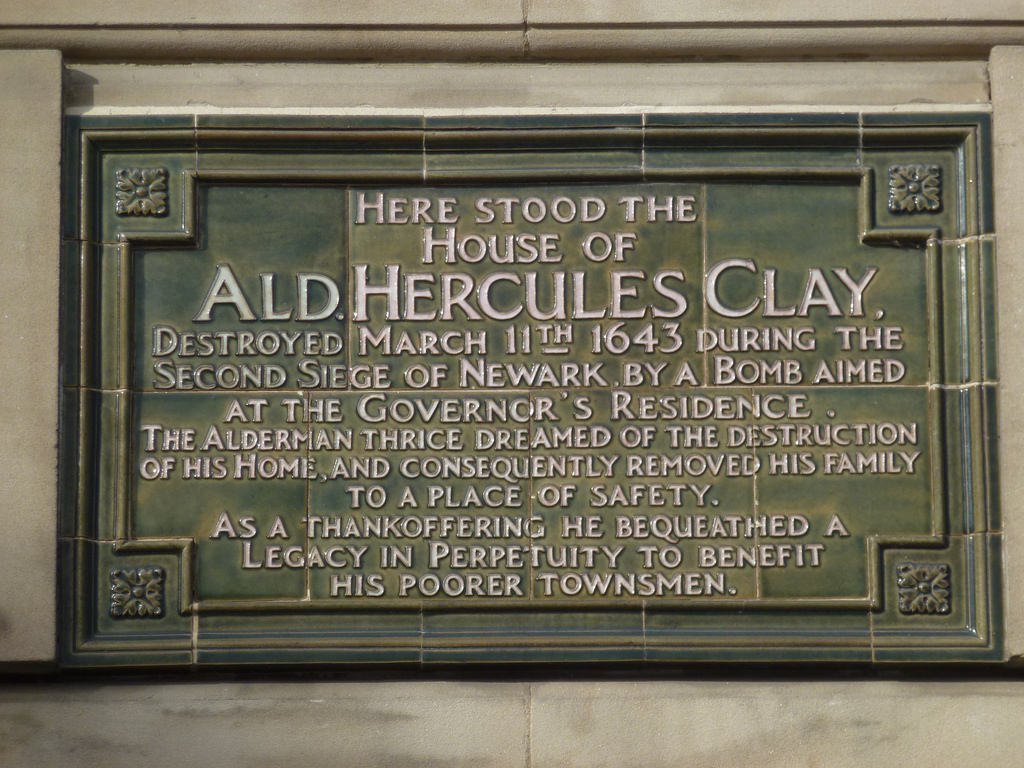
Listing Details
|
Entry Name: National Westminster Bank
Listing Date: 20 January 1992 Grade: II Source: Historic England Source ID: 1231081 English Heritage Legacy ID: 385077 Location: Newark, Newark and Sherwood, Nottinghamshire, NG24 County: Nottinghamshire District: Newark and Sherwood Civil Parish: Newark Built-Up Area: Newark-on-Trent Traditional County: Nottinghamshire Lieutenancy Area (Ceremonial County): Nottinghamshire Church of England Parish: Newark-upon-Trent with Coddington Church of England Diocese: Southwell and Nottingham |
Coordinates
Latitude: 53.0762 / 53°4'34"N Longitude: -0.81 / 0°48'35"W OS Eastings: 479818 OS Northings: 353875 OS Grid: SK798538 Mapcode National: GBR CLN.01X Mapcode Global: WHFHH.JYH4 |
Near Miss
28 March 2019 (04:00) - Arson to blame for blaze at Doncaster town centre shop
28 March 2019 (04:00) - Arson to blame for blaze at Doncaster town centre shop
A blaze at a shop in Doncaster town centre this morning was started deliberately, according to firefighters. The fire at Doncaster Mobile, a disused shop on High Street, broke out at around 4am. Firefighters who dealt with the incident said it was started deliberately. It is cordoned off this morning.
The Doncaster Mobile shop is next door to the Grade II listed National Westminster Bank, built in 1925.
News Source: Doncaster Free Press
The Doncaster Mobile shop is next door to the Grade II listed National Westminster Bank, built in 1925.
News Source: Doncaster Free Press
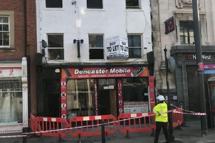
The shop is cordoned off this morning.
Listing Details
|
Entry Name: National Westminster Bank
Listing Date: 1 February 1988 Grade: II Source: Historic England Source ID: 1151421 English Heritage Legacy ID: 335036 Location: Doncaster, DN1 County: Doncaster Electoral Ward/Division: Town Built-Up Area: Doncaster Traditional County: Yorkshire Lieutenancy Area (Ceremonial County): South Yorkshire Church of England Parish: Doncaster St George Church of England Diocese: Sheffield |
Coordinates
Latitude: 53.5235 / 53°31'24"N Longitude: -1.134 / 1°8'2"W OS Eastings: 457509 OS Northings: 403330 OS Grid: SE575033 Mapcode National: GBR NWJP.8N Mapcode Global: WHDD2.KP6P |
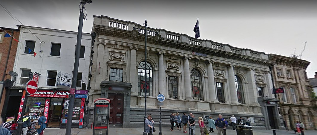
The shop is next door to the Grade II listed National Westminster Bank building (Credit: Google)
27 March 2019 (12:20) - Eight fire crews called to thatched house blaze near Long Stratton
Firefighters from across Norfolk were called in to deal with a blaze at a thatched house. Emergency services were called to reports of a fire at Harris Green, near Long Stratton, at 12.20pm today. Eight fire crews from as far afield as Diss, Wymondham and Wroxham, as well as the aerial platform ladder from Earlham were called in to attend the scene of the blaze. Firefighters climbed onto the roof to cut away the thatch and managed to save most of it, but around 20pc of the roof was lost.
Alan Jaye, station manager at Earlham fire station, said: “What we were faced with when we got here was a fire in the thatched roof. We put an offensive fire fighting tactic in which meant deploying firefighters to the roof of the property on ladders and taking the thatch off to stop the fire spreading. The damage is about 20pc of the thatched roof. Internally we have saved all of the property inside and moved it away to safety. There is also minimum water damage inside as well. Firefighters have worked extremely hard to save the property. It obviously could have been much worse. Thatch fires once they get going they are really hard to bring under control. Thatch is built to repel water so we do struggle with them if they are well alight. It is years of experience how you tackle them.”
The woman householder was out of the property by the time fire crews arrived, and was uninjured. An East of England Ambulance Service spokesman said: “An ambulance and two hazardous area response team vehicles were called to an address in Harris Green shortly after 12.30pm today following reports of a house fire. One person was assessed at the scene, but did not require transport to hospital.” The woman was too upset to speak but thanked firefighters for their efforts. Mr Jaye said: “She is a bit emotional at the moment as you can understand. But the fact that we have managed to save her property is going to be an immense relief.” The cause of the fire is not known at this stage but is suspected to be accidental. An investigation is now under way.
Harris Green Farmhouse is a small Grade II listed 17th century timber framed house.
News Source: Eastern Daily Press
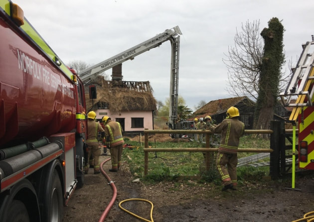
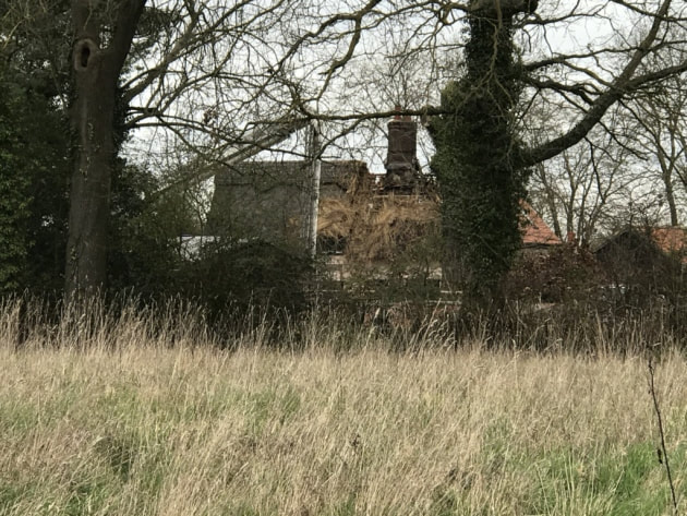
Listing Details
|
Entry Name: Harris Green Farmhouse
Listing Date: 26 June 1981 Grade: II Source: Historic England Source ID: 1156728 English Heritage Legacy ID: 226054 Location: Shelton and Hardwick, South Norfolk, Norfolk, NR15 County: Norfolk District: South Norfolk Civil Parish: Shelton and Hardwick Traditional County: Norfolk Lieutenancy Area (Ceremonial County): Norfolk Church of England Parish: Shelton St Mary Church of England Diocese: Norwich |
Coordinates
Latitude: 52.4609 / 52°27'39"N Longitude: 1.2863 / 1°17'10"E OS Eastings: 623356 OS Northings: 289856 OS Grid: TM233898 Mapcode National: GBR VJC.N1Q Mapcode Global: VHL8Y.7DWS |
26 March 2019 (18:00*) - Fire rips through thatched roof in Murcott, Bicester
Flames tore through the roof of a thatched cottage yesterday as crews scrambled to salvage the home. Smoke poured from the home in Murcott, near Bicester, yesterday evening as firefighters tried to put out the fire.
Flames could be seen burning through the roof and Oxfordshire Fire Service said desperate salvage attempts were carried out to save as much of the roof as possible, as well as belongings inside. Firefighters have been at the scene overnight to ensure the fire is completely put out and the thatch has been completely stripped back. Crews were called from Kidlington and Bicester to help deal with the fire.
Fiveacres is a late 17th century farmhouse and is Grade II listed.
News Source: Oxford Mail
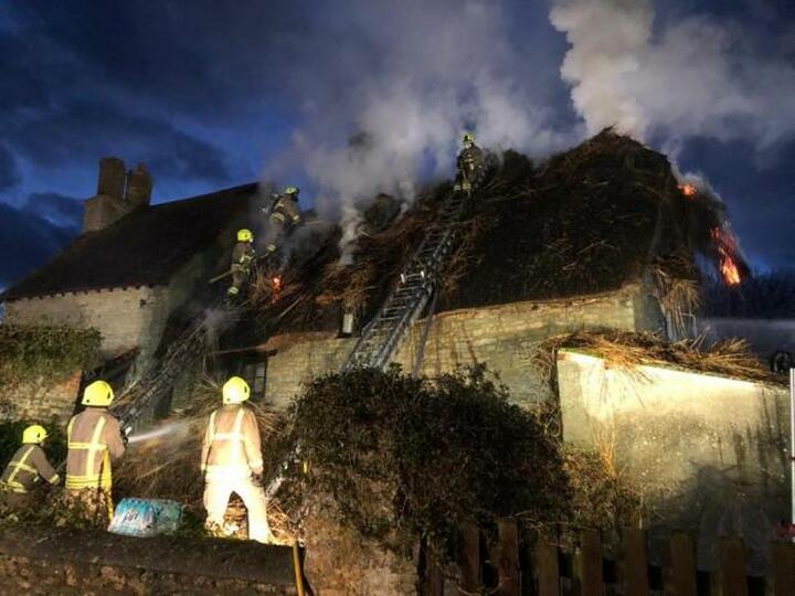
Fiveacres is a late 17th century farmhouse and is Grade II listed.
Listing Details
|
Entry Name: Fiveacres
Listing Date: 10 April 1987 Grade: II Source: Historic England Source ID: 1286513 English Heritage Legacy ID: 243270 Location: Fencott and Murcott, Cherwell, Oxfordshire, OX5 County: Oxfordshire District: Cherwell Civil Parish: Fencott and Murcott Traditional County: Oxfordshire Lieutenancy Area (Ceremonial County): Oxfordshire Church of England Parish: Charlton-on-Otmoor Church of England Diocese: Oxford |
Coordinates
Latitude: 51.8378 / 51°50'15"N Longitude: -1.1534 / 1°9'12"W OS Eastings: 458423 OS Northings: 215801 OS Grid: SP584158 Mapcode National: GBR 8Y3.P6C Mapcode Global: VHCXH.Y2LH |
Near Miss
26 March 2019 (15:48) - 18 firefighters called to blaze at north-east war memorial
26 March 2019 (15:48) - 18 firefighters called to blaze at north-east war memorial
A patch of grass at a north-east war memorial was on fire. Reports of the incident were made at 3.48pm, at the Stonehaven war memorial, near Dunnottar Castle. A total of 18 firefighters have been sent to the scene, including three appliances and a water carrier. A Scottish Fire and Rescue Service spokesman said: “We were in attendance at a grass fire. It measures around 50 square metres, and is grass and scrubland.” He added that due to the location, more manpower was sent. The fire was put out around 5pm.
A Scottish Fire and Rescue Service spokeswoman added: “We used two jets and four beaters and knapsacks.” Yesterday the Scottish Wildlife Forum and the Scottish Fire and Rescue Service issued a wildfire alert ahead of what is expected to be dry and windy weather this week. The order has been put in place for central and eastern areas of Scotland.
The memorial was designed by local architect John Ellis, and unveiled on Sunday 20 May 1923. It is a Category C listed building. Scotland's war memorials come in all shapes and sizes, with many featuring a statue of a kilted infantryman of the era. Stonehaven’s war memorial is rather different, and rather larger, and stands on the top of Black Hill overlooking the town from the south. The memorial is in the form of a classical temple. Most sources describe it as "round", though it is actually octagonal in shape. The structure has something of the appearance of an ancient ruin. This was deliberate, and meant to signify the many shortened and ruined lives caused by the conflict.
The names of eight First World War battles are inscribed around the crown of the structure: Gallipoli, Jutland, Marne, Mons, Somne, Vimy, Ypres and Zeebrugge. The names of Second World War campaigns and battles were later added around its base. Steps and a gate lead into the heart of the memorial, and here is a centrally placed triangular stone on which are inscribed the names of those from Stonehaven who fell during the First World War. The names of those killed during the Second World War are inscribed on a series of tablets added to the inside of the temple.
News Source: Evening Express
The Stonehaven war memorial, near Dunnottar Castle
Listing Details
|
Entry Name: War Memorial, Black Hill
Listing Date: 25 November 1980 Category: C Source: Historic Scotland Source ID: 333893 Historic Scotland Designation Reference: LB2918 Building Class: Cultural Location: Dunnottar County: Aberdeenshire Electoral Ward: Stonehaven and Lower Deeside Traditional County: Kincardineshire |
Coordinates
Latitude: 56.955 / 56°57'17"N Longitude: -2.2027 / 2°12'9"W OS Eastings: 387768 OS Northings: 784878 OS Grid: NO877848 Mapcode National: GBR XL.C6GN Mapcode Global: WH9RN.4GC2 |
26 March 2019 (12:06) - Pub fire at Windwhistle near Chard
Firefighters from three towns were called to a public house at Windwhistle, near Chard, today (Tuesday, March 26) after reports that smoke was coming from the roof. Crews from Chard, Crewkerne and Ilminster, along with the aerial appliance from Yeovil, put out the blaze using one hose reel jet, and thermal imaging camera and small tools. They then ventilated the property using positive pressure equipment. Fire chiefs confirmed this was an accidental fire, and duty of care was left with the owners. The roof sustained moderate damage from the flames and was also damaged by water and smoke.
Windwhistle Inn dates from the 17th Century and was once a notorious haunt of smugglers, highwaymen, and cut-throats. It has a romantic ‘Jamaica Inn’ type atmosphere and local folklore has it that if you looked like you had money on you, you would be lured or dragged down into the cellar, your throat slit and your corpse tossed down a nearby pit. The road it stands on was an old pilgrim route, an extension of the Fosse Way to Lincoln. More recently in 1902 Thomas Hardy mentioned the inn by name in his poem "A Trampwoman's Tragedy".
News Source: Midweek Herald
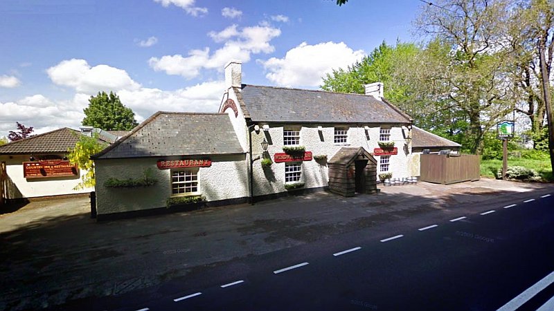
17th century Windwhistle Inn
26 March 2019 (11:25) - Seven fire crews called to ‘suspicious’ blaze in Norwich city centre
Seven fire crews were sent to a blaze which broke out in the basement of a building in Norwich city centre. Norfolk Fire and Rescue Service were called to the fire in King Street, opposite the Last Pub Standing, at just before 11.25am today (Tuesday, March 26).
The fire had broken out in the bin store area of the Grade II listed Hardwick House flats, which are accessed through a door in King Street. Because of the residential nature of the building and its city centre location, seven fire crews were initially called. Two crews from Earlham, two from Great Yarmouth, one from Carrow, one from Sprowston and one from Hethersett went to the scene. The majority of the appliances were on standby, with the fire being tackled by firefighters from Carrow and Earlham. They used water jets, a fan to clear away smoke and a thermal imaging camera to put out the fire. The flames were out by just after 11.45am. Norfolk police were also called, as there were ‘suspicious circumstances’ around the cause of the fire, which did not spread beyond the bin area.
News Source: Eastern Daily Press

Listing Details
|
Entry Name: Hardwick House
Listing Date: 23 October 1970 Grade: II Source: Historic England Source ID: 1280895 English Heritage Legacy ID: 228743 Location: Norwich, Norfolk, NR1 County: Norfolk District: Norwich Town: Norwich Electoral Ward/Division: Thorpe Hamlet Built-Up Area: Norwich Traditional County: Norfolk Lieutenancy Area (Ceremonial County): Norfolk Church of England Parish: Norwich St George, Tombland Church of England Diocese: Norwich |
Coordinates
Latitude: 52.6289 / 52°37'44"N Longitude: 1.2989 / 1°17'56"E OS Eastings: 623357 OS Northings: 308572 OS Grid: TG233085 Mapcode National: GBR W9V.MH Mapcode Global: WHMTM.X5QY |
Building History
(Researched by Heritage & Ecclesiastical Fire Protection)
Hardwick House is one of Norwich’s landmark buildings. It was built in 1866 and designed by Philip C. Hardwick as Harvey and Hudson’s Crown Bank. Four years later the bank collapsed and its owner Sir Robert Harvey had amassed debts of £400,000, later killing himself in the garden of his home in Crown Point, Trowse. The Post Office took over the former bank and was there for almost a century. It later became offices and now houses 23 residential flats, a three bedroom penthouse and commercial space.
It is built from Bath stone in a grand neo-classical stone style, presiding over Agricultural Hall Plain, at the top of Prince of Wales Road. It is considered one of the city’s most architecturally elaborate buildings.
26 March 2019 (09:35) - Huge thatch fire at The Ship Inn pub in Levington
A 13th century pub in Suffolk has been badly damaged after its thatched roof caught fire. Fire tore through the roof of the historic Ship Inn in the village of Levington near Ipswich. The alarm was raised by a passer-by who saw flames in the thatch at the Inn in Church Lane. Staff had to flee the burning building but no-one was hurt.
A total of 10 engines and two appliances from across the county were at the scene, where crews stripped the roof using breathing apparatus and ladders in an attempt to stem the blaze. An aerial platform failed to make it because it was unable to get down narrow country lines and under telegraph wires. A spokesman for Suffolk police said officers were called shortly before 9.40am to assist fire crews at the scene. The road is blocked and people are being warned to avoid the area. The Ship Inn is owned by the Southwold-based brewery Adams and had only recently re-opened after refurbishment. The cause of the fire is not yet known but is being investigated by Suffolk Fire and Rescue Service.
The pub is no stranger to fire – it suffered a blaze in the late 1980s and then a devastating fire in 2001 when flames engulfed the building as eight crews tackled the incident. The fire caused substantial damage but the pub was rebuilt and reopened successfully as a popular eating and drinking place.
The building is Grade II listed and is believed to have originally been a pair of 13th century estate cottages, and is a rare example of an aisled hall house of modest status.
News Source: Ipswich Star
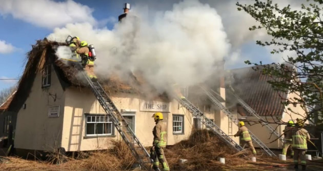
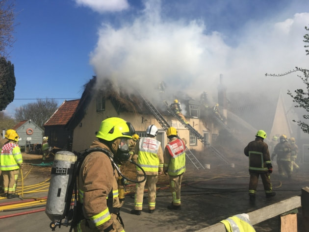
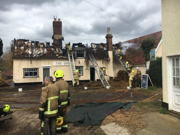
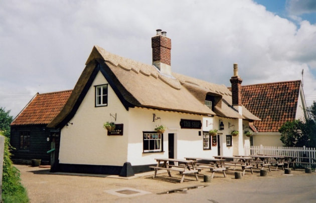
Listing Details
|
Entry Name: The Ship Inn
Listing Date: 20 May 1985 Grade: II Source: Historic England Source ID: 1030423 English Heritage Legacy ID: 286181 Location: Levington, Suffolk Coastal, Suffolk, IP10 County: Suffolk District: Suffolk Coastal Civil Parish: Levington Traditional County: Suffolk Lieutenancy Area (Ceremonial County): Suffolk Church of England Parish: Levington Church of England Diocese: St.Edmundsbury and Ipswich |
Coordinates
Latitude: 52.0045 / 52°0'16"N Longitude: 1.2546 / 1°15'16"E OS Eastings: 623479 OS Northings: 239012 OS Grid: TM234390 Mapcode National: GBR VPY.60K Mapcode Global: VHLC1.PWL6 |
Building History
On its high vantage point overlooking the marshes and mud flats of the picturesque Orwell estuary, The Ship Inn has long been a landmark to all those who have journeyed along the river. With links to the legendary 18th century figure Margaret Catchpole, The Ship has in recent years become a favourite haunt of tourists and the yachting community using the nearby marina.
The famous old inn has stood in the village just down the road from the church since at least the early 1700s, although the building is much older with some parts dating back to medieval times. Made from the timbers of an old merchant ship it was not built originally to withstand the devastating effects of fire. It was traditionally a place of sanctuary for smugglers returning to Suffolk. There was a secret passage upstairs leading from one wall of the pub to a smugglers’ loft.
One of Suffolk’s most famous historical smuggling figures, Margaret Catchpole, has links with the pub. She is believed to have stood outside and shone a torch to guide her smuggler boyfriend back to shore. The first licence was granted at the pub to John Girling in 1712. Not much is known of the pub between 1712 and 1844, when Charles Pierce took over. It was originally called "The Musket".
24 March 2019 (20:10) - Fire crews battle thatched roof blaze near Taunton for nearly 12 hours
Firefighters have been tackling a thatch roof fire for nearly 12 hours at a property to the north of Taunton. The fire service were first called out at shortly after 8pm yesterday (March 24) to a home on Mark Herniman Hill, Crowcombe. There are reports of the road being closed while firefighters deal with the incident. Eight fire engines, from Williton, Nether Stowey, Taunton and Bridgwater, were rushed to the scene, as well as an aerial ladder platform, a water carrier, an incident command unit from Wiveliscombe, and a high volume pump and 4x4 from Wellington.
The fire involved a pair of Grade II listed cottages, dating back to the late 16th to early 17th century. They are known as Timewell and Timewell Cottage, (formerly listed as Shute Cottage and Timewell Cottage)
A spokesman for Devon and Somerset Fire Service said: "Once the crews got in attendance the officer in charge confirmed the thatch of the property to be well alight. Fire crews were 'at work trying to create a fire break by stripping the thatch of the roof of the property”. The spokesman added: "The crews also have four hose reel jets, one thatching lance, one compressed air foam jet, 2 main jets, 4 breathing apparatus, two 13.5 metre ladders and one roof ladder in use. Due to the volume of smoke coming from this fire all residents within the area of Crowcombe are being advised to keep all windows and doors shut until the incident has been resolved."
At around 10pm, the officer in charge requested the attendance of four more fire engines for personnel and breathing apparatus. One fire engine from Ilminster, one fire appliance from Bridgwater and one fire engine from Minehead were sent to the incident. The fire service started to scale down operations at midnight, reducing the active crews to six pumps monitoring the property and dampening down hot spots. At 5am today (March 25), the incident was scaled down to three pumps still monitoring the property and dampening down hot spots. The incident was concluded at 8am.
The fire service spokesman said: "This incident caused 75 per cent fire damage to the roof of two thatched properties, 50 per cent fire and water damage to the first floor, and 25 per cent fire and water damage to the ground floor. "However the firefighters salvaged 90 per cent of the properties contents. Firefighters are still on scene monitoring the properties and dampening down hot spots." The cause of this fire is believed to be accidental.
News Source: Somerset County Gazette
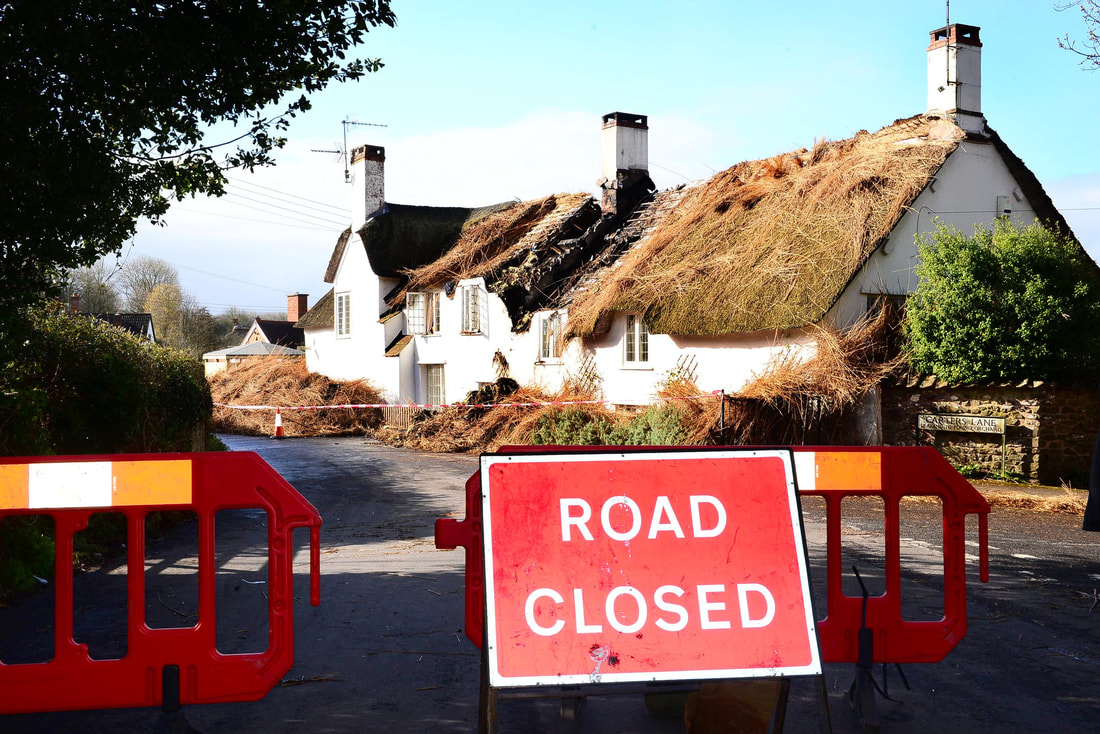
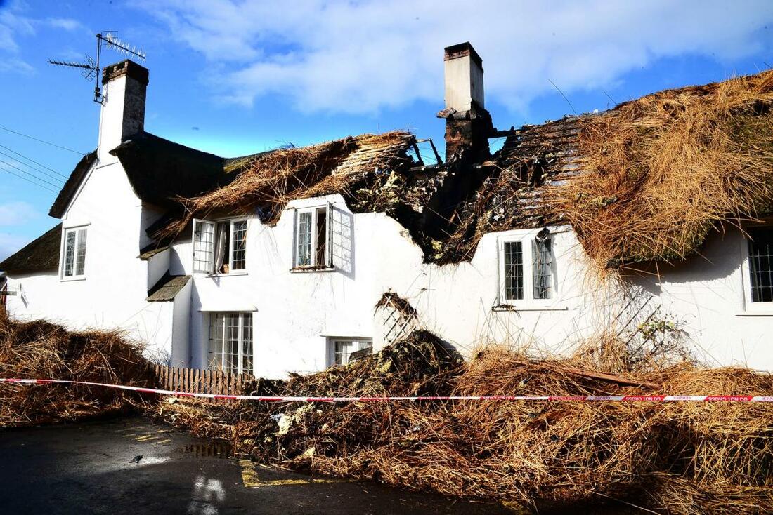
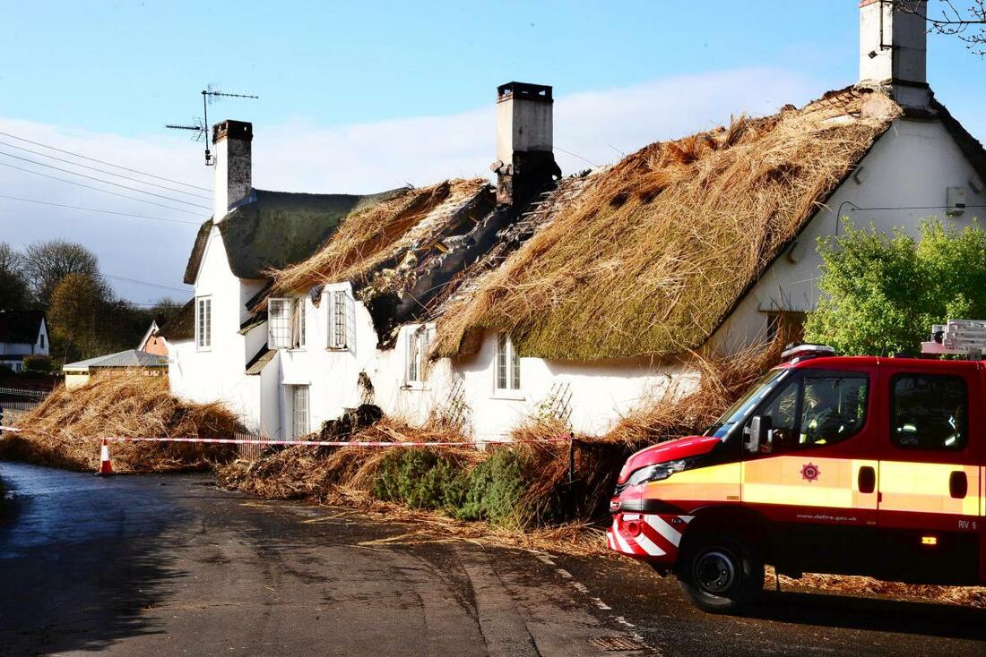
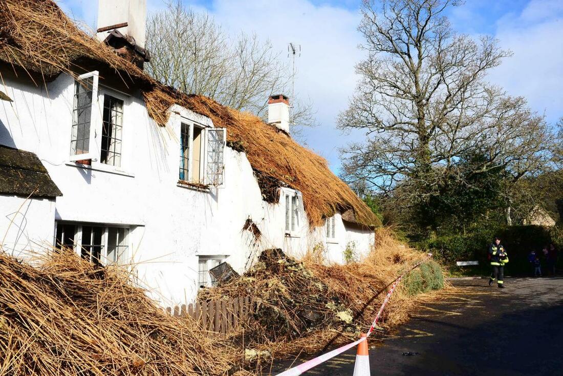
Listing Details
|
Entry Name: Timewell timewell Cottage
Listing Date: 22 May 1969 Last Amended: 16 November 1984 Grade: II Source: Historic England Source ID: 1057447 English Heritage Legacy ID: 265102 Location: Crowcombe, West Somerset, Somerset, TA4 County: Somerset District: West Somerset Civil Parish: Crowcombe Traditional County: Somerset Lieutenancy Area (Ceremonial County): Somerset |
Coordinates
Latitude: 51.1221 / 51°7'19"N Longitude: -3.2295 / 3°13'46"W OS Eastings: 314047 OS Northings: 136585 OS Grid: ST140365 Mapcode National: GBR LV.9RMS Mapcode Global: VH6H3.Z214 |
24 March 2019 (20:00) - Lord Line building on fire for the second week in a row
Thick smoke has been spotted billowing out of Hull's Lord Line building for the second weekend in a row. Dramatic video footage captured the smoke pouring out the large derelict building on St Andrew's Dock at around 8pm on Sunday evening. It was almost a direct like-for-like repeat of the same fire which was started among a torrent of rubbish inside the building on Sunday, March 17.
Fire engines from Humberside Fire and Rescue had attended the scene last night, but it is believed the fire was already put out prior to their arrival. A spokesperson for Humberside Fire and Rescue said: "We can confirm Humberside Rescue Service attended the scene last night. There are no more updates on the log on the incident." It is the second fire at the building in the space of seven days after footage of a blackened room within the building surfaced ast weekend.
A video by a member of the public, surveyed the scene after the fire was extinguished last Sunday and it shows the graffiti-covered walls - which was covered in black ash.
The Lord Line building has become a hive of activity and target for vandals with urban explorers using the structure as a "play area" after footage emerged of the "eerie" rooms online. City councillors gave the go-ahead to the bar or restaurant plans at the derelict former trawler company site following a green-light planning proposal in November.
The building is Locally Listed and lies within the St Andrew’s Dock Conservation Area.
News Source: Hull Daily Mail
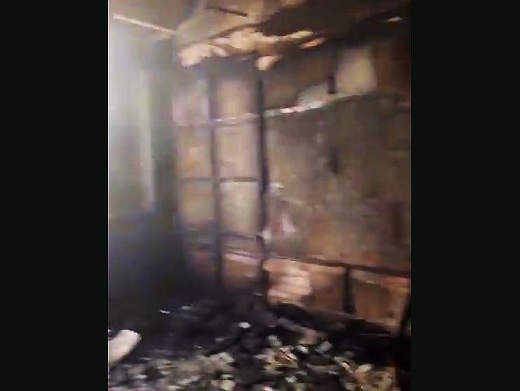
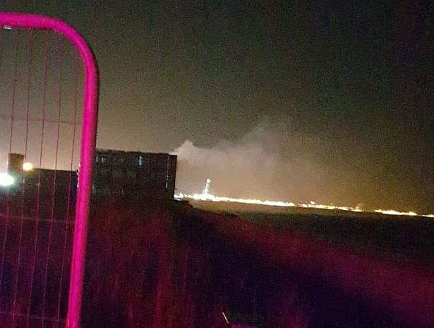
24 March 2019 (18:57) - Firefighters battle blaze at old hospital again
Firefighters have put out fires at the derelict Strathmartine Hospital near Dundee after suspected wilful fire raising. Police are now investigating the “multiple fires” and suspect that they were started deliberately. Emergency services were called to the abandoned site, which sits on the border of Dundee and Angus, shortly before 7pm and had the fire extinguished after an hour. A Police Scotland spokesman said: “There were multiple small fires within derelict buildings. It is being treated as a crime – suspected wilful fire raising.”
The site, previously a hospital and orphanage for people with learning difficulties, has been empty for 15 years but has been regularly targeted by vandals and people starting fires. The site is
Category B listed and the main building is considered to be one of Tayside’s most historic.
A Scottish Fire and Rescue Service spokeswoman said: “We were called to a fire within a derelict building at the hospital.Two breathing apparatus and one hose reel were in use. We received the report at 18.57 and the stop message from crews at 19.59. Police were in attendance.”
A report published just one day ago praised firefighters for their efforts in driving down a shocking trend in deliberate blazes at the derelict Angus hospital. Since 2013, Scottish Fire and Rescue Service crews have been mobilised to tackle almost 30 deliberate incidents at the site. A third of the cases took place during the spring and summer months of 2017. However, following the continued efforts of SFRS and Police Scotland colleagues, call-outs to the disused complex have fallen – and there had been no incidents of fire at the site since September last year.
News Source: Evening Telegraph
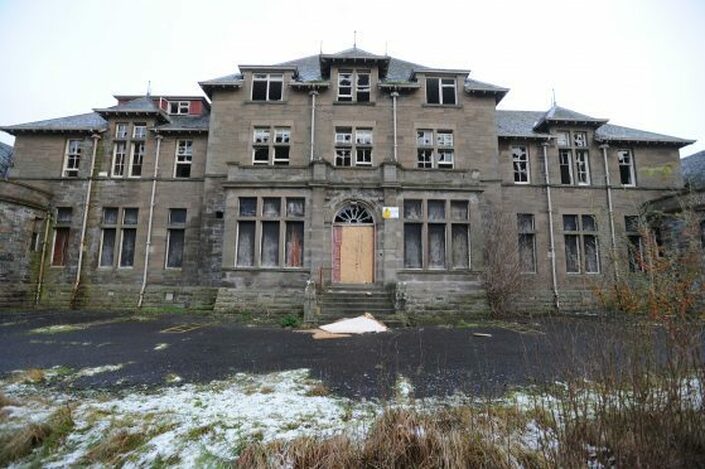
After a break of six months, fire-raising has resumed at the old hospital site.
Listing Details
|
Entry Name: Baldovan, Strathmartine Hospital, Former Baldovan Institute
Listing Date: 10 August 2001 Category: B Source: Historic Scotland Source ID: 395542 Historic Scotland Designation Reference: LB48113 Building Class: Cultural Location: Mains and Strathmartine County: Angus Electoral Ward: Monifieth and Sidlaw Traditional County: Angus |
Coordinates
Latitude: 56.5038 / 56°30'13"N Longitude: -2.9977 / 2°59'51"W OS Eastings: 338684 OS Northings: 735077 OS Grid: NO386350 Mapcode National: GBR VJ.Z9LS Mapcode Global: WH7R3.XSPJ |
24 March 2019 - Fire at derelict building in Manningham
A fire at a derelict building in Manningham is suspected to have been deliberate. Firefighters from Shipley and Fairweather Green were called to Birr Road earlier today. A West Yorkshire Fire and Rescue Service spokesman said it was a small fire which was contained to one room. Hose reels and breathing apparatus were used at the scene.
The former Sunday school is a substantially sized building constructed from rock-faced stone with a steeply pitched blue slate roof. It is identified as a Key Unlisted Building providing a positive contribution to character of the North Park Road Conservation Area and has a clear visual relationship with the nearby Grade II listed former St John’s Methodist Church. The Sunday School was built in 1886 in a Gothic Revival style that is complementary to the church that stands next to it. Incorporated into the northern end of the building is a small dwelling, 11 Birr Road that may have originally been a caretaker’s house.
News Source: The Telegraph and Argus
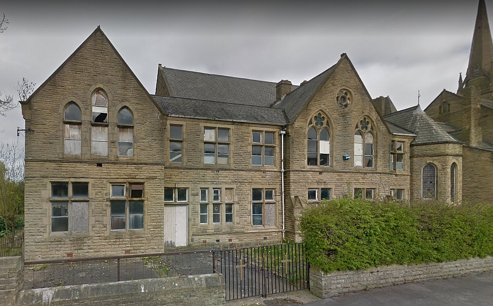
The former Sunday school has fallen into dereliction.
Near Miss
23 March 2019 (19:20) - Fire in Gibson Street - pubs and restaurants evacuated in Glasgow's west end
23 March 2019 (19:20) - Fire in Gibson Street - pubs and restaurants evacuated in Glasgow's west end
Pubs and restaurants in Glasgow's west end have been evacuated tonight after a blaze in Gibson Street. The Scottish Fire and Rescue Service confirmed that four crews are currently on the scene. A spokesperson said that the alarm had been raised shortly after 7.20pm tonight (Saturday). They say the source of the blaze is in a building on the street, but can provide no further details at this time.
Toni's Pizzeria released this update via Twitter with regards to their west end branch. They said: "Due to a fire in Gibson Street, our restaurant has been evacuated/we have no access to telephones or online order systems. We are unable to access our premises - we apologise for any inconvenience this has caused and will be in touch with customers this has affected!" Police Scotland are also on the scene.
The building is directly opposite a terraced row of Category C listed buildings built in 1875. Gibson Street lies within the Glasgow West Conservation Area.
News Source: Glasgow Live

All the buildings / structures inside the red circles are Category C listed, and those in yellow are Category B listed. The location of the fire is indicated by the orange star (Credit: Google Earth)
Listing Details
|
Entry Name: 12, 14, 16, 18, 20, 22, 24, 26, 30, 32, 34, 36, 38 Gibson Street and 89 Otago Street
Listing Date: 20 May 1986 Category: C Source: Historic Scotland Source ID: 373707 Historic Scotland Designation Reference: LB32190 Building Class: Cultural Location: Glasgow County: Glasgow Electoral Ward: Hillhead Traditional County: Lanarkshire |
Coordinates
Latitude: 55.8725 / 55°52'21"N Longitude: -4.2819 / 4°16'54"W OS Eastings: 257320 OS Northings: 666727 OS Grid: NS573667 Mapcode National: GBR 0FG.2L Mapcode Global: WH3P2.6N7D |
23 March 2019 (07:49) - Fareham fire in town centre pub
Fire crews were this morning mobilised to a pub fire in Fareham town centre. After receiving a call at 7.49 am this morning, Fareham Fire Station sent three appliances to Wetherspoon’s The Crown pub on West Street. They were also joined by fire crews from Portchester. The fire, which was located in the cellar, had already been extinguished by the time crews arrived. A firefighter from Fareham said: ‘When we arrived at the scene it was a case of dealing with the smoke and using our thermal imaging cameras to make sure any potential fires were out. We needed to ensure the property was safe. As yet the cause of the fire is unknown.’ The pub is expected to open today as usual.
The Crown is Grade II listed and was built in the late 18th/early 19th century. It was first recorded in 1841 as The Crown Brewery and was then the nearest inn to the old market site. From around 1870 to the early 1900s, The Crown Brewery was run by the Cawte brothers. In the 1911 trade directory for Fareham, the premises were listed as The Crown Inn. The licensee was Mrs Clara Frost, who remained in charge for nearly 20 years.
News Source: The Portsmouth News
The fire was in the cellar of The Crown pub in Fareham
Listing Details
|
Entry Name: The Crown Public House
Listing Date: 22 October 1976 Grade: II Source: Historic England Source ID: 1233393 English Heritage Legacy ID: 408892 Location: Fareham, Hampshire, PO16 County: Hampshire District: Fareham Town: Fareham Electoral Ward/Division: Fareham East Built-Up Area: Fareham Traditional County: Hampshire Lieutenancy Area (Ceremonial County): Hampshire Church of England Parish: Fareham St Peter and St Paul Church of England Diocese: Portsmouth |
Coordinates
Latitude: 50.8522 / 50°51'8"N Longitude: -1.1768 / 1°10'36"W OS Eastings: 458047 OS Northings: 106180 OS Grid: SU580061 Mapcode National: GBR 9B2.H9C Mapcode Global: FRA 86FV.7CL |
21 March 2019 (07:05) - Family home gutted in 'chilling' fire
A “chilling” fire has gutted a family home – said to have once been owned by a Lea & Perrins sauce co-founder. Thirty-five firefighters in five engines descended on the semi-detached property in Lansdowne Crescent Lane at 7.05am yesterday and battled the blaze for four hours. A neighbour described seeing a plume of smoke coming from the roof and said she understands it is a Georgian property, formerly the home of city entrepreneur John Wheeley Lea. The eye witness, who did not wish to be named, said the owners had gone out to walk their dog, leaving behind their two sons, thought to be in their 20s. She said the pair then came running out into the street “in their boxer shorts and pyjamas” as smoke seeped from the roof. It must’ve been gutted upstairs,” she added.
Hereford & Worcester Fire Service has said the fire is believed to have been started accidentally and confirmed nobody was hurt. The witness said: “I didn’t exactly see what happened. The owners had gone out to walk the dogs and their two lads were out of there in their boxer shorts and pyjamas. I saw three fire engines – one outside the house, one in front of me and one down the street.” She continued: “Smoke was coming out of the window and out of the roof. It might’ve damaged the roof – it spread into the roof. It just went on and on and on. It’s a Georgian listed (sic) house. It’s Lea House, as in Lea and Perrins. Mr Lea owned that house." She said the owners came back around 8am after their sons had been attempting to contact them and the four subsequently left.
A fire crew came back to the property at around 3pm for a reinspection and the windows and doors were left open, as were those of the home next door. “It might’ve affected the roof,” said the witness. “The roof space – there’s nothing to divide them.” She went on to say, the fire “stopped and then suddenly took off again. I’d never seen it done before, the hosepipe blasted against the house like that and it was quite chilling. Firing your roof with water. Water goes down into the sitting room and the cellar. The fire won't have affected down the bottom, but the water will have,” she added.
A fire spokesman said crews from Worcester, Malvern, Evesham, Pershore, Droitwich and Bromsgrove were at the scene. Breathing apparatus, thermal imaging cameras and main jets were all used.
The building is not statutorily listed, but it is included in the Lansdowne Crescent & Rainbow Hill Terrace Conservation Area, and is historically significant due to its links to John Wheeley Lea.
News Source: Worcester News
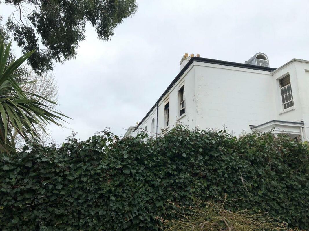
20 March 2019 (15:47) - Urban Bar and Brasserie in Glasgow city centre forced to evacuate due to blaze
A Glasgow city centre restaurant was evacuated this afternoon due to a fire. Punters were seen pouring out of Urban Bar and Brasserie on St Vincent Place this afternoon. Fire crews rushed to the scene and managed to put out the fire. Pictures and video taken from outside show what appears to be two washing machines burned out. It's understood the fire originated in the basement of the building. A spokesman for Scottish Fire and Rescue Service said: "We were called out at 3.47pm to a fire on St Vincent Place. We mobilised three appliances and it was all dealt with by 5.13pm."
The Scottish Provident Institution Building, where Urban is located is Category A listed. Building began in 1904 but was not completed until after 1908. It is a French Renaissance style commercial building with 6-storeys, 2 attics and basement.
News Source: Scottish Sun
The Scottish Provident Institution Building, where Urban is located is Category A listed. Building began in 1904 but was not completed until after 1908. It is a French Renaissance style commercial building with 6-storeys, 2 attics and basement.
News Source: Scottish Sun
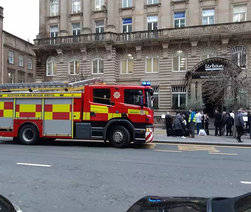
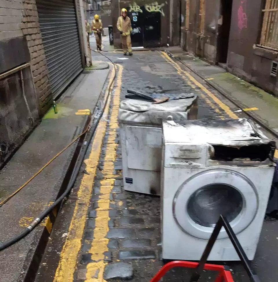
Listing Details
|
Entry Name: 17-29 (Odd Nos) St Vincent Place, Scottish Provident Institution
Listing Date: 15 December 1970 Category: A Source: Historic Scotland Source ID: 375791 Historic Scotland Designation Reference: LB32836 Building Class: Cultural Location: Glasgow County: Glasgow Electoral Ward: Anderston/City/Yorkhill Traditional County: Lanarkshire |
Coordinates
Latitude: 55.8608 / 55°51'38"N Longitude: -4.2531 / 4°15'11"W OS Eastings: 259082 OS Northings: 665365 OS Grid: NS590653 Mapcode National: GBR 0LL.XT Mapcode Global: WH3P2.MYXD |
20 March 2019 (07:12) - Northern Quarter fire: Emergency services on Stevenson Square
Firefighters are tackling a blaze at a building in the Northern Quarter. Smoke could be seen pouring from the top floors of the building, in Stevenson Square, this morning. Greater Manchester Fire and Rescue Service said they were called to reports of a fire at 7.12am. A spokesman for Greater Manchester Fire and Rescue Service said the blaze is being tackled in ‘three sectors’. Firefighters are using hose reels and breathing apparatus to tackle the fire. There were five fire engines at the scene but these were later scaled back to four.
The building is shared by three bars - The Fitzgerald, Rosylee and Hula.The NQ Photo Studio is also located on the very top floor of the building. According to the studio’s website it is the largest of its kind in Manchester city centre. Rosalind Haskins, from HNQ Ltd, which owns the three bars, said, “They’ve extinguished the fire but they don’t know where it’s originated from yet. They are trying to work that out now. I got a phone call at 7 this morning from the alarm company to say the alarm was going off so I jumped out of bed and came in.There was nobody in the building thankfully as it was first thing in the morning.”
It is now understood the fire was discovered by cleaners this morning. One line of enquiry is that it was caused by an electrical fault. The fire was still ongoing at 9.30am, but was not as serious as it was initially thought. There are believed to be no casualties. Later, firefighters confirmed the fire started in a basement of a unit on Little Lever Street. They can’t be sure where exactly the fire started but have been using the entrance to Hula to access said basement.
Hula, The Fitzgerald and Rosylee closed along with Walrus, Tusk and The Blue Pig last October when parent company MAD Ltd went into liquidation. Several former employees split away from founder Mark Andrew and fellow director Jonathan Haskins to form a new company, HNQ Ltd, which later reopened the Stevenson Square venues. Rosylee closed again in January to be refurbished and rebranded and is due to reopen as a barbecue restaurant, The Quarterhouse, which promises ‘fire, beer and BBQ’ on its Instagram account. HNQ Ltd has also reopened Walrus and Tusk.
This Victorian building is not listed but lies within the Stevenson Square Conservation Area.
News Source: Manchester Evening News
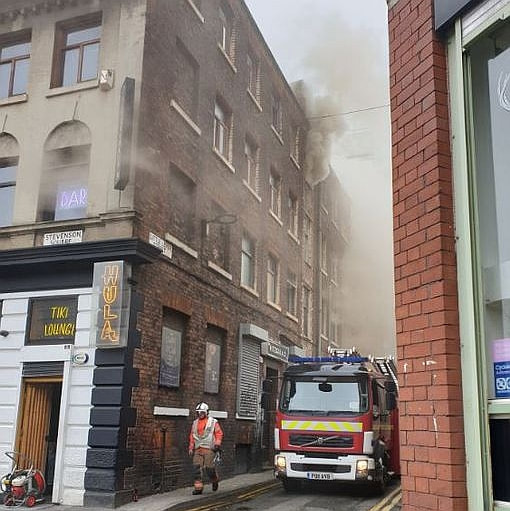
Clouds of smoke in the Northern Quarter after a fire broke out. (Image: @ellieq)
19 March 2019 (18:00*) - Firefighters tackle chimney fire at Bridgnorth pub
Firefighters were called to a chimney fire at The Kings Head in Bridgnorth yesterday evening. Crews were called to the historic pub in Whitburn Street at just before 6pm. Three fire appliances including the aerial ladder platform were mobilised from Bridgnorth and Shrewsbury. Firefighters used chimney rods, small gear and a thermal imaging camera to deal with the fire. West Mercia Police officer were also at the scene to close the road. Firefighters spent just under two hours at the scene.
The King’s Head is a Grade II listed 16th Century former Coaching Inn.
News Source: Shropshire Live
The King’s Head is a Grade II listed 16th Century former Coaching Inn.
News Source: Shropshire Live
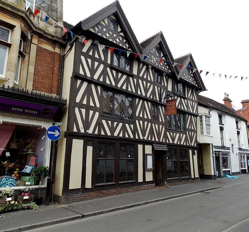
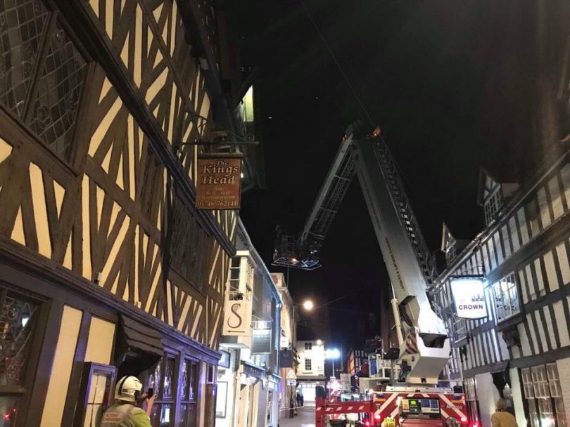
Listing Details
|
Entry Name: Kings Head Public House
Listing Date: 18 July 1949 Grade: II Source: Historic England Source ID: 1374844 English Heritage Legacy ID: 254571 Location: Bridgnorth, Shropshire, WV16 County: Shropshire Civil Parish: Bridgnorth Built-Up Area: Bridgnorth Traditional County: Shropshire Lieutenancy Area (Ceremonial County): Shropshire Church of England Parish: Bridgnorth Church of England Diocese: Hereford |
Coordinates
Latitude: 52.5364 / 52°32'10"N Longitude: -2.421 / 2°25'15"W OS Eastings: 371539 OS Northings: 293253 OS Grid: SO715932 Mapcode National: GBR BZ.F6PF Mapcode Global: VH83H.ZHGY |
19 March 2019 (17:30) - Ten fire engines battling major fire at four storey mill in Bradford
Ten fire engines are currently at the scene of a large fire at a mill in Bradford. The cause of the fire on Great Horton Road is still unknown but the roof is said to be '100% on fire', according to West Yorkshire Fire and Rescue Service.
West Yorkshire Fire and Rescue Service said: "We are currently in attendance at a large 4 storey mill fire. The roof is 100% involved. We have 10 crews from across WY at the scene along with 2 aerial appliances. If you are in the area and affected by smoke please close doors/windows as a precaution." The fire was reported at around 5.30pm. Firefighters managed to get the fire under control by around 6.45pm and they had begun damping down the remnants of the old mill's roof. Large parts of the roof have been destroyed by the fire and it has also affected the top floor of the building. The fire could be seen from across the city as smoke from the blaze billows into the night sky. The roof which measures 80 metres by 30 metres, was fully engulfed by the fire and has been seriously damaged. The fire service were waiting on a structural engineer to assess the stability of the building on Wednesday morning.
Harris Court Mill, which includes one three-storey and one four-storey building, was built in 1861. The last occupier, The Yorkshire Envelope Company, moved out in 2007, and the mill site has stood empty since then and has now fallen into dereliction. The mill lies in the Great Horton Conservation Area and is described as a Key Unlisted Building.
News Source: The Yorkshire Post
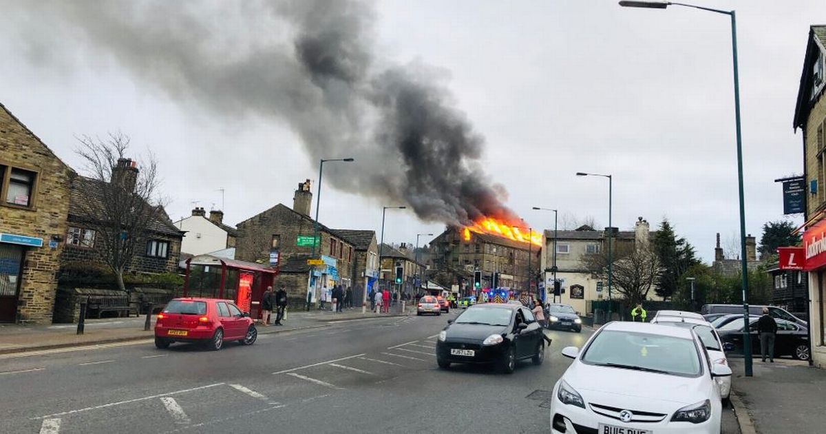
Huge mill fire on Great Horton Road, Bradford (Image: @asifbymajic)
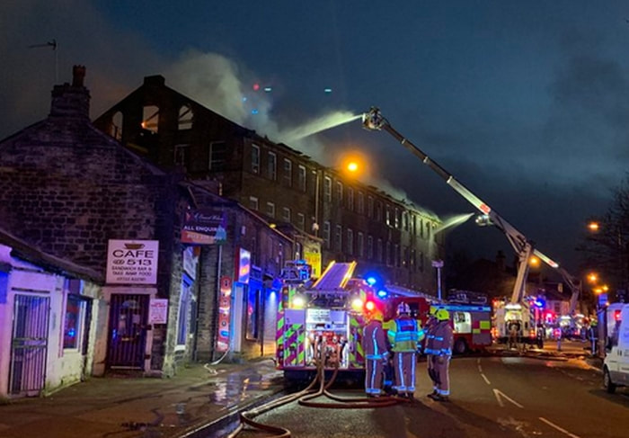

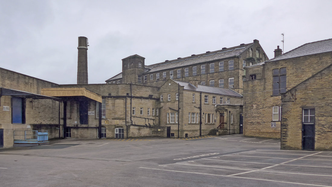
Harris Court Mill complex
19 March 2019 (15:25) - Arson attack on Historic Henley-on-Thames house
A fire that destroyed an early-1900s house in Henley-on-Thames is being treated as arson. About 40 firefighters from six crews were called to the blaze in Gillotts Lane, opposite Gillotts School, at 15:25 GMT on Tuesday. Smoke from the fire could be seen from across most of the town whilst firefighters brought the fire under control, assisted by School staff working to keep pupils and vehicles away from the area. The house was empty at the time.
Fire crews remained on scene throughout the night and the incident was scaled down to two fire appliances at 10.30pm. One fire appliance reminained on scene from 1am this morning to extinguish any hot spots and isolated pockets of fire that may have reignited. The fire is now completely extinguished, and Oxfordshire Fire and Rescue Service will be handing the property back to the owners this morning. Thames Valley Police have not concluded investigations into the cause, however it is being treated as arson.
News Source: BBC News
Update: 20 March 2019 – The blaze destroyed the £5 million former Oxfordshire home of actor Basil Rathbone . Rathbone is a Hollywood legend who played Sherlock Holmes in several movies including The Hound of the Baskervilles, and lived at the now empty home for many years before his death in 1967. It is also understood that one of the UK's top cigar importers, Melbourne Hart, once lived there too.
Police, forensic science experts and fire brigade specialists are combing the scene today. Fire crews from Berkshire and Oxfordshire fought the fire and the fire service also believe that it was started deliberately. Neighbours said that the extensive property, built in 1915, had been the subject of numerous planning applications, including a scheme to build 47 homes on the six acre site, which had all been turned down. Mark Charter, head of estate agents Carter Jonas' Oxford office, said previously commenting on Tree Tops: 'It is full of natural light and space, it has lots of scope for someone to refurbish it to make it a fine country house in a super location.”
South Oxfordshire District Council has resisted planning applications to make changes or developments on the Tree Tops property. The council stated that there will be a presumption against further development beyond the existing limits of Henley-on-Thames in order that the attractive countryside and landscape setting of the town be preserved.
In the grounds of Tree Tops are various outbuildings with a garage, stables, a former tennis court and swimming pool and an unfinished timber pool house. There was also a separate office and annexe accessed from the back of the house or via the alley leading from the kitchen. The property, which had a galleried landing, has a gravel driveway sweeping up to the front of the house. Tree Tops House was owned by company director Robert Hale until his death in January 2015. It was then bought by its current owner, a Russian oligarch who neighbours say lives abroad.
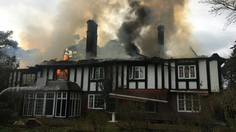
The blaze consumed the whole house in Gillotts Lane, the fire service said
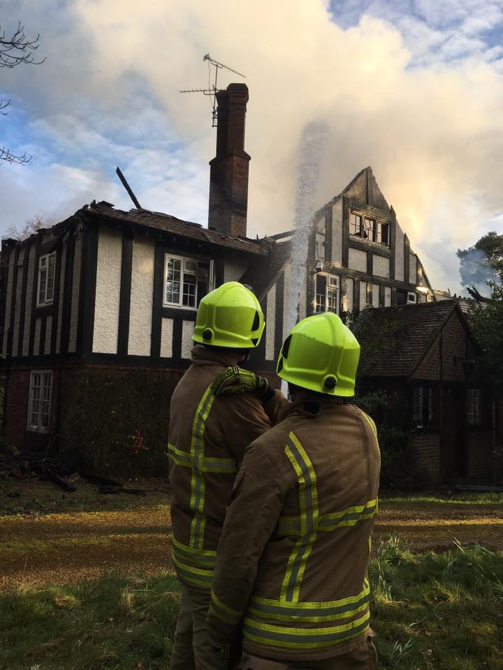
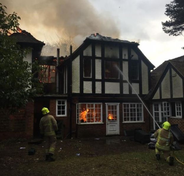
18 March 2019 (19:30) - Dozens of firefighters battle with major fire at old Stroud mill
Dozens of firefighters have been battling with a major fire in Gloucestershire overnight. About 40 firefighters were sent to deal with the fire "at a commercial premises" in London Road, Stroud. An investigation into the cause of the fire is under way. A spokesman for Gloucestershire Fire and Rescue said: “We were called at around 7.30pm yesterday evening by a member of the public informing us of a fire at commercial premises on the London Road in Stroud. The fire is now mostly out. One engine remains at the scene damping down. No persons were involved in the incident. The cause of the fire is currently unknown and under investigation.”
Police sealed off roads in order to allow the nine teams of firefighters to battle the blaze which broke out near Stroud last night. Witnesses told Gloucestershire Live the fire appeared to be at the Stafford Mill estate near Thrupp with unconfirmed reports that a car repair shop was involved. Gloucestershire Constabulary confirmed they were called to the scene to close the surrounding roads. The main A419 is said to have been closed amid reports of heavy, acrid smoke in the area. The road has been closed near the Ship pub in Brimscombe and the fire service is using an aerial platform to help douse the flames.
The fire was at a car repair unit, which is part of the Historic Georgian Stafford’s Mill site. Stafford's Mill takes its name from a ford across the river (Stone Ford), mentioned in the late 14th century. The mill was first recorded in 1608, and was used as a cloth mill. In 1793, the property consisted of a house, a fulling mill with two stocks and a gig mill. The mill was sold in that year to William Stanton, clothier, whose descendants continued to work the mill until about 1886. Three members of this family served as MP for Stroud in the mid-late 19th century.
By 1833, steam engines had been introduced, and in 1836, 28 power looms were installed alongside the existing 88 handlooms. By 1889, cloth production had ceased and the site was occupied by a paint and chemical manufacturing company, S.G. Bailey & Co., which remained here until the 1960s, when they moved to Griffin's Mill. A number of stone buildings built between 1825 and 1831 still survive, and the site is currently occupied by a variety of small businesses.
News Source: Gloucestershire Live

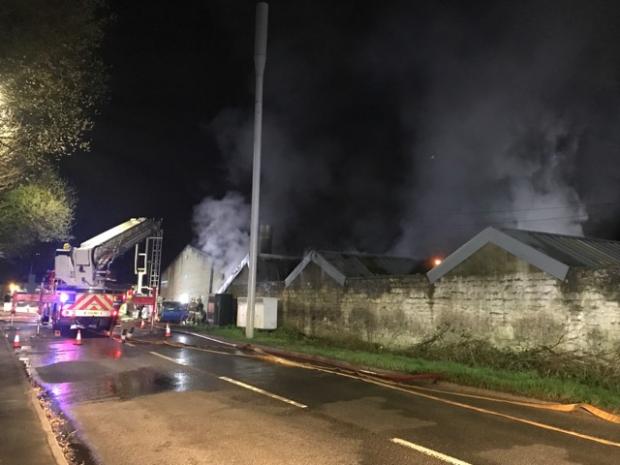
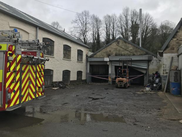
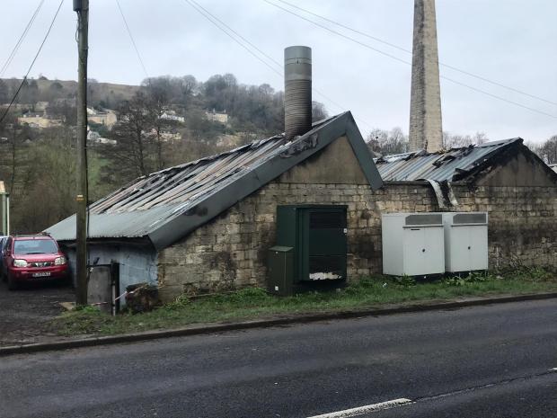
Near Miss
18 March 2019 (07:15) - Armagh’s Northern Bar targeted in second arson attack in as many weeks
18 March 2019 (07:15) - Armagh’s Northern Bar targeted in second arson attack in as many weeks
A popular Armagh bar extensively damaged in an arson attack a fortnight ago has been targeted again. Emergency services were called to the incident to the rear of the Railway Street property following reports of a large fire earlier this morning (Monday). Police said they are now treating the fire as arson and will be investigating. Sergeant Moffett explained: “We received a report shortly after 7:15am that a marquee located outside, to the rear of the premises, was on fire. Police attended, along with the NIFRS who extinguished the blaze. NIFRS have ruled this to be deliberate ignition and so we are treating this as arson at this time. I want to appeal to anyone who was in the area around this time and saw what happened, or anyone who has information which could assist our investigation to contact us.”
The bar had opened over the weekend and hosted a St Patrick’s party in the courtyard to the rear. A marquee and temporary bar had been erected to host the event. Posting on the bar’s Facebook page, owner Michael Hughes said: “It wouldn’t be St Patrick’s without a party,” he said. Adding: “We are having an outside party with a heated marquee and outside bar. Saturday and Sunday, music and good craic and Irish stew on Sunday to warm your bellies! We once again want to say a massive thank you to everyone for the messages and the support we’ve had over the last week, it has honestly been a struggle and feels longer than a week. Looking forward to seeing you all over the weekend.”
The pub is the historical home of the Ulster GAA headquarters.
News Source: Armagh-i
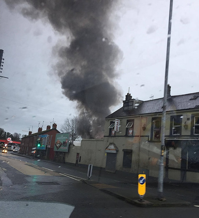
The second fire in two weeks at the Northern Bar.
17 March 2019 (14:30) - Hull's derelict Lord Line building seen on fire
The once iconic building - now turned eyesore - has once against been targeted by vandals. Smoke was seen pouring from Hull's Lord Line building on Sunday afternoon. Firefighters were called to douse the flames at the west Hull landmark after black smoke was seen billowing from one of the second floor rooms after "rubbish was set alight" at around 2.30pm on Sunday. A pair of fire engines attended the scene and quickly extinguished the small fire. A Humber Fire and Rescue spokesperson said: "We attended the Lord Line building on St. Andrew's dock at around 2.30pm with two fire crews to the put out a small fire after rubbish was set alight. It is under control and being extinguished. No one was inside the building, which is currently derelict. Investigations are continuing into how the fire was started."
The video, provided to Hull Live by a member of the public, surveyed the scene after the fire was extinguished and it shows the graffiti-covered walls - which had now been covered in black ash. The Lord Line building has become a hive of activity and target for vandals with urban explorers using the structure as a "play area" after footage emerged of the "eerie" rooms online.
City councillors gave the go-ahead to the bar or restaurant plans at the derelict former trawler company site following a green-light planning proposal in November. But they have given owners Manor Property Group 12 months to start facelift work on the derelict former trawler company office on St Andrews Dock. If that deadline is not met, the planning approval will expire. The council has been at loggerheads with Manor over a series of stalled developments in recent years. The 12-month condition was put forward by Councillor John Fareham at this afternoon’s planning committee. He said: “This developer has a history of overpromising and underdelivering. He said simply digging a trench and putting a pipe in would not be acceptable as evidence of development at the site. “We need a measurable timetable of when things will be happening,” he added.
Council planning manager Alex Codd said the 12-month time limit was “fairly unusual” but claimed it was justified because of continuing concerns by the police and fire service over the risks associated with people continuing to enter the derelict building. “I think giving the applicant 12 months to get on site and make a start is realistic given the circumstances," he said. We are not asking for it to be completed within 12 months. There have been regular fires at the dockside landmark in recent years as well as regular vandalism."
Opened in 1949, the Lord Line trawler company offices once served as the home of the world's largest deep-water fishing fleet. The building is Locally Listed and lies within the St Andrew’s Dock Conservation Area.
News Source: Hull Live
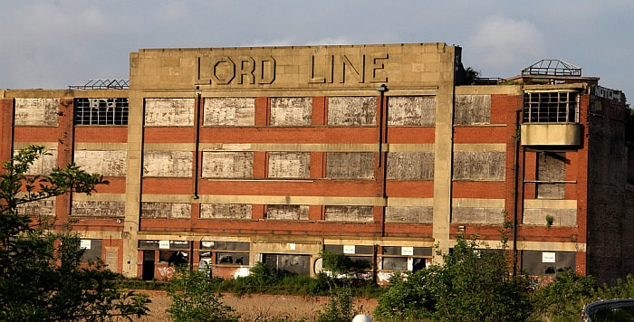
The Lord Line Building in Hull is a hotspot for trespass, vandalism and arson.
Near Miss
16 March 2019 (18:15) - Bin set on fire behind business in Barnard Castle
16 March 2019 (18:15) - Bin set on fire behind business in Barnard Castle
The fire brigade were called to a County Durham market town at the weekend following reports youths had set fire to a barn. The County Durham and Darlington Fire and Rescue Service confirmed they were called to Barnard Castle, just after 6.15pm on Saturday, to an incident. The incident was less serious than first thought and fire fighters from Barnard Castle extinguished a fire in a metal cage bin at the rear of the Boyes store, in Horse Market. The bin contained rubbish but is understood not to have gotten out of control. A spokeswoman for Durham Constabulary confirmed no report was made to the police. Members of Barnard Castle Town Council discussed the incident last night.
Boyes store occupies a late 18th century Grade II listed building, and lies within the
Barnard Castle Conservation Area.
News Source: The Northern Echo
Boyes store occupies a late 18th century Grade II listed building, and lies within the
Barnard Castle Conservation Area.
News Source: The Northern Echo
The fire was in a metal cage bin at the rear of Boyes shop.
Listing Details
|
Entry Name: 32, Horse Market
Listing Date: 22 February 1973 Last Amended: 28 November 1994 Grade: II Source: Historic England Source ID: 1201349 English Heritage Legacy ID: 388720 Location: Barnard Castle, County Durham, DL12 County: County Durham Civil Parish: Barnard Castle Built-Up Area: Barnard Castle Traditional County: Durham Lieutenancy Area (Ceremonial County): County Durham Church of England Parish: Barnard Castle with Whorlton Church of England Diocese: Durham |
Coordinates
Latitude: 54.5442 / 54°32'38"N Longitude: -1.9246 / 1°55'28"W OS Eastings: 404973 OS Northings: 516547 OS Grid: NZ049165 Mapcode National: GBR HH0W.3T Mapcode Global: WHB4L.D1RP |
16 March 2019 (17:50) - Fire at former Mersey Arms pub in Birkenhead
A fire broke out at the former Mersey Arms pub in Birkenhead. Four fire engines attended the incident at the boarded up pub on Neptune Street at around 6pm on Saturday, March 16. On arrival crews discovered that both the ground and first floor of the derelict building was well alight. Crews used a combined platform ladder to extinguish the flames before checking neighbouring properties for fire spread. No injuries were reported and it is not known what caused the fire.
A spokeswoman for Merseyside Fire and Rescue Service said: "Firefighters attended a fire at a derelict pub on Neptune Street, Birkenhead on Saturday. Crews were alerted at 5.50pm and were on scene at 6pm. The fire was under control by 6.53pm. Crews left the scene at 8pm."
The pub is not listed, but is at least 160 years old and is a classic example of abandonment over decades - with windows boarded up and mature trees growing through the roof. A very sad end to what was once a busy Victorian pub.
News Source: Wirral Globe

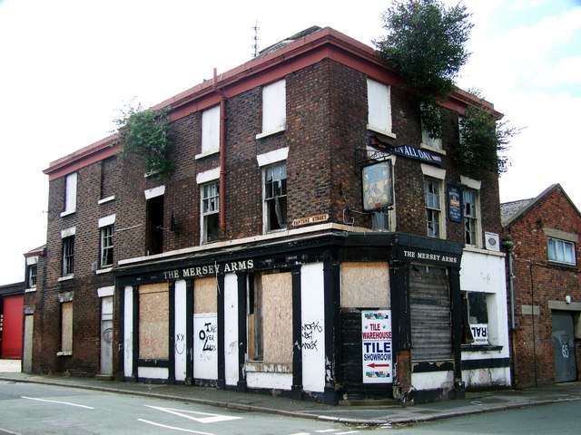
16 March 2019 (17:17) - Firefighters battling blaze at Fort Gilkicker in Gosport
A fire has broken out at a historic fort in Gosport. Firefighters are battling the blaze at Fort Gilkicker this evening. Hampshire Fire and Rescue have said that they were called at 5.17pm to reports of a fire. Four fire engines and a water carrier are at the scene and firefighters are still dealing with the blaze. Fort Gilkicker is currently abandoned although there are plans to restore it and turn it into apartments.
It is a Grade II* listed building, and a Scheduled Ancient Monument. It lies within the
Gilkicker Heritage Area.
News Source: The Portsmouth News
It is a Grade II* listed building, and a Scheduled Ancient Monument. It lies within the
Gilkicker Heritage Area.
News Source: The Portsmouth News
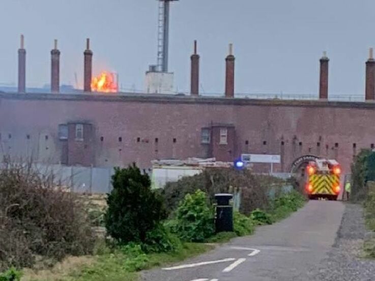
Fire engine at the scene of the blaze at Fort Gilkicker. (Picture: Katie Fairhall Beaumont)
Listing Details
|
Entry Name: Fort Gilkicker
Listing Date: 20 April 1983 Grade: II* Source: Historic England Source ID: 1276716 English Heritage Legacy ID: 408680 Location: Gosport, Hampshire, PO12 County: Hampshire District: Gosport Town: Gosport Electoral Ward/Division: Anglesey Built-Up Area: Gosport Traditional County: Hampshire Lieutenancy Area (Ceremonial County): Hampshire Church of England Parish: Alverstoke St Mary Church of England Diocese: Portsmouth |
Coordinates
Latitude: 50.7739 / 50°46'25"N Longitude: -1.1411 / 1°8'27"W OS Eastings: 460657 OS Northings: 97494 OS Grid: SZ606974 Mapcode National: GBR 9C3.D9Y |
Building History
(Researched by Heritage & Ecclesiastical Fire Protection)
Gilkicker Fort was built between 1863 and 1871. It was built as a result of the 1860 Royal Commission on the Defence of the UK, as a defence against France. It replaced an earlier one constructed in 1856 on the same site, this was known as Monckton Auxiliary Battery. The present structure is semi-circular, facing southwards to protect the fleet anchorage. During its short 30 year service history the Fort was modified several times. Its casemates were strengthened to protect it against the constantly developing artillery of the day. It was upgraded with the latest coast defence guns in the late nineteenth century and became useless (and apparently never used).
Finally it was re-armed during WWI to protect Portsmouth from air attack. After a brief new lease of life during WWII it began to fall into disuse and was released by the military in 1956. From then on it served as workshops and was acquired by Hampshire County Council in 1986, but has since been sold and is awaiting proposals to convert it for modern use in order to secure it for the enjoyment of future generations. The Coastguard station now stands on top of the Fort.
This unique piece of Victorian engineering is of immense importance to the history of coast defence in the United Kingdom and must be preserved at all costs. There are no proposals to open the fort for public access.
Raising the guns at Fort Gilkicker 29 July 1871 (Credit: Friends of Stokes Bay)
Near Miss
16 March 2019 (12:21) - Firefighters called as vehicle destroyed in blaze near country house
16 March 2019 (12:21) - Firefighters called as vehicle destroyed in blaze near country house
Firefighters have dealt with a car fire near a country house which completely destroyed the vehicle. A crew from Audlem was called to the scene near Hankelow Hall, Hall Lane, Hankelow, at around 12.21pm this afternoon. The vehicle was well alight as the crew arrived before they used hose reel jets and breathing apparatus to extinguish the blaze.
A Cheshire Fire and Rescue Service spokesman said: "Shortly after 12.20pm firefighters were called to a report of a car being on fire in Hankleow. On arrival at Hankelow Hall on Hall Lane the crew found a saloon car well alight. Two firefighters wearing breathing apparatus extinguished the fire with a hose reel jet."
The first record of the hall is from 1369, but the house as it is today was remodelled in the Georgian period by William Baker in about 1755. The property is Grade II* listed and has many original features including sash windows and wooden panelling. A property developer bought it in 1989 for £328,000, after the hall had stood empty for many years and was in such poor condition that it was possible to stand in the cellar and see the sky through the collapsed ceilings of five storeys. So derelict was its condition that it was on the list of “Lost Country Houses”. During the restoration process, evidence was found of the earlier house at its core, including wattle and daub walls, remains of a timber framed building, and window frames that have been dated to the 17th century. After more than two decades of restoring the house and grounds, the building has now been converted into luxury apartments.
News Source: Stoke Sentinel


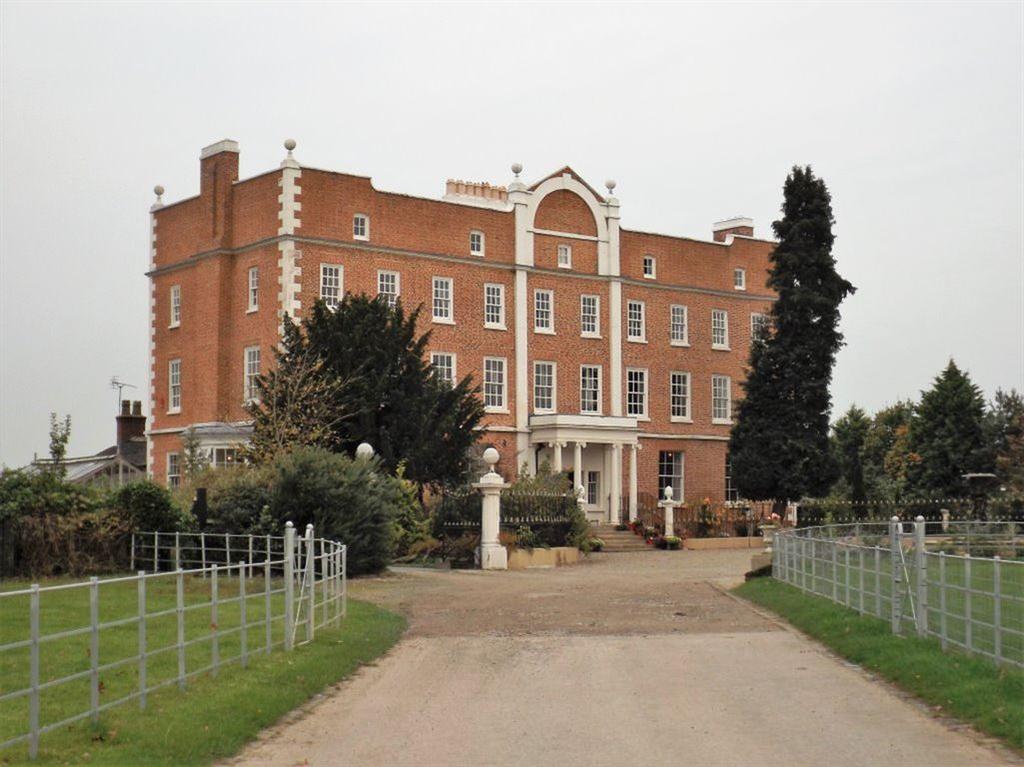
Listing Details
|
Entry Name: Hankelow Hall
Listing Date: 20 September 1954 Grade: II* Source: Historic England Source ID: 1312531 English Heritage Legacy ID: 57072 Location: Hankelow, Cheshire East, CW3 County: Cheshire East Civil Parish: Hankelow Traditional County: Cheshire Lieutenancy Area (Ceremonial County): Cheshire Church of England Parish: Audlem St James the Great Church of England Diocese: Chester |
Coordinates
Latitude: 53.0127 / 53°0'45"N Longitude: -2.4951 / 2°29'42"W OS Eastings: 366881 OS Northings: 346270 OS Grid: SJ668462 Mapcode National: GBR 7V.G6FC Mapcode Global: WH9BJ.NJ2R |
Near Miss
15 March 2019 (09:15) - De Montfort Hall was evacuated this morning
15 March 2019 (09:15) - De Montfort Hall was evacuated this morning
Firefighters were dealing with an incident this morning at De Montfort Hall after smoke was seen in the building. Leicestershire Fire and Rescue Service said smoke was spotted coming from the ground floor of the concert venue. Two crews, from the city’s Eastern and Central fire stations were at the scene, with a third en route. Everyone in the building was evacuated.
A Leicestershire Fire and Rescue Service spokeswoman said: “A small amount of smoke was seen on the ground floor." One onlooker saw people standing outside the building and fire engines. The smoke is said to have been caused by a small motor in a ceiling fan that tripped in a foyer cloakroom. The decision was made to evacuate the building but the incident has now been dealt with, De Montfort Hall has confirmed that everything is back up and running now. The incident has now been resolved.
The Hall is Grade II listed and was built by the Corporation of Leicester in the early 20th century, and was finished in 1913 costing £21,000. The architect was Shirley Harrison (1876–1961) son of Stockdale Harrison, architect of Vaughan College.
Its indoor auditorium seating capacity is approximately 2000, and the hall contains a restored pipe organ believed to be the only surviving example of a large concert organ constructed by the Leicester organ builders, Stephen Taylor & Son Ltd, in 1914. The pipe organ is a particularly fine example and comprises 6000 pipes, attracting many distinguished organists to play recitals. In the 2014 the pipe organ was estimated to be worth over five million GBP.
The hall features in Richard Attenborough's film Grey Owl (1999), in a reenactment of Attenborough and his brother David's boyhood attendance at a wildlife lecture.
News Source: Leicestershire Live
De Montfort Hall in Leicester (Image: Alex Hannam)
Listing Details
|
Entry Name: De Montfort Hall
Listing Date: 14 March 1975 Grade: II Source: Historic England Source ID: 1185187 English Heritage Legacy ID: 188787 Location: Leicester, LE1 County: City of Leicester Electoral Ward/Division: Castle Built-Up Area: Leicester Traditional County: Leicestershire Lieutenancy Area (Ceremonial County): Leicestershire Church of England Parish: Leicester Holy Trinity with St John the Divine Church of England Diocese: Leicester |
Coordinates
Latitude: 52.6251 / 52°37'30"N Longitude: -1.122 / 1°7'19"W OS Eastings: 459529 OS Northings: 303394 OS Grid: SK595033 Mapcode National: GBR FKN.7W |
Near Miss
14 March 2019 (09:43) - Fire at White Lion in Bridport
14 March 2019 (09:43) - Fire at White Lion in Bridport
A fire broke out at a pub this morning. Firefighters were called to the White Lion, West Allington, shortly before 10am. An outhouse used for beer storage was alight. Crews from stations in Bridport, Charmouth and Yeovil attended. Nearby CO2 cylinders were removed and the fire extinguished using two breathing apparatus wearers and a hose reel jet.
The 18th century White Lion is a Grade II listed building.
News Source: Bridport News
The 18th century White Lion is a Grade II listed building.
News Source: Bridport News
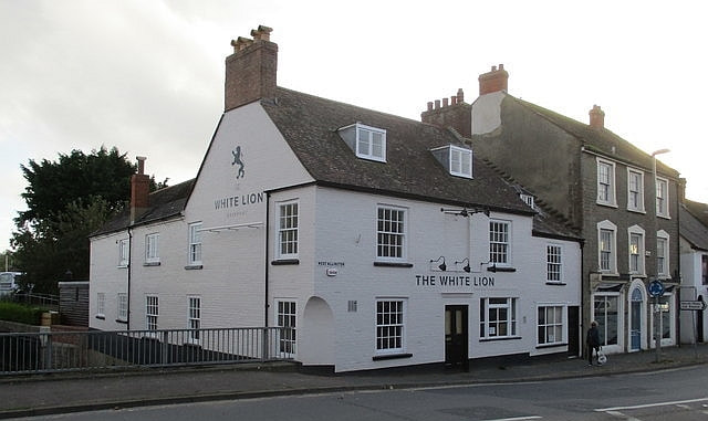
Fire in an outbuilding at the Red Lion.
Listing Details
|
Entry Name: The White Lion Public House
Listing Date: 19 September 1975 Grade: II Source: Historic England Source ID: 1228669 English Heritage Legacy ID: 403201 Location: Bridport, West Dorset, Dorset, DT6 County: Dorset District: West Dorset Civil Parish: Bridport Built-Up Area: Bridport Traditional County: Dorset Lieutenancy Area (Ceremonial County): Dorset Church of England Parish: Bridport St Mary Church of England Diocese: Salisbury |
Coordinates
Latitude: 50.7343 / 50°44'3"N Longitude: -2.763 / 2°45'46"W OS Eastings: 346250 OS Northings: 93015 OS Grid: SY462930 Mapcode National: GBR PP.09R6 Mapcode Global: FRA 5734.FF0 |
13 March 2019 (19:42) - Fifteen fire crews tackle fire at New Look in Bridgwater into the early hours
Fifteen fire crews fought into the early hours to bring a fire in a four storey terrace in Bridgwater under control. Devon and Somerset Fire and Rescue Service were called at 7.42pm on Wednesday (March 13) following several reports from members of the public that there was a fire in New Look in Cornhill. Fire engines from Bridgwater and Burnham-On-Sea, along with an aerial ladder platform were initially sent to the incident. When crews arrived they confirmed there was a fire in the store and the floors above.
At 8pm the officer in charge asked for five further pumps to come to the scene which came from Burnham-on-Sea and Taunton, along with an incident command unit from Street and supporting officers. At 8.31pm the officer in charge asked for a further four pumps for breathing apparatus and personnel which came from Nether Stowey, Taunton and Glastonbury. Crews used four attack jets, four safety jets, two covering jets, four fog spikes and 12 breathing apparatus to fight the fire.
At 9.43pm the officer in charge asked for an additional six pumps and an aerial ladder platform which came from Wellington, Street, Cheddar, Somerton, Ilminster and Yeovil. Various other agencies also attended the incident throughout the evening, including police, ambulance and Western Power. Crews carried out a thorough search of the building to check for fire spread and made sure everyone involved was accounted for. Fortunately, no one was injured and the incident was scaled down at 11.19pm with six fire engines remaining at the scene. Firefighters did a thorough check of the adjacent properties and reported that the fire had not spread.
At 12.16am the incident was reduced to one sector with two working platforms in the building, one on the ground floor and the other on the first floor revealing the extent of fire spread. Crews continued to check to see if the fire had spread inside the building and at 1.08am the incident was scaled down. A spokesman for Devon and Somerset Fire and Rescue Service, said: "This was a four storey property including one basement consisting of commercial property and unoccupied flats. The building measured approximately 15m by 45m and was constructed of stone and wood walls with a tiled roof. The building suffered 10 per cent fire damage and 40 per cent smoke damage. There were twenty nine breathing apparatus wearers in total using two hose reel jets, two main jets, four fog nails, a thermal imaging camera, and snake camera, ladder and working platforms. The cause of the fire was deemed accidental."
Nos 8 & 9 Cornhill is a Grade II listed building, built in the 1860s originally as offices, now two shops. The buildings on either side are also Grade II listed.
News Source: Bridgwater Mercury
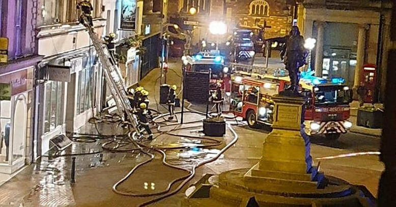
A fire has reportedly broken out in a building in Bridgwater town centre (Image: Michael Lamper)
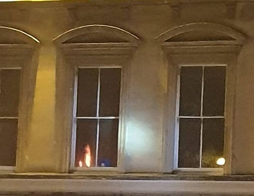
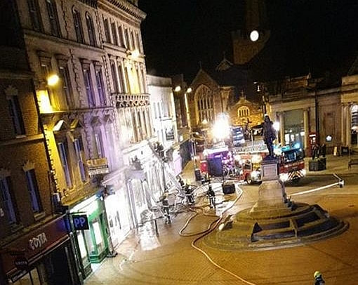
Listing Details
|
Entry Name: 8 and 9, Cornhill
Listing Date: 16 December 1974 Grade: II Source: Historic England Source ID: 1297188 English Heritage Legacy ID: 373855 Location: Bridgwater, Sedgemoor, Somerset, TA6 County: Somerset District: Sedgemoor Civil Parish: Bridgwater Built-Up Area: Bridgwater Traditional County: Somerset Lieutenancy Area (Ceremonial County): Somerset |
Coordinates
Latitude: 51.1282 / 51°7'41"N Longitude: -3.0036 / 3°0'12"W OS Eastings: 329867 OS Northings: 137023 OS Grid: ST298370 Mapcode National: GBR M5.98VC Mapcode Global: VH7DH.WXH0 |
13 March 2019 (04:55) - Tanning salon gutted in fire just yards from Birmingham New Street Station
A popular city centre tanning salon has been gutted in a devastating fire. Twenty firefighters swarmed New Street in the early hours of Wednesday morning after a blaze broke out inside The Tanning Shop's basement. Fire crews were forced to smash their way into neighbouring businesses on Pinfold Street as the flames spread.The salon's shop window was left cracked after the fire gutted the interior.
Shocking images from inside the four-star business captured the aftermath of the inferno, with what appears to be sunbeds completely destroyed. A burst water main added to the chaos inside the shop as help from Severn Trent was requested, WMFS said. Crews cordoned off Eat, Inovape and the affected street shortly after 5am. Fire crews later took to Twitter to thank staff from the nearby Greggs for "free tea and coffee". Highgate Fire wrote: "Shout out to @GreggsOfficial for free tea & coffee for @HighgateFire @ladywoodfire @Bournbrookfire working hard to extinguish basement fire on Pinfold Street this morning."
A spokesman for West Midlands Fire Service added: "The call came in at 4.55am this morning to Pinfold Street. Two appliances still there at 9am there were four appliances at the height of the job. Stop message has come in, crews are just checking over the premises with a thermal camera for hot spots and dampening down. Fire in basement of six storey building used as a tanning shop. Six breathing apparatus used. All electrics isolated. Had to force entry to adjoining properties to check for fire spread. Severe smoke warning, badly damaged inside.There was also a burst pipe inside the premises. Requested Severn Trent. Affected two other properties adjoining. No fire investigation as doesn't look malicious."
The Tanning Shop is part of a triangular block containing several Grade II listed buildings. Although the Salon's address is 49 Pinfold Street, it is actually listed as 80 – 83 New Street – see map below. The block lies within the Colmore Row and Environs Conservation Area.
News Source: Birmingham Live
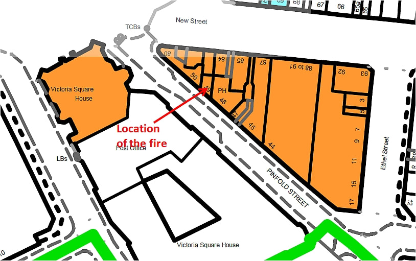
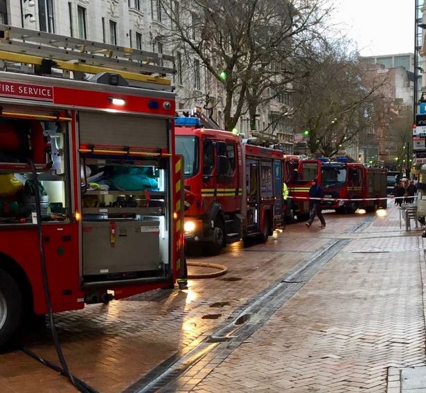
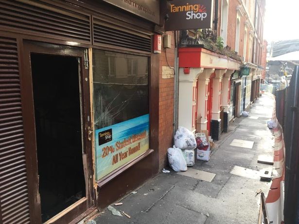
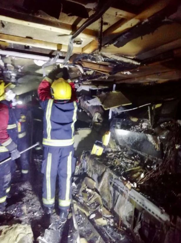
Listing Details
|
Entry Name: 80-83, New Street B2
Listing Date: 8 July 1982 Last Amended: 19 January 1983 Grade: II Source: Historic England Source ID: 1343089 English Heritage Legacy ID: 217448 Location: Birmingham, B2 County: Birmingham Electoral Ward/Division: Ladywood Built-Up Area: Birmingham Traditional County: Warwickshire Lieutenancy Area (Ceremonial County): West Midlands Church of England Parish: Cathedral Church of St Philip Birmingham Church of England Diocese: Birmingham |
Coordinates
Latitude: 52.4793 / 52°28'45"N Longitude: -1.902 / 1°54'7"W OS Eastings: 406750 OS Northings: 286826 OS Grid: SP067868 Mapcode National: GBR 5Z9.X3 Mapcode Global: VH9YW.ZYB7 |
Near Miss
12 March 2019 (15:30) – Workshop, close to the birthplace of the Bronte sisters, is on fire
12 March 2019 (15:30) – Workshop, close to the birthplace of the Bronte sisters, is on fire
Four fire engines are currently battling the blaze in Sapgate Lane in Thornton. Market Street, where the Bronte sisters were born before moving to Haworth, is just metres away. The workshop, used for old scrap vehicles, is fully ablaze, according to West Yorkshire Fire and Rescue Service. People in the area are asked to keep doors and windows closed as a precautionary measure. Sara Cahill said on Facebook: “It was very scary. We were walking past from school and saw the flames. We rushed past and then there was a massive boom.”
Pictures from the scene show flames and plumes of smoke. There are reports of some houses close to the fire being evacuated. A West Yorkshire Fire and Rescue spokesperson said 100 per cent of the site is involved in the fire, with exposure risk to three sides. Four breathing apparatus, four large jets, one hand jet and two ground monitors are in use. Four engines, from Fairweather Green, Illingworth and Odsal, are at the scene.
Not only is the fire just metres away from the Grade II* listed building that is the Bronte birthplace, but the workshop is surrounded by Grade II listed buildings as shown on the map, which lie within the Thornton Conservation Area.
News Source: Yorkshire Evening Post
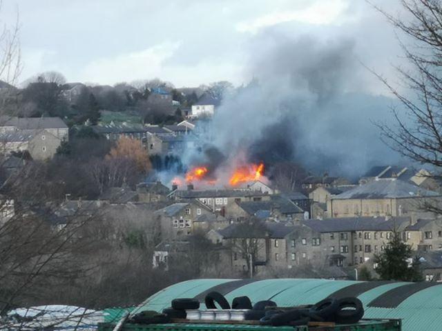
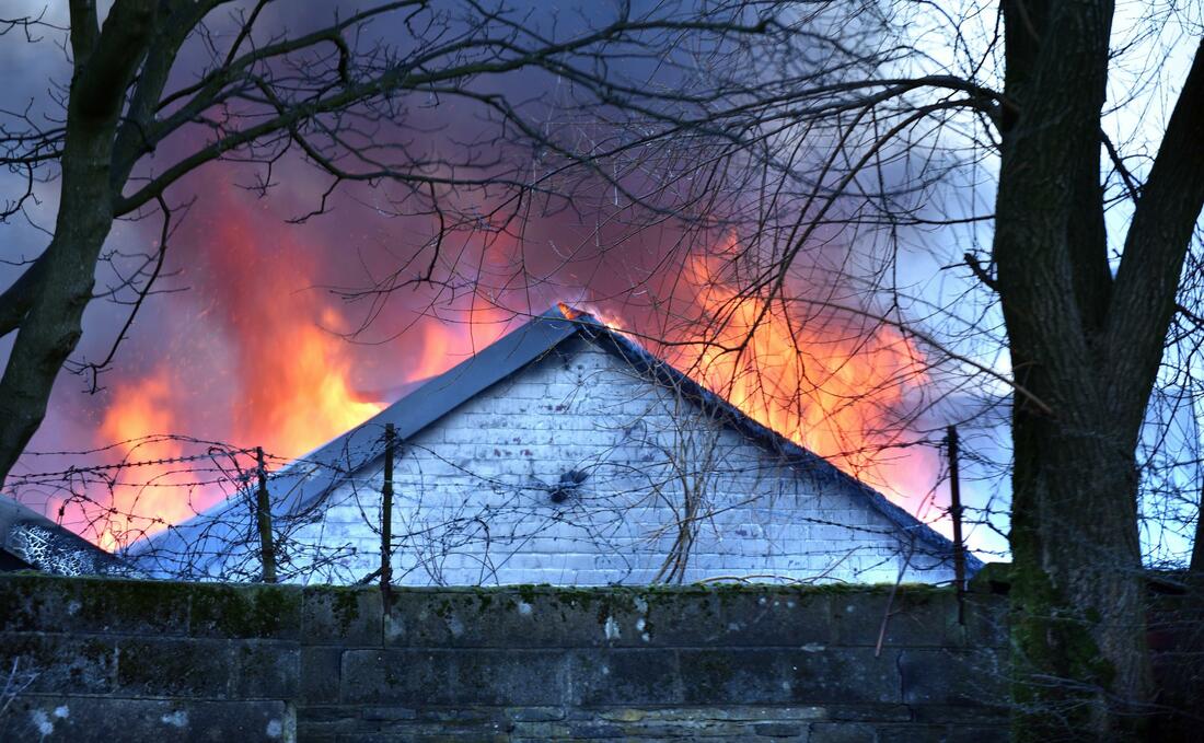
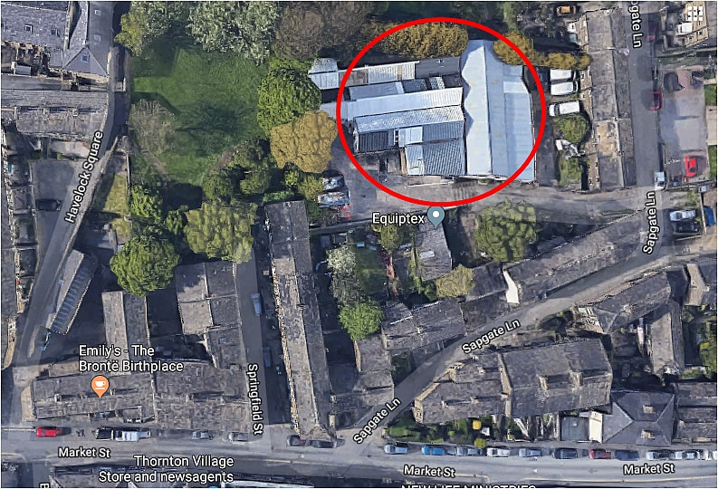
The location of the workshop fire relative to the Bronte birthplace (Image: Google Maps)
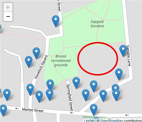
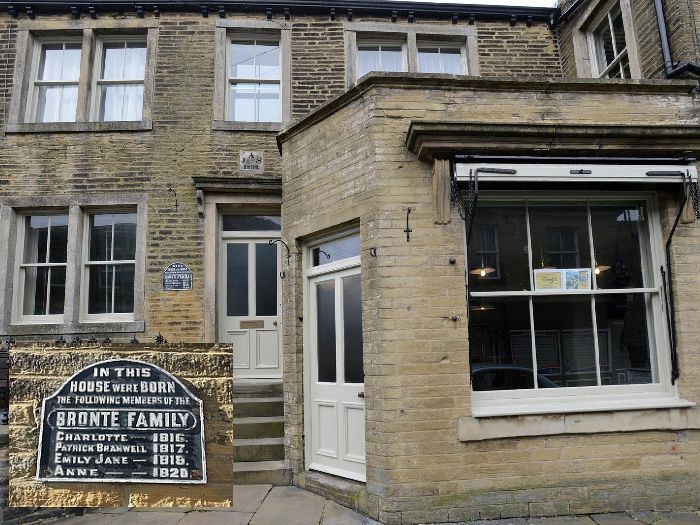
10 March 2019 (13:00*) - Fire breaks out on Weston-super-Mare’s Grand Pier
Visitors had to be evacuated after a fire broke out on Weston-super-Mare Grand Pier’s this afternoon (Sunday). A ‘small fire’ was discovered at the popular seafront attraction on one of the go-karts and the alarm was sounded so people had to leave the premises. Nobody was injured but the pier had to be closed for the rest of the day. It is understood the pier will reopen at 10am tomorrow (Monday) as normal.
The Grand Pier posted a statement on Facebook after the incident. It said: “As some of you may be aware, we had a small fire on the Grand Pier today. The fire was contained and everyone was evacuated safely. We will remain closed for the rest of the day.”
The rebuilt Grade II listed Grand Pier opened in 2010 after burning down in a fire two years before.
News Source: The Weston Mercury
Fire breaks out on Weston-super-Mare’s Grand Pier go-karts
Listing Details
|
Entry Name: Grand Pier
Listing Date: 19 May 1983 Last Amended: 17 October 2012 Grade: II Source: Historic England Source ID: 1137759 English Heritage Legacy ID: 33217 Location: Weston-Super-Mare, North Somerset, BS23 County: North Somerset Civil Parish: Weston-super-Mare Built-Up Area: Weston-Super-Mare Lieutenancy Area (Ceremonial County): Somerset |
Coordinates
Latitude: 51.3477 / 51°20'51"N Longitude: -2.9846 / 2°59'4"W OS Eastings: 331524 OS Northings: 161422 OS Grid: ST315614 Mapcode National: GBR J6.V7ZG Mapcode Global: VH7CK.7D05 |
Building History
(Researched by Heritage & Ecclesiastical Fire Protection)
Seaside resorts first emerged in the C18 as rival to inland spas, and became increasingly accessible to greater volumes of visitors after the coming of the railways in the mid-C19. The seaside's most characteristic buildings were piers, established from the beginning of the C19 to provide landings for steam ferries. They soon became used for strolling, or promenading, and later examples were built on a larger scale to accommodate entertainment buildings. Grand Pier, Weston-Super-Mare belongs to the latter category and was first built in 1903/4 to the designs of P. Munroe, engineer. The pier was extended in 1905 to provide a passenger steamer landing stage, although following a lack of use it was reduced in scale. The pier was altered and embellished at regular intervals in the C20, often responding to the changing tastes of the seaside-going public, or to replace structural damaged caused by the coastal elements. Notably, a fire in 1930 destroyed the theatre at the pier end, and a new pavilion was constructed three years later.
The pier continued to evolve through the C20 and early-C21, until a serious fire destroyed much of the superstructure in 2008. The deck and buildings were rebuilt with planning consents, and the substructure repaired and reinforced. The pier reopened in 2010.
Grand Pier, Weston-Super-Mare, is designated at Grade II, for the following principal reasons:
* Rarity: pre-1914 seaside piers are rare and this example retains a significant proportion of its early substructure;
* Architectural interest: the cast-iron substructure retains its distinctive appearance with openwork girders and columns on an impressive scale;
* Historic interest: Grand Pier remains a significant historic feature of the Weston-Super-Mare seafront, and is redolent of the resort's early-C20 heyday, which is an important period of seaside development nationally.
8 March 2019 (19:37) - Wetherspoon pub in Portsmouth evacuated as firefighters tackle kitchen blaze
Punters and staff have been evacuated from a bustling Portsmouth pub after a fridge-freezer caught fire in its kitchen. Firefighters from Southsea and Portchester were called to the the Isambard Kingdom Brunel Wetherspoon in Guildhall Walk at 7.37pm.
A fire originating from a fridge-freezer in the drinking hole's kitchen was put out using hose reels, a powder extinguisher and two breathing apparatus. Bosses at the pub have said it remains closed while assessments are carried out and have praised the efforts of firefighters who quickly got control of the blaze. A spokesman for Southsea Fire Station said: “Staff at the pub did very well. Spoons evacuated all staff and members of the public very quickly and there were no injuries. The fire was put out very quickly.” The pub hit national headlines in January when Wetherspoon founder Tim Martin visited as part of his 100-leg tour to promote the benefits of a no-deal Brexit.
The Isambard Kingdom Brunel pub is a Locally listed building. It was built in 1915 as the offices of the Gas Board. It lies within the Guildhall & Victoria Park Conservation Area.
News Source: The Portsmouth News
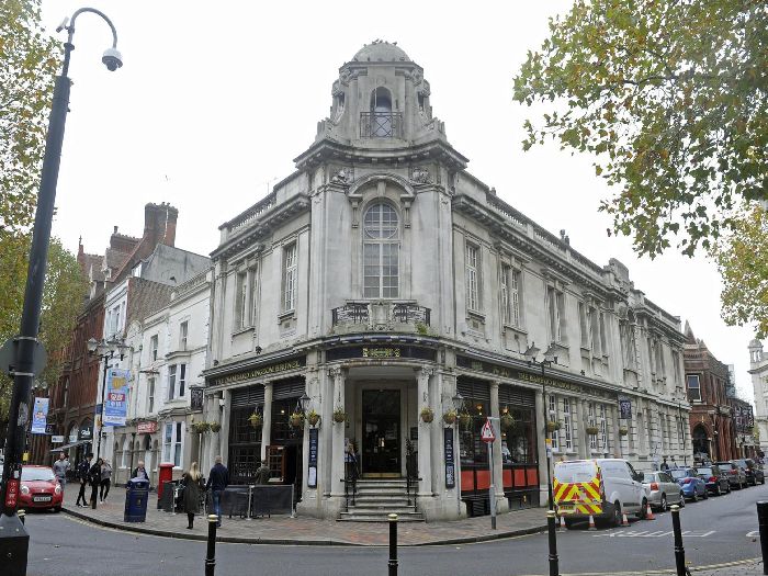
The Isambard Kingdom Brunel public house in Guildhall Walk. (Picture: Ian Hargreaves)
8 March 2019 (08:51) - Fire crews called to heater blaze at Aberdeen hairdresser
Two fire appliances were called to attend a heater on fire at an Aberdeen hairdresser this morning.The incident was reported just before 9am, at James Dun’s House in the city centre. A Scottish Fire and Rescue Services spokeswoman said the crews were sent out to Schoolhill this morning. She said: “The call came in to us at 8.51am and we sent two appliances from central station. It was a small fire on the ground floor of a hairdresser. It was out on arrival and we took no action.”
James Dun's House is a beautiful building on Schoolhill. It is Category B listed and was a popular museum and gallery with changing exhibitions but in 2001 was converted into a hairdresser and cafe. It was built in 1769 and the architect may have been William Law, designer of Marischal Street. It was owned by James Dun who was the rector of Aberdeen Grammar School which originally stood immediately opposite, before being moved in the 19th century. It is one of the earliest buildings to survive on Schoolhill and originally had long garden plot to rear. Originally one of a terrace of three similar houses, its simple Classical style and seemingly diminutive proportions are somewhat overshadowed by the later, taller and more exuberant buildings that surround it. The later buildings made use of 19th century granite cutting techniques and now make up the character of the street. No 61 is further distinguished by being set back from its neighbours and it retains much of the character of an early townhouse. The lying pane glazing is particularly unusual in this area of Aberdeen.
News Source: Evening Express
The building was owned by James Dun who was the rector of Aberdeen Grammar School
Listing Details
|
Entry Name: 61 Schoolhill, Former James Dun's House
Listing Date: 12 January 1967 Category: B Source: Historic Scotland Source ID: 355370 Historic Scotland Designation Reference: LB20483 Building Class: Cultural Location: Aberdeen County: Aberdeen Electoral Ward: George St/Harbour Traditional County: Aberdeenshire |
Coordinates
Latitude: 57.1477 / 57°8'51"N Longitude: -2.1011 / 2°6'3"W OS Eastings: 393980 OS Northings: 806318 OS Grid: NJ939063 Mapcode National: GBR SC1.48 Mapcode Global: WH9QQ.PLNV |
Near Miss
8 March 2019 (05:59) - Blaze broke out in restaurant outbuilding
8 March 2019 (05:59) - Blaze broke out in restaurant outbuilding
A fire at an outbuilding of an Edinburgh restaurant has seen roads closed off while emergency services tackle the flames. Fire crews were scrambled to the scene at Lancers Restaurant in the Stockbridge area of the capital after the alarm was raised around 5.49am this morning. And crews remained at the scene after 7.30am as they continued their work. A spokesperson for the SFRS said that the fire had been extinguished, but teams remained at the scene.
A spokesperson for the fire service said: "We were called to reports of a fire at an outbuilding of Lancers Restaurant in Stockbridge around 5.49am this morning. Crews attended and remain at the scene at this time. There were no reported injuries." Lothian Buses reported that there would be diversions in place for some of their local services while the fire was dealt with. Lancers also suffered a minor electrical fire in their hot plate area on the 29th April last year. The restaurant, has been open for 34 years.
The restaurant Occupies No 5 Hamilton Square and No 1 Dean Bank Lane and lies within the New Town Conservation Area. No 5 Hamilton Square is Category B listed together with No 3, which is now a public toilets. They were built in 1831, designed by Thomas Brown, as a pair of single Storey overbasements for the police. No 3 has blind elliptical arched recesses in each bay now with altered openings, No 5 has a central door with "No 5" on a panel above.
News Source: The Scottish Sun
The fire broke out in an outbuilding of the restaurant
Listing Details
|
Entry Name: 3 and 5 Hamilton Place
Listing Date: 30 January 1981 Category: B Source: Historic Scotland Source ID: 368059 Historic Scotland Designation Reference: LB28993 Building Class: Cultural Location: Edinburgh County: Edinburgh Electoral Ward: Inverleith Traditional County: Midlothian |
Coordinates
Latitude: 55.9585 / 55°57'30"N Longitude: -3.2083 / 3°12'29"W OS Eastings: 324659 OS Northings: 674603 OS Grid: NT246746 Mapcode National: GBR 8KC.MJ Mapcode Global: WH6SL.PHGH |
5 March 2019 (03:00*) - Fire damage to Skegness church after arson attack
Pictures have emerged showing the extent of the damage on a church in Skegness after a suspected arson attack nearby. The damage was discovered at St Matthew's Church on Lumley Avenue, Skegness in the early hours of March 5. The fire was one of four incidents that night that fire crews were called to – three sheds and one caravan were set alight. According to a reverend, smoke had filled the church, which was badly damaged as a result.
A spokesperson for Lincolnshire Police said: “We believe it was deliberate ignition and therefore treating this as arson. If anyone saw or heard anything suspicious, we want to know. Enquiries are ongoing. No-one was injured.” The person who contacted the fire brigade claimed that they heard ‘youths’ shouting “fire, fire” at the time of the blaze. A spokesperson for Lincolnshire Fire & Rescue said: “Skegness Fire and Wainfleet Fire attended Lumley Avenue, Skegness to a wooden shed on fire. Fire damage to shed and contents, fire spread to cause heat damage to 2 windows and stonework plus guttering. Extinguished using two hose reels and two thermal imaging cameras. No injuries.”
Reverend Michelle Houldershaw said: “I was woken up at about 3.50am by the police who came round to my house. There was damage to the outside of the church, all the brickwork is damaged and the windows are gone. It had even spread to the carpet. It still smells of smoke now. We had to cancel a school assembly the next day, we had a funeral planned and relatives of the deceased came in to a smoke filled building.” Pictures from the outside of the church shows the extent of the damage which the parish say they are still working on clearing up. This is yet another arson incident in Skegness, which has seen a number of fires in 2019.
St Matthew’s was built between 1879 and 1885 and is a Grade II listed building of the early English style and built with Ancaster stone. Thanks to the 9th Earl of Scarborough it is uniquely placed in the centre of a roundabout. The Earl donated the land for the church when he laid out his plans for the town. He wanted the church to be the focal point of the town and its spiritual centre.That was fine when the fastest vehicle was horse-drawn, today getting to church can be more exciting than he intended!
News Source: Lincolnshire Live
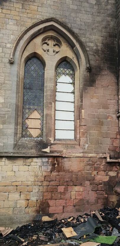
The damaged caused to the church by the fire
|
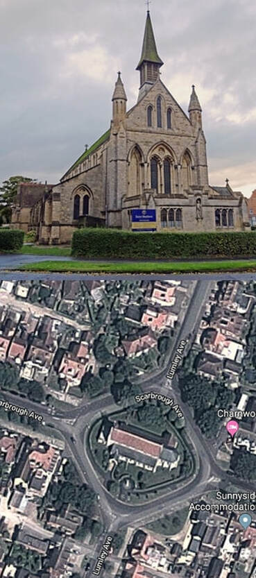
St Matthew's Church is located on a roundabout.
|
Listing Details
|
Entry Name: Church of St Matthew
Listing Date: 20 April 1976 Grade: II Source: Historic England Source ID: 1230006 English Heritage Legacy ID: 404840 Location: Skegness, East Lindsey, Lincolnshire, PE25 County: Lincolnshire District: East Lindsey Civil Parish: Skegness Built-Up Area: Skegness Traditional County: Lincolnshire Lieutenancy Area (Ceremonial County): Lincolnshire Church of England Parish: Skegness and Winthorpe Church of England Diocese: Lincoln |
Coordinates
Latitude: 53.1459 / 53°8'45"N Longitude: 0.3407 / 0°20'26"E OS Eastings: 556646 OS Northings: 363535 OS Grid: TF566635 Mapcode National: GBR MYT.NZP Mapcode Global: WHJM8.66H3 |
4 March 2019 (07:55) - Historic Armagh GAA pub damaged in fire
More than 30 firefighters tackled a major blaze at The Northern Bar in Railway Street for eight hours, using an aerial turntable ladder to bring it under control. PSNI Inspector Gary Moore said it was believed that entry had been gained to the bar some time in the early hours of the morning and the premises then ransacked and set alight. The Northern Bar blaze was described as "significant" by Fire and Rescue Service group commander Marcus Wright. Four fire appliances from Armagh, Keady, Portadown and Lisburn stations attended the incident along with the command support unit from Lisburn and, on arrival, found a "well-developed fire".
A spokesperson for Northern Ireland Fire and Rescue Service (NIFRS) said: “The call was received at 7.55am this morning and it was initially thought that there were people trapped within the premises. Firefighters wearing breathing apparatus quickly carried out a search of the building to confirm that no one was inside. The complex layout of the building, combined with floors that had been compromised due to the intensity of the fire, added significant challenges for firefighting operations. Firefighters worked hard to contain the fire and prevented it from spreading to adjacent buildings." She added: "Integral to firefighting operations was the new turntable ladder appliance based at Portadown Fire Station which also attended the incident. This enabled firefighters to attack the fire from a height to quickly bring it under control." The incident was dealt with at 3.54pm.
The pub is the historical home of the Ulster GAA headquarters. A plaque on the outside wall commemorates the formation of the Ulster GAA Council in the building on March 22, 1903. Sinn Fein's Newry and Armagh MLA Cathal Boylan said the bar "holds some dear memories to most in Armagh". He added: "Our thoughts are with the management and staff at this time and I have no doubt that the community will do all we can to support them."
News Source: The Irish News
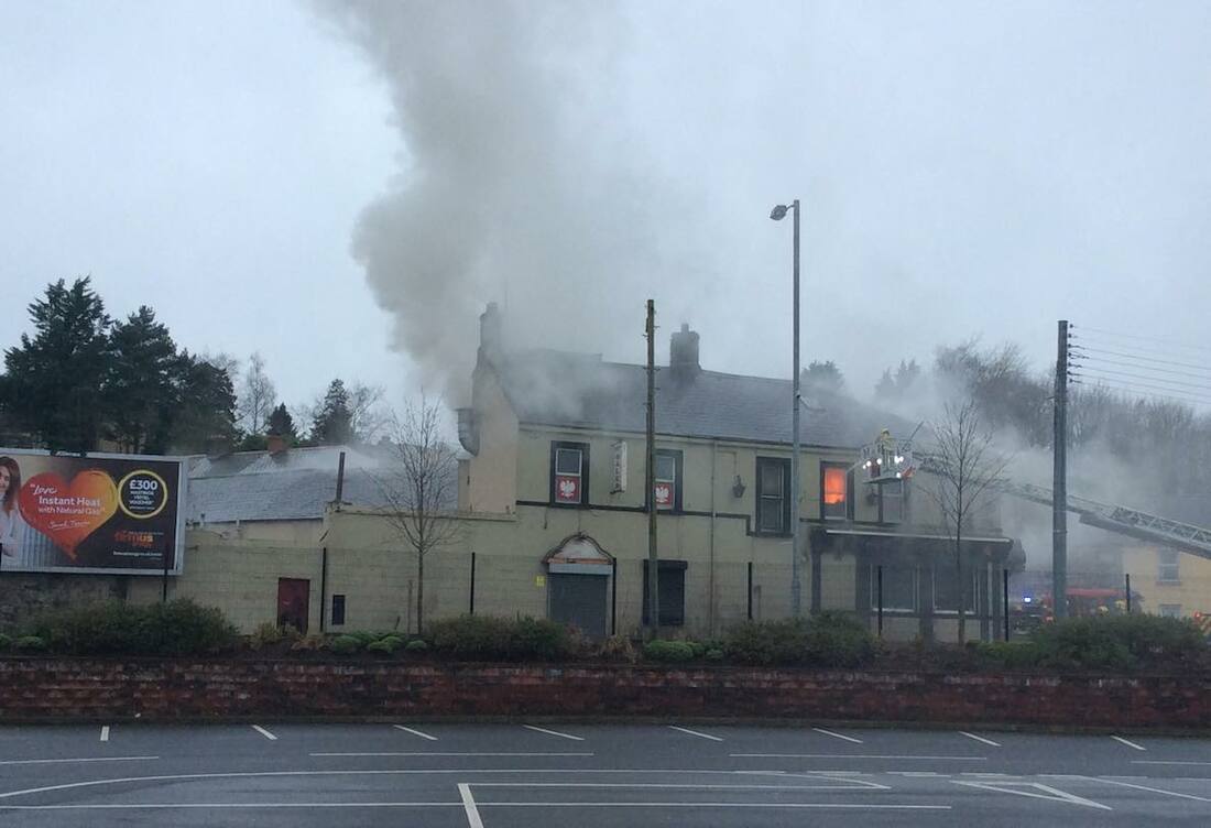
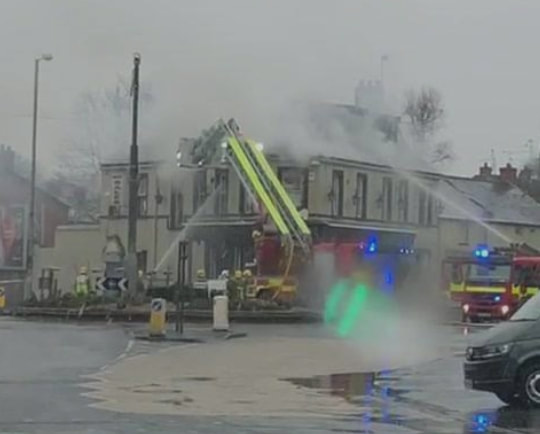
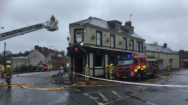
4 March 2019 (03:00*) - Petrol bomb behind fire at Bushmills pub The Scotch House
Police said a petrol bombing was responsible for a fire at a pub in the Co Antrim town of Bushmills. Fire broke out at the Bushmills pub The Scotch House in the early hours of Monday morning at around 3am. Police said two males smashed a window before pouring flammable liquid inside and setting it alight. Damage was caused to an alcove inside the bar. The Army bomb squad was sent to the scene as a precaution.
Local councillor Norman Hillis said the Army attendance sparked concern a pipe bomb had been left in the area."Bushmills has come a long way in the last few years and markets itself as the gateway to the Causeway," the UUP councillor said. The road has been reopened to traffic. Police have appealed for anyone with information to contact detectives on 101.
The Scotch House is a Category B2 listed building, built in about 1832. It lies within the Bushmills Conservation Area.
News Source: Belfast Telegraph Digital
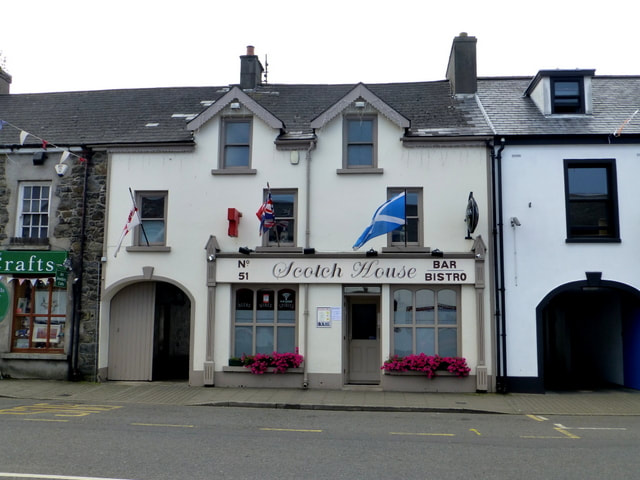
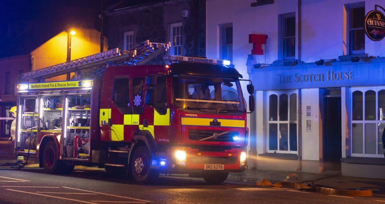
Listing Details
|
HB Ref No: HB05/08/059
Extent of Listing: Public House, outbuilding and portion of boundary wall Date of Construction: 1820 - 1839 Address : Scotch House 51 Main Street Bushmills Co. Antrim BT57 8QB Townland: Clogher North Survey 2: B2 Date of Listing: 02/12/1980 00:00:00 Date of De-listing: Current Use: Public House Former Use: Public House Conservation Area: Yes Industrial Archaeology: No Vernacular: No Thatched: No Monument: No Derelict: No |
Coordinates
OS Map No: 7/5SW IG Ref: C9402 4092 |
Building History
(Researched by Heritage & Ecclesiastical Fire Protection - From Listing Information)
No. 51 Main Street, a two-storey three-bay late-Georgian dwelling (with coach arch and dormer windows) located on the west side of Main Street in Bushmills, was constructed in c. 1834 as part of the reconstruction of the village in the early-19th century. The Bushmills Conservation Area Guide records that Bushmills was a significant settlement before the end of the 18th century but in the 1820s the village was extensively rebuilt by the MacNaghten family of Bushmills House (who had acquired the estate in 1787).
No. 51 Main Street was first depicted on the Townland Valuation Town Plan (c. 1834). The contemporary Townland Valuation (1835) described the structure as a 1A class dwelling and shop (that is a new or nearly new slated building) that measured 22.6ft by 28ft and stood 20ft in height. The house was initially occupied by a Mr. William Mitchell and was valued at £5 and 18 shillings. There was little change to the layout of No. 51 Main Street by the mid-19th century and the second edition Ordnance Survey map (1855). The contemporary Griffith’s Valuation (1859) noted that the building was increased in value to £12 and was leased by the MacNaghten estate to Daniel Anderson, a local publican who established a public house at the site and remained at the address until his death in 1875.
The next occupant of the public house was a Mr. Robert Gilpin, however the property continued to change occupant over the following decades. The Census of Ireland records that No. 51 Main Street was occupied by a Ms. Jane Campbell in 1911. The accompanying census building return described the building as a 2nd class public house that consisted of eight inhabited rooms and possessed two stables and a fowl house as its sole outbuildings. The contemporary Ordnance Survey Town Plan (1902) had depicted the property along its current layout and recorded a rectangular-shaped outbuilding to rear.
No. 51 Main Street had been purchased outright from the MacNaghten estate by a Mr. Catherine McCollum by the First General Revaluation of Property in Northern Ireland which increased the value of the public house to £22. By the end of the Second General Revaluation (1956-72) the public house (which was known as the Scotch House) was occupied by a Mr. John Cochrane and had been further raised in value to £51. In 1972 the UAHS Guide for North Antrim described the buildings along Main Street in Bushmills in the following general terms: ‘A well-scaled street. Many good doorways and shopfronts remain, although there is the usual profusion of signs. While no building apart from the former Courthouse is worthy of individual mention, the unity of the street frontages must be maintained’.
No. 51 Main Street was listed in 1980 and was subsequently included in the Bushmills Conservation Area. The conservation area was designated in 1992 in order to preserve the built heritage of the village which possesses the highest number of listed buildings in the North East of Northern Ireland. The NIEA HB Records note that No. 51 Main Street underwent an extensive renovation in c. 1996 which included the replacement of defective window frames and the installation of a new shopfront. The refurbishment also included the erection of the site’s two-storey return which was added to the rear of the building in order to provide the public house with new kitchen and toilet facilities whilst providing additional living accommodation on the first floor.
2 March 2019 (14:20) - Fire crews called to put out blaze at former Ambergate lime kiln
Derbyshire Fire & Rescue crews have put out a blaze in a disused lime kiln near Ambergate this afternoon. Engines from Crich and Alfreton were called to the site on Drovers Way at around 2.20pm. A spokesman for the service said: “Our crews used one hose reel jet and two breathing apparatus to extinguish the fire.”
The lime kiln is part of a historic site formerly known as Clay Cross lime works, built by George Stephenson between 1837-41, to burn limestone from Crich Quarries, using slack coal from Clay Cross Colliery. Until mid-1966, Clay Cross lime works had an impressive curved bank of twenty limekilns. Started as eight kilns it increased to twenty in October 1841. Stephenson also bought a narrow strip of land for access to the main railway line by a spur line and turntable, still visible. A 12 hp horizontal steam engine installed by him in 1841 for hoisting, in use until 1946, is preserved at Sheffield University.
News Source: Belper News
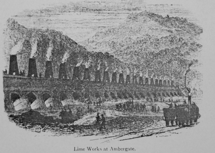
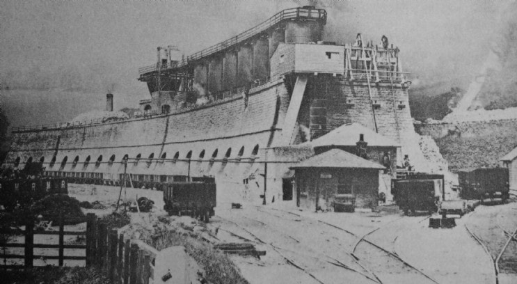
2 March 2019 (03:30) - Suspected arson at the Old Forge in Faversham
Twelve people had to be evacuated from their homes after a suspected arson of a building in Faversham. Fire crews in four engines rushed to Canterbury Road at just after 3.30am this morning (March 2) following reports that The Old Forge, former home of Able Antiques, was ablaze. People in nearby houses were evacuated while crews used their main jets to put out the fire in the building filled with wooden furniture.
The fire spread to the bedroom one of the neighbours’ homes, which was believed to have happened as a results of an ember from the derelict building floated in through an open window. Both this and the main fire, which is suspected to have been started deliberately, were put out by just before 5am. No injuries were reported, however The Old Forge was completely destroyed. A Kent Fire and Rescue spokesman reminded residents of the importance of closing their windows and doors. The spokesman said: “If there is a fire near your home remember to close windows and doors to prevent smoke or embers entering. Such a simple step can make a huge difference to the outcome.”
There is little information available on the history of The Old Forge. It is marked on the 1906 OS map as a smithy and is possibly late 19th century. It was for sale in November 2018, and was already in a poor condition at that time with a collapsing roof an lots of fly-tipping around the building.
News Source: Kent Live
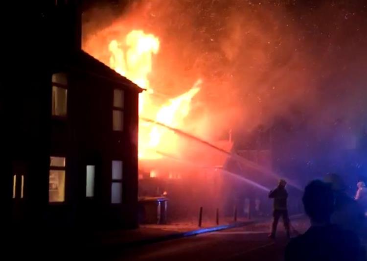
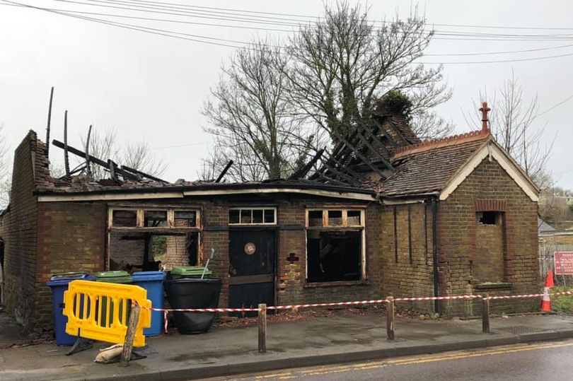
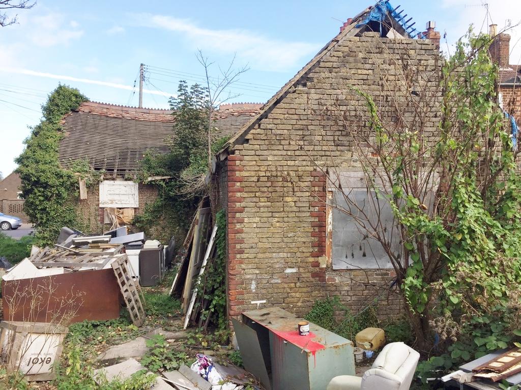
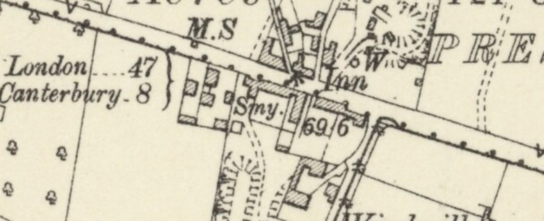
1 March 2019 (21:00*) - Asbestos building fire in Bolton town centre
A Fire in the town centre burned through a derelict early 19th century mill with asbestos in it last night. Just after 9pm, police and fire teams responded to reports of a blaze in Spa Mill on Spa Road, next to Bolton Lads and Girls Club. The road was cordoned off as police established a scene. A drone was also deployed to search the area, looking for anyone who may have been involved. The incident was confirmed to be caused by a rubbish fire in the basement of the building, with police suspecting that someone had been trying to keep warm and the fire had become out of control. Police said that the fire could have been much worse, after it was extinguished by the fire service and the road reopened at approximately 9.30pm. Police confirmed that there was asbestos in the building, which was also the site of a fire on Christmas Day.
One comment on the news item, posted on The Bolton News’ webpage said, “Isn't this the way Bolton gets rid of a building containing Asbestos but without the hefty bill of an official clean up operation? There's definitely a pattern of known asbestos buildings suddenly being set on fire and then either the homeless, travellers or kids are blamed without any arrests made while the rest of us breathe in the pollution and pay with our health - needs an investigation.”
Spa Mill was built in 1801 and has been derelict since 2007. It was for sale in 2012 with planning permission to demolish the mill, but was then taken off the market. There were new proposals to convert the building into 32 self contained apartments in 2015, with demolition of the more recent annexe.
Previous occupiers:
1801 - Jeremiah and Joshua Crook
1809 - Crook and Haselden (Crook withdrew 1833)
1836-1843 - Executors of John Haselden
1844 - James Haselden
1849 - Cannon and Haslam
1871 - Henry M. Richardson
1930s - Soap Works
1985-2007 Multiple users
News Source: The Bolton News
Heritage & Ecclesiastical Fire Protection
Preventing Fire, Protecting Life, Preserving Heritage
Click HERE for Expert Specialist Fire Safety Risk Assessments for Historic and Listed Buildings
Preventing Fire, Protecting Life, Preserving Heritage
Click HERE for Expert Specialist Fire Safety Risk Assessments for Historic and Listed Buildings
Phone: 07840 351458 Email: hello@fireprotect.me.uk
February - 37 Fires & 8 Near Misses
Heritage & Ecclesiastical Fire Protection
Preventing Fire, Protecting Life, Preserving Heritage
Click HERE for Expert Specialist Fire Safety Risk Assessments for Historic and Listed Buildings
Preventing Fire, Protecting Life, Preserving Heritage
Click HERE for Expert Specialist Fire Safety Risk Assessments for Historic and Listed Buildings
Phone: 07840 351458 Email: hello@fireprotect.me.uk
January - 41 Fires & 11 Near Misses
Phone: 07840 351458 Email: hello@fireprotect.me.uk
Deeside, Flintshire, North Wales, CH5 1PE
Heritage & Ecclesiastical Fire Protection is a trading style of Dragon Fire Safety
Heritage & Ecclesiastical Fire Protection is a trading style of Dragon Fire Safety
